Takarazuka Kofun: Successive Elite Burial Mounds in Matsusaka, Japan
Site at a Glance
- Rating
- 3.9
- Popularity
- Low
- Country
- Japan
- Primary era
- Classical
- External website
- Open
- Eras represented
- Classical
- Civilizations
- Yamato
- Site type
- Burial
- Remains
- Necropolis
On this page10 sections
History
Takarazuka Kofun is a pair of fifth-century burial mounds in Matsusaka, Japan, built by the mound-building societies of the Kofun period. Takarazuka No. 1 dates to approximately the beginning of the fifth century, while Takarazuka No. 2 belongs to the first half of that century. Together, they represent successive chiefly tombs associated with the Ise region, a historical province corresponding broadly to central and eastern Mie Prefecture.
A Large Kofun Group
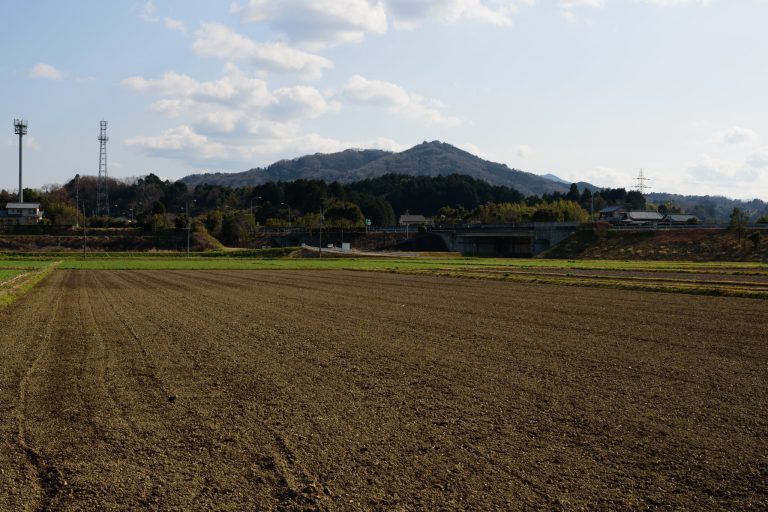
The two mounds stand on low hills beside the right bank of the Sakanai River, about three kilometers south of central Matsusaka. The occupied hill area extends for roughly one kilometer from north to south and 1.25 kilometers from east to west. Takarazuka No. 1 and No. 2 were the principal surviving members of a cemetery that once contained at least 88 kofun, the Japanese burial mounds generally built for political and social elites during the Kofun period, conventionally dated from about the third to the seventh century.
The name Takarazuka emerged from interviews with local villagers during Toshio Suzuki’s mound-distribution survey in the early Showa period. That survey recorded the extensive group before wartime and postwar land reclamation, cultivation, and residential development removed most of its mounds. Takarazuka No. 4 also survives as part of the former group, and another mound is said to have had a keyhole-shaped plan that may place it within the same chiefly succession.
Chiefly Succession and Yamato Connections
Takarazuka No. 1 was the principal mound of the group and represented the exceptional scale of an Ise regional ruler. It was the largest kofun in Ise Province and the fourth-largest in Mie Prefecture. Its size, combined with local and non-local forms among its haniwa, has led to the interpretation that it belonged to a local elite whose authority over Ise had been delegated by the Yamato polity. The Yamato polity was an early Japanese political authority centered in the Yamato region that developed increasing influence over regional elites during the Kofun period.
The number and variety of haniwa at No. 1, particularly the fully investigated projecting ritual facility, have been connected with support from the Yamato polity. This interpretation also relates the tomb to the ancient port of Matokata, regarded as an external harbor of that polity, and to the importance of the Ise and Mikawa coastal areas in securing maritime routes and extending Yamato control toward eastern Japan. Mikawa corresponds broadly to eastern Aichi Prefecture.
A local tradition identifies the occupant of No. 1 as Otokazuchi no Mikoto, regarded as the progenitor of the local Iitaka clan. The actual occupant remains unidentified. No. 2 is understood as the later chief’s tomb. Its scallop-shell plan, a keyhole-shaped form with an unusually short front, was generally considered lower in status than No. 1’s keyhole plan. The later Ise chiefly tombs nevertheless show a marked reduction in scale after No. 2, making the pair important for understanding changes in regional authority.
Protection and Investigation
The mound areas of Nos. 1 and 2 became a National Historic Site on April 25, 1932. Their protected area was enlarged on September 18, 1978, after No. 2 was recognized as a scallop-shell mound rather than a circular mound. Measurement surveys took place in 1970 and 1971. Matsusaka City Board of Education excavated No. 1 during fiscal years 1998 to 2000 and No. 2 during fiscal years 2001 to 2003. The complete excavation of No. 1’s projecting facility helped reconstruct Kofun-period funerary practices and refine interpretations of Yamato political expansion.
The mounds were incorporated into Takarazuka Kofun Park, which opened in 2005. Haniwa from No. 1 became an Important Cultural Property in 2006 and were designated a National Treasure on August 27, 2024. The excavated material is kept at the Matsusaka City Cultural Center, where finds from Takarazuka are displayed.
Remains
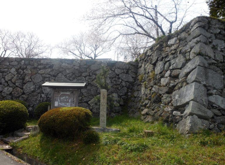
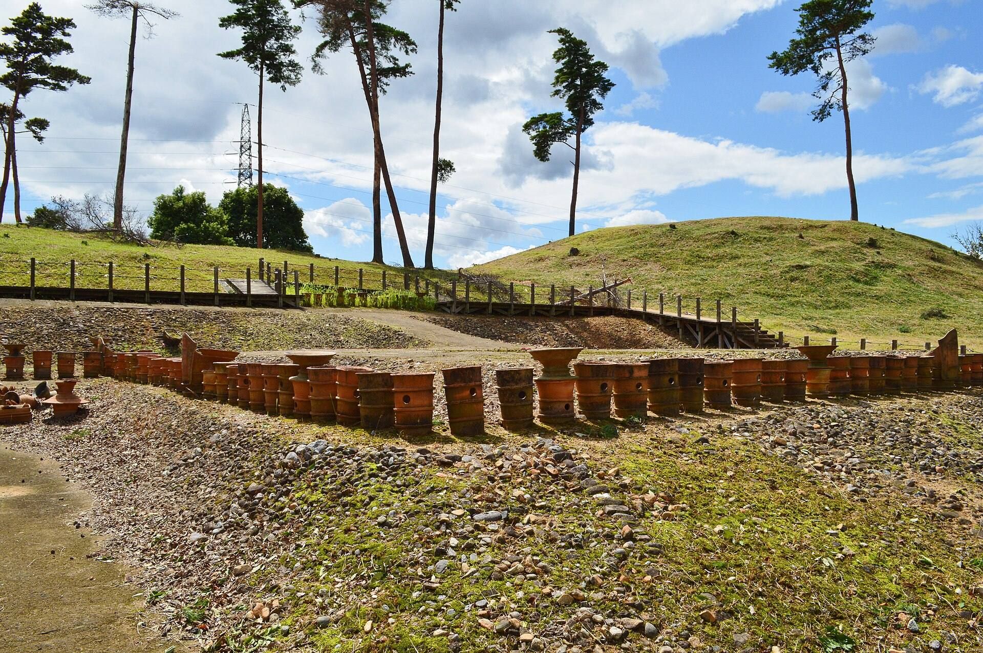
Takarazuka No. 1 and No. 2 survive as large earthen burial mounds within Takarazuka Kofun Park. Both preserve evidence of stone facing and haniwa, clay funerary sculptures and cylinders placed on or around mounds to mark them and to represent houses, people, boats, ritual installations, and other elements associated with funerary ceremonies. Their construction plans appear to have used the same basic measuring unit, while the land division of No. 2 fits as an extension of No. 1’s layout.
Takarazuka No. 1
Main Mound
No. 1 is a keyhole-shaped kofun, with a circular rear section joined to a rectangular front oriented eastward. It measures 111 meters in total length. The mound has three tiers. Its rear section is about 75 meters in diameter and 10 meters high, while the front is approximately 66 meters wide and 8.1 meters high, measured from the base of the projecting facility. A construction plan based on a small hiro, approximately 154 centimeters, has been proposed for the mound.
Stone facing and haniwa survive on the mound exterior. The first tier has been confirmed on the northern side, and the northern face, together with the projecting facility, may have formed the principal front if the southern side was originally constructed without that tier. A laser investigation indicates a clay-lined burial chamber, a burial space enclosed or lined with clay, approximately seven meters long. It runs north to south about 1.2 meters below the summit of the circular rear section. A house-shaped haniwa from the front has also raised the possibility of an additional burial facility in that area.
Near the southwestern foot of the projecting facility, workers found a deposit interpreted as a haniwa coffin made with shield-shaped haniwa. It had been installed by cutting through the stone facing, showing that this feature postdated the facing. The burial chamber beneath the rear section has not been excavated, so its contents and precise construction remain uncertain.
Detached Ritual Facility
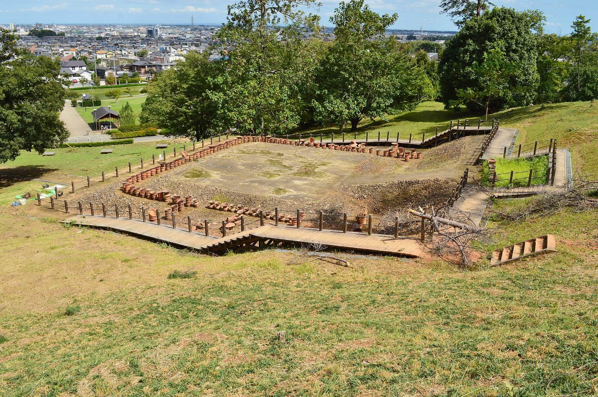
North of the main mound stands an island-like projecting facility, a detached platform associated with funerary rituals or offerings. Unlike an attached platform, it is separated from the mound and linked to it by a narrow earthen bridge. Later leveling damaged part of its original upper surface, while its foot retains numerous haniwa close to their original positions. The island-like form may have evoked the sea, although that interpretation remains conjectural.
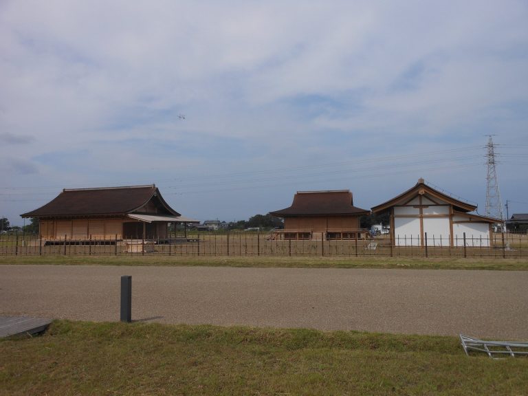
The facility lies north of the junction between the front and rear sections of the mound and was built in two tiers. Its lower tier measures about 18 meters from east to west and 16 meters from north to south. The upper tier measures approximately 13 by 10 meters and corresponds to the second tier of the main mound. The facility has been reproduced at full scale.
Different haniwa groups occupied different parts of the installation. Water-conduit-type enclosing haniwa and house-shaped haniwa were concentrated along the eastern foot. Two enclosing haniwa representing spring-water facilities stood along the western foot, while a boat-shaped haniwa marked each side of the earthen bridge. These arrangements provide unusually detailed evidence for the organization of ritual imagery around a Kofun-period tomb.
Haniwa Assemblage
Excavation of No. 1 produced 276 haniwa and 11 pottery or earthen objects. The National Treasure group contains one boat haniwa from the projecting facility, three enclosing haniwa, four house-shaped haniwa, 262 additional haniwa fragments, and eight associated pottery and earthen objects. Other finds include haniwa representing single-story and multi-story houses, as well as armored figures. Together, the objects show the range of architectural, military, and ritual forms placed around the mound.
Takarazuka No. 2
No. 2 lies north of No. 1 and has a scallop-shell-shaped plan, meaning that its rectangular front is unusually short in relation to the circular rear section. The front points south-southeast toward No. 1. The mound is about 90 meters long. Its three-tiered circular rear section measures approximately 83 meters in diameter and 10.5 meters in height. The front has two tiers and measures about 17 meters long, 39 to 40 meters wide, and 2.9 meters high. Road construction cut away part of the eastern corner.
Stone facing and haniwa were used on No. 2. Its assemblage includes morning-glory-shaped haniwa, forms made by combining jar-shaped and cylindrical elements. The burial facility has not been excavated, and its arrangement remains uncertain. The rear section is larger in diameter and height than that of No. 1, while the mound was built mainly with earth fill rather than relying chiefly on the natural hill. The labor invested in No. 2 may therefore have been comparable to that required for No. 1 despite its different, lower-status mound form.
The surviving mounds preserve the central physical evidence of a cemetery that once extended across the low hills south of Matsusaka. Their dimensions, shared planning system, facing stones, haniwa, and relationship to the surrounding mound group reveal changing forms of elite burial and ritual practice in fifth-century Ise.