Susa: An Ancient Elamite and Persian Royal City in Iran


Site at a Glance
- Rating
- 4.5
- Popularity
- Low
- Country
- Iran
- Primary era
- Classical
- Eras represented
- Bronze Age, Iron Age, Classical, Medieval
- Civilizations
- Abbasid, Achaemenid, Elamite, Parthian, Sassanid, Seleucid
- Site type
- City
On this page29 sections
History
Susa is an ancient city in Iran, beside modern Shush, founded during the late fifth millennium BCE, probably around 4395–4200 BCE. Its early growth took place at a passage between the Tigris lowlands and the Iranian plateau, where Mesopotamian and Iranian traditions met. The settlement emerged as nearby communities declined or were abandoned, marking an important stage in the development of urban life and early state formation.
Prehistoric origins and Proto-Elamite development
The prehistoric sequence of Susa is conventionally divided into three phases. Susa I extends from the late fifth millennium to about 3700 BCE, Susa II covers approximately 3700–3100 BCE and was contemporary with the Uruk period, and Susa III represents the Proto-Elamite phase, ending by about 2800 BCE. These dates remain approximate, and the transition between Susa II and Susa III includes a break in the archaeological sequence whose duration has not been established.
During Susa I, the settlement appears to have served as a political or ritual centre for the surrounding region. Its rapid expansion may have involved the deliberate relocation of people from settlements that had declined, although this remains an interpretation rather than a settled fact. Susa I society produced distinctive painted pottery, administrative seals, and funerary practices that demonstrate a developed social and ceremonial organisation.
Susa II brought strong connections with the Uruk world of southern Mesopotamia. New pottery forms, cylinder seals, accounting devices, and early writing appeared alongside older local traditions. A cylinder seal, a small engraved cylinder rolled across wet clay to create a continuous impression, served administrative purposes while also depicting religious, political, and everyday scenes. The nature of the cultural change remains debated, with conquest, colonisation, migration, local choice, or several of these processes proposed as possible explanations.
In the Proto-Elamite period, occupation contracted initially toward the Acropolis and later spread eastward. Susa continued to act as a commercial and cultural link between Mesopotamia and the Iranian plateau. More than 1,600 Proto-Elamite tablets and fragments record the storage and movement of goods, people, and animals, as well as agricultural and pastoral production. Proto-Elamite writing was an early administrative system used mainly for accounting, and its signs remain only partly understood.
Elamite and Mesopotamian powers
From the third millennium BCE, Susa belonged to the wider political and cultural world of Elam, an ancient region centred in southwestern Iran. Elam’s principal population centres included lowland Susa and highland Anshan, and its early political organisation was a loose confederation in which Awan and Simashki were important centres. Susa alternated between expansion and decline as power shifted between the Mesopotamian plain and the Iranian plateau. It became an Elamite capital and a major intermediary in trade linking Mesopotamia, Iran, the Gulf, and regions farther east.
Sargon of Akkad conquered Susa after 2340 BCE and incorporated it into the Akkadian Empire. Akkadian administrative practices were established in the city, and its population and material culture became closely connected with southern Mesopotamia. After the fall of Akkad, Puzur-Inshushinak ruled Susa, called himself king of Elam and Awan, and promoted an Elamite political and artistic tradition. His inscriptions used Akkadian and Linear Elamite, a briefly used script whose signs remain undeciphered, and describe the restoration and decoration of temples.
Ur-Nammu of Ur defeated Puzur-Inshushinak, after which Susa entered the Third Dynasty of Ur. Shulgi recorded the construction or restoration of temples dedicated to Inshushinak and Ninhursag. Later campaigns under Shulgi and Ibbi-Sin show how difficult it was to maintain authority over the region. Susa then came under Simashki control, and forces associated with Simashki helped overthrow the kingdom of Ur. Destruction layers and large numbers of clay sling bullets in the Royal City belong to the conflicts surrounding the end of Ur’s rule.
The Sukkalmah period
Around 1900 BCE, Elamite rulers adopted the title Sukkalmah, which also gives its name to the ruling dynasty and period. Susa became an important Elamite capital and expanded to an estimated 85 hectares from the eighteenth century BCE. Its position made it a major long-distance trading centre, with connections reaching Mesopotamia, the Iranian plateau, Dilmun in the Gulf, Magan, and Bactria. Tin was among the commodities exchanged through these networks.
More than 1,400 cuneiform tablets from the Sukkalmah period concern administration, property, loans, marriage, divorce, adoption, inheritance, sales, donations, and legal proceedings. They reveal the influence of the royal family, temples, and powerful landed families. They also show legal practices in which women could testify, bring lawsuits, inherit property, and sometimes serve as principal heirs.
Susa possessed scribal and intellectual institutions as well as commercial archives. Students learned Akkadian and Sumerian through a curriculum comparable to those used in contemporary Mesopotamian cities. The surviving texts include divinatory, magical, literary, mathematical, and dynastic works, showing that the city was a centre of learning as well as administration and trade.
Middle Elamite power
Under the Igehalkid and Shutrukid dynasties, Susa formed part of Elam’s political and cultural high point. Royal policy increased the use of the Elamite language and promoted the worship of deities from other Elamite regions. Untash-Napirisha, one of the period’s major builders, constructed, restored, or decorated at least ten religious buildings at Susa. His reign is represented by the bronze statue of Queen Napir-asu and other works found on the Acropolis.
Shutruk-Nahhunte, Kutir-Nahhunte III, and Shilhak-Inshushinak led successful campaigns in Babylonia. Their armies brought royal monuments to Susa as war booty, including the stele bearing Hammurabi’s law code and the victory stele of Naram-Sin. Shilhak-Inshushinak undertook extensive building work, including sanctuaries and a temple linked with the royal palace, and his reign is associated with major architectural decoration in glazed bricks.
After Hutelutush-Inshushinak, the son of Shilhak-Inshushinak, was defeated by the Babylonian king Nebuchadnezzar I, Susa was plundered. Elam then entered a poorly documented period lasting roughly four centuries. The city revived during the late eighth century BCE, although the political history of the first part of the first millennium BCE remains uncertain. In 648 BCE, the Assyrian king Ashurbanipal captured and destroyed Susa.
Susa continued after the Assyrian attack, and later Elamite rulers carried out work on the Acropolis. An archive of 298 administrative and economic texts may have come from a royal institution. The city’s material culture continued through this period, linking later occupation with its long Elamite past.
Achaemenid royal residence
Cyrus II brought Susiana under Achaemenid control around 539 BCE or slightly earlier. Under Cyrus and Cambyses, Susa served as the capital of the Elam satrapy. Under Darius I, it became one of the principal royal residences of the Achaemenid Empire, the Persian imperial state founded by Cyrus II in the sixth century BCE.
Darius established a royal palace on the Apadana mound and remodelled the city on a large scale. Workers and materials came from different parts of the empire. The principal mounds were reshaped through extensive terracing and reinforced by a glacis, a sloping defensive embankment. Susa was not a fixed imperial capital, because the Achaemenid court moved between royal residences, but Greek writers frequently associated the kings with the city and praised the splendour of its palace.
Artaxerxes II rebuilt the great palace, including the Apadana, and constructed another palace beside the Chaour River. Negotiations held at Susa led to the Peace of Antalcidas in 387 or 386 BCE, an agreement that reshaped relations among the Greek states and the Persian Empire.
Alexander the Great held a mass marriage ceremony at Susa in 324 BCE after the fall of the Achaemenid Empire. He married two daughters of Darius III and arranged marriages between his officers and Persian aristocratic women. The ceremony expressed his intended political and social unity between Macedonian Greeks and Persians.
Hellenistic, Parthian, and Sasanian Susa
After the Achaemenid collapse in the late fourth century BCE, Susa lost its role as a royal residence but remained an important provincial city under the Seleucids, Parthians, Elymaeans, and Sasanians. Under Seleucid rule it was an economic centre and mint. By the late third century BCE at the latest, it had become a Greek city known as Seleucia on the Eulaeus, with Greek civic institutions, a Greek community, and a military garrison.
Susa was the seat of a Seleucid satrapy governed by a strategos, or military governor. Inscriptions mention a treasurer, an epistates, and a chreophylax. During the second and first centuries BCE, the city changed hands repeatedly among Seleucids, Elymaeans, and Parthians. It retained substantial civic and Greek institutional autonomy, while the cult of Nanaya, a Mesopotamian goddess identified in the Hellenistic environment with Artemis, became prominent.
The Parthian period brought renewed urban expansion, large residences, extended cemeteries, abundant coins and pottery, and continuing commercial activity. Phraates IV refounded the city in 31 or 30 BCE and renamed it the City of the Phraateans of the Eulaeus. Susa remained connected with Parthian royal authority, although the extent of Elymaean autonomy is uncertain. An inscription dated to 215 CE records a satrap of the Parthian king Artabanus IV at Susa.
Ardashir, founder of the Sasanian dynasty, conquered Susa in the early third century CE. The city apparently served at times as a Sasanian royal residence, while newer centres such as Gundishapur, Shushtar, Ahwaz, and Iwan-e Karkheh developed nearby. After Shapur I defeated the Roman emperor Valerian in 260 CE, Roman prisoners, including Christians, were settled in Susiana, and Susa became the seat of a Christian bishopric.
Christian communities in Susiana faced persecution under Shapur II from 339 CE. A revolt at Susa was violently suppressed, and tradition describes an army with 300 elephants and extensive destruction in the city. The extent to which this episode caused Susa’s later decline remains uncertain.
Islamic Susa and abandonment
Muslim forces conquered Susa after the submission of the Sasanian governor Hormuzan in 642 CE. The city recovered during the early Islamic period and remained inhabited for roughly six centuries, although it no longer held major political importance. Under the Abbasids, Susa reached its greatest known extent, covering about four square kilometres, and became an agricultural and manufacturing centre known for sugar, lemons, silk textiles, and coin production.
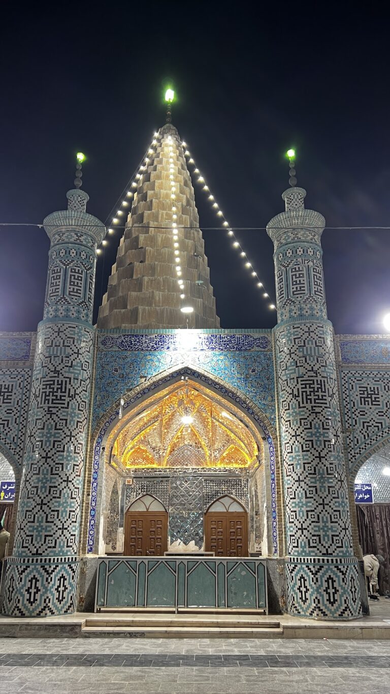
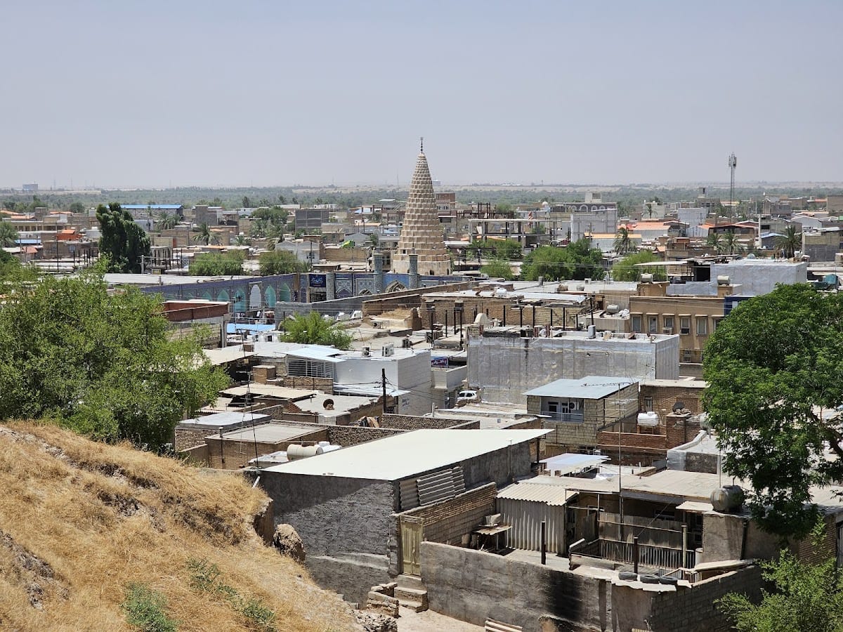
The Islamic city contained Muslim, Jewish, Christian, and Zoroastrian communities. Benjamin of Tudela reported fourteen synagogues. The tomb attributed to the prophet Daniel remained a major landmark, although other places also claimed his burial and its status as a major pilgrimage destination varied over time.
Susa declined after the thirteenth century. One historical tradition dates a Mongol destruction to 1218, while archaeological evidence places occupation in some quarters into the fifteenth century. The city was probably deserted by the fifteenth century. The tomb associated with Daniel continued to identify the abandoned site and helped preserve its ancient name. In the nineteenth century, travellers visited the ruins, which were also occupied seasonally by local pastoral groups.
Archaeological exploration and heritage
Modern Shush developed beside the archaeological site from the mid-twentieth century. Exploration began with visits by Henry Rawlinson in 1836 and Austen Henry Layard in 1840 and 1842. William Kennett Loftus carried out more substantial investigations in 1851–1852, produced an early plan, and found Elamite objects and remains of the Persian palace.
Marcel and Jane Dieulafoy excavated at Susa in 1884–1886, concentrating on the Achaemenid palace. They exposed the Lion Frieze, the Archers Frieze, and an almost intact Apadana capital. These objects were transported to France, later restored, and displayed in the Louvre.
In 1895, the French obtained exclusive excavation rights in Iran from Shah Naser al-Din, and the privilege was renewed in 1900. Jacques de Morgan directed the French archaeological delegation established in 1897 and excavated Susa until 1907. His large-scale work concentrated on the Acropolis, especially the Great Trench. The speed of excavation led to inadequate recording of buildings and deposits, but the discoveries transformed knowledge of Elam, Mesopotamia, and the early history of Susa.
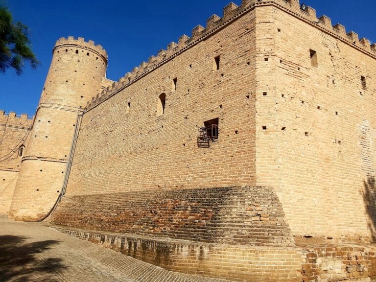
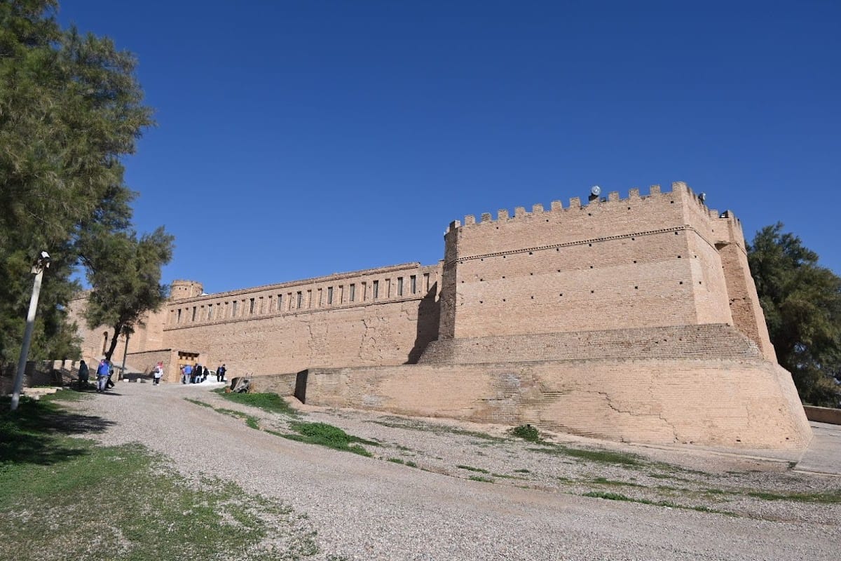
De Morgan’s excavations uncovered the stele of Hammurabi’s law code and the victory stele of Naram-Sin in 1900–1901. In 1906–1907, work reached early levels and exposed a large cemetery containing the distinctive Susa I ceramic tradition. Roland de Mecquenem assisted de Morgan from 1903 and directed excavations after his departure. Work was interrupted during the First World War, when a British garrison occupied the excavation castle, and resumed in 1920.
Roman Ghirshman directed post-war excavations from 1946, investigating the Royal City, the City of Artisans, and the Acropolis with more systematic stratigraphic methods. Jean Perrot directed the French excavations from 1967 to 1979 with an international, multidisciplinary team and increased cooperation with Iranian archaeologists. Excavations stopped in 1979 because of the Iranian Revolution and the Iran-Iraq War. The work of Ghirshman and Perrot revealed residential, religious, administrative, industrial, and funerary remains from the Elamite, Achaemenid, Parthian, Sasanian, and Islamic periods.
Excavated objects were initially transferred largely to France under the nineteenth-century division agreement. After 1929, finds were divided between France and Iran, with tablets, architectural elements, and especially important objects excluded from division. From the beginning of the Perrot mission in 1969, finds were retained by Iran. Important Iranian-held objects are exhibited at the Susa Archaeological Museum and the National Museum of Iran, while approximately 30,000 inventoried objects from Susa are held in the Louvre.
The discoveries at Susa provide evidence for Elamite history, Mesopotamian art, Proto-Elamite writing, early Iranian ceramics, and medieval Islamic ceramics. Susa was inscribed on the UNESCO World Heritage List in 2015 under criteria I, II, III, and IV. The designated property covers approximately 350 hectares, with a 600-hectare buffer zone.
Remains
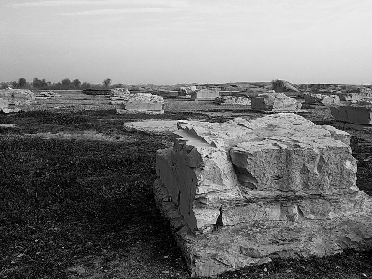
The principal archaeological area covers about 70 hectares and consists of three major tells beside the Chaour River, the Acropolis, the Apadana, and the Royal City. The wider site, including the City of Artisans and a fifth tell west of the river, covers approximately 250–300 hectares. The arrangement changed considerably over time, and the entire wider area was occupied simultaneously only during the Islamic period.
Prehistoric mounds and early administrative remains
Acropolis and early sacred area
The Acropolis is the highest mound, rising approximately 35–38 metres above the surrounding area at the beginning of excavation. It contains Susa’s earliest known occupation, including Susa I remains and the principal Elamite sanctuaries. Susa I occupation on the Acropolis covered about seven hectares. The mound’s later construction and early excavation affected the survival and interpretation of its earlier buildings.
Susa I funerary complex
The Susa I funerary complex on the Acropolis was a rectangular structure with a possible base measuring about 7 by 14 metres. It contained or covered numerous burials, perhaps as many as 2,000. The relationship between these burials and the generations who used the complex remains uncertain. A later High Terrace succeeded the funerary complex. Only one side has been exposed, including a southern stretch about 80 metres long that may have risen approximately 10 metres. Buildings, possibly including a sanctuary, stood on the terrace.
Apadana mound and Susa I building
The Apadana mound takes its name from Darius I’s palace and was formed through substantial terracing over earlier Elamite remains. Its earliest occupation dates to Susa I, when the mound covered slightly more than six hectares. A Susa I building exposed in a small area had mud-brick walls more than two metres wide, coated with pinkish plaster, and was probably a monumental structure. A mud-plastered wall on the mound, more than six metres thick in one description, enclosed the settlement.
The Susa I cemetery produced hundreds, perhaps approximately 2,000, fine painted vessels. Handmade from fine white clay, the vessels were covered with dark slip and decorated with geometric designs or stylised ibexes, birds, and running dogs. Bowls, jars, cups, and large conical-based bushels were common. Richer graves contained finely decorated ceramics and copper objects, including flat axes and round disks that may have served as mirrors or priestly ornaments. Circular stamp seals and seal impressions secured jars and doors, while their imagery included ritual or mythological scenes and the recurring anthropomorphic Master of Animals.
Uruk and Proto-Elamite evidence
Susa II occupation initially contracted around the Acropolis and later spread toward the Royal City and the Donjon, possibly reaching about 25 hectares. Two cult deposits on the Acropolis contained Late Uruk objects, including alabaster worshipper figurines and animal representations. Cylinder seals replaced stamp seals and showed agriculture, crafts, storage, ritual activity, animals, and the king-priest, a modern description for an Uruk-period figure combining royal and religious attributes.
Level 18 of an Acropolis sounding contained clay envelopes with accounting tokens, sealed envelopes, incised clay objects, and numerical tablets. The sequence illustrates a change from token-based accounting to numerical tablets, although the relationship between these systems and later pictographic writing remains uncertain. More than 1,600 Proto-Elamite tablets and fragments record the storage and movement of goods, people, and animals. One text may refer to 23,600 animals.
Elamite religious and residential remains
Sanctuaries of Inshushinak and Ninhursag
Elamite sanctuaries were concentrated on the Acropolis, while the principal Elamite palace stood on the Apadana. Royal foundation inscriptions provide much of the evidence for buildings whose archaeological plans were affected by later construction and early excavation. Elamite texts called the sacred area the high city or elevated city. It belonged to Inshushinak, Susa’s principal tutelary deity, who was associated with the city’s kingship, main sanctuary, and funerary traditions.
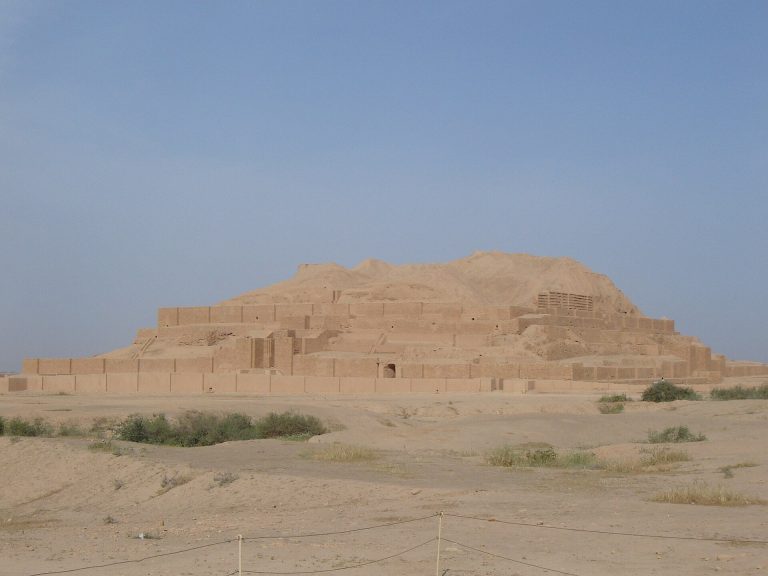
The principal temple of Inshushinak may have measured about 40 by 20 metres. Its entrance opened toward a forecourt in the central part of the mound, and a paved esplanade ran along its southern side. A ziggurat, a monumental stepped temple platform, stood beside the temple. Untash-Napirisha built or restored it in the fourteenth century BCE. The ziggurat has not been located, although it may have stood west of the temple between it and the sanctuary of Ninhursag.
The Inshushinak complex may also have included the hashtu, perhaps a pit associated with the god’s funerary role, along with sacred groves or grove temples. The sanctuary accommodated the cults of Ishme-karab and Lagamal. Ninhursag’s sanctuary occupied a terrace near the centre of the Acropolis. Its main building may have measured about 16 by 8 metres and contained a possible cella, or inner sacred room, of roughly six square metres. The bronze statue of Queen Napir-asu was found there.
Other sanctuaries were dedicated to Inanna, Pinigir, Narundi, Napirisha, Kiririsha, Nahhunte, Shimut, Manzat, Ruhuratir, and other deities. Royal inscriptions also refer to the temple of Ishme-karab. A deposit from the temple of Inshushinak included a glazed lion statue, jewellery, bronze worshipper figurines, and limestone figures of a lion and a hedgehog mounted on bitumen-stone carts.
Palaces and glazed-brick decoration
The Elamite palace, called a hiyan, stood on the Apadana before Darius I replaced it with his royal palace. An associated outer temple, called the kumpun kiduya, is known through Middle Elamite glazed-brick reliefs and foundation inscriptions. Shilhak-Inshushinak’s temple on the Apadana included the structure known as Kumpume Kiduya. Its glazed-brick façades showed protective goddesses and bull-men alternating around palm trees.
A chapel called the Suhter, apparently linked with dynastic worship, carried glazed-brick images of the royal family. Only a small part of this decoration has been reconstructed. The Acropolis also produced a bronze model of a sunrise ritual, with two priests performing a ceremony in a ritual landscape containing a ziggurat, altar, cult basin, and sacred tree or grove. A gold worshipper statue with a matching silver replica, faience worshipper figurines, and animal figures of agate and lapis lazuli formed an offering assemblage known as the Gold Statuette Find.
Royal City neighbourhoods
The Royal City formed Susa’s central urban area and was occupied by at least the Proto-Elamite period. It contains residential, administrative, religious, and funerary remains from later phases. The neighbourhood called Excavation A covered slightly less than one hectare north of Excavation B. Two broad roads formed the basis of its street network and led to smaller streets whose general routes remained stable through successive phases.
The earliest level of Excavation A contained small residences and a small cult place with a preserved sanctuary, vaulted niche, and altar. Later levels included larger residences and more specialised domestic, administrative, and craft areas. The House of Rabibi, also called the Central Complex, was arranged around a large paved courtyard and a long vaulted reception room divided into three spaces by four opposing pilasters. Tablets associated one owner, Temti-wartash, with landholding, livestock, lending, and international trade.
Later occupation replaced the large residence with potters’ kilns, an open area, and a large central building of uncertain function. Numerous erotic terracotta plaques from the open area have led to suggestions that the building was a temple or drinking establishment associated with prostitution, although that interpretation remains uncertain. The House of Attar-uktuh, or Eastern Complex, stood near internal fortifications and contained courtyards, a bathroom, latrine, kitchens, storerooms, scribal-training spaces, and carefully built fireplaces. Building T, a roughly square structure in later levels, stood near an archive recording the transition from the Sukkalmah dynasty to the Kidinuides.
Sukkalmah-period burials included vaulted collective brick tombs, individual jar burials, simple pits, and graves beneath residences or courtyards. Painted terracotta heads, probably funerary effigies, accompanied some of the dead. Middle Elamite levels contained residences, burials, and more finely executed terracotta effigies, sometimes polychrome. Buildings from some phases are difficult to reconstruct because graves occupy much of the excavated area.
Achaemenid royal complex
Darius’s palace
Darius I’s palace was built at the beginning of the fifth century BCE on an artificial terrace of approximately 12 hectares. Artaxerxes II restored or rebuilt it at the beginning of the fourth century BCE. A mud-brick ramp about 40 metres long connected the Royal City to the palace terrace and passed through the Propylea, a square structure approximately 24 metres on each side. The Propylea contained an axial passage, two rooms, and small porticoes.
The palace gateway measured approximately 40 metres in length and 28 metres in width and was arranged around a square hall with four columns. Its foundations rested on a large fill reinforced by substantial retaining walls. A large stone statue of Darius from Egypt originally stood as one of two colossal statues beside the entrance from the broad square esplanade.
The palace formed a quadrilateral approximately 246 by 155 metres and covered about 38,000 square metres. Its eastern entrance opened through a double guard hall onto three successive courts. The eastern court measured about 64 by 55 metres and carried the Lion Frieze. It opened north toward the Apadana and west toward the central court, which measured approximately 36 by 33 metres. Beyond it lay the honour court, about 36 by 31 metres, with a pavement of large fired-brick tiles.
South of the honour court, a vestibule and antechamber, each approximately 35 by 9 metres, led to a royal chamber of about 70 square metres. Small rooms beside the royal units have been interpreted as stores and chancellery offices. A passage south of the royal apartments led to five further suites that may have belonged to royal wives. The functions of the northern rooms remain debated, as does the possibility of an upper storey above the royal apartments.
Glazed siliceous-paste bricks decorated the palace. The Lion Frieze in the eastern court showed passing lions above bands of rosettes, lotus flowers, and geometric designs, with crenellations above. The Archers Frieze depicted rows of soldiers carrying spears, bows, and quivers while wearing Persian ceremonial dress. Its original location is uncertain because the bricks were scattered across the site. Other decoration showed winged bulls, chimeras, lions, soldiers, floral motifs, and animals in glazed or unglazed relief.
Apadana audience hall
The Apadana, a large Persian audience hall organised around a columned central space and porticoes, stood north of the palace among gardens. It was a square building approximately 109 metres on each side, with a central hall about 58 metres square. A wooden roof rested on 36 columns arranged in six rows of six. The columns probably rose more than 20 metres and had square bases in the central hall.
Porticoes occupied the west, north, and east sides, each with two rows of six columns. Their capitals combined double bull protomes with preceding volutes, while the bases used bell-shaped forms with geometric or floral decoration. Four towers marked the corners. The columns and bases combined Mesopotamian, Egyptian, and Greek-derived architectural features.
Chaour palace
Artaxerxes II’s palace stood on the western bank of the Chaour opposite Darius’s palace. Its surrounding complex measured approximately 220 by 150 metres and probably included a garden. The building contained a hypostyle hall, a room whose roof was supported by multiple columns, measuring about 37.5 by 34.6 metres, together with four surrounding porticoes and four corner towers. Wall-painting fragments showed plants and human figures.
A northern garden building contained a small four-column hypostyle hall on a terrace about two metres high. Its purpose remains uncertain. It may have served as a more private royal retreat or as a temporary residence while the principal palace was being restored. A late Achaemenid burial on the Acropolis held an individual in an earthen sarcophagus with gold and semi-precious-stone jewellery, a silver bowl, alabaster vessels, Egyptian-style objects, and coins dated to 350 and 332 BCE.
Hellenistic, Parthian, and Sasanian buildings
Seleucid and Parthian residences
A Seleucid house in the Royal City was roughly square, measuring about 26 metres on each side. It had a peristyle court, a tiled double-pitched roof, terracotta roof ornaments called antefixes, and meander friezes. The house was a Greek-type residence. The Seleucid Propylea gradually fell into ruin, and its bricks were reused in later buildings. Terracotta friezes and antefixes from the Acropolis probably decorated other Seleucid structures.
Parthian residences in the Royal City were large and strongly built. One replaced the Seleucid house around the middle of the second century BCE and had a cruciform plan, approximately twenty ground-floor rooms, and probably an upper storey. Other Parthian houses were arranged around central courtyards beside elongated reception rooms. The period also produced large cemeteries, child burials in jars, anthropoid sarcophagi, and funerary chambers.
Sasanian building
A Sasanian building in Royal City level IV was arranged around a hall approximately 14 metres square and reused six column bases from Darius’s palace. Its courtyard entrance carried a fresco of two mounted hunters riding among game. The building has been interpreted as a Mithraic sanctuary, although that identification is doubtful. Associated burials were hurriedly arranged, and jars bearing crosses occur in the same level, while the date and relationship of these burials to Sasanian destruction remain uncertain.
Islamic urban remains and objects
City of Artisans and neighbourhoods
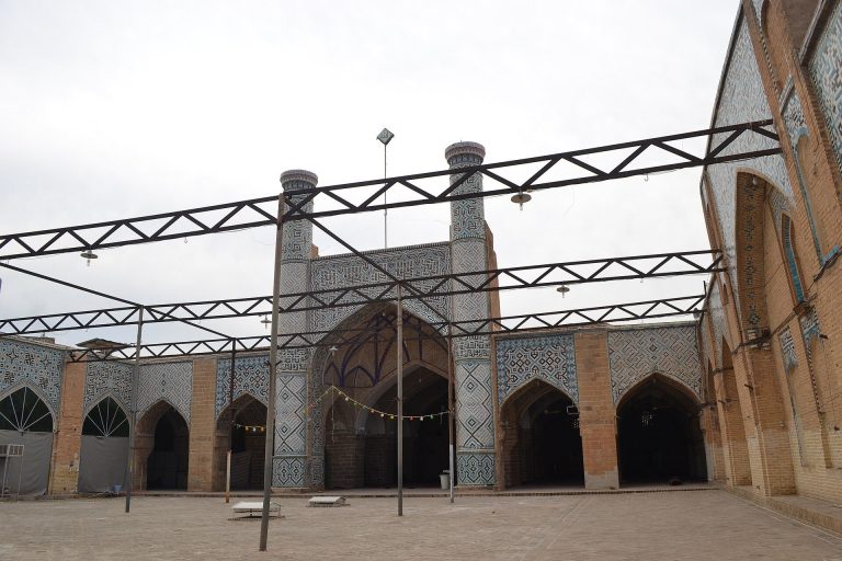
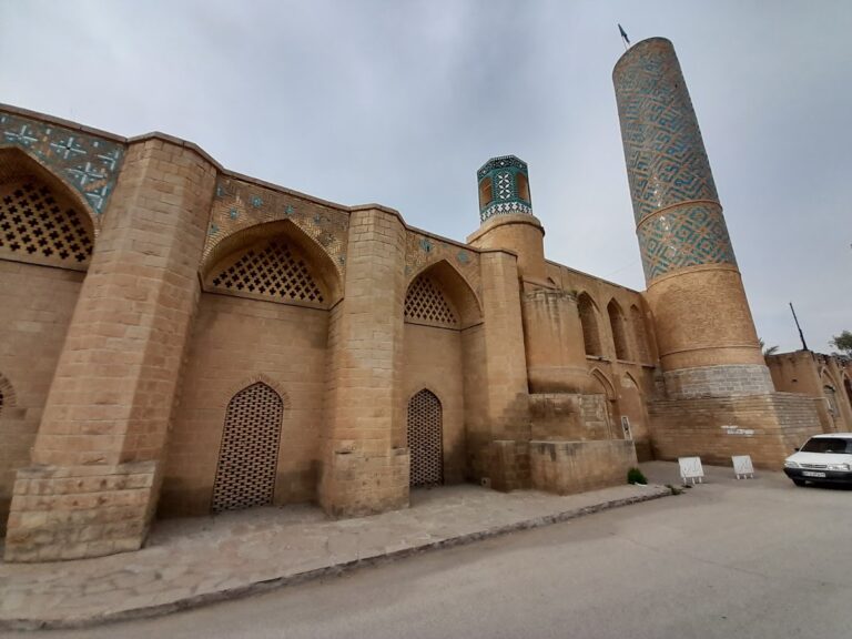
The City of Artisans is the largest eastern tell. It was occupied at least from the Neo-Elamite period and became the principal settlement area during later ancient and medieval phases. An early Islamic square enclosure there measured approximately 400 metres on each side. A large mosque occupied the settlement, while Building B, identified as a khanqah, an Islamic devotional institution with communal and residential spaces, had cells arranged around a rectangular courtyard.
Islamic residences occupied areas between the Apadana and the northern Royal City. They formed dense neighbourhoods of houses of varied sizes. A tenth-century hammam, or bathhouse, was identified on the Apadana. A twelfth-century sugar-processing installation occupied the former Achaemenid palace site west of the Chaour and contained moulds for forming sugar loaves.
Ceramics and other movable remains
Islamic ceramics from Susa include unglazed and glazed jars, pitchers, bowls, lids, lamps, and filtered jugs. Their decoration used combing, incision, stamping, moulding, slip, painted designs, and lustre. Some lids and vessels carry Arabic or Aramaic inscriptions, including magical texts and personal correspondence. Other finds include anthropomorphic figurines, toys and games, sugar moulds, and a mongoose cage.
Glazed wares include blue-on-white vessels, marbled or splashed glazes, and lustre-painted pieces. The earliest glazed forms preserve Sasanian influences, while later lustre decoration became increasingly simplified. Together with Susa I painted ceramics, copper axes and disks, Uruk accounting devices and seals, Proto-Elamite tablets, Elamite sculptures and inscriptions, Achaemenid palace decoration, and Seleucid, Parthian, and Sasanian objects, these finds represent the long material history of the city.
The archaeological record is uneven. Many monuments outside the Achaemenid palace were destroyed in antiquity or affected by early excavations, and early investigators often recorded mud-brick buildings and layers inadequately. Even so, the surviving mounds, buildings, inscriptions, archives, artworks, burials, and industrial remains preserve evidence for Susa’s development across more than six millennia.