Pasargadae: The First Royal Capital of the Achaemenid Empire


Site at a Glance
- Rating
- 4.7
- Popularity
- Low
- Country
- Iran
- Primary era
- Classical
- External website
- Open
- Eras represented
- Classical, Medieval
- Civilizations
- Achaemenid
- Site type
- Civic
- Remains
- Palace
On this page22 sections
History
Pasargadae in Iran was the first royal capital of the Achaemenid Empire, founded by Cyrus II, known as Cyrus the Great, in the sixth century BC. Construction probably began around 546 BC or later, and the city served as an administrative center, royal residence, and retreat. Its architecture formed an early expression of Achaemenid royal design, combining Iranian traditions with influences brought by craftsmen from across the empire.
Foundation under Cyrus
Cyrus selected the site in the Murghab plain, where permanent water, fertile land, a protected valley, and surrounding mountains favored settlement. Tradition also connected the location with his victory over Astyages, the last king of the Median Empire. Under Cyrus, Pasargadae became the center of an empire that extended from Anatolia to India.
The palace complex is generally attributed to Cyrus rather than to Cyrus the Younger. Its relationship to the tomb associated with Cyrus, inscriptions bearing his royal name, and its early architectural and sculptural forms support this attribution. The city’s buildings brought together Iranian, Elamite, Babylonian, Assyrian, Egyptian, and Anatolian elements, with particularly strong participation from traditions associated with Lydia and Ionia.
From the Achaemenid court to later occupation
Cambyses II, Cyrus’s son and successor, continued the development of Pasargadae. Darius I later established Persepolis as a new royal center about 70 kilometers south, but Pasargadae retained its importance as a dynastic and ceremonial place until Alexander the Great defeated the Achaemenid Empire in 330 BC.
After the Achaemenid period, Tall-e Takht continued to serve as a fortified site. The palaces were abandoned, and their building materials were reused. The destruction of the fortified complex is associated with a local revolt around 280 BC, during the establishment of Seleucid control in Fars. Later occupation included Seleucid, Parthian, and late Sasanian phases.
Islamic-period transformation
During the Islamic period, the identity of the ancient city was forgotten. Cyrus’s tomb was reinterpreted as the tomb of Solomon’s mother and became a pilgrimage site from approximately the seventh century onward. During the Atabeg period, a mosque was built around the tomb. In 602 AH, Atabeg Sa’d ibn Zangi commissioned this mosque, which was then regarded as the shrine of Solomon’s mother. It remained in use until approximately the fourteenth century.
During the Muzaffarid period, Shah Shuja Muzaffari commissioned the building now called the Muzaffari Caravanserai, probably in the fourteenth century. Its original function is variously identified as a caravanserai or a school. The mosque and later visitors removed and reused architectural elements from the ancient buildings. In the twentieth century, many of the mosque’s columns and other stones were dismantled and moved back toward their presumed original positions, especially during preparations for the 1971 imperial celebrations.
Rediscovery and archaeological investigation
European travelers visited Pasargadae from probably 1474 onward. During the nineteenth century, the ruins became increasingly associated with the Pasargadae described by classical authors. Archaeological investigation and the study of cuneiform inscriptions around 1820 helped establish the identification of the tomb as that of Cyrus. The ancient account associated with Aristobulus, an officer of Alexander and an eyewitness connected with the Macedonian conqueror’s visit, also influenced the interpretation of the tomb.
Ernst Herzfeld first visited Pasargadae in 1905 and carried out the first systematic excavations there in 1928 with Friedrich Krefter. Iranian archaeologists later continued the investigation, while David Stronach directed major British excavations from 1961 to 1963. Later excavations and geophysical surveys identified additional garden channels and other archaeological remains.
Research in the wider Tang-i Bulaghi valley revealed evidence from the Middle Paleolithic through the Islamic period. The valley contains prehistoric caves and settlements, Achaemenid palaces, fortifications, villages, burials, Sasanian industrial installations, and Islamic-period remains. Renewed investigation followed concern about the Sivand Dam and its artificial lake, including possible effects on archaeological sites and local humidity levels.
Heritage and historical importance
The Pasargadae archaeological ensemble was entered on Iran’s national heritage register under number 19 in 1931 and inscribed on the UNESCO World Heritage List in 2004 as Iran’s fifth World Heritage property, under registration number 1106. Its international importance rests on the early development of Achaemenid royal architecture, the participation of peoples from across the empire in its construction, the evidence it preserves for Achaemenid civilization, and the influence of its royal gardens on later Persian garden traditions.
Remains
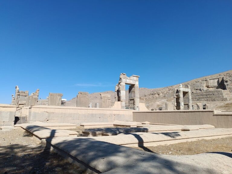
Pasargadae lies in the Murghab plain at approximately 1,850 to 1,900 meters above sea level, within a mountainous landscape in Fars Province. The principal archaeological area covers about 160 hectares and measures approximately 2.7 by 0.8 kilometers. A protected landscape of about 7,127 hectares surrounds it. The main remains are arranged around the tomb of Cyrus to the south, Tall-e Takht to the north, and the central royal palace district, with the Gate Palace to the east and gardens, ritual structures, and associated buildings extending around them.
Construction used stone, mud brick, fired brick, and wood. Wood served for columns, roof structures, doors, lintels, and stairs, while mud brick formed wall cores, upper walls, and some platform layers. Red bricks measured approximately 45 by 32 by 5.5 centimeters and were set with a water-resistant natural bitumen mortar. White limestone, resembling marble, came mainly from Mount Sivand. Dark stone came from Tang-e Siyah and Tang-i Bulaghi, while other structures used bluish hard stone and fragile black marble. Large stone elements were often assembled without mortar and joined with iron-and-lead dovetail clamps, metal fastenings shaped like swallowtails.
The tomb and southern buildings
Tomb of Cyrus
The Tomb of Cyrus stands south of the palace district, where it was originally set within the royal gardens. Built from large white limestone blocks, some reportedly reaching seven meters in length, it rises approximately 11 meters. Its six-stepped base measures about 13.35 by 12.30 meters. The lowest step is approximately 1.65 to 1.70 meters high, the second and third are about 1.04 to 1.05 meters, and the final three measure about 57.5 centimeters each.
A small rectangular chamber with a gabled roof stands above the stepped base. Its walls are about 1.5 meters thick, and the chamber measures approximately 6.4 meters long and 5.35 meters wide at the base. A low, narrow entrance on the western or northwestern side is about 1.39 meters high and 0.78 meters wide. The original stone doors have disappeared. Most of the metal clamps that joined the blocks were later removed, leaving visible clamp holes that have been partly repaired. Two large cavities beneath the roof reduce the weight of the masonry and the load placed on the chamber.
The tomb combines a stepped platform with a gabled-roof chamber. Its design has been interpreted as a synthesis of Iranian, Elamite, Anatolian, Lydian, Ionian, and possibly earlier Mesopotamian and Urartian traditions. A rosette decorated the lintel above the entrance. An inscription traditionally associated with the tomb, reportedly seen by historians accompanying Alexander, is no longer present. Ancient descriptions also mention a gold coffin, a table, gold vessels, weapons, clothing, jewelry, and other royal objects inside the chamber. These objects were reportedly looted during Alexander’s period and do not survive at the tomb.
Muzaffari Caravanserai and mosque
About 100 meters north of the tomb is the Muzaffari Caravanserai. The building has an irregular courtyard approximately 16.4 by 18.5 meters, an eastern entrance, a portico 3.3 meters wide, and small and large rooms set behind irregular stone piers. Much of its white stone came from the Achaemenid palaces. The masonry was joined with gypsum mortar, although some areas used no mortar.
The later mosque enclosed the tomb within its courtyard. It contained stone columns, Quranic inscriptions, and a small mihrab, a prayer niche, carved into the southwestern wall of the tomb chamber. The mosque’s surviving columns and stones were later collected and transferred toward the palace area.
Tall-e Takht and the northern precinct
Throne Hill
Tall-e Takht, meaning “Throne Hill,” occupies the northern or northeastern part of Pasargadae. Its main platform was approximately 98 meters wide on the south, 79 meters on the west, and 66 meters on the north, with an original height of roughly 14.5 to 15 meters. Its history comprises four principal phases: an initial stone phase under Cyrus, extensive mud-brick construction from the late sixth to early third century BC, a later reoccupation, and a fortified pre-Islamic settlement.
The earliest platform had outer and inner stone walls around a central core. The outer wall used large dressed limestone blocks laid without mortar, with iron-and-lead dovetail clamps reinforcing the vertical joints. The inner wall contained roughly dressed reddish sandstone, while smaller dark-gray limestone formed the core. More than 70 masons’ marks, including circles, crosses, and L-shaped signs, were cut into the masonry.
The stone phase used anathyrosis, a technique in which the edges of adjoining blocks are carefully smoothed so that large stones fit closely together. A surviving southern parapet or balustrade consists of heavy stone blocks with panels and hanging rails, although it is uncertain whether a parapet was planned around the entire platform. Two broad northern stairways provided access. Stairway A is approximately 5.5 meters wide and Stairway B about 5.85 meters wide. Their steps are about 26 centimeters high and 53 centimeters deep.
Later construction on Tall-e Takht used mud brick, stone, and fired brick. A large columned hall on the western side measured approximately 25 by 7 meters and contained eight column bases. Much of the western retaining wall has collapsed, and an unfinished stone stairway was later blocked by a large mud-brick wall.
Royal palace district
Gate Palace
The Gate Palace, also called Gate R, stood in the eastern part of the palace district. Its rectangular plan measured approximately 28.5 by 25.5 meters. The building contained a hypostyle hall, a large room whose roof was supported by multiple columns, more than 16 meters high. It had two main entrances and two side entrances, with guard rooms near the northeastern and southwestern side entrances. Eight square stone column bases, each approximately two meters on a side, mark the positions of the columns.
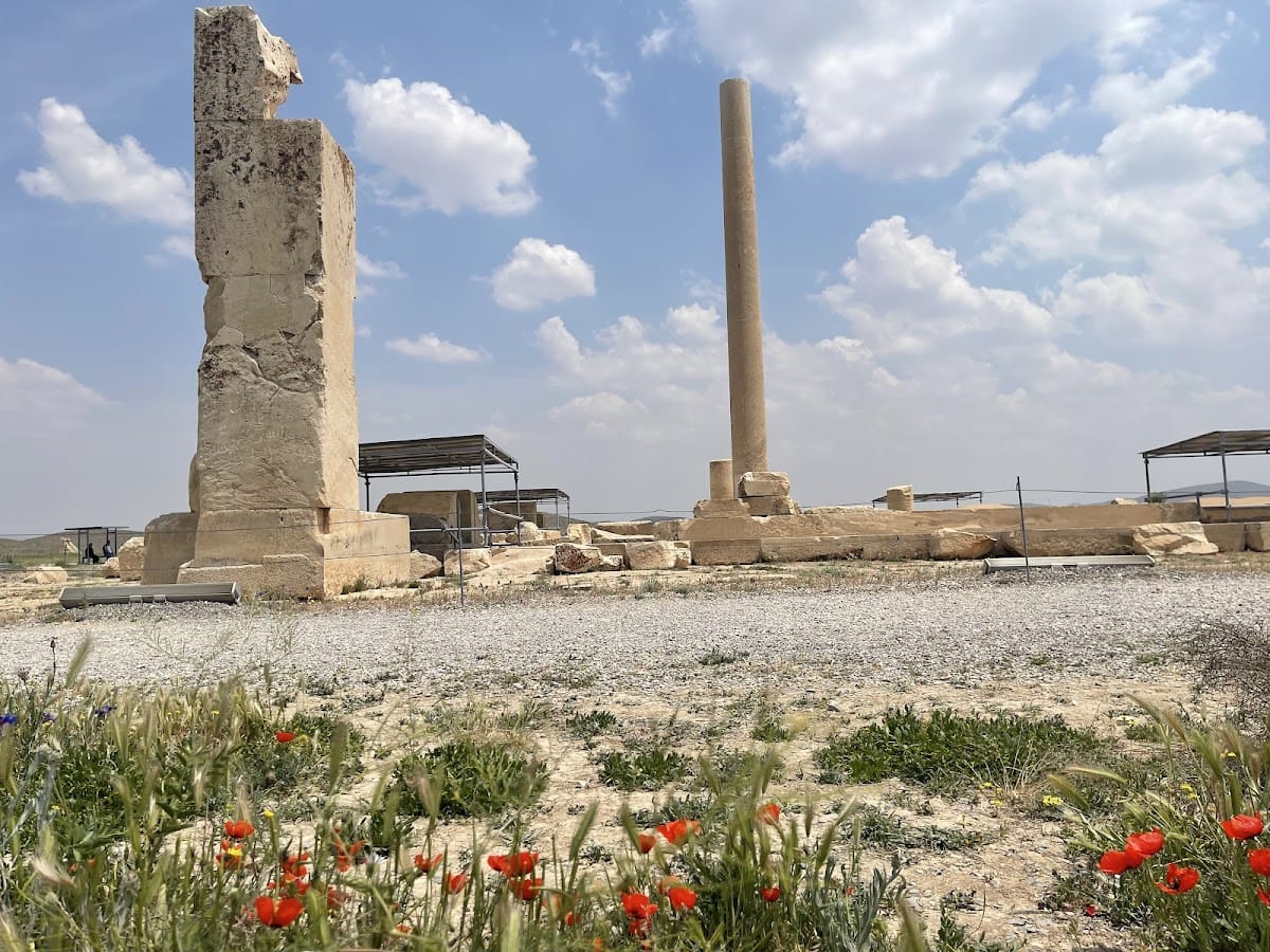
Stone foundations, paving, column bases, and doorframes supported plastered mud-brick walls and a partly wooden roof. The entrances were approximately nine meters high, but only one major doorway pier survives. Its relief shows a four-winged humanlike figure facing into the hall. The figure wears a close-fitting ribbed cap surmounted by an Egyptian-style Hemhem crown and a long fringed garment. An inscription known as CMa, formerly placed above the relief, disappeared with its stone between 1861 and 1874.
Audience Palace
The Audience Palace, or Palace S, stood between the Gate Palace and the Residential Palace. It was a rectangular building with a central hypostyle hall approximately 32.35 by 22.14 meters, four surrounding porticoes, and mud-brick walls about 1.62 to 1.64 meters thick. The hall contained two rows of four columns. The side porticoes had 16 columns each, while the larger northeastern portico contained 48 columns.
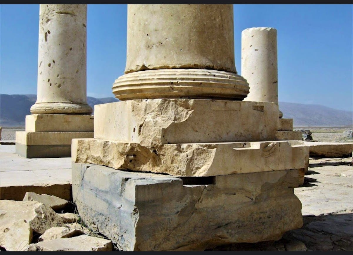
Only one of the original columns remains standing, rising more than 13 meters. Its white limestone shaft consists of four diminishing drums joined with wooden dowels and horizontal anathyrosis. The base includes a limestone foundation, two square plinths, and a smooth torus. Capital fragments represent lions, bulls, and horses, with the horse capital unusual within Achaemenid art. Three damaged projecting wall ends, or antae, survive, and one still preserves part of the CMa inscription.
Reliefs at the entrances depict composite human and animal figures. One entrance preserves human feet leading to legs that end in claws. Another shows a figure with human feet, a short skirt, and a fish-shaped garment, accompanied by the legs and tail of a bull.
Residential Palace
Palace P, the Residential or Private Palace of Cyrus, measures approximately 76 by 46 meters. Its hypostyle hall measures about 31.1 by 22.1 meters and contained five rows of six columns. The southeastern portico had two rows of 20 columns, while the northwestern portico had two rows of 12.
The columns stood on double black-and-white limestone bases with horizontally fluted toruses. Only lower column elements survive, while the upper portions may have been wooden and plastered. Traces of yellow, lapis, turquoise, copper-green, madder, and light-red pigments, along with spiral, triangular, and diamond motifs, show that the columns and architectural surfaces were decorated.
The southeastern portico is known as the Throne Portico. Its paved floor is approximately 72.5 meters long and 9.35 meters deep. A white stone throne stands to the left of the entrance. Traces of anathyrosis suggest that it originally carried a dark-stone upper element, and a small stone block may have served as a footstool. Two entrances connect the hall with the porticoes, and their reliefs include figures whose clothing bears the multilingual inscription CMc. Several stone column elements have been repositioned through restoration.
Royal gardens and waterworks
The royal gardens, known as the Cyrus or Persian Paradise, were formally arranged spaces enclosed by stone-lined channels. David Stronach reconstructed a chahar-bagh, a garden divided into four principal sections by intersecting channels or paths, measuring approximately 145 by 112.5 meters. The channels defined adjoining garden spaces and led toward the palace and a pavilion.
The waterworks supplied irrigation and ornamental circulation. Small basins placed at intervals of approximately 9.5 to 13.5 meters divided and slowed the water and allowed silt to settle. The basins measured about 87 by 87 centimeters internally and were approximately 52 centimeters deep. The channels were about 25 centimeters deep, with edges approximately 15 to 16 centimeters wide. Approximately 1,100 meters of the garden waterworks have been excavated, and later geophysical surveys identified additional channels. Branches from the Pulvar River supplied the gardens. Some channels may also have followed a natural streambed or assisted in transporting building materials.
Garden pavilions and bridge
Pavilion A stood on the southern side of the garden on a rectangular stone base measuring approximately 11.5 by 10.2 meters. Projecting porticoes on its northeastern and southwestern sides were each about 17 meters long and 4.3 meters wide. Only limited remains survive. Pavilion B, west of the garden, stood on a dressed-stone rectangular platform measuring approximately 11.7 by 10.1 meters and was probably connected with access to the royal garden.
A stone bridge crossed one of the principal garden channels. It measured approximately 15.6 meters in length and 16 meters in width and had three rows of columns spaced about four meters apart. The columns were approximately 90 centimeters in diameter and originally more than two meters high. They lacked capitals. The bridge’s date and precise function remain uncertain.
Ritual and sacred structures
Zendan-e Soleyman
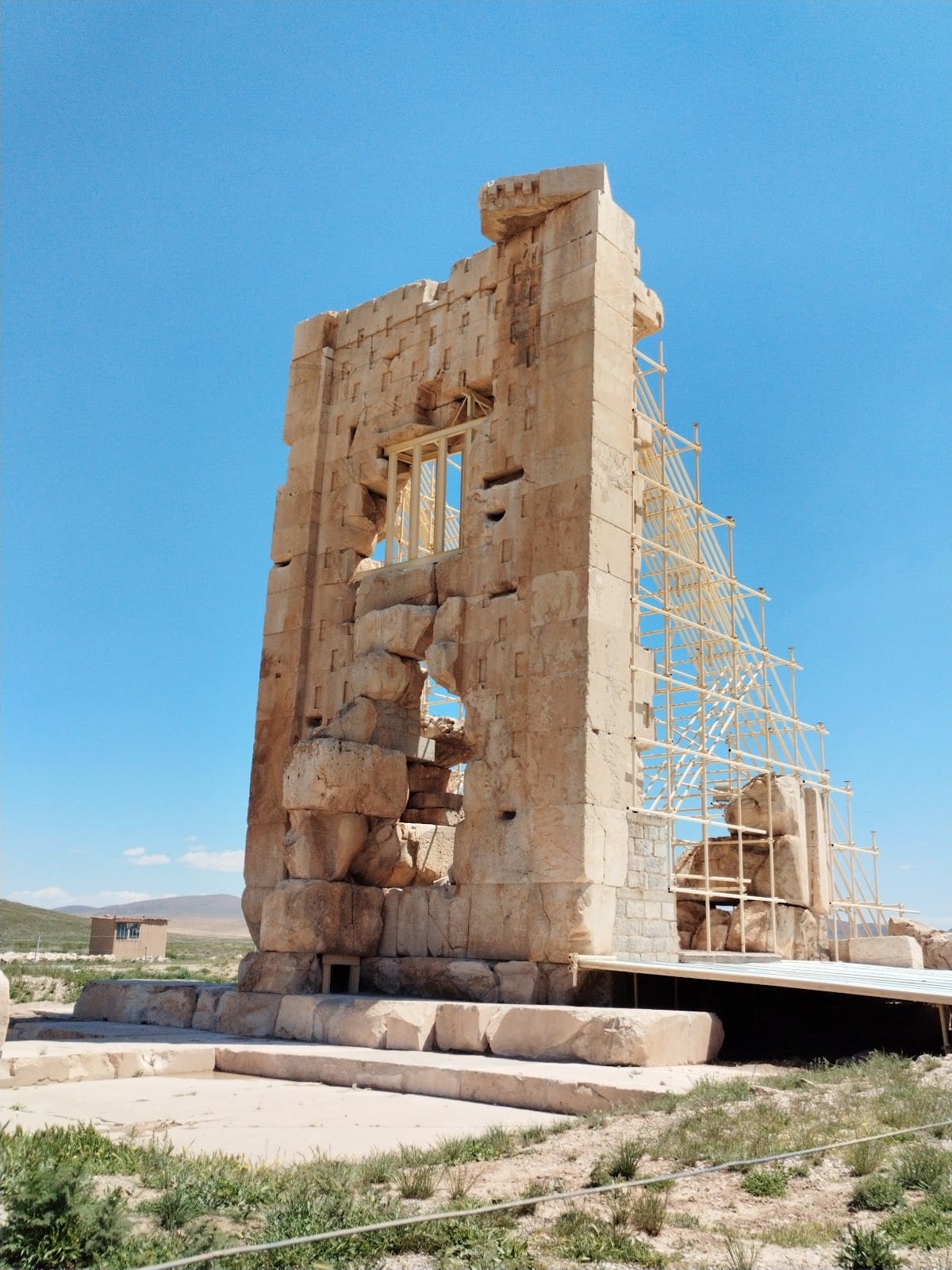
Zendan-e Soleyman, meaning “Prison of Solomon,” stood north of the palace district. The heavily damaged tower was originally a nearly square white-stone building, with sides of approximately 7.25 to 7.33 meters and a total height exceeding 14 meters. It stood on a three-stepped platform and contained a single windowless chamber reached by a northwestern stairway.
Three rows of black limestone blind windows, recessed window-like features that do not open through the wall, decorated three sides. Fifteen rows of regularly spaced rectangular recesses covered the walls. A low pyramidal roof and interlocking cornice completed the structure. Large white blocks were joined with anathyrosis and reinforced at the corners. The stairway contained 29 steps, with a total length of approximately eight meters and a height of about 7.8 meters. Only a fragment of an inscription found in 1952 on the southwestern side is associated with the tower.
The building is generally dated to the second half of Cyrus’s reign, but its function remains uncertain. Proposed interpretations include a religious building, a royal tomb, a repository for royal or religious objects, and a place connected with royal ceremonies.
Sacred precinct
The sacred precinct lies northwest of the palace district. It contains two white limestone platforms, a stepped rectangular mound, and traces of an enclosing wall. A stone bridge links the precinct with the palace area. The southern platform has a stairway and an internal hollow space that reduces its weight. It measures approximately 2.43 meters square and 2.16 meters high, on a foundation about 90 centimeters high. The northern platform is approximately 2.8 meters square and 2.10 meters high and has no stairway.
The two platforms are traditionally interpreted as ritual installations, possibly fire altars. The southern platform may have been used by the king during ceremonies before a stepped altar placed on the northern platform. Three fragments of similar stepped altars have been found elsewhere in the Pasargadae area.
West of the platforms, the stepped mound measures approximately 74.85 meters long and 46.65 to 50.4 meters wide. It consists of five terraces. The lower four were built of rubble stone and the fifth of mud brick. Former accesses lay on the north and northeast. Its date may be Achaemenid or post-Achaemenid, and its function has been connected with sacrifice or religious ceremonies.
Tang-i Bulaghi landscape
Tang-i Bulaghi is a river valley between the Pasargadae and Saadat-Shahr plains. Its permanent river joins the Kor River after passing through Pasargadae and the Marvdasht plain. The valley contains Middle Paleolithic open sites dated approximately 250,000 to 100,000 years ago, more than 40 caves and rock shelters, prehistoric settlements, Achaemenid palaces, forts and villages, Parthian burials and boundary walls, Sasanian wine-processing and metalworking installations, and Islamic-period graves, kilns, and temporary pastoral enclosures.
Ancient wild pistachio trees, some reportedly more than 1,000 years old, grow in the valley. The landscape also remains associated with seasonal pasture used by local pastoral groups, extending the archaeological setting of Pasargadae beyond the central royal complex.