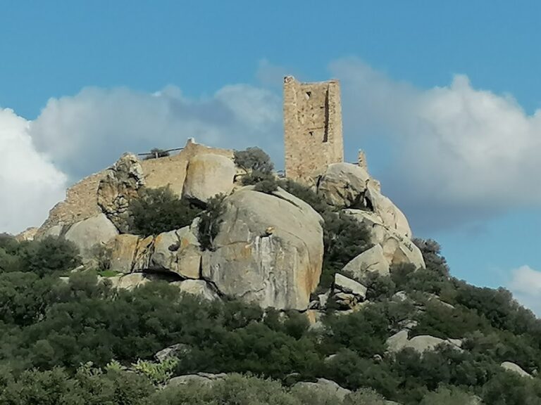
Su Romanzesu: A Nuragic Sanctuary Village in Sardinia
Site at a Glance
- Popularity
- Medium
- Country
- Italy
- Primary era
- Bronze Age
- Eras represented
- Bronze Age, Iron Age
- Civilizations
- Nuragic
- Site type
- Religious
- Remains
- Sanctuary
On this page19 sections
History
Su Romanzesu is a Nuragic sanctuary village near Bitti, Sardinia, Italy, occupied from the Bronze Age into the Iron Age and generally dated from the 14th to the 7th centuries BCE. The Nuragic civilization was Sardinia’s Bronze Age and early Iron Age culture, known for its stone architecture and settlements. Activity at the site began as early as about 1500–1400 BCE, and the settlement developed into a major sanctuary used by communities across a broad surrounding area.
From village to sanctuary
Su Romanzesu grew over time from a settlement into a religious centre. Its inhabitants’ economy is understood to have included livestock raising, farming, hunting, and fishing. A sacred well and connected water installations formed part of the wider ritual complex. These features may have supported religious practices involving water. A water ordeal, a ritual test using water to judge guilt or innocence, has also been proposed in connection with the Roman writer Gaius Julius Solinus, whose third-century CE account describes water ordeals in Sardinia.
The settlement appears to have been abandoned around the 7th century BCE. A pottery fragment from a meeting hut has been interpreted as evidence for this dating.
Roman-era surroundings
The name Romanzesu probably reflects Roman-era remains in the surrounding area. Romans occupied the nearby highlands during the 2nd and 3rd centuries CE. Roman establishments included Sa Pathata, Juanne Pala, and Olusthes, while other remains are known at Solle and Muru ’e colovras. A funerary stone at Sa Pathata commemorated Decumus, a soldier who died at 32 after serving for 15 years in the Cohors Aquitanorum, a Roman auxiliary military unit.
Rediscovery and excavation
In 1919, Italian archaeologist Antonio Taramelli was alerted to the sacred well during work to locate water on the property. Workers partly damaged its access stair and diverted spring water to a trough. Work in the 1950s carried water through a larger channel to a deeper cistern, damaging the well’s original paving.
After a drought, mechanical water-searching damaged the monument in 1986. Emergency work followed protective measures and exposed the well’s structure as well as further parts of the Nuragic village, including huts, temples, and granite standing stones. Seven excavation campaigns directed by Italian archaeologist Maria Ausilia Fadda took place from the late 1980s through 2001.
Remains
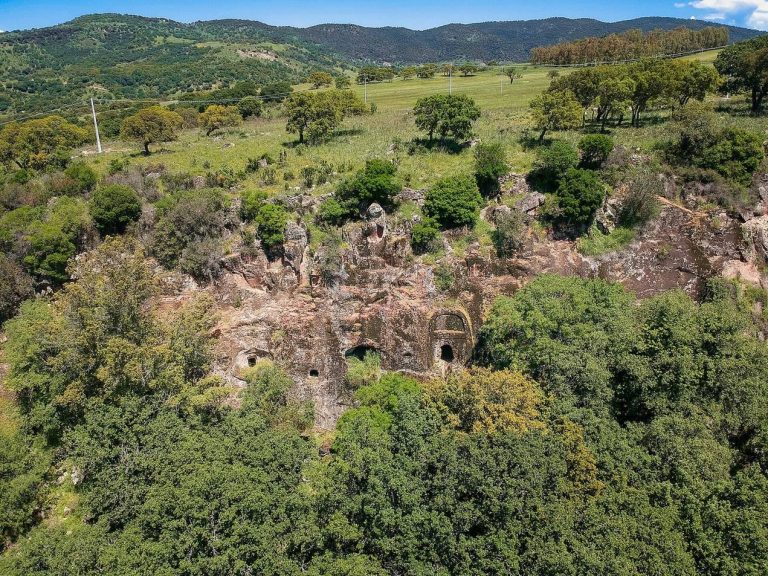
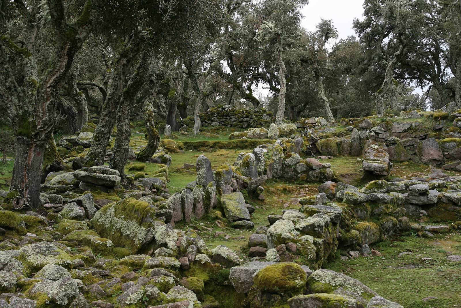
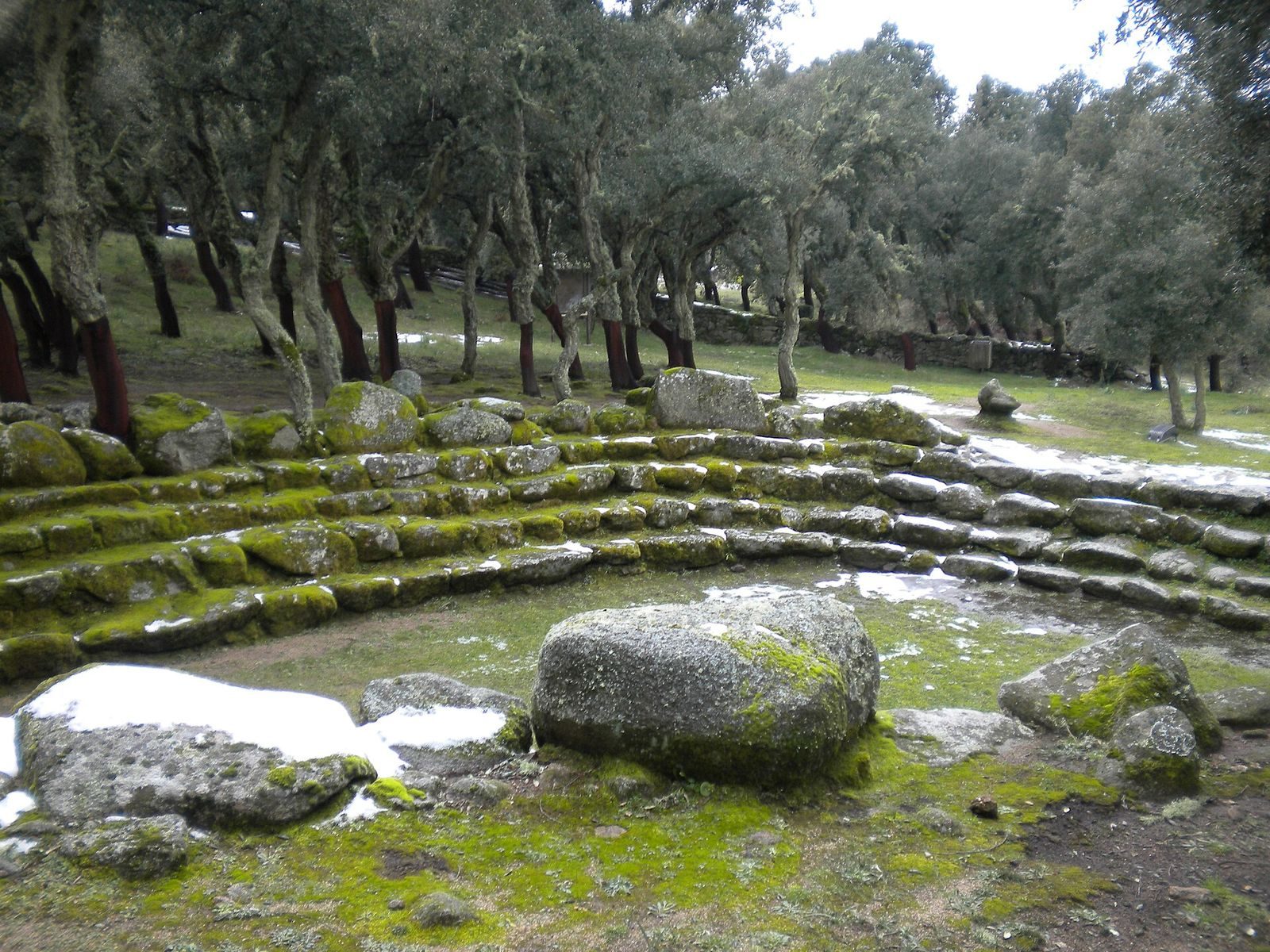
The archaeological area covers about seven hectares on a granite plateau roughly 750 metres above sea level, near the source of the Tirso River. Granite outcrops and cork oaks surround the settlement, whose inhabited area covers approximately 6–6.5 hectares. The remains include around 100 huts, temples, a sacred well and waterworks, a ceremonial enclosure, and other ritual structures, built largely from local granite.
Village and meeting huts
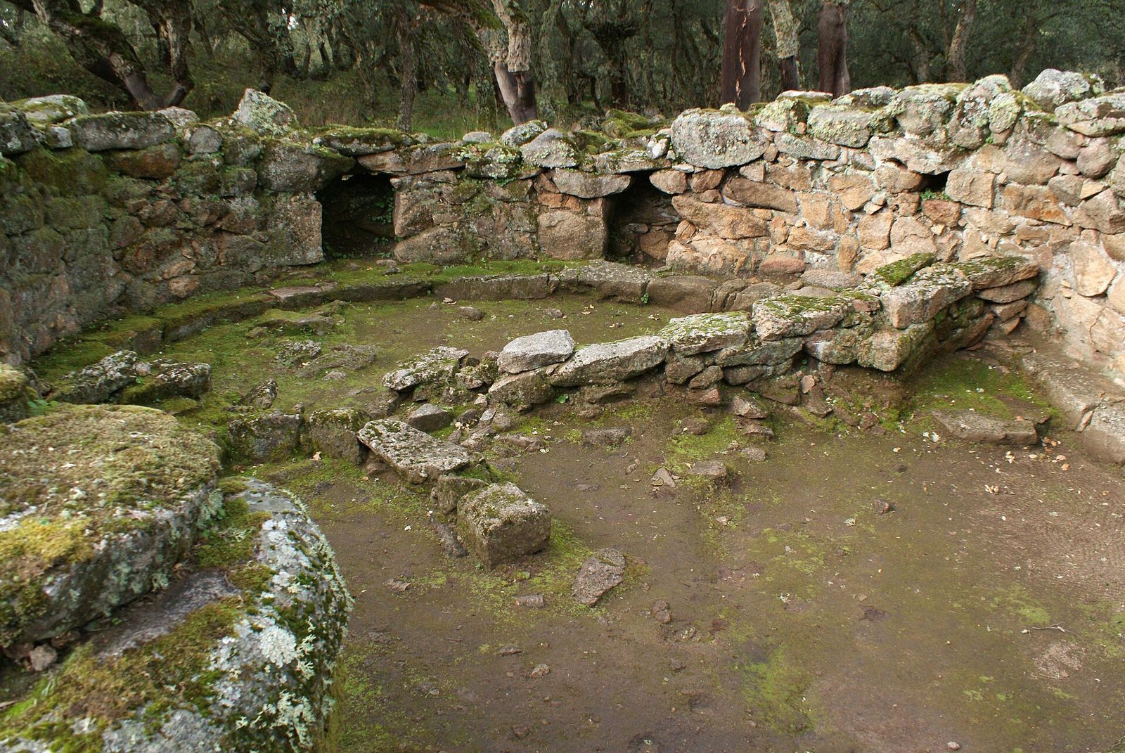
Huts at Su Romanzesu have circular, oval, irregular, and figure-eight plans, alongside a large building divided into sectors. Their walls were built from granite blocks laid without mortar. Interiors include stone benches, wall niches, and hearths at the centre or beside a wall. These varied arrangements have been interpreted as evidence that buildings served different purposes, potentially including ritual activities.
Meeting huts
At least five circular meeting huts have been excavated. They share paved floors, stone benches around the interior walls, and central stone hearths. Some larger buildings also contain niches and an internal dividing wall.
Hut 1
Hut 1 has an interior diameter of 6.75 metres and granite walls laid in uneven courses. Its right-hand wall survives six courses high, reaching 1.65 metres, and is 1.34 metres thick. The entrance faces east; a long granite slab there may have served as a lintel. A bench of granite blocks follows the inner circumference, and the base of a hearth remains at the centre. Pottery from the deepest layers includes undecorated or comb-marked coarseware plates, ridged bowls, and a small spoon-shaped lamp. Fragments of rounded pots from an upper layer belong to a later phase.
Hut 2
Hut 2 stands to 1.40 metres high and is built from granite blocks of differing sizes, with smaller packing stones used to even out the wall courses. Two steps lead to its east-facing entrance. Inside, the room measures 6.50 metres across and retains parts of a slab floor and a seat made from 15 granite slabs on the left. A large hearth at the centre measures 1.70 by 1.50 metres. Pottery found mainly around the hearth and wall base includes plain plates, thick-rimmed rounded pots, and some sharply ridged bowls.
Other hut forms
Other buildings include oval and partly oval huts, irregular structures, two-room figure-eight plans, and the large sector-divided building. Their sizes and internal arrangements vary, adding to the evidence for a settlement with buildings put to different uses.
Sacred well and waterworks
Sacred well
The well stands at the centre of the sacred area. Its circular granite walls measure 3.40 metres across at the base and 3.30 metres at the top, and are made from irregular courses of roughly worked blocks. Above ground, the surviving vaulted roof reaches 3.60 metres and is formed from 19 courses of medium-sized granite blocks, with smaller stones packed between them. The entrance is an arch-shaped opening. It was originally topped by a lintel 1.70 metres above the first step.
The access stair widens outward and measures 1.60 metres long by 1–1.30 metres wide. Sockets for wall stones survive along both sides. Wooden steps now supplement the removed granite steps, and the paving has been restored. Inside, a bench curves around the well, with four slabs on the left and eight on the right. Natural rock interrupts the bench and is incorporated into the masonry in several places. Part of the original floor survives beneath the bench stones. The spring emerges through a rectangular opening, 0.38 by 0.30 metres, between the masonry and the natural rock.
Overflow channel and basins
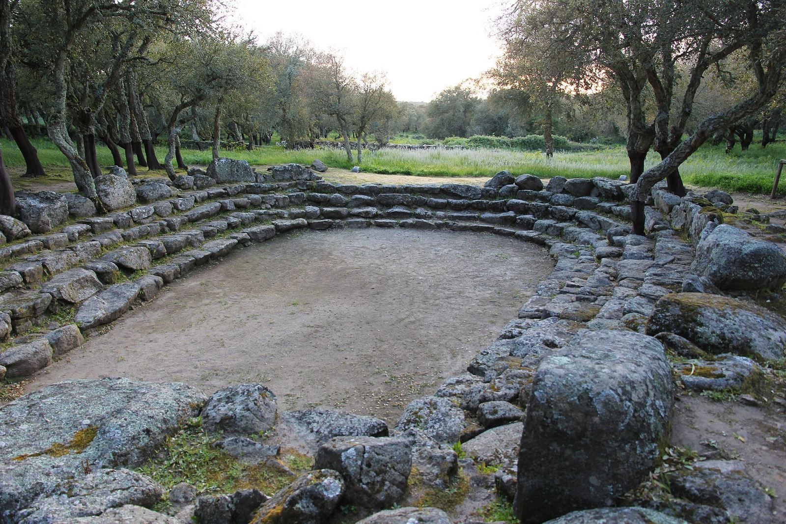
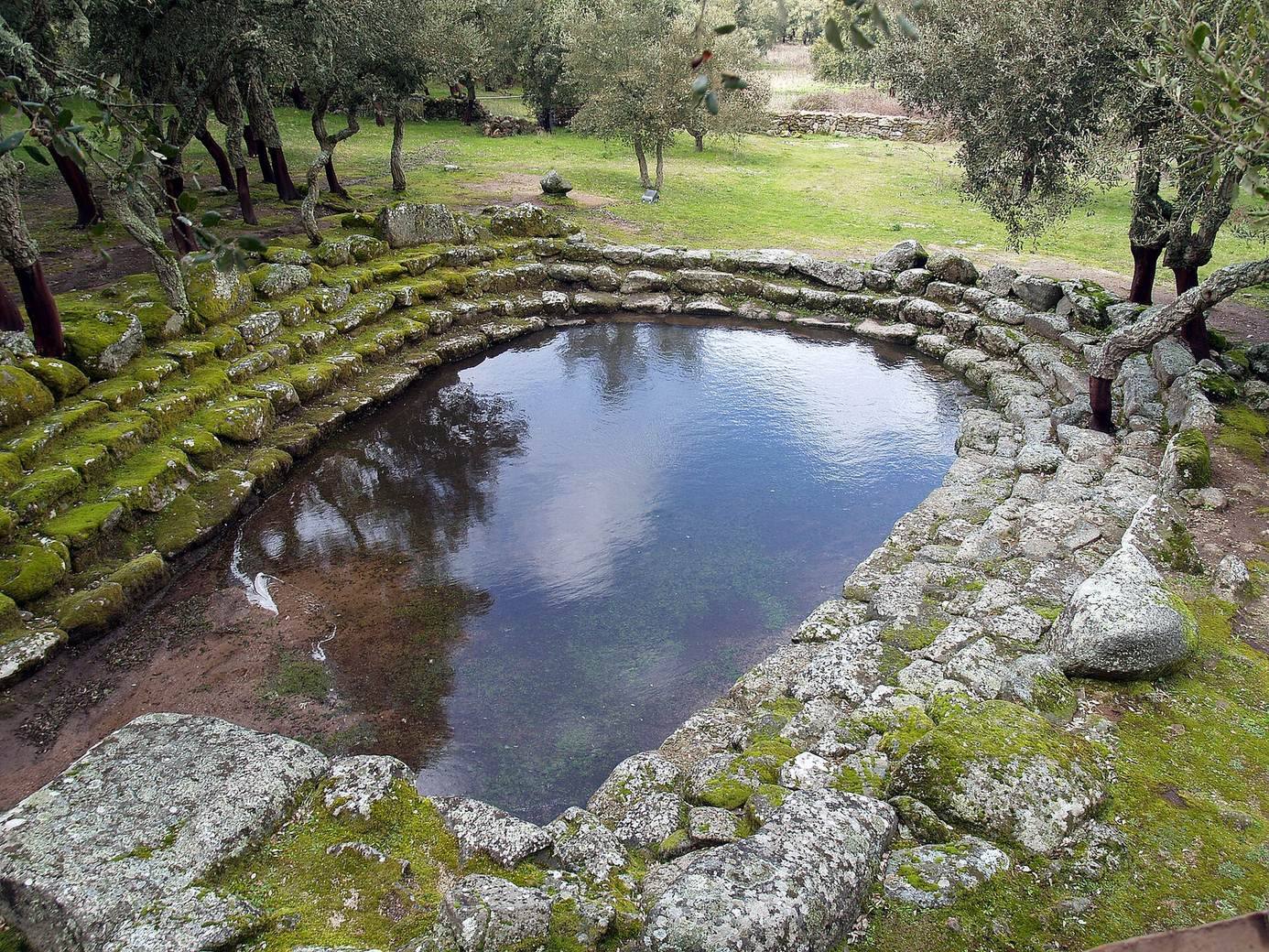
Overflow passed through a double entrance chamber, where a short section of paved surface and part of the right-hand bench remain. From there, a channel ran 42 metres from east to west, passing two circular basins before reaching a large stepped basin. Thin granite slabs paved the channel edges, and some remain in place.
The terminal basin is elliptical, with an interior length of 11.10 metres and a width of 4.65–7.10 metres. Six stepped tiers create a level change of 1.60 metres. The basin was paved and may have gathered overflow from the well while accommodating people from the village. The paving beside the channel has been taken to suggest ritual washing or immersion; religious and political ceremonies are also possible interpretations. Three small granite standing stones, associated with a deity or sacred presence, were found near the well and entrance chamber and built into its masonry.
Temples
Temple A
Temple A lies about 100 metres from the well. Its irregular rectangular plan has curved front walls attached to earlier temple structures. The recorded maximum measurements are 2.15 metres in length and height, with a width of 5.40–6.20 metres.
In its first phase, a rectangular entrance space led through an east-facing passage, 1.20 by 0.89 metres, to an inner rectangular room measuring 5.30 by 3.30 metres. Irregular benches followed the chamber walls. A circular pit at the centre may have supported large bronze or ceramic vessels, or the base of an architectural feature connected with purification rites. Finds from this phase include pottery, pin fragments, and fittings for Nuragic bronze objects.
In the second phase, builders closed the front to create a straight facade and a rectangular entrance space measuring 1.50 by 3 metres. Its central entrance, 0.65 by 0.85 metres, aligned with the earlier doorway. Two semicircular installations of small granite blocks occupied the old wall corners. They were intended to steady large storage jars used to collect water for ritual washing. Finds include fragments of plates, bowls, ridged cups, and rounded pots, as well as burned animal bones.
In the final phase, the straight facade was demolished and replaced by curved walls measuring 2.80 by 3 metres, enlarging the entrance space. The masonry used smaller stones arranged more carefully. Small stones covered the two semicircular installations and the threshold, and a packed-earth floor was laid above them. Finds include bowls and plates, decorated ridged bowls with projecting knobs, handled rounded pots, a tall-footed vessel, a pestle, a bronze dagger, and a bronze pin.
Temple B
Temple B was built among large granite boulders, about 100 metres from the ceremonial enclosure. Its earliest building phase dates to the Middle Bronze Age. The plan, which has projecting wall ends at both front and rear, measures 8.80 by 2.30 metres. The temple itself is a 3.70-metre-long rectangular building with walls 1.35–1.40 metres thick, made from many-sided granite blocks laid in regular courses. A sacred enclosure around it survives at foundation level. In a later phase, granite slabs levelled the sloping approach, and a wall closed the entrance space.
Finds include a porphyry base for offerings with irregular holes, a large storage vessel against the rear wall, and a bronze bracelet beside the main inner chamber. Numerous whole or broken vessels lay on the paved area in front, including rounded pots, bowls, ring-footed vessels, and handles from pear-shaped jugs.
Temple C
Temple C lies east-northeast of the well, beneath dry-stone walls that shepherds built in the early 20th century to enclose livestock. Its highly irregular rectangular exterior reaches 11.90 metres in length and measures about 6 metres across at the rear and 5.50 metres at the front. Uneven courses of local granite blocks form the walls. Inside, a rectangular room measuring 4.90–5.15 metres long and about 1.60 metres wide has a floor of closely fitted granite slabs. Two offering bases outside the right side bear traces of poured lead.
Objects from the temple include four spearheads designed to fit over their shafts, two well-preserved spear butts measuring 20 and 24 centimetres, small daggers, pins, and fragments of metal ingots shaped like stretched hides. Other finds include two conical bronze buttons with animal-shaped attachments, part of a male bronze figurine, a small sculpted bovine head, bronze beads, rings, bracelets, four amber beads, and three glass-paste beads.
Small enclosure south of Temple C
Finds from a disturbed archaeological layer in this enclosure include fragmentary daggers, pins, necklace beads, bracelets, bronze pendants and brooches, rings, and ingot fragments. The assemblage also contains 131 intact amber beads and many amber fragments. Pottery includes incised ridged bowls, rounded pots with cylindrical necks and sharply angled handles, and pear-shaped jugs with geometric decoration; glass-paste beads were also found. Su Romanzesu has yielded the largest assemblage of Baltic amber found in Sardinia.
Ceremonial enclosure
The large ceremonial enclosure opens to the east. Concentric walls form a winding route through a ring-shaped corridor to a central circular space 4.74 metres in diameter. Part of a paved floor survives at the centre, alongside a circular stone base that may have supported a structure connected with worship. The corridor may once have had a single-sloping roof carried by long wooden beams.
Finds from the central space include fragments of small bronze daggers and votive swords, a terracotta model of a nuraghe, a characteristic Nuragic stone tower, and a pilgrim’s flask whose neck carefully reproduces a tower. More than a thousand river pebbles of white and reddish quartz, in varied sizes, were associated with the space. Their presence may relate to a particular religious practice.