Stopham Bridge: A Medieval Crossing of the River Arun
Site at a Glance
- Popularity
- Low
- Country
- United Kingdom
- Primary era
- Medieval
- Eras represented
- Medieval, Early Modern, Modern
- Civilizations
- British, English
- Site type
- Infrastructure
- Remains
- Bridge
On this page10 sections
History
Medieval origins
Stopham Bridge is a medieval stone crossing of the River Arun between Stopham and Pulborough in England. A stone bridge probably replaced an earlier timber crossing and a ford. The earliest crossing identified in records was the Eastover Ferry, while a bridge in some form is thought to have existed by the early 13th century. The first known written record specifically naming a bridge dates to 1347, when responsibility for its upkeep lay with the Sussex administrative divisions known as rapes: Chichester, Arundel and Bramber.
In 1399, a grant of pontage, permission to collect tolls for bridge maintenance, allowed tolls to be charged for two years. This may indicate that the bridge was temporary at the time. The date of the present structure remains uncertain. Nineteenth-century historians Thomas Walker Horsfield and James Dallaway dated it to 1309. Edwin Jervoise proposed a 16th-century bridge replacing a medieval one dated to 1347, while A. A. Evans placed it at 1423. Historic England considers 1422–23 the probable construction date. Stopham is a rare medieval bridge survivor in Sussex, where large bridges of this period were uncommon. Historic England estimates that fewer than 200 medieval multi-arch bridges survive in England and regards unaltered examples as nationally important.
Conflict, navigation and repair
During the English Civil War, the 17th-century conflict between supporters of the king and Parliament, one arch was destroyed and replaced by a drawbridge. The drawbridge was fenced off in 1650. The River Arun had served as a trade route since the Middle Ages. In the 19th century, the Wey and Arun Canal connected it with the River Wey, creating a water route between London and the south coast. In 1822, the bridge’s central arch was raised to allow larger boats to pass. Repairs in 1865 improved the approaches and replaced defective stonework with brick in several places.
Road traffic and modern conservation
The bridge carried the A283, the main road between Petworth and Fittleworth and Pulborough. Military convoys damaged it during the Second World War, and heavier traffic later in the 20th century worsened the damage. Traffic lights were installed, but vehicles increasingly struck the parapet at the bend. A modern concrete bridge opened 100 feet (30 metres) upstream in 1986, allowing the A283 to be diverted. Stopham Bridge was restored in 1991 and now carries cyclists and pedestrians. West Sussex County Council maintains it. It is Grade I listed and has been a scheduled monument since February 1955.
Remains
Setting and overall form
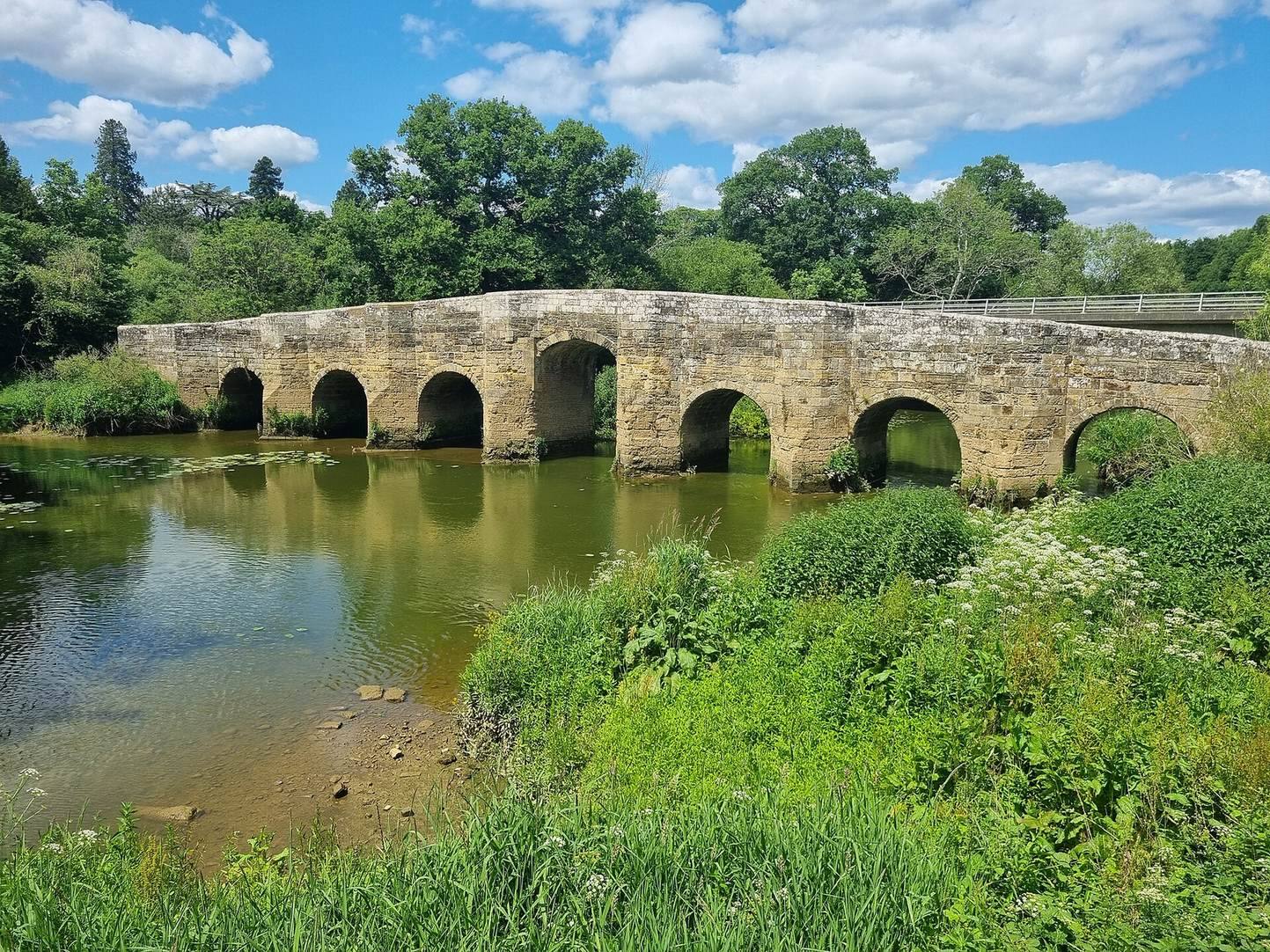
The bridge crosses the Arun at the river’s uppermost navigable and tidal reaches, just upstream of its meeting with the River Rother. The sea at Littlehampton is about 10 miles (16 kilometres) away in a straight line and almost 20 miles (32 kilometres) along the river. Built from locally quarried ironstone and sandstone, the bridge measures 246 feet (75 metres) in length, or 190 feet (58 metres) without its abutments, and is 12 feet (3.7 metres) wide. It runs roughly east to west, with a slight bend at the Stopham end that probably avoided the grounds of Stopham Manor.
Arches and river piers
Arch openings
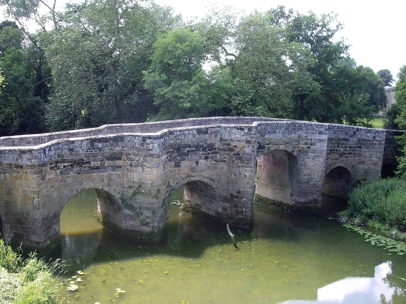
Seven arches span the river, and an eighth, added later, passes through the causeway to relieve flooding. Six flanking arches each span 11 feet 9 inches (3.6 metres); the central arch spans 12 feet 9 inches (3.9 metres). The visible flanking arches are round-headed, while the central opening has a shallower curve. It stands five feet (1.5 metres) higher than before its raising.
Cutwaters and refuges
Cutwaters, projecting structures that deflect the current around bridge piers, extend from both sides. On the downstream, southern side, they form semi-hexagonal buttresses ending below the parapet. On the northern side, the buttresses reach parapet height and create nine recesses used as pedestrian refuges.
Inscriptions and surviving repairs
An inscription on the central arch records its raising, and a plaque marks the 1991 restoration. Brick repairs survive at several points, including the piers, the cutwaters and the underside of the central arch. The bridge remains unusually well preserved.