Skipsea Castle: A Norman Motte-and-Bailey Fortress in Yorkshire


Site at a Glance
- Rating
- 3.6
- Popularity
- Low
- Country
- United Kingdom
- Primary era
- Medieval
- External website
- Open
- Eras represented
- Iron Age, Medieval
- Civilizations
- Norman
- Site type
- Military
- Remains
- Castle
On this page12 sections
History
Skipsea Castle is a Norman motte-and-bailey fortress in the United Kingdom, built around 1086 by Drogo de la Beuvrière, a Flemish mercenary who became the first Lord of Holderness. Founded after the Norman Conquest, the Norman takeover of England that began in 1066, and the Harrying of the North, William the Conqueror’s campaign of devastation in northern England, it helped secure the newly conquered region. The castle also guarded central Yorkshire against possible Danish attacks across the North Sea and controlled the main trading route through the surrounding marshes.
Foundation and lordship of Holderness
Skipsea became the administrative centre and principal residence, or caput, of Drogo’s extensive estates. In medieval administration, a caput was the main seat of a lordship. His lands stretched from the Humber to Bridlington, and the castle combined military responsibilities with economic control. Its position beside a waterway connected to the North Sea allowed it to oversee trade through an inland harbour.
The name Skipsea has Scandinavian roots and referred to a lake navigable by ships. During the medieval period, the surrounding land was described as an island because an estuary and floodplains enclosed it. A channel then connected the area with the North Sea, which is now about 2 kilometres away. A dam was probably built to create Skipsea Mere from the marshland. The castle complex apparently included a private harbour, a possible boatyard, and a freshwater fishery. A church stood east of the castle across the mere by the end of the eleventh century, and the village of Skipsea grew beside it.
Drogo settled ten knights on estates near the castle under a castle-guard arrangement. This system granted land to knights in return for military service at the fortress. One of the knights probably built a smaller fortification at nearby Aldborough. Over time, the arrangement declined and the estates instead provided monetary rents.
Changes of ownership and the growth of Skipsea Brough
After the suspicious death of his wife, Drogo fled England. William the Conqueror reassigned Skipsea Castle to Odo, Count of Aumale. The castle passed to Arnulf de Montgomery in 1096 and returned to the Aumale family in 1102. The family retained it until 1221.
Trade initially prospered around the castle. William le Gros founded the fortified settlement of Skipsea Brough on the ridge south of the fortress, probably around 1160. The settlement was intended to produce revenue for the earls and to strengthen the castle’s vulnerable southern side, which was overlooked by the ridge. Skipsea Brough did not develop into a successful commercial centre. Only three burgesses, legally recognized town inhabitants who commonly held property or trading rights, paid rent there in 1260.
Decline, rebellion, and destruction
After about 1200, Skipsea Castle declined in importance. Its location was considered poor, while the Danish threat had receded. The nearby manor of Burstwick became the administrative centre of the lordship instead.
Around 1220 to 1221, William de Forz, Count of Aumale by marriage and owner of the castle, rebelled against Henry III. The dispute included Henry’s seizure of the estate of Driffield, about 18 kilometres from Skipsea. William was excommunicated, meaning that the Church formally excluded him from its religious community, and royal forces besieged his castles, including Skipsea. He soon surrendered and was later pardoned.
After the rebellion, Henry III ordered Skipsea Castle to be destroyed, although the extent to which the order was carried out remains uncertain. William de Forz passed the castle to his son. After the death of his son’s widow, Isabella, the property passed to the Crown in 1293.
Landscape change and modern protection
Skipsea Mere was drained during the second half of the fourteenth century. By 1397, the castle was considered worthless and the surrounding 20 acres were being used for grazing. The Counts of Aumale used the manor house at nearby Cleeton when visiting the area. Skipsea Brough was largely abandoned by the late fourteenth century, and the combined population of Skipsea and Skipsea Brough recorded for the 1377 poll tax was 95. The medieval poll tax was a levy charged on individuals.
Further drainage took place around 1720, after which reclaimed land was used for farming. The ground remained marshy and still flooded occasionally at the beginning of the twentieth century. Skipsea Castle entered state guardianship in 1911 under the Commissioners of Works and Public Buildings and later passed to English Heritage. Archaeological surveys were conducted in 1987, 1988, 1992, and 2001. The castle is protected as a Scheduled Monument, a site protected under United Kingdom law because of its archaeological or historical importance. Between 2010 and 2014, concerns focused on the condition of the earthworks and the effects of drainage and the resulting drying of the ground.
Remains
The motte and surrounding water
The earlier mound and Norman motte
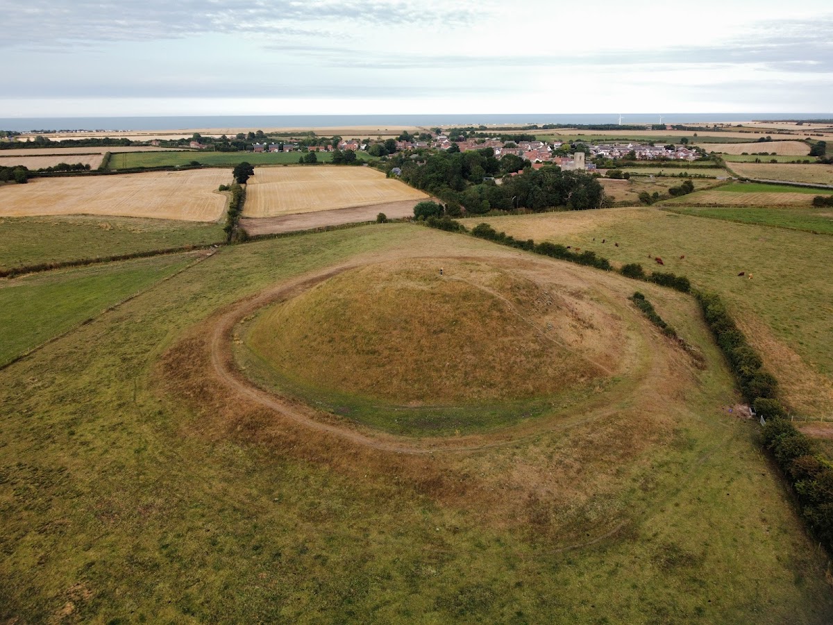
Skipsea Castle was arranged as a motte-and-bailey complex divided by Skipsea Mere. A motte-and-bailey castle combined a raised defensive mound, usually topped by a keep, with an enclosed lower court. The motte was built from sand and gravel on a natural glacial mound, which increased its apparent size. It measures about 100 metres across and rises approximately 11 metres, with around 0.25 acres of level ground at the summit.
The castle mound was built on, or incorporated, a much earlier Iron Age mound. The Iron Age was the period when iron became widely used for tools and weapons in Britain before Roman rule. Core sampling in 2016 recovered seeds and other organic material indicating that this earlier mound was constructed around 400 BC. It has been described as an artificial mound, possibly a burial mound, on a scale comparable to Silbury Hill.
A bank about 1.5 metres high protected the base of the motte, together with a ditch up to 10 metres wide. Both the bank and ditch were originally higher and deeper than they are today. A timber keep stood on the summit. A keep was the principal fortified building of a castle. A stone gatehouse may have occupied the south-eastern corner and opened onto the earthwork causeway crossing the mere toward the bailey. The eastern causeway connected the motte with the church in Skipsea village.
Skipsea Mere and harbour features
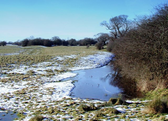
The mere surrounded the motte, while two causeways cut off its south-eastern corner from the rest of the water. A curved channel about 25 metres wide and 200 metres long ran around the motte’s south-west side toward the North Sea. It gave boats access to wharves inside the bailey and may have ended in a boatyard at its eastern end. A second inland harbour may have existed west of the bailey, although that interpretation remains disputed among archaeologists.
The water also supported a fishery. Eels were caught in the mere during the thirteenth century, and its south-eastern section may have been used as a freshwater fishery. Drainage later altered the landscape and affected the condition of the earthworks.
The bailey and its entrances
Bailey earthworks
The bailey curved around the west and south sides of the motte. It measured approximately 300 by 100 metres and covered about 8.25 acres. Its earthworks were formed from clay, with a rampart rising as high as 4 metres. A ditch about 10 metres wide protected the rampart and was originally up to 4 metres deep.
Bail Gate and Scotch Gap
The principal entrance lay on the southern side at Bail Gate, where a gatehouse controlled access. A gatehouse was a fortified building that guarded an entrance. A subsidiary northern entrance connected with a path. A break in the defences known as Scotch Gap was cut through the earthworks during the castle’s thirteenth-century destruction. Drainage works also damaged parts of the rampart.
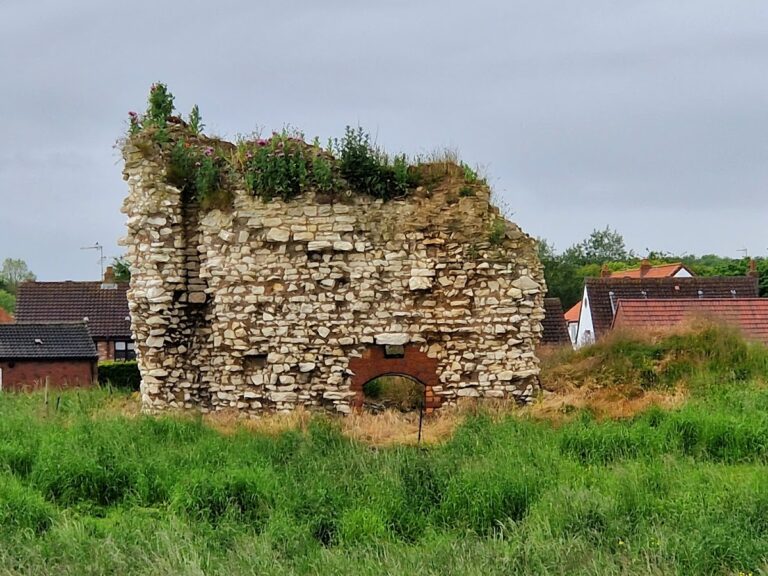
Only earthworks survive at the castle itself. A handful of buildings remain in the planned settlement of Skipsea Brough, the fortified settlement established south of the castle in the twelfth century.