Montgué: A Middle Neolithic Fortified Enclosure at Asnan
Site at a Glance
- Popularity
- Very Low
- Country
- France
- Primary era
- Stone Age
- Eras represented
- Stone Age
- Civilizations
- Unclassified
- Site type
- Military
- Remains
- Fort
On this page14 sections
History
Middle Neolithic enclosure
The Montgué Neolithic site is a fortified enclosure at Asnan, France. It was built during the Middle Neolithic, a phase of the prehistoric period associated with farming and polished stone tools. The enclosure occupies a projecting piece of high ground, with steep natural slopes and a constructed barrier across its landward approach. Enclosures of this kind became more common in Burgundy during this period, although Montgué’s precise purpose is uncertain.
The wider region had been occupied from about 5400 BCE. Until around 4600 BCE, communities there remained strongly dependent on hunting and forest resources. Fortified camps began appearing in France around 4500 BCE. Comparable enclosures were generally used for about five centuries and had been abandoned by the end of the fourth millennium BCE; these regional patterns do not establish the exact dates of Montgué’s use.
Henri Coqblin considered temporary refuge during periods of threat a possible explanation for Montgué. Other suggested uses for enclosures of this type include protecting livestock or crops, or providing a place for occasional gatherings. The evidence does not establish which, if any, of these functions applied at the site.
Finds and investigations
In 1925, amateur prehistorian Jules Subert found worked flints near Asnan and attributed them to the Paleolithic, perhaps the Mousterian, a Middle Paleolithic tradition, or the Magdalenian, an Upper Paleolithic tradition. He gave part of his collection to a local learned society, which published news of the find in 1926. Subert is regarded as the discoverer of the Asnan archaeological site. In 1937, while examining former signal locations in the Nièvre, he suggested that the hill above Asnan might have served as a fire-signal post. He also noted a concentration of flints, without establishing their date or archaeological context.
Flint objects were found on the slopes and at the foot of Montgué before the main excavations, including cores, scrapers, burins, arrowheads and polished axes. A burin is a chipped-stone tool with a chisel-like edge. In 1970–71, the Groupe Nivernais de Recherches archéologiques, a regional archaeological group, surveyed and excavated three areas under Coqblin’s direction. This work identified the fortified spur as a Middle Neolithic enclosure of about half a hectare.
Erosion at a ravine near a roadside cross led to urgent salvage work after a spring resurgence and landslide disrupted the soil layers. Because the disturbance prevented secure dating, archaeologist Jean Arnoux considered the recovered material probably Neolithic. The finds from the commune may include Paleolithic material, while the enclosure itself is more firmly associated with the Middle Neolithic.
Remains
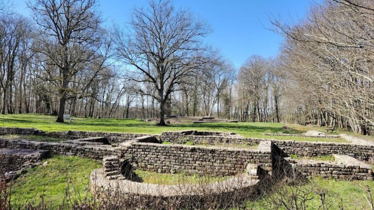
The enclosure is arranged across the southern end of a plateau, with a rampart and ditch cutting off the approach from the plateau and steep ground helping defend the spur. Its principal earthworks are joined by a second, partly levelled barrier within the enclosed area. The surviving remains and excavated finds provide evidence for stone-tool production, fires and a human cremation deposit.
Setting and defenses
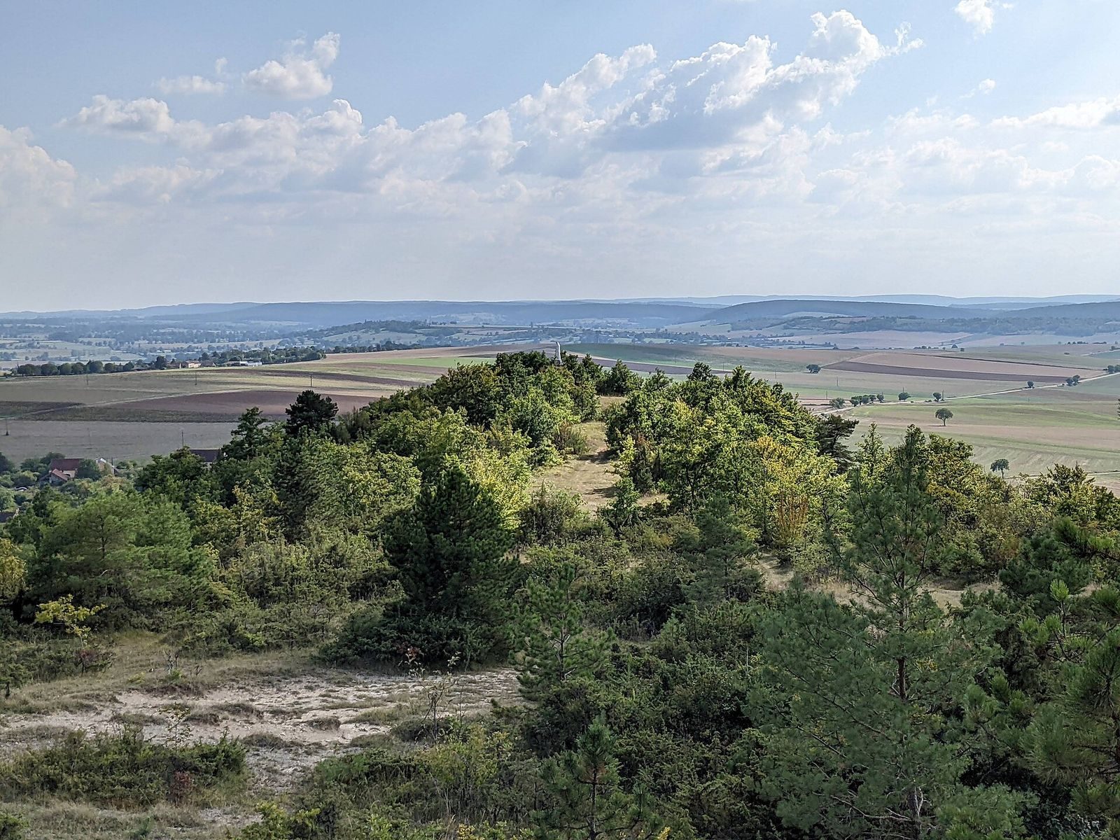
The site lies at 355–360 metres above sea level, on the southern end of a plateau that reaches about 391 metres in the woodland of Bois des Menées. It overlooks the Yonne valley and faces the western edge of the Morvan. The rocky spur drops more than 30 metres over a distance of 100 metres, a slope of about 30 percent. A nearby spring feeds the Asnan stream, which had a torrential flow.
A rampart about 37 metres long crosses the spur from east to west, enclosing roughly 0.5 hectares with an estimated perimeter of 274 metres. The rampart survives to about 1 metre high. In its excavated eastern half, which was 4 metres wide, investigators identified five post holes spaced about 1.5 metres apart. Their arrangement suggests that an interwoven-branch framework helped hold the earth and stones in place. A V-shaped ditch lay in front of the rampart. It was originally about 4 metres wide and 3.38 metres deep. A second earthwork inside the enclosure has been partly levelled.
Excavated areas and activity
Survey areas
Investigations covered the plateau summit, at about 390 metres; a ravine near the roadside cross, at 370–380 metres; and the fortified spur, at 355–360 metres. Probing and coring at the summit recovered lightly modified flints. At the ravine, poor-quality local flint and small cores with irregular flakes indicate production focused on blade-like flakes. Finds from this area included scrapers, three end scrapers, pointed perforators and fourteen robust burins.
Burnt-stone deposits
The 1971 excavation of the rampart and ditch covered 42 square metres and reached a depth of 0.90–1.10 metres. Within the enclosure, excavators found burnt animal bones and stones cracked by fire, alongside a retouched flake, a scraper and a blade fragment. A separate excavation of 36 square metres between the rampart and inner earthwork exposed a concentration of burnt stones covering nearly 14 square metres. In some places, stones made up about half of the excavated material, and burnt animal bones were mixed among them. The deposit may have served as a cooking area, perhaps using heated stones to cook food under cover. Cooking crops or smoking meat have also been proposed.
Cremation deposit
At the bottom of the ditch, pottery fragments and heavily broken, burnt human bones lay between two rows of stones on the original ground surface. The deposit was found at a depth of 2.15–2.28 metres in excavation squares A-7 to C-8. Bone fragments formed uneven layers, in places mixed with fallen stones or positioned between the rows. Skull and facial fragments were especially crushed and concentrated in square A-7; dental roots and one intact, unburnt vertebra were also recovered. The distribution, particularly that of the skull fragments, suggests the body had been oriented westward. Whether the body was burned at this spot or cremated elsewhere and transferred remains uncertain. A secondary cremation burial is one possibility, while the association of bones, pottery and ditch has also prompted a possible ritual interpretation. Dental roots and the vertebra were sent for radiocarbon dating, which estimates the age of once-living material.
Flint tools and production
Cores and flakes
The assemblage includes abundant flint flakes, many produced during toolmaking. A core is a block of stone from which flakes or elongated blanks are struck. At least 39 cores are represented: at least 19 polyhedral or globular examples, 18 bladelet cores and two discoidal cores. The polyhedral and globular group is the largest; its intersecting flake scars indicate striking from multiple directions, and none has a recorded removal longer than 4 centimetres. The small bladelet cores reflect more controlled production of elongated blanks. Better-quality flint was selected for these cores, while local stone was generally poor and prone to tiny fractures.
Several pieces labelled bladelets in excavation sketches were described by the excavators as blade-like flakes. A bladelet is a small, elongated stone blank; a blade-like flake can resemble one without being made by a dedicated production method. The pieces differ in form and edge regularity, and the excavators interpreted them as flakes produced while shaping core faces. Most had unmodified edges, while one was retouched. Possible uses include knives, scrapers, burins or projectile barbs.
Worked tools
Other flakes were used with their natural edges or modified to make small end scrapers, side scrapers, notched pieces and denticulates. Three principal end scrapers appear in the early assemblage. One thick-flake example, measuring 5.5 by 4 centimetres, has a high, rounded working edge. Another measures 4.3 by 3.3 centimetres and has an uneven edge that appears to reflect localized resharpening. Hide-working has been proposed for both, but their specific uses are interpretations. One perforator, a pointed tool for piercing, has two points and measures 5.5 by 2.7 centimetres. The fourteen burins have sturdy working edges despite their irregular forms, which reflect the quality of local flint. Most are angled tools made on a break; woodworking has been suggested as a use.
Polished axe fragment
A fragment of a polished Neolithic axe was found 6 metres south of the rampart, near the edge of the excavation area and 98 centimetres deep. Measuring 7 by 9 centimetres, it preserves the symmetrical cutting edge but not the body or butt, and its rock type and precise form could not be determined. One face is carefully polished, while the other has been naturally eroded. The find was associated with six similar stones, a flint, an ammonite fossil, three pottery fragments and a medieval nail.
Archived and displayed finds
A flake in the 1969 excavation archive measures 4.5 by 2.5 centimetres at the butt. Its rounded outline, flat base and curved back retain the flint’s natural outer surface. Modification on the front created an abrasive edge, while the thicker back provided a grip; its shape suits scraping, though its particular use is uncertain. Finds displayed at the Musée de la Tour des Barons in Luzy include Asnan cores, flint percussion tools, burins, scrapers and flakes. The percussion tools include a hard-flint hammerstone and a narrow, elongated core used to transmit blows indirectly through an intermediate tool.