Seikan-ji Temple: Buddhist Temple and Imperial Mausoleum Site in Kyoto


Site at a Glance
- Rating
- 4.3
- Popularity
- Low
- Country
- Japan
- Primary era
- Early Modern
- Eras represented
- Early Modern, Modern
- Civilizations
- Japanese, Tokugawa
- Site type
- Religious
- Remains
- Monastery
On this page14 sections
History
Seikan-ji Temple is a Buddhist temple in Kyoto, Japan, traditionally founded in 802 as a Tendai institution by a monk from Mount Hiei. Its principal image is an Eleven-Headed, Thousand-Armed Kannon, a form of the Buddhist bodhisattva of compassion whose many faces and arms represent the ability to respond to beings in different ways. The temple later became part of the Chizan School of Shingon Buddhism, a branch of esoteric Japanese Buddhism, and is associated with the mountain name Uta no Nakayama.
Foundation and Heian revival
Traditions differ over the temple’s beginnings. Some attribute its foundation to Saeki no Kimiyuki, while others connect it with Emperor Kanmu. During the reign of Emperor Ichijo, from 986 to 1011, Saeki no Kimiyuki, then governor of Harima Province, revived the deteriorated institution as a religious center serving state protection. He built a Hokke Samadhi Hall, a pagoda, and a hall for the mountain deity. A Hokke-do was a hall used for rites centered on the Lotus Sutra.
Saeki installed an Eleven-Headed, Thousand-Armed Kannon attributed to Sugawara no Michizane and gave the temple the name Seikan-ji. In 996, Emperor Ichijo designated it as a temple for imperial prayers. It continued as a Tendai institution under the name Seikan-ji Hokke-do until its later change of affiliation. Fire destroyed the temple on October 14, 1129, after which it was rebuilt.
Imperial associations and medieval development
Seikan-ji became connected with the imperial household during the late Heian period. Kogo, a consort beloved by Emperor Takakura, was compelled to enter religious life there after angering Taira no Kiyomori. Emperor Rokujo died in 1176 at the Higashiyama residence of Fujiwara no Kunitsuna within the temple precinct. He was buried in a small temple hall, which later tradition identified with the imperial burial site on the mountainside.
Emperor Takakura died in 1181 at the Rokuhara Ikedono residence. In accordance with his final wishes, his remains were taken to a small hall at Seikan-ji that night, cremated at the foot of the eastern hills, and buried in the temple’s Hokke-do. The buildings were repaired and remodeled in 1206. By the late Kamakura period, the later second-ranking chief of To-ji was living at Seikan-ji, and during the Nanboku-cho period its abbot was Kenshun, the twenty-first chief abbot of To-ji. By then, the temple had changed from Tendai to Shingon affiliation, a transition associated in one tradition with its later revival.
Land disputes and military history
At its height, Seikan-ji occupied an area approximately 545 meters from east to west and 654 meters from north to south, comparable in scale to neighboring Kiyomizu-dera. A dispute over the boundary between their estates became violent in 1213, when monks from Kiyomizu-dera built a hall within Seikan-ji territory. More than one hundred monks of Enryaku-ji then gathered at Choraku-ji intending to burn Kiyomizu-dera. A ruling in 1214 assigned the disputed land to Kiyomizu-dera. Its former executive, Kaigen, was defrocked and exiled to Sado Province.
Seikan-ji also had a military role in the fourteenth century. In 1336, Ashikaga Takauji ordered the temple’s executive and monks to guard Kyoto’s eastern approaches, including the Shibuya Road and Mount Amidamine, against the forces of Nitta Yoshisada. Takauji prayed at Seikan-ji for peace throughout the realm and lasting military fortune in 1351, and visited the temple in 1355. During the Muromachi period, the temple’s subtemples Hokke-do, Daishoin, and Nanji-in belonged to Daigo-ji. A mountain residence of an abbot of Sanbo-in also stood within the estate.
Destruction, revival, and modern change
On August 7, 1468, during the Onin War, the western army stationed on Mount Kiyomizu demolished Seikan-ji’s halls and left the temple in ruins. The monk Shosei of Negoro-ji revived the institution during the Keicho era, from 1596 to 1615, rebuilding the main hall. The bell tower followed in 1730. During the Edo period, Seikan-ji was administered together with Inabado Byodo-ji.
The Meiji Restoration brought a severe decline in the temple’s fortunes. The government’s 1871 confiscation of temple land transferred most of Seikan-ji’s estate into government ownership. In 1901, the temple’s guardian Sanno Shrine became independent and was moved to its present location along the Shibuya Road. The precincts were improved during the early Showa period.
Seikan-ji’s place in local history is also reflected in its name. Place names containing “Seikan-ji” derive from the temple, whose former village was once entirely temple land before medieval decline divided the estate. Uta no Nakayama, the temple’s mountain name and an old name for the area, now refers to the mountain path running south from Kiyomizu-dera’s Otowa Falls to Seikan-ji. Temple tradition links the name with a poem exchanged between the monk Shin’en and a beautiful woman who vanished after answering his question about the road. Medieval literature uses the name, but its precise location has been variously identified with Seikanji Mountain, the southern ridge of Mount Kiyomizu, or the mountain west of the road. A historical map also labels the mountain west of Mount Kiyomizu as Uta no Nakayama.
Kogo’s connection with the temple is commemorated by a stone memorial pagoda in the precincts, while another pagoda inside Emperor Takakura’s mausoleum enclosure is traditionally identified as her grave. In 1858, the tea house Kakkotei above the bell tower hosted a secret discussion between Saigo Takamori and Gessho, the abbot of Kiyomizu-dera’s Joju-in, concerning the restoration of imperial rule. The tea house was repaired during the early Showa period, but corrosion led to its dismantling in July 1991. A stone monument before the bell tower marks the former site.
The present temple’s abbot also serves as superintendent of Naritasan Fudoson. Its resident monk Sohaku is associated with the origin of Seikan-ji ware, also called old Kiyomizu ware. The two imperial mausoleums on the former temple grounds are protected within the Higashiyama Historic Landscape Preservation Zone and the Kiyomizu Historic Landscape Special Preservation District. Their surrounding woodland is managed as national forest, while the mausoleum enclosures are imperial property under the Imperial Household Agency.
Reconstruction of the imperial mausoleums
The present identification of the Seikan-ji Imperial Mausoleum of Emperor Rokujo and the Later Seikan-ji Imperial Mausoleum of Emperor Takakura developed through investigation and reconstruction. Both original burial halls were eventually lost, and a nineteenth-century interpretation even identified the present Takakura mausoleum as Emperor Rokujo’s burial place. During the 1863 restoration, presumed burial sites were cleared, approaches and worship areas were created, and walls, gates, and fences were built or altered. Further work on the Rokujo mausoleum took place in 1895 and 1896. The present name of the Takakura mausoleum was formally established in December 1896 to distinguish it from the Rokujo mausoleum.
Remains
The present complex combines a Buddhist temple on the former estate with two imperial mausoleums on the middle slope of the southern ridge of Mount Kiyomizu, also known as Seikanji Mountain. The temple buildings include the main hall, monks’ quarters, bell tower, and mountain gate. The mausoleums occupy separate level areas on the mountainside and are enclosed by earthen walls, south-southwest-facing entrances, cypress-bark-roofed flat-roofed formal gates, and wire fencing. Together, their enclosures cover 9,889.44 square meters and have a perimeter of approximately 390.9 meters.
Temple precinct
Main hall and Buddhist images
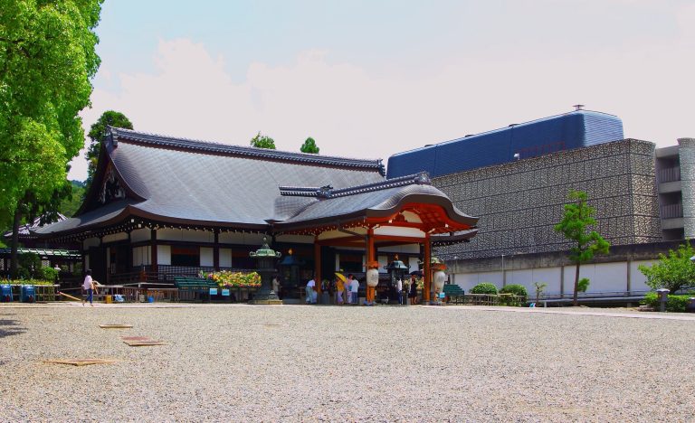
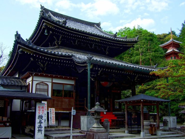
The main hall was rebuilt during the Keicho era by Shosei of Negoro-ji. It houses the Eleven-Headed, Thousand-Armed Kannon attributed to Sugawara no Michizane, the principal image of the temple. An image of Fudo Myoo stands behind the main hall. Fudo Myoo is a wrathful Buddhist protector associated with removing obstacles and with esoteric ritual.
Bell tower and memorial features
The bell tower was rebuilt in 1730. A stone hokyo-in pagoda stands within the precincts in memory of Kogo. A hokyo-in pagoda is a Buddhist memorial monument traditionally associated with funerary rites and the accumulation of religious merit. In front of the bell tower, a stone monument marks the former location of Kakkotei and commemorates the 1858 discussion between Saigo Takamori and Gessho.
Kiln marker and Kanameishi
A marker in the southeastern part of the precinct identifies the birthplace of the Seikan-ji kiln, a tradition associated with the resident monk Sohaku and with Seikan-ji ware, or old Kiyomizu ware. In the front garden, part of a large exposed boulder is called Kanameishi, meaning “Pivot Stone.” The name refers to the way the view of Kyoto spreads outward from the stone like an opened fan, with the boulder occupying the fan’s pivot. A stone fence surrounds it, ritual paper streamers hang at its four corners, and the stone is treated as an object of faith. Tradition holds that a vow made there brings a wish to fulfillment.
Imperial mausoleums
Emperor Rokujo’s mausoleum
Emperor Rokujo’s Seikan-ji Imperial Mausoleum occupies the uppermost of four level areas on the mountainside, at approximately 160 meters above sea level. Its official form is a circular mound. The level area measures about 26 by 16 meters and has an irregular rectangular outline, while the mound at its center is approximately 7 meters in diameter. An earthen enclosure facing south-southwest measures about 12 meters across and more than 10 meters in depth, with a gate at the southern center.
The worship area lies at approximately 137 meters above sea level. Stone steps, a path passing beside the Takakura mausoleum, and three further flights of steps connect it with Rokujo’s burial area. The site was reconstructed in 1863 after a bamboo-covered level place, traditionally called the former Hokke-do, was identified as the location of the lost burial hall. The restoration cleared the ground, created a small central rectangular enclosure, built earthen walls and a southern gate, terraced the southern slope, and established the approach and worship area.
Further work in 1895 and 1896 repaired the circular mound, replaced a former wooden torii with a stone one, and reshaped the enclosure with a south-facing gate. The mausoleum is now enclosed within the wider protected landscape of the former Seikan-ji grounds.
Emperor Takakura’s mausoleum
The Later Seikan-ji Imperial Mausoleum of Emperor Takakura occupies the lowest of the four level areas, at approximately 145 meters above sea level. Its official form is a square mound. Forty-seven stone steps lead from the worship area, approximately 137 meters above sea level, to a level area about 24 by 21 meters in size. An earthen enclosure approximately 20 meters wide and 15 meters deep faces south-southwest and has a gate on its southern side.
The present burial mound stands slightly west of the enclosure’s center. It is a square earthen platform approximately 4.5 meters on each side and 0.5 meters high, and is considered likely to incorporate part of the foundation of the former Hokke-do. An earlier description gives the mound a height of about 0.6 meters and records a large oak growing above it. The nearby stone hokyo-in pagoda was traditionally identified as Kogo’s grave.
Before the 1863 restoration, a wooden fence enclosed the mausoleum, with an earthen wall and gate on the east and an approach from Seikan-ji. The restoration replaced the fence with stone railings and an earthen enclosure, added a southern stone gate, cleared the bamboo-covered southern slope, and formed new stone steps and an approach. The Takakura mausoleum is positioned in front of the Rokujo mausoleum, while Rokujo’s enclosure occupies higher ground behind it.