Schloss Philippsthal: A Baroque Landgravial Residence in Germany


Site at a Glance
- Rating
- 4.6
- Popularity
- Low
- Country
- Germany
- Primary era
- Early Modern
- Eras represented
- Early Modern, Modern
- Civilizations
- Holy Roman Empire
- Site type
- Domestic
- Remains
- Palace
On this page12 sections
History
Schloss Philippsthal is a Baroque residence in Philippsthal, Germany, built between 1685 and 1735 for the Landgraves of Hesse-Philippsthal, a collateral branch of the Hessian ruling house. The palace was established on the site of the former Kreuzberg monastery of Hersfeld in the lower Werra Valley. Its position was also connected to the nearby Via Regia, a major medieval and early-modern overland route that linked Frankfurt and Leipzig.
From monastery estate to princely residence
The monastery had been dissolved after the Reformation, the sixteenth-century religious transformation that led to the closure of many monasteries in Protestant territories. After the last nuns left around 1560, the former monastery estate was managed as an agricultural operation. By about 1590, the southern side aisle of the monastery church had been separated from the main church and put to use as storage.
Landgrave Philipp of Hesse-Philippsthal began building the new residence in 1685. His son and successor, Karl, continued the project until its completion in 1735. The former agricultural estate was therefore transformed into a princely residence while elements of the earlier religious complex were retained and adapted. The separated church aisle became a series of representational rooms, including two rooms for the princely family from which they could attend services in the church.
The palace entrance was oriented toward the east. Approximately 1.5 kilometers upstream, the heavily traveled Via Regia crossed the Werra by the old bridge at Vacha. This route helped determine the approach to the residence and the position of its principal entrance.
The church and the Philippsthal line
The former monastery church was altered during the palace’s construction. Its original western entrance was bricked up in 1733, when a family crypt was built beneath the church tower. Katharine Christine of Saxe-Eisenach, the wife of Landgrave Karl I of Hesse-Philippsthal, was buried there in 1743 as the first landgravine of the Philippsthal line.
The church had originally possessed a western work, a monumental western section that could include an entrance, towers, and internal circulation spaces. Its two flanking towers may never have been completed to their full intended height. They were later reduced to the height of the palace buildings and incorporated into the complex as staircases and connections between the south wing and rooms on the southern side of the church. The church consequently came to have a central western tower, beneath which the family crypt remains.
Fire, municipal acquisition, and reuse
The north wing burned down in 1976. A new tract was subsequently constructed on the surviving foundations, preserving the character of the three-wing complex. In 1985, the political municipality acquired the estate and renovated it for municipal purposes in the following years.
The former princely residence now serves several public and community functions. The west wing contains the municipal library, the south wing houses the town hall of the market municipality of Philippsthal, and the rebuilt north tract contains shops and a residential home for older people. The former gatehouse housed a border-customs information office until 1998 and later became the home of the Border Museum.
Remains
Schloss Philippsthal is arranged as three wings around a trapezoidal courtyard of approximately 4,000 square meters. The courtyard narrows toward the east and remains open on that side. The buildings combine the surviving fabric of the former monastery complex with the Baroque residence constructed for the landgravial family.
Palace wings and entrance buildings
West wing
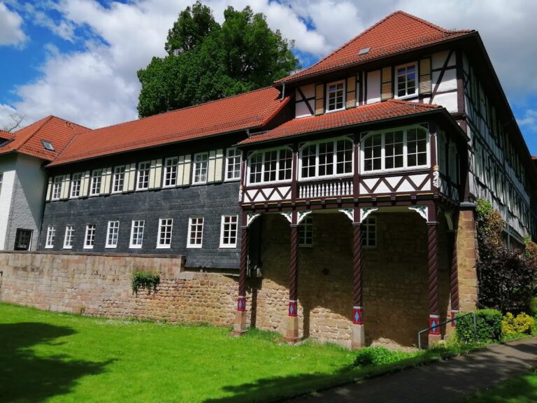
The west wing extends for approximately 120 meters along the edge of the old village center. It is two stories high in much of its length and rises to three stories farther south. A prominent sandstone gateway occupies its center, and the gable field above it bears the coat of arms of the Landgraviate of Hesse-Kassel. The former landgravial library was located in this wing. Its rooms now contain the municipal library.
North wing
The north wing runs southeast along Schlossstrasse toward the gatehouse. The present tract was built on the foundations that survived the 1976 fire. It forms part of the reconstructed three-wing arrangement and now contains several retail units together with a residential home for older people.
Eastern gatehouse
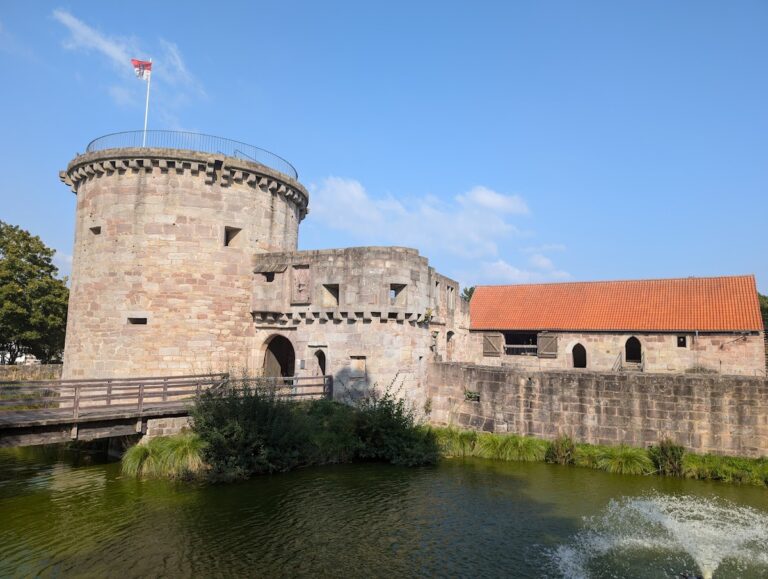
The eastern gatehouse formed the representational main entrance to the palace. Built in 1734, it has a mansard roof, a roof form with two slopes on each side in which the lower slope is steeper than the upper one. The building now houses the Border Museum.
South wing
The three-story south wing was the principal building of the palace. It extends approximately 50 meters eastward and adjoins the northern side aisle of the former monastery church. The wing developed from the provost’s house, the residential building of the monastery’s provost, which was extended eastward and adapted architecturally for the palace. The adjoining church aisle was incorporated as representational rooms, including the spaces that allowed the princely family to attend worship.
Former monastery church
The former monastery church retains the altered remains of its western structure. The two square-plan towers that once flanked the western work were reduced to the height of the palace buildings. They now serve as staircases and connecting spaces between the south wing and rooms on the church’s southern side. A central western church tower stands between them, with the family crypt beneath it. The former western entrance was closed in 1733 during the crypt’s construction.
Palace park
The palace park extends southward beyond the south wing and church to the Werra. Covering approximately 50,000 square meters, it is almost entirely enclosed by a sandstone wall about the height of a person. Its upper section, next to the palace, combines ornamental and productive gardens in the French style.
The lower part of the park extends from the orangery toward the river and follows the form of an English landscape garden. The orangery was built in 1731. Until 1905, the grounds also extended across the opposite bank of the Werra, but that section was leveled for the construction of the Ulster Valley Railway.
Nearby sites