Schanze Unterfinning: A Possible Tenth-Century Earthwork Fortification
Site at a Glance
- Rating
- 3
- Popularity
- Very Low
- Country
- Germany
- Primary era
- Medieval
- Eras represented
- Medieval
- Civilizations
- Duchy of Bavaria
- Site type
- Military
- Remains
- Fort
On this page6 sections
History
Schanze Unterfinning is an earthwork fortification north of Unterfinning in Bavaria, Germany. It is plausibly interpreted as a tenth-century stronghold built during the Magyar incursions, raids into central Europe by the medieval Hungarian people.
The site may have served as a refuge for people from several nearby villages or as a place for troops to gather. Its ring-shaped enclosure has been considered more suited to defense against infantry than mounted attackers, suggesting Magyar raids may not have been the only concern. Regional conflicts in the East Frankish realm, a medieval kingdom in central Europe, may have created opportunities for Magyar and Norman attacks. The Normans were raiders and settlers of Scandinavian origin active in medieval Europe. The fortification’s main defenses may have depended on additional obstacles to slow an approaching force. Its coherent form and comparatively low profile have also been interpreted as evidence of rapid development.
Remains
Setting and layout
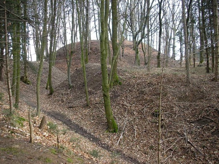
The two-part earthwork occupies an almost level spur above the Windach, on the western side of the steep Windachleite. A deep stream ravine protects it to the east, while slopes toward the Windach descend by as much as 20 metres. The main enclosure measures about 215 by 140 metres; a defended outer area, or outer bailey, lies to its southeast. Banks and ditches form the surviving defenses.
Main enclosure and western defenses
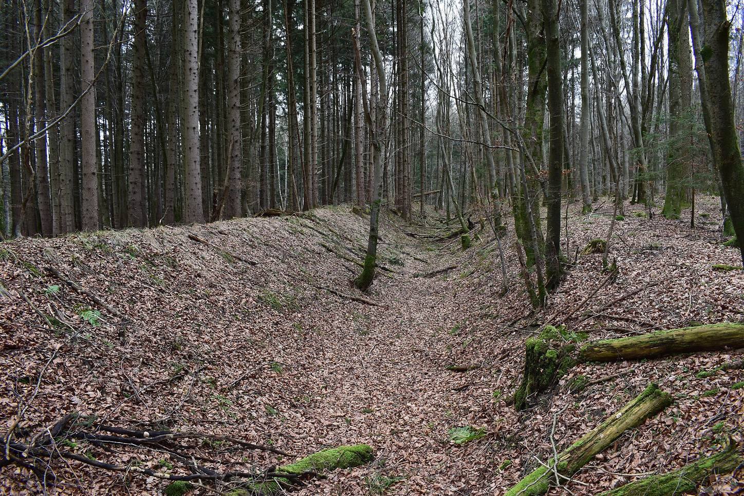
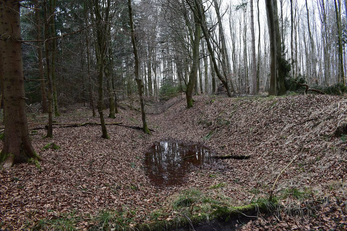
A defensive bank, or rampart, and an inner ditch follow the steep slopes around the main enclosure and the western side of the outer bailey. The ditch reaches 2 metres deep, while the main bank rises only slightly above the enclosed ground. Where the terrain falls steeply, the ditch was placed on the plateau rather than below the slope edge. The rampart’s outer face is unusually shallow and its crest narrow, a form thought suitable for a palisade, a fence of upright stakes, a thorn hedge, or another fence. On the eastern side of the main enclosure, the bank widens in places into level platforms several metres across that may have supported small outworks, or secondary defenses. The enclosure’s plan has been compared with the rectangular earthwork above Purk near Moorenweis; there, the bank-and-ditch defenses are more pronounced, with ditches up to 5 metres deep.
Outer bailey rampart
A curved rampart marks the outer bailey’s boundary and ends at the edge of the western slope. Measured from the bottom of its ditch, the bank stands about 2 to 2.5 metres high.
Northern plateau rampart
About 60 metres north of the outer-bailey rampart, a nearly straight defensive bank protects the plateau from one approach. Its outer ditch remains about 1.5 to 2 metres deep, and the bank rises roughly 1 to 1.5 metres above the ground on its inner side. This stretch is particularly well preserved, although a timber-haul road cuts through it.