Sangarius Bridge: A Late Roman Imperial Bridge in Turkey

Site at a Glance
- Rating
- 3.6
- Popularity
- Low
- Country
- Turkey
- Primary era
- Medieval
- External website
- Open
- Eras represented
- Medieval
- Civilizations
- Byzantine
- Site type
- Infrastructure
- Remains
- Bridge
On this page11 sections
History
Sangarius Bridge, also known as Justinian’s Bridge or Beşköprü, is a sixth-century Late Roman bridge near Adapazarı in Turkey. Commissioned by the Eastern Roman Emperor Justinian I and completed in 562, it improved communications between Constantinople and the empire’s eastern provinces.
Imperial construction and military communications
Before the stone bridge was built, a wooden pontoon crossing carried the road over the Sangarius River. The historian Procopius wrote that floods repeatedly swept this structure away, interrupting travel and causing many deaths. The replacement bridge carried a strategically important military road linking the Bosphorus with the eastern Roman provinces, which faced pressure from the Sasanian Empire, the major Iranian rival of the Eastern Roman Empire during Late Antiquity.
The date of construction has been discussed through several sixth-century accounts. Theophanes places its beginning in 559 or 560, while Procopius’ description of imperial building indicates that work was still continuing in 560 or 561. The poems of Paul the Silentiary and Agathias celebrate the bridge’s completion in 562. Because Theophanes’ dating is imprecise, construction may have begun as early as about 554.
River change and later history
The bridge originally crossed the much wider Sangarius River. After the river changed course, the structure came to span the smaller Çark Deresi, which flows from Lake Sapanca. The modern Sangarius lies about 3 km to the east. In 1899, a railway branch was laid beneath the bridge along the river course, and railway construction partly damaged its eastern end.
The bridge has also been linked with a proposed canal between Lake Sapanca and the Propontis, the ancient name for the Sea of Marmara. Pliny the Younger had proposed such a connection to Emperor Trajan, but the project apparently was never completed. Some interpretations associate a similar plan with Justinian and regard the bridge’s unusually large scale and pier design as possible evidence. Other interpretations reject the idea because the river course was unsuitable for navigation, while pointed water-cutting structures also appear on other bridges. Local topography has supported an alternative possibility involving a redirected river toward Lake Sapanca. The bridge was added to UNESCO’s World Heritage Tentative List in 2018.
Remains
The surviving limestone structure, including its abutments, extends approximately 429 to 430 m. It is about 9.85 m wide and reaches up to 10 m in height. Seven principal arches form the main bridge, while additional openings carry floodwater beyond the central channel. Its monumental scale attracted attention from contemporary writers and poets.
Main bridge and water management
Principal arches and piers
Five central arches span approximately 23 to 24.5 m each and rest on piers about 6 m thick. Two smaller flanking arches have spans of about 20 m. Çark Deresi currently passes through one of the western arches. The piers incorporate cutwaters, projecting parts that divide and deflect flowing water. Their upstream faces are rounded and their downstream faces pointed. The broadest pier on the western bank differs from the others, with a wedge-shaped profile on both sides.
Flood-relief arches
Five additional arches provide flood-relief passages outside the main river channel. Two stand at the western end and three at the eastern end, with spans ranging from approximately 3 to 9 m. Their position and smaller dimensions allowed floodwater to pass through the outer parts of the bridge.
Entrances and surviving decoration
Western entrance
A triumphal arch once marked the western entrance. Drawings made by Léon de Laborde in 1838 show a stone-built, round-arched portal immediately at the bridge entrance. The portal was approximately 10.37 m high and 6.19 m wide, while the columns on either side measured about 4.35 m in thickness. One column contained a winding stairway.
Eastern arched structure
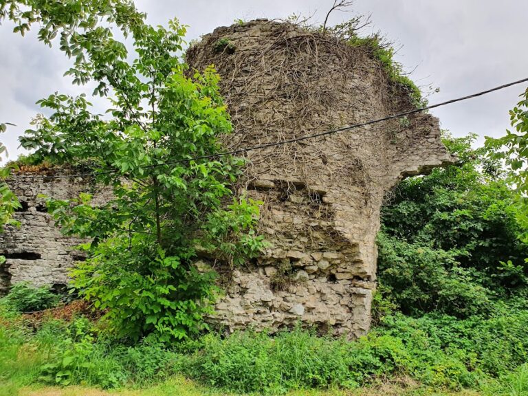
An eastern apse, a rounded or semicircular recess, or another arched structure remains at the bridge. Its purpose is uncertain, although it may have served as a religious shrine. The east-facing structure is approximately 11 m high and 9 m wide.
Inscription and crosses
An inscription carrying a Greek epigram by Agathias once decorated the bridge. The text was preserved in the writings of the Byzantine Emperor Constantine VII Porphyrogenitus. It describes the formerly uncontrollable and unnavigable Sangarius as subdued and bound by the bridge’s stone arches. The seven principal piers apparently carried small Christian crosses, and two are thought to remain.
Nearby sites