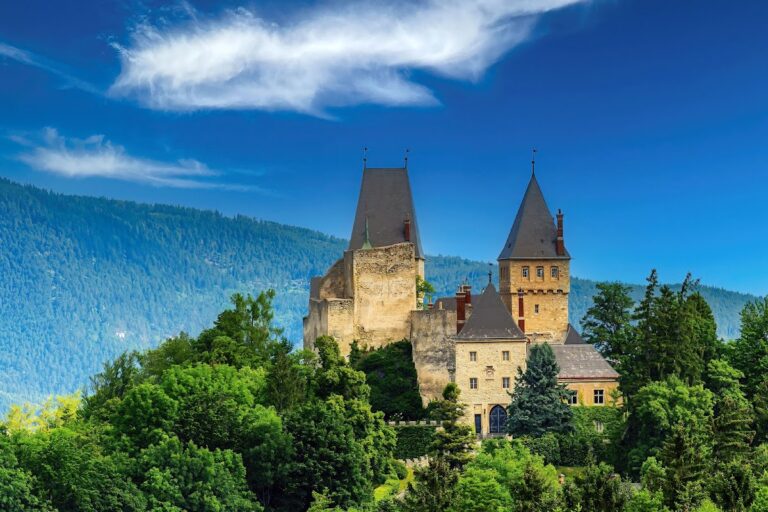
Ruine Hohenwang: Medieval Hilltop Fortress in Austria


Site at a Glance
- Rating
- 4.8
- Popularity
- Low
- Country
- Austria
- Primary era
- Medieval
- Eras represented
- Medieval, Early Modern
- Civilizations
- Duchy of Styria, Habsburg, Holy Roman Empire
- Site type
- Military
- Remains
- Castle
On this page21 sections
History
Ruine Hohenwang is a medieval hilltop fortress in Austria, above the municipality of Langenwang in Styria. Its core was built in the twelfth century by the Landesere family, probably between 1122 and about 1160, during the period when surrounding territories were being consolidated under the Styrian territorial rulers. The fortress became Langenwang’s landmark and served for centuries as the administrative center of the Hohenwang lordship.
Foundation and the Landesere family
The area had earlier belonged to the Eppensteins, a medieval noble dynasty that controlled substantial territories in the eastern Alps, including parts of the upper Mürztal. After the surrounding territory was transferred to the Styrian territorial rulers in 1122, Margrave Ottokar III granted extensive parts of the Mürztal as a territorial fief to the Stubenberg family. Hohenwang then passed to their relative Erchinger I von Landesere, who probably commissioned the fortress during the following decades.
The Landesere family had originally been based at Landsee Castle in what is now Burgenland. After acquiring Hohenwang, its members adopted the title Lords of Hohenwang. The castle was first mentioned in 1222. It was administered by castellans or castle custodians, who often incorporated Hohenwang into their own titles and exercised authority on behalf of its lords.
Medieval lordship and administration
Hohenwang was primarily a regional administrative center. Its custodians oversaw the surrounding territory, protected local people during periods of danger, exercised lower judicial authority, and supported settlement in the upper Mürztal. The castle was also associated with the spread of Christianity in the region. From the thirteenth century onward, a priest lived at Hohenwang, although the lords possessed only lower jurisdiction. People accused of capital crimes had to be transferred to the Kapfenberg district court, which held the higher authority.
The castle’s medieval history includes an encounter with the minnesinger Ulrich von Liechtenstein, a noble poet and tournament participant. In 1240 he stopped at Hohenwang during a tournament journey and challenged Erchinger II to a mounted duel. A literary account says that the two men broke their lances six times without either being unhorsed. A document from 1249 also names a priest or vicar called Heinrich in connection with Hohenwang.
Erchinger III von Landesere was the first witness named in the 1282 agreement concerning the enfeoffment of King Rudolf I of Habsburg’s sons with the duchies of Austria and Styria. The Landesere line ended with Erchinger III’s death in 1286, which probably took place at Hohenwang. The lordship subsequently passed through inheritance and dynastic connections among established Styrian noble families.
Hungarian occupation and the Scherffenbergs
During the conflict between King Matthias Corvinus of Hungary and Emperor Frederick III, Hungarian forces invaded Styria in 1477. Matthias Corvinus’s wars against Frederick III brought military occupation to parts of the region, and Hohenwang remained held by Hungarian mercenaries until the end of the fifteenth century.
Hohenwang entered the possession of the Scherffenberg family through a series of inheritance agreements. In 1484 Christoph and Ulrich von Fladnitz concluded a contract concerning the inheritance of Hohenwang. After Wilhelm von Fladnitz the Elder died in 1489, the castle passed through his sister Elisabeth and her husband, Pernhard von Scherffenberg, to the Scherffenbergs in 1490, initially in shared possession with Praxedis von Traun. The lordship is also recorded as having passed into Scherffenberg possession in 1512. Andree Kleech administered the castle for its new owners from 1496 to 1497.
The Scherffenbergs held Hohenwang for several centuries. In the seventeenth century they re-established a largely consolidated lordship, particularly by buying back former Stadecker holdings. The territorial inheritance associated with the Eppensteins continued broadly through the lordships of Neuberg, Spital, and Hohenwang until 1848. Hohenwang’s domain reached north to the Veitschbach, Neuberg, and Kapellen line, south to the Mürz, west toward Malleisten, Masingbach, and Hocheck, and east to Mürzzuschlag.
The lordship’s fifteenth-century revenues came from demesne farmland, meadows, woodland, fishing rights on the Mürz, and a grain, stamping, and saw mill at Langenwang. Other income included a masonry cellar, vineyards near Schottwien, tithes, dependent holdings in several settlements, market-stall fees, and compulsory labor for transporting and processing agricultural and forest produce.
War, fire, and religious conflict
The Peasants’ Revolt of 1525 did not spread among Hohenwang’s peasants. During the fifteenth century, many had bought their freedom from dependency and gained hereditary rights to their farms, improving their position within the lordship. The Scherffenbergs therefore felt able to arm them heavily during enemy incursions without fearing an uprising against the lords.
A major fire caused severe damage at Hohenwang in 1525. In early October 1529, approximately 3,000 Turkish cavalrymen entered the Mürztal over the Semmering, devastating villages and farms and taking numerous captives. A raiding party reportedly approached Hohenwang but withdrew because it lacked siege artillery. The later account of the castle’s alleged defense and burning by the writer Peter Rosegger belongs to literary tradition rather than a direct military record.
Some sixteenth-century Scherffenbergs were committed Lutherans, leading to repeated disputes with the Cistercian abbot of Neuberg Abbey. Between 1580 and 1600, the castle chapel was opened to Protestant citizens and peasants from the surrounding area for worship and assembly. After Ulrich Christoph von Scherffenberg returned to Catholicism, his son Maximilian undertook to maintain a permanent priest at the chapel, where four Masses were to be celebrated each week.
From 1622, Ulrich Christoph von Scherffenberg served as provincial administrator of Styria, deputy to the governor, and presiding officer of the Landschranne, a regional court reserved for nobles and clergy. Styria escaped the destruction experienced in many areas during the Thirty Years’ War, a conflict that affected much of central Europe from 1618 to 1648, but the Mürztal endured repeated troop billeting. In 1633, Mürzzuschlag became a recruitment and mustering site, and the surrounding lordships, including Hohenwang, had to supply provisions for the troops.
During the Ottoman war of 1683, Hohenwang and Neuberg carried much of the region’s defensive burden. Together, the two lordships supplied 300 armed men under Baron Johann Cassinedi to man the fortifications at the Semmering Pass. Nuns from Kirchberg am Wechsel also found refuge at Hohenwang, although the fortress itself was not seriously threatened. From the second half of the seventeenth century, the Scherffenbergs rarely lived at the castle.
Decline and conservation
On 18 May 1700, lightning ignited the upper story of the chapel tower. Castle residents, together with people from the demesne farm and village, extinguished the fire quickly, and the regional estates contributed to the restoration. The upper part of the tower was never rebuilt. From 1706, the fortress was occupied only by servants, while maintenance declined. The roof was removed to avoid the roof tax, and its beams and tiles were sold.
The earthquake of 1770 severely damaged the castle masonry. In 1772, construction began on Schloss Neu-Hohenwang beside the Krottenhof. The administrative residence was officially transferred to the valley in 1780, and much of the new building’s stone was taken from Hohenwang. This dismantled parts of the historic fabric and accelerated the fortress’s final decline. The older site thereafter became known as Alt-Hohenwang.
The chapel and an already unstable wing of the high castle were demolished in 1776. The last known resident was reportedly a hermit who warned the population of approaching storms by ringing the chapel-tower bell. Tradition holds that lightning killed him in 1774. On 1 April 1945, an American air force bomb destroyed a large section of the southern curtain wall and the remaining traces of the castle chapel during an attack on the railway bridge near Schloss Feistritz at Krieglach. The pilots probably mistook the ruin for Schloss Neu-Hohenwang, where a Waffen-SS unit was stationed.
The Hohenwang Castle Association was founded in Langenwang in 1961 under Gerhard Wresounig. From 1963, its members secured and conserved the remaining masonry. Early work repaired Gate 1 and cleared rubble from the north wall, after which the route from Gate 3 to the chapel was made passable. Gate 2 was later roofed, the area between Gates 2 and 3 was cleared, and the shield wall was extensively repaired in 1969. Some wall sections were rebuilt, and the grounds were gradually arranged as a park-like area. The ruin is privately owned by the Schrack Company, while its surviving masonry has chiefly been conserved by the association.
Hohenwang has also remained associated with pilgrimage to the chapel dedicated to the Visitation of Mary. The annual Hochschlosskirtag procession begins at the parish church of Langenwang and ends in the chapel area, continuing a religious association that reaches back to the castle’s medieval chapel.
Remains
Hilltop setting and overall layout
Hohenwang occupies a rocky spur about 100 metres high, extending from the Sulzkogel in the Fischbach Alps on the southern side of the Mürztal. The ground falls steeply to the south, west, and north, while the Sulzkogel’s high forest rises to the east. The castle historically had visual connections toward the Wartbergkogel in the southwest and Mürzzuschlag in the northeast. Dense woodland now restricts those views.
The elongated fortress follows a southwest to northeast axis for about 90 metres. Its principal divisions are the western high castle, or core fortification, the lower outer castle, and two outworks separated by ditches. The high castle’s western core is approximately 70 metres long and is largely twelfth-century masonry. It is heavily ruined, and the arrangement of its original interior rooms has been obscured by the collapse and later alteration of the complex.
Outer defenses and entrances
Neck ditch and eastern outwork
The eastern approach was protected by a neck ditch, a defensive trench cut across the narrow connection between the fortified spur and the surrounding terrain. The ditch reached up to 25 metres in width. Two drawbridges originally crossed it, followed later by a stone-arch bridge. A masonry road embankment now occupies the crossing.
An outwork in or immediately before the ditch contained a crenellated gate structure supported by two northern arches. A north to south wall extended from it, carrying a wall-walk and loopholes, and the gate was reached by a drawbridge. A smithy stood in this area according to the fifteenth-century land register. The broader defenses also included a ditch outwork and the steep rock faces around the hilltop.
Gate 1 and the outer castle
The roughly 60-metre-long outer castle was completed in the seventeenth century. Its southern side contained an irregular bastion, a projecting defensive work, also called the high garden. It was partly built on artificial fill and ended in a rounded southeastern corner. The bastion wall reached the upper story of the main gate, from which the former gate tower could be entered. A stable stood to the west, with only a few remains surviving.
Gate 1, the main entrance, dates from the sixteenth or seventeenth century and is the youngest major surviving section of the masonry. Its massive construction has allowed it to survive relatively well. The gate chamber contains a passage and a small manhole. Two keyhole-shaped loopholes once occupied the upper story, of which one survives. Historical images show the demolished gate tower with an onion-shaped roof. The chamber has been partly reconstructed, and its passage leads directly into the long zwinger, an enclosed defensive space between successive walls or defensive lines, in the outer castle.
Ramp and Gate 2
A ramp on the right side of the outer castle led toward the high castle. It was partly roofed and originally rested on four arches open toward the castle. The westernmost arch is the surviving example.
Gate 2 is a shallow-arched entrance with a manhole. It opened onto a two-bent defensive gallery in front of the shield wall, a particularly strong wall designed to face the principal direction of attack. The gallery was originally roofed and reached by a drawbridge. Only its southeastern side survives, pierced by three loopholes set in deep niches, while a small postern opens from its southern corner.
The Gate 2 drawbridge crossed a rock fissure about 4 metres wide and 7 metres deep. A fixed wooden bridge later replaced it, and brick blocked the openings for the lifting beams. The entrance’s small manhole remains part of the gate structure.
Gate 3 and the high castle entrance
Gate 3 leads into the high castle and the palas, the principal residential building of a medieval castle. A remnant of roof framing and a beam socket remain in the southern wall. Restoration work in 1998 uncovered a tripartite cross above the passage. It was originally painted red and probably represented the Holy Trinity.
Residential castle and shield wall
Palas and courtyard
The residential castle enclosed a courtyard about 65 metres long. The upper stories of the palas probably contained as many as ten rooms. The fifteenth-century land register lists a chapel, a servants’ room, several chambers, a large hall, four cellars, four grain stores, a bathhouse, a kitchen, and vaulted stables for twelve horses, providing a picture of the buildings that supported life and administration within the fortress.
The eastern side of the residential castle was formed by the shield wall, which extended more than 20 metres above the site and measured about 2 metres in thickness. Rectangular crenellations crowned it, and three large window openings lay directly below them. The wall was built with a stone facing and a rubble-stone core arranged in horizontal courses and partly bonded with mortar. It also formed the eastern exterior of the palas, which extended about 34 metres along the northern curtain wall. The palas probably had a roof sloping down toward the courtyard.
House 1 and House 2
The western side of the palas retains three ochre strips on a white ground, probably remnants of the wall finish of House 1. A small square window survives at the reconstructed entrance to the building. House 2, a residential structure in the western main castle, was built directly against the curtain wall. A crenellated wall with a wall-walk connected it to the palas on the north, and two of its pillars remain. The northwestern corner preserves the outlines of two later-built-over crenellations, while two exterior corbels probably belonged to a balcony.
Chapel and underground passage
Chapel of the Visitation of Mary
A Romanesque chapel dedicated to the Visitation of Mary was established in the southern part of the main castle during the twelfth-century construction phase. Its popularity as a pilgrimage church brought later alterations and extensions. The chapel had a polygonal choir with a five-eighths termination, a double-leaf capital, two carefully worked Romanesque round-arched windows, and a bell tower.
The collapse of part of the southern curtain wall in 1950 exposed the chapel choir and its Romanesque windows again. Lightning had largely destroyed the bell tower in 1700, and the upper section was not rebuilt. The chapel was demolished in 1776. A Romanesque cover stone remains in the courtyard, and a double console survives on the southeastern wall. The chapel ruins have not yet been fully uncovered.
The chapel’s late Gothic devotional image was removed before demolition. It was transferred with the chapel’s 1509 Gothic winged altar to the newly built Marian Chapel in front of the castle, and the altar later moved to the parish church of Langenwang. These objects therefore survive away from their original setting.
Subterranean passage
An entrance in the chapel or arcade area leads toward an underground passage that reportedly ended in a cellar at the outer defensive fence. A section of its vaulted passage was exposed during twentieth-century building work at the Pöllerbauer property and was later filled in because of the danger of collapse.
Water supply
Hohenwang’s water system consisted of a draw well, a cistern, and a piped freshwater supply. The date of the draw well is unknown. It lies northeast of the Marian Chapel within a wooden structure and has a shaft 45 metres deep. The well remains in use for water supply.
The former wooden lifting mechanism had a drive wheel 4 metres in diameter, with a rim 1 metre wide. An adult could stand upright inside the wheel and power it. One lifting cycle required 34 revolutions and about ten minutes, raising approximately 100 litres of water.
A cistern is listed in the fifteenth-century land register. A separate pipeline was later built, probably because the cistern’s capacity was insufficient or its water quality was poor. The wooden pipeline probably dates from around 1630 and extended approximately 4 to 5 kilometres from a spring near Brunnsteig and the Weather Cross. Iron socket couplings were found by forest workers in the 1960s, further examples appeared within the ruin in 1994, and pieces of wooden pipe were discovered during road construction near Brunnsteig in the late 1980s.
Tournament and training grounds
A mostly level meadow west of the castle hill, known as the Place at the Sprengzaun, served as a ground for tournaments and festivals. A separate area near Siglreit or Timmerteich was used to train the mounted castle garrison.