Royal Palace of Werla: An Ottonian and Salian Royal Residence in Germany


Site at a Glance
- Rating
- 4.6
- Popularity
- Low
- Country
- Germany
- Primary era
- Medieval
- External website
- Open
- Eras represented
- Medieval
- Civilizations
- Holy Roman Empire
- Site type
- Civic
- Remains
- Palace
On this page19 sections
History
The Royal Palace of Werla was a medieval royal residence and administrative center in Germany, developed by East Frankish and Ottonian rulers on the Kreuzberg plateau above the Oker in Lower Saxony. Converted into a fortified royal palace at the beginning of the tenth century, it became one of the important Ottonian and Salian royal palaces in the region. Unlike a permanent capital, a royal palace was a temporary residence used by the traveling court for government and administration.
From prehistoric settlement to royal palace
The Kreuzberg had been occupied in prehistoric times, but excavations indicate a settlement gap between the Roman Imperial period, approximately the first to third centuries, and the eighth or ninth century. Settlement expanded again in the ninth century, when a fortified economic estate was established with a ring wall and simple wooden buildings.
At the start of the tenth century, this estate was transformed into a fortified royal palace. The earliest documentary evidence includes a royal diploma issued by Henry I in 931. The Saxon chronicler Widukind of Corvey also describes a stay by Henry I, conventionally dated to either 924 or 926, when the king and his inexperienced army sought refuge from a Hungarian attack. A Hungarian leader was captured during the same episode. His release helped Henry obtain a nine-year truce and gave him time to strengthen the defenses of his realm.
Ottonian political center
Werla entered its first major period of importance under the Ottonian dynasty, the ruling family descended from Henry I and his successors. Fourteen royal stays are recorded between 924 and 1013, and every Ottonian ruler is known to have visited the palace. Otto the Great issued documents there on five occasions.
The palace was also connected with royal succession. During the crisis of 1002, the Bavarian duke Henry II was accepted at Werla as successor to the childless Otto III, while the candidacy of Margrave Ekkehard of Meissen failed. Saxon nobles later met at Werla before the election of Conrad II in 1024. Four assemblies of Saxon nobles are known from the site, although the evidence does not establish that Werla hosted regular regional diets.
Decline of royal prominence and later settlement
Under Henry II, Werla lost political importance to the newly established palace of Goslar. Goslar’s position was associated with the rich silver deposits of the Rammelsberg. Werla’s palatine rights were not formally transferred, despite a later claim in the Sachsenspiegel, a thirteenth-century German legal compilation.
In 1086, Henry IV granted about 400 hides of land from the estate to Udo of Gleichen-Reinhausen, Bishop of Hildesheim. The grant probably helped secure the bishop’s support during the Investiture Controversy, the medieval conflict over the authority to appoint bishops and other church officials.
The decline in political importance did not bring immediate abandonment. During the eleventh and twelfth centuries, the settlement grew, its defenses were strengthened, and the site developed into a permanent community with metalworking and textile production. In 1180, Frederick I Barbarossa ended his conflict with Henry the Lion in the vicinity of Werla and issued an ultimatum to Henry’s supporters. His choice of the old palace indicates that Werla still carried symbolic weight in Saxon historical memory.
Church administration and abandonment
In 1240, the Bishop of Hildesheim assigned Werla’s tithe to Heiningen Abbey and placed the old palace church under the abbey’s authority. Dorstadt Abbey had administered the church for a short period beforehand. Thirteenth-century construction included new internal ditches and cellar structures whose purposes remain uncertain.
Settlement traces continued into the fourteenth century, but Werla and its parish church had probably been deserted by about 1550 at the latest. Some inhabitants probably moved to nearby Burgdorf, which was renamed Werlaburgdorf in 1958. Local residents, and possibly Heiningen Abbey, reused stone from the palace in other buildings. A chapel remained on the hill until 1817, although its origin was no longer known locally. Around fifty royal documents and chronicle references from the tenth to thirteenth centuries preserved knowledge of the former palace.
Rediscovery and archaeological investigation
During the nineteenth century, researchers renewed the search for Werla. Earlier conjectures had placed the palace at Werle in Mecklenburg or Werl in Westphalia. Hermann Adolf Lüntzel’s study of documentary evidence narrowed the search to the area around Schladen, while local farmers’ reports of stones brought to the surface by ploughing focused attention on the Kreuzberg.
E. F. A. Schulze conducted a short excavation in 1875 and exposed foundations that were accepted as evidence for the palace. A commemorative stone inscribed “Kaiserpfalz Werla” and a linden tree were then installed at the site. Renewed interest around 1920, encouraged by the teacher Franz Kaufmann, led to a one-day trial excavation directed by Uvo Hölscher in 1926.
Goslar District purchased part of the core-fortress area in 1929 to protect it from agricultural damage. The Werla Commission was founded in 1933, and the first major excavation campaign began in 1934 under Karl Becker. After Becker became ill, Hans Steckeweh temporarily directed the work, while Hermann Schroller assumed overall direction in 1937.
The excavations of 1934 to 1939 used aerial photography, stereophotography, chemical analysis, and cooperation between building researchers, archaeologists, and geologists. Aerial surveys revealed the approximate 600-by-600-metre extent of the palace and its outworks. The work was also shaped by Nazi ideology. Excavators tried to fit the remains into an idealized picture of an Ottonian palace and promoted Werla as the “Cradle of the First Reich.” Hasty interpretations and internal disputes produced errors that influenced later scholarship. The campaign ended with the outbreak of the Second World War.
Excavations resumed in 1957. After Schroller’s death in 1959, Gudrun Stelzer and Carl-Heinrich Seebach continued the work until 1964. The core fortress was then considered almost completely explored, while the earlier settlement and the importance of High Medieval alterations received greater attention. Workshops and pit-houses showed that the outworks had not served only as military camps. Werla increasingly emerged as a regional center of government and economic activity, rather than simply a defensive installation against the Hungarians.
Recent research and conservation
Further excavations began in 2007 and continued through later campaigns, including work in 2016. The investigations exposed and resurveyed the chapel, the Estrichbau, gates, walls, ditches, and parts of the core fortress. Excavation and geomagnetic survey, a non-invasive method that detects buried features through changes in the earth’s magnetic field, also clarified the development, economic activity, and organization of the outworks. By April 2023, the excavations were described as complete and a comprehensive evaluation was available.
Later research showed that the inner bailey, an enclosed subsidiary area beside the fortified core, had been considerably smaller during the palatial period than earlier reconstructions assumed. It was expanded westward in the High Middle Ages. A wall dating approximately from the tenth or eleventh century divided the inner bailey from north to south, indicating at least two stages of development. The relationship between Werla, Schladen, and Werlaburgdorf was also reassessed, as the outworks appear to have remained occupied through more phases and for longer than previously believed.
A ninth- or tenth-century cemetery at Werlaburgdorf is regarded as the burial ground of a village whose inhabitants probably worked on the palace estate. This evidence challenged the earlier assumption that Schladen alone had been the economic center associated with Werla.
Since 1958, Werla has been protected as a landscape area. In 2008, the Lower Saxon Ministry for Science and Culture acquired surrounding agricultural land for the Archaeological and Landscape Park of the Imperial Palace of Werla. Restoration and partial reconstruction of earthworks and selected masonry began in autumn 2010, and the park was inaugurated on 14 September 2012. The site is presented through protected earthworks, reconstructed walls, and partial rebuilding rather than a complete reconstruction of the palace.
Remains
Werla occupied a natural plateau on the Kreuzberg, about 17 metres above the Oker floodplain. Steep slopes toward the river protected two sides of the main fortress. The palace complex covered approximately 20 hectares and consisted of an approximately circular core fortress with three attached outworks, forming a large fortified and productive settlement.
Fortress and outworks
Core fortress
The core fortress was about 150 metres in diameter. A ring wall approximately 1 metre thick enclosed it, with two gates and several towers. Outside the wall was a V-shaped ditch about 9 metres wide and 4 metres deep. The fortress contained the principal representative buildings and the main enclosure of the palatial period.
During the eleventh and twelfth centuries, central buildings were substantially altered. Additional towers, ditches, and a secondary core-fortress area were added. A further ditch in the area known as Chapel Hill may relate to another fortified enclosure. Stone-building remains on the hill could belong to this phase, although that interpretation remains probable rather than certain.
Outworks and internal divisions
Inner Bailey 1, Inner Bailey 2, and the Outer Bailey extended beyond the core fortress. Their ditches were of comparable depth, while earth ramparts, probably strengthened with palisades, took the place of continuous masonry walls. The outworks were separated and enlarged in successive phases.
A wall west of the North Gate ran from north to south and appears to have divided the inner bailey. The later western expansion was accompanied by another ditch, with the foot of a rampart immediately behind the inner-bailey wall. Paved paths, pit-houses, waste pits, workshops, and a pole-built structure called a Rutenberg were found within the outworks. The discoveries show that these areas supported practical and economic activities as well as defense.
Ninth-century predecessor settlement
Before the royal palace was established, a ninth-century settlement occupied the area of the later core fortress. Its ring rampart surrounded several simple wooden buildings. Later investigations traced the line of this earlier rampart more precisely, helping distinguish the fortified estate from the subsequent palatial complex.
Palace buildings
Chapel and Chapel Hill
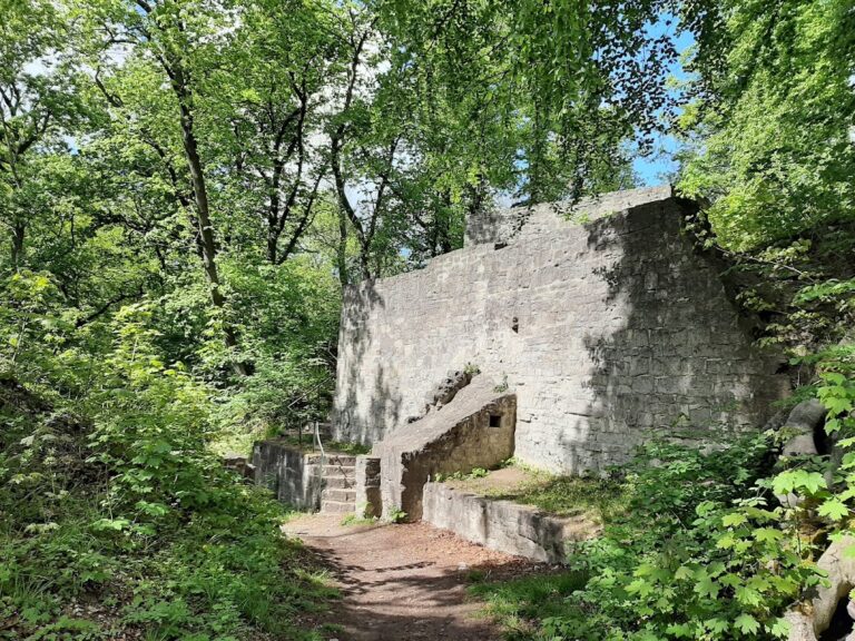
The excavated chapel measured approximately 23 by 7.5 metres. Excavations around it in 2007 revealed well-preserved paving with a rosette design, an unusual survival for its period. The chapel foundations, the nearby North Gate, associated walls, and ditches were subsequently exposed, measured, or partly rebuilt.
Representative and residential buildings
The principal buildings inside the core fortress included a hall measuring 17 by 7 metres, a heated chamber known as a Kemenate measuring 5 by 8 metres, and Palas I, a 22-metre-long representative or residential building with a heating installation. Palas II measured 15 by 34 metres. Together these structures formed the principal architectural group associated with royal residence and administration.
Other excavated features included watch houses, kitchen buildings, cellars, the Estrichbau, and an underground or earth-covered passage approximately 35 metres long. The passage has been interpreted as an escape route. The purposes of some later ditches and cellar buildings remain uncertain.
Building materials and construction
Mortar analysis and comparison with similar buildings refined the dating of individual structures. Geological study of the building stone helped estimate the quantities of material required and indicated that construction of the core fortress took several years and drew heavily on resources from the surrounding area.
A 2017 interpretation proposed that some major buildings, including the central tract and the church, were cast in gypsum over wooden climbing formwork rather than built entirely from stone. The gypsum may have become difficult to repair after about fifty years because of weathering. This possibility has been connected with the later shift of royal activity to Goslar.
Craft activity and archaeological finds
Loom remains and clay loom weights point to textile production in the outworks. Clay bellows nozzles and slag indicate metalworking. Thousands of individual finds, mainly pottery, were recovered alongside iron and bronze objects. Coins from mints including Rostock, Göttingen, and Bremen were also found, most dating from the thirteenth century. The finds do not directly reflect the temporary visits of high-ranking royal guests, whose presence is instead expressed principally through the palace architecture.
Earlier burials and Neolithic remains
A richly furnished grave from the late Baalberg Culture, a Neolithic archaeological culture of central Europe, was discovered in 2010. It contained the skeletons of an older woman and a small child, together with more than thirty ceramic vessels from the same culture.
A separate field-school excavation in 2010 uncovered three female skeletons dated to approximately 3700 BC. The individuals were estimated to have died at about four, twenty, and forty-five years of age, with the child spatially associated with the twenty-year-old woman. These remains demonstrate the long prehistoric use of the Kreuzberg before the medieval estate and palace.
Modern presentation of the site
Since 2010, the earthworks and ditches have been restored or partly reconstructed to convey the scale of the core fortress and its outworks. The original rampart foundations were covered with new earth for protection, while excavated foundations inside the fortress were partly rebuilt.
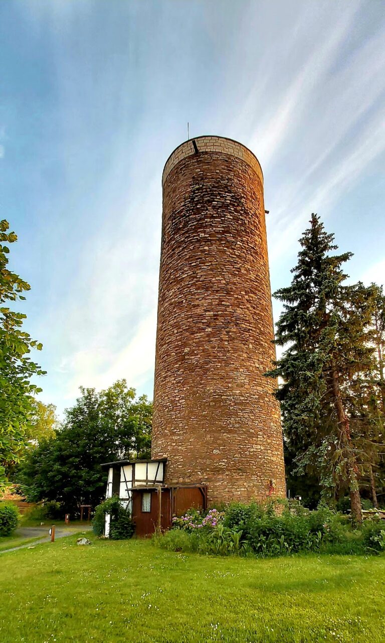
The West Tower, identified as Tower II of the core fortress, was reconstructed in 2012, and a gatehouse was shown within the reconstructed tower in 2013. The North Gate was exposed and raised in masonry. A western wall section approximately 6 metres long, 1.40 metres thick, and 1.70 metres high was also reconstructed as a guide for later work. A model in the Braunschweig Regional Museum represents the palace’s tenth-century form as understood from research completed by 1985, although subsequent excavations have altered parts of that interpretation.