Roman Bridge of Mérida: An Ancient Crossing of the Guadiana
Site at a Glance
- Country
- Spain
- Primary era
- Classical
- Eras represented
- Classical, Early Modern
- Civilizations
- Crown of Castile, Roman, Spanish
- Site type
- Infrastructure
- Remains
- Bridge
On this page9 sections
History
Roman foundation and route network
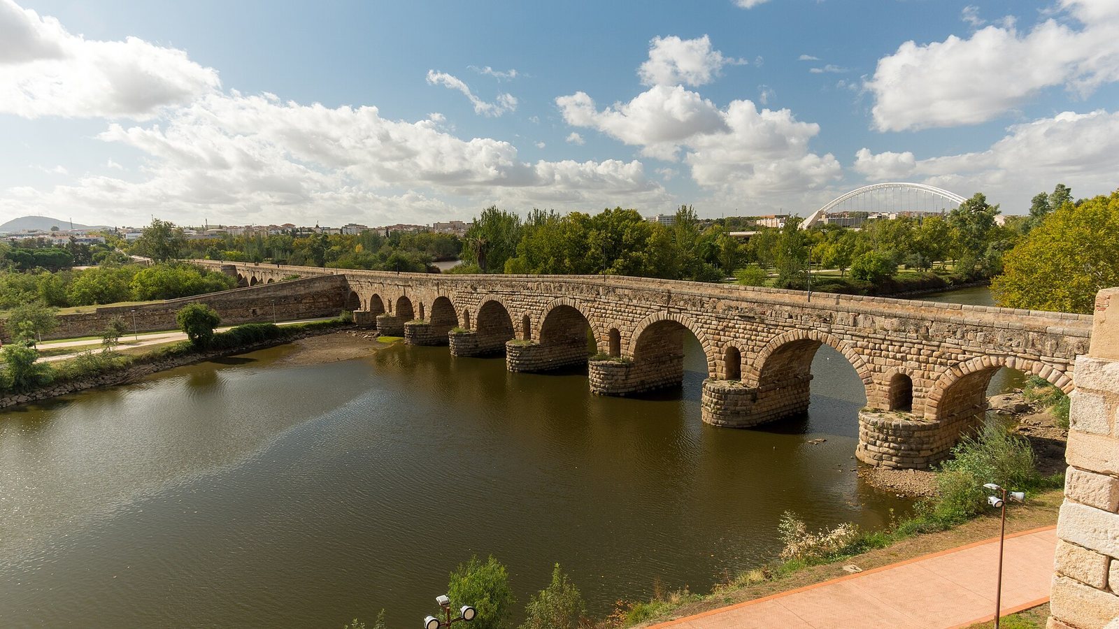
The Roman Bridge of Mérida is an ancient Roman crossing of the Guadiana in Spain, built in the final decades of the first century BC during the reign of Augustus, as the colony of Augusta Emerita was founded in 25 BC. The bridge helped determine the colony’s location and provided a crossing of the river. Mérida became the capital of Lusitania, a Roman province in western Iberia, and a major communications hub. The Silver Route, a principal north–south road through the region, and routes toward Lisbon, Córdoba, Toledo, and Zaragoza all converged there and crossed the Guadiana by the bridge. It is considered the longest surviving bridge from antiquity.
Visigothic and Islamic periods
Repairs took place in 483, during the Visigothic period, when the Visigoths had established a kingdom in parts of Iberia. A Latin inscription associates a restoration with Salla, a senior Visigothic duke. The work was probably not the bridge’s first repair. In the ninth century, Muhammad I, emir of Córdoba, destroyed one pier while suppressing a revolt against Muslim rule in Mérida. Further reconstruction took place in the thirteenth, fifteenth, and nineteenth centuries, with much of the recorded work concentrated in the central part.
Floods, rebuilding, and war
A major flood in 1603 badly damaged the bridge. The two earlier sections connecting the central island to the riverbanks were joined into a continuous crossing, and work on the central section was completed in 1611. Its design combined Roman forms with the restrained architecture of the Habsburg period. A small pavilion added in the seventeenth century commemorated a restoration associated with Philip III, king of Spain from 1598 to 1621. On the Humilladero approach, the Chapel of Saint Anthony served as a prayer place for travelers until the flood of 1860 destroyed it.
During the Spanish War of Independence, fought against French forces during the Napoleonic Wars, 17 arches were demolished in 1812 to prevent French troops from crossing. Repairs followed flood damage in 1823, and damage from the 1860 flood was repaired in 1878. Bank-regeneration work in the late 1990s exposed three arches that had been concealed. The bridge became pedestrian-only on 10 December 1991, when the Lusitania Bridge opened, to protect it from further damage caused by road traffic.
Declared a National Monument in 1912, the bridge is now a Spanish monument of cultural interest. It forms part of the Archaeological Ensemble of Mérida, inscribed on the UNESCO World Heritage List in 1993.
Remains
Layout and construction
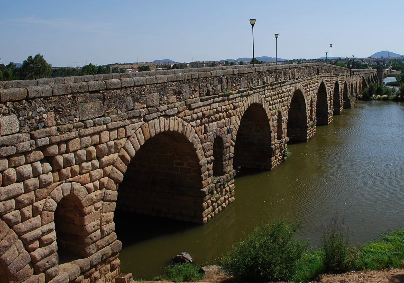
The bridge crosses a shallow reach of the broad Guadiana, where a natural island divides the riverbed. Diorite formations in the bed provide a firm foundation. The structure is about 790 metres long, 7.1 metres wide, and 12 metres above the river’s mean water level. Its 60 arches include a longest span of 11.6 metres. Three stretches run from the city to the Humilladero descent, onward to the Saint Anthony descent, and then to the far end. Roman concrete forms the core, with granite also used in construction. The first and third stretches have a facing of rusticated ashlar, dressed stone blocks with deliberately rough surfaces. The present profile rises in a slight hump, shaped by rebuilding and the gradual sinking of the riverbed over two millennia.
City-side stretch
The ten arches nearest the city have undergone the fewest changes. Their square piers carry semicircular cutwaters, projections that meet the current, on the upstream side; these extend to the full height of the piers. Round arches rise above them, and small circular flood openings pierce the spandrels, the spaces between each arch and the structure above. The spans decrease symmetrically along this stretch, whose piers are comparatively broad. In the imperial period, a city entrance gate and more than one triumphal arch stood here. Roman coins struck at the colony show their appearance, and the gate remains the central motif of Mérida’s coat of arms.
Central channel and island connection
The central stretch crosses the river’s main channel and has suffered the greatest natural wear and human damage. Its principal rebuilt section has five round arches with wider spans than those of the city-side stretch. Rectangular piers support them, with pointed, pyramid-topped cutwaters facing upstream and buttresses on the opposite side. The seventeenth-century Humilladero descent connects the bridge with the island and rests on a Roman-concrete platform. This platform projected about 150 metres upstream as a cutwater protecting the central crossing.
Far-side stretch
Beginning at the Saint Anthony descent, the third stretch retains much of its earlier fabric and shares the city-side section’s stone facing and similar proportions of arches and piers. It rises across a bank rarely reached by floods during the Guadiana’s usual low flow. Its sloping line reflects the sinking of the riverbed. A Roman-concrete platform near the far end may have supported a Roman descent or triumphal arch.