York City Walls: A Medieval Defensive Circuit with Roman Origins
Site at a Glance
- Country
- United Kingdom
- Primary era
- Medieval
- Eras represented
- Classical, Medieval, Early Modern, Modern
- Civilizations
- British, English, Roman
- Site type
- Military
- Remains
- Wall
On this page24 sections
History
York city walls are a defensive circuit in York, United Kingdom, whose history began with a Roman fort established around AD 71. The surviving walls are chiefly medieval, with later Gothic Revival work, a revival of medieval architectural forms. They are England’s longest town walls, and York retains more miles of intact wall than any other city in England. The name Roman walls can be misleading: the circuit’s route has changed substantially, and little of its surviving stonework is Roman.
Roman fort and early medieval reuse
Roman forces built a fort of about 50 acres (21.5 hectares) beside the River Ouse. Its defences included a rectangular wall circuit. The Roman walls are almost certainly associated with Emperor Septimius Severus, while the Multangular Tower was probably added around AD 310–320, during the reign of Constantine the Great.
A land grant points to continued use, in the late seventh century, of the Roman gate on the site of Bootham Bar. When the Danes occupied York in 867, the Roman defences were in poor repair. They demolished the towers apart from the Multangular Tower and restored the walls.
Medieval defences and city gates
Most of the walls that enclosed the medieval city date from the 13th and 14th centuries. The defensive line also included a ditch and a rampart, or defensive bank. Beyond Layerthorpe Bridge, the Normans, who established rule in England after 1066, dammed the River Foss to create the King’s Fishpool. This swamp protected the city, so no wall was built along that stretch.
Monk Bar, built in the early 14th century, replaced a 12th-century gate called Munecagate, about 100 yards (91 metres) to its northwest. The four principal gatehouses, Bootham Bar, Monk Bar, Walmgate Bar and Micklegate Bar, controlled traffic, collected tolls and served defensive purposes.
Micklegate Bar also had a ceremonial role. A tradition dating to 1389, during the reign of Richard II, held that monarchs entering the city touched the state sword there, a ceremonial sword representing royal authority. At least six reigning monarchs passed through the gate. Its symbolic importance was also reflected in the display of severed heads: those of Henry Hotspur Percy in 1403, Henry Scrope in 1415, Richard Plantagenet in 1461 and Thomas Percy in 1572.
Conflict, repairs and changing use
In 1489, rebels protesting tax increases burned Walmgate Bar and Fishergate Bar. Walmgate was later damaged by cannon fire during the 1644 siege of York and repaired in 1648. Bootham Bar had also been damaged during the siege and was repaired the following year. Parliamentarians repaired the walls during the English Civil War, the conflict between Parliament and the king. Repairs were undertaken again during later Jacobite risings, rebellions connected with attempts to restore the Stuart dynasty to the British throne.
After years of neglect, the walls underwent restoration during the Victorian period, Queen Victoria’s reign from 1837 to 1901. The work widened and extended the wall-walk, the path along the top of a wall, in places, and rebuilt battlements and some wall tops. Robin Hood Tower was constructed in 1889. Some small openings may be 17th-century musket loops, but restoration makes their age uncertain.
Changes to the gates and smaller openings also altered the circuit. A wall section and the outer defensive work at Bootham Bar were removed for St Leonard’s Place; the outer work was demolished in 1835. Micklegate Bar’s original outer work was removed in 1826. Fishergate Bar, bricked up after the 1489 riots, reopened in 1827. Victoria Bar opened in 1838 to connect Nunnery Lane and Bishophill. During its construction, remains of an older gateway were found, probably the small early medieval entrance known in the 12th century as the secluded gateway. It was later blocked with earth and stone, possibly when a wooden palisade formed part of the defences, before stone rebuilding began around 1250.
Several smaller gates and towers were demolished: Skeldergate Postern, also called Crane Tower, in 1808; Castlegate Postern in 1826–27; Layerthorpe Postern around 1829–30 during construction of a new bridge over the Foss; and Friargate Postern around 1840. A section of wall at Bootham Bar was removed in the 1830s to make way for St Leonard’s Place. Lendal Tower became a water tower in the 17th century and was adapted for offices in the 19th. North Street Postern Tower, also known as Barker Tower, was restored for modern use in 1930.
Excavation, restoration and protection
The East Angle Tower was partly excavated in 1926, and the remains visible today were exposed in 1953. In 1972, the Royal Commission on the Historical Monuments of England surveyed and numbered the wall towers. Restoration of Micklegate Bar was completed in late 2017. The walls and associated defences are protected as a scheduled monument, a legally protected archaeological or historic site; parts are also Grade I listed, England’s highest listed-building category.
Remains
Circuit and Roman remains
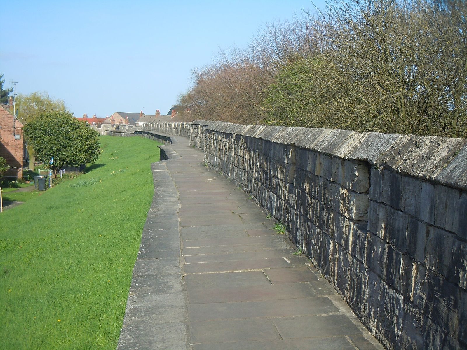
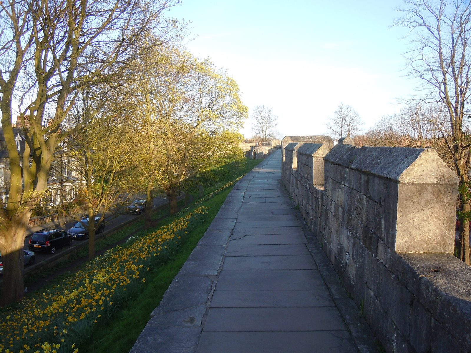
The walls extend for about 3.4 kilometres (2.11 miles), generally standing 4 metres high and measuring 1.8 metres wide. Substantial stretches survive. Their medieval fabric and later Gothic Revival work form a broken circuit around the city, with Roman foundations and sections of the earlier wall line incorporated into parts of it.
Roman wall line
Foundations and the alignment of about half the Roman circuit form part of the present walls. Surviving sections include the western corner in the Museum Gardens, the northwest and northeast stretches between Bootham Bar and Monk Bar, and a length between Monk Bar and Merchant Taylors’ Hall. Lower courses at the Roman eastern corner can be seen on the city-centre side of the present wall. The Roman circuit also ran southwest across the fort’s main cross street, at present-day King’s Square, before reaching its southern corner at Feasegate and turning northwest towards the western corner. A plaque in St Helen’s Square marks where the fort’s main approach road crossed the wall.
Multangular Tower
The Multangular Tower stands at the western corner of the Roman fortifications. It has ten sides arranged on the plan of a regular fourteen-sided figure; its rear four sides are missing, leaving the interior open. A low projecting base runs around its lowest course. The tower stands nearly 9.1 metres high, with an external diameter of 14.8 metres at its base and 14 metres above the base. Its inner faces measure about 2.3 to 3.4 metres across, and it projects 11.2 metres beyond the adjoining wall.
Concrete forms the foundations. Above them, a core of rubble and mortar is faced with neatly squared, small blocks of magnesian limestone. At a height of 4.6 metres, a ledge marks a reduction in wall thickness from 1.5 metres to 0.99 metres. That thinner section continues for another 1.2 metres, above which 3.4 metres of 13th-century masonry form the upper part of the tower, including arrow slits.
East Angle Tower
The East Angle Tower is visible above ground in the grounds of Merchant Taylors’ Hall.
Medieval circuit and defences
Wall alignment
The medieval wall line ran from the Roman eastern corner to Layerthorpe Bridge. Beyond the canalised Foss it resumes at Red Tower, then continues south and west around Walmgate to Fishergate Postern, near York Castle, which formerly had its own walls and moat. A short stretch west of Tower Gardens ends at Davy Tower beside the Ouse. From there the wall once continued to the castle walls, with a smaller gate on Tower Street. Across the river, it resumes at Skeldergate, passes Baile Hill and runs northwest, parallel to the Inner Ring Road. Near the railway station it turns northeast and ends at Barker Tower on the Ouse. A shorter stretch leads from there to the Museum Gardens entrance and the Roman wall line.
Ditch, rampart and towers
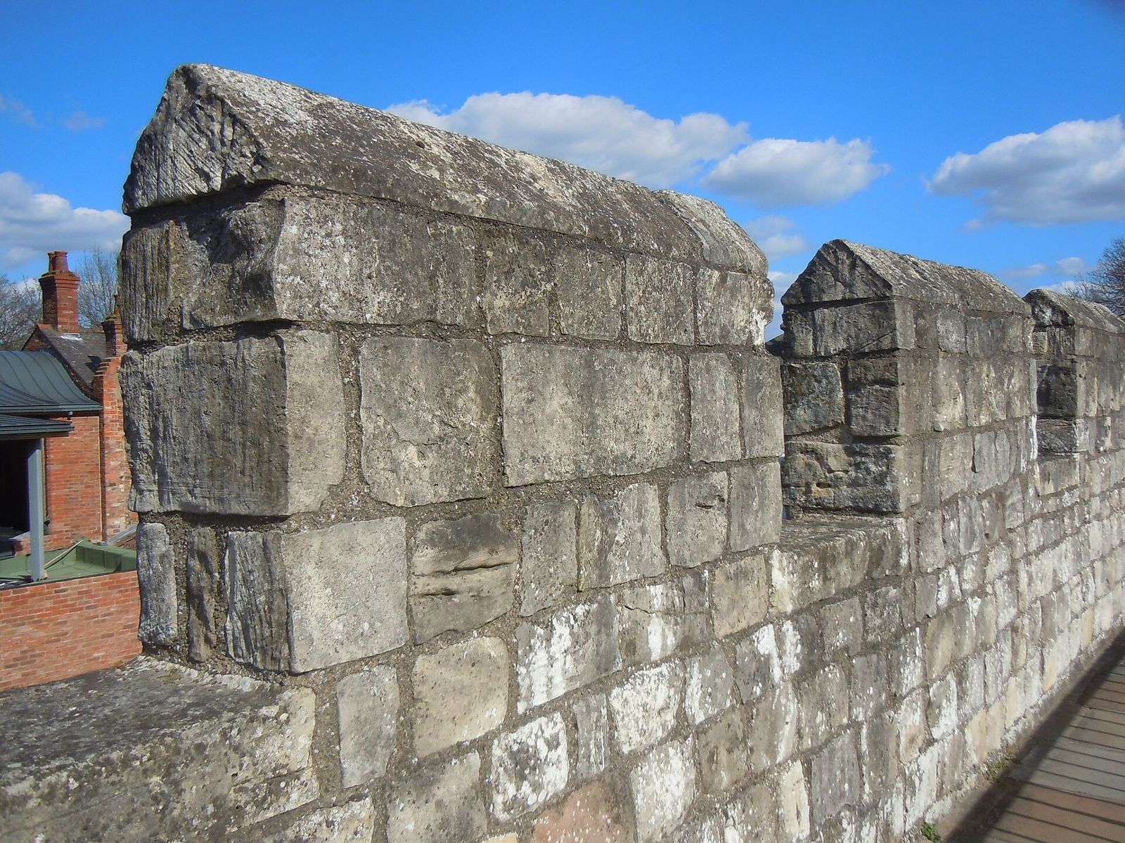
The medieval ditch was about 18.3 metres wide and 3 metres deep. It has since been almost entirely filled, leaving the ground immediately around the walls higher in most places than it was in the medieval period. The circuit includes 39 towers of differing construction. The northern towers between the main gates were formerly higher than they are now, following Victorian restoration. Many of the raised blocks of the battlements were also restored then, and few original examples remain. Illustrations from 1782 and 1807 show that some features predated that work.
Gatehouses and smaller openings
Bootham Bar
Bootham Bar stands close to the site of a Roman side gate. Its structure combines surviving 11th-century stonework with substantial fabric from the 14th and 19th centuries. The present openings include doorways on the first floor and three windows on the northeast side that light the second floor. The slot for its vertically moving gate, or portcullis, remains visible, although it is blocked and the gate is fixed in place. A low recess marks a former doorway on the western side, while the southwest doorway remains unchanged. The original entrance was reached from an adjoining house; a stone staircase in St Leonard’s Place leads to the first floor.
Monk Bar
Monk Bar is a four-storey gatehouse, the tallest and most elaborate of the city’s four principal bars. Designed as a self-contained fort, it has floors that could each be defended separately, and its portcullis remains in working order. The earlier Munecagate stood about 100 yards to the northwest, at the site of the Roman rear gate. A slight dip in the earth rampart indicates its former position.
Walmgate Bar
Walmgate Bar combines a 14th-century structure with a 12th-century inner gateway. Its outer defensive work, called a barbican, is the only surviving example on an English town gate. The gate retains a portcullis and has replacement oak doors based on 15th-century examples. On the inner side, an Elizabethan house projects over the entrance on stone columns of the Tuscan style, adapted in 1584.
Micklegate Bar
Micklegate Bar rises four storeys. Its lower section dates from the 12th century and the upper levels from the 14th. The top two floors served as living quarters and now house the City Walls Experience at Micklegate Bar museum.
Fishergate Bar and Victoria Bar
Fishergate Bar is a small pedestrian opening through the wall. Victoria Bar is a 19th-century addition; remains of an older gateway were found beneath it during construction. The earlier entrance may have been the small gateway known in the 12th century as the secluded gateway.
Posterns
A postern is a smaller secondary opening in a fortification. Fishergate Postern, also called St George’s Postern, stands at the corner of Fishergate and Piccadilly. It has four floors and was separated from York Castle’s walls by water. The former sites of other posterns help locate the earlier line of the defences: Castlegate Postern lies beneath the pedestrian crossing on Tower Street in front of Clifford’s Tower, Friargate Postern was northwest of St George’s Field, and Layerthorpe Postern stood at the junction of Peasholme Green, Layerthorpe, Foss Islands Road and Jewbury.
River towers and associated features
Barker Tower and Lendal Tower
North Street Postern Tower, or Barker Tower, stands on the west bank of the Ouse, north of Lendal Bridge. It was built to secure a chain across the river to Lendal Tower on the opposite bank. The chain ran parallel to the 19th-century bridge. Lendal Tower stands on the river’s north bank, and remains of its earlier structure survive in the waterworks yard.
Red Tower and Davy Tower
Red Tower is a brick structure at the end of the wall beyond the canalised Foss. It is in good condition, though extensively restored. Davy Tower, also built of brick, stands beside the Ouse.
Wider defensive landscape
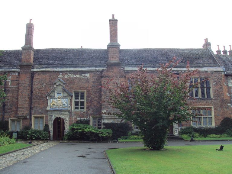
The wider complex includes moats and mounds, Baile Hill, St Leonard’s Hospital and Merchant Taylors’ Hall at Aldwark.