Rohanschanze: A Seventeenth-Century Defensive Fortification in Switzerland
Site at a Glance
- Popularity
- Medium
- Country
- Switzerland
- Primary era
- Early Modern
- Eras represented
- Early Modern
- Civilizations
- French
- Site type
- Military
- Remains
- Fort
On this page7 sections
History
Construction and wartime role
Rohanschanze is a defensive earthwork built between 1631 and 1635 in Malans, Switzerland. Also called the Rheinschanze and Landquarter Schanze, it was ordered by French commander Henri de Rohan and constructed under the direction of Swiss architect and engineer Johannes Ardüser. From the fort, Rohan controlled almost all north–south traffic near the only two bridges in the Bündner Herrschaft, which crossed the Rhine and Landquart.
The fort was built during the Thirty Years’ War (1618–1648), a major European conflict involving religious and dynastic-political struggles. The Three Leagues, a federation of political leagues in what is now Graubünden, and their subject territory of Valtellina, an Alpine valley south of Graubünden, formed an important transit region. Spanish Habsburg forces operated from Milan, while Austrian forces advanced from the east. Rohan entered Graubünden with a French corps in 1631 to take command of troops recruited there for France.
With the help of Jörg Jenatsch, a Protestant political and military leader from Graubünden, Rohan drove Spanish and Austrian forces out of Valtellina in 1634. When France refused to grant the valley independence, Jenatsch turned against Rohan.
The 1637 withdrawal and later recognition
Graubünden politicians formed the clandestine Chain League to resist Rohan’s occupation. On 21 March 1637, 3,000 Graubünden troops assembled unexpectedly before the fort. With only 1,000 French soldiers available, Rohan ordered its abandonment and withdrew. The Graubünden forces later demolished most of the earthworks.
The site is included in the Canton of Graubünden’s inventory of cultural properties of national importance. Part of it is also protected as nationally important dry meadows and pastures.
Remains
Original layout
The fort was a regularly arranged, star-shaped earthwork, consisting of a square area with eight redoubts, small defensive works, attached around it and ditches outside. It measured about 300 metres in length and about 420 metres diagonally. The remains lie in Malans, immediately east of the Landquart–Maienfeld road and north of the Landquart–Davos Platz railway. The road cuts through the ground occupied by the former earthworks.
Surviving earthworks
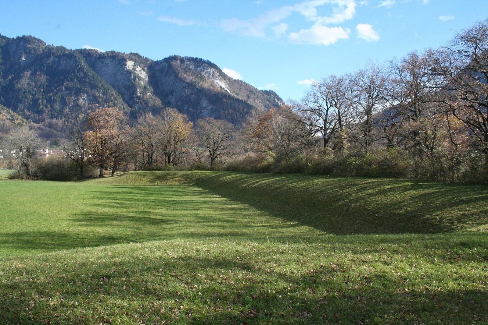
A tall earthen rampart remains on the north side, with an upper surface about 10 metres wide. On the south and east sides, a few mounds survive. Strips of woodland and groups of trees grow along parts of the former earthworks.
Memorial stone
A memorial stone beside the Landquart–Maienfeld road was erected in 1938. It shows the fort’s layout at a scale of 1:1,000. Its inscription attributes the fort to “Duke Heinrich Rohan” and states that it was built to protect the Three Leagues.