Rocca San Silvestro: A Medieval Fortified Mining Settlement in Italy




Site at a Glance
- Rating
- 4.6
- Popularity
- Low
- Country
- Italy
- Primary era
- Medieval
- External website
- Open
- Eras represented
- Medieval
- Civilizations
- Holy Roman Empire
- Site type
- Military
- Remains
- Fortified Town
On this page23 sections
History
Rocca San Silvestro is a fortified medieval mining settlement in Italy, near Campiglia Marittima, established between the tenth and eleventh centuries by the Della Gherardesca counts to exploit copper and silver-bearing lead. The settlement formed part of the San Silvestro mining district, an area worked for mining and metallurgy since the Etruscan period. Its original medieval name was Rocca a Palmento, while the name Rocca San Silvestro was adopted after abandonment from the dedication of its church to San Silvestro, or Saint Sylvester.
Foundation and seigneurial rule
The mines supplied copper and silver-bearing lead to Tuscan mints, including those of Lucca and Pisa. From the eleventh century, the territory belonged to the Pisan contado, the rural territory controlled by a medieval Italian city, and remained under Pisa until its transfer to Florence in the early fifteenth century. Rocca a Palmento nevertheless retained considerable autonomy under its own lords.
The Della Gherardesca were succeeded by the Della Rocca during the twelfth century, probably when former vassals became independent lords. Under the Della Rocca, the settlement underwent major economic and urban development. The walls were rebuilt and strengthened, a fortified entrance was added, the church was enlarged, and the residential area was reconstructed according to a more regular plan. Residential space lay to the east, while industrial and craft activities were concentrated to the west.
Growth and economic organization
Rocca San Silvestro reached its greatest expansion in the second half of the thirteenth century, when about 200 to 250 people lived in roughly 42 houses. Population growth led to the subdivision of existing homes and the construction of upper floors. The community was organized around mining and metallurgy, with men, women, and children contributing to different stages of production.
Miners followed narrow ore veins through galleries and carried the extracted material in leather bags or baskets. Women and children crushed the ore outside the settlement, after which useful minerals were separated by hand or with water before being taken into the castle for processing. Copper came from chalcopyrite in the Lanzi and Temperino valleys. Silver-bearing lead came from galena, and iron production supplied the settlement’s own needs, particularly the manufacture and repair of mining tools.
The inhabitants also shared defensive responsibilities. Guard duty was performed in rotation by the adult men as compulsory service owed to the lords, rather than by a permanent professional guard. This arrangement reflected the settlement’s seigneurial character, in which a lord or aristocratic family governed the community directly rather than through an autonomous urban commune.
Decline and abandonment
The castle was sold in 1310 to Raniero di Donoratico. Its decline followed a combination of political conflict, a possible earthquake in the second decade of the fourteenth century, and the failure to introduce water-powered technology for bellows and hammers. Competition from more productive mining and metallurgical centers, including Villa di Chiesa in Sardinia, further weakened the settlement’s economy.
Rocca San Silvestro began to be abandoned toward the end of the fourteenth century and was fully deserted by the middle of the fifteenth century after a period of intermittent occupation. The decline also reflected the weakening of the seigneurial political and social system and changes in urban markets. After abandonment, the buildings were used occasionally for shelter by shepherds and animals. The church continued in ecclesiastical use until 1399.
Excavation and interpretation
Archaeological research began in 1984 under the University of Siena’s Department of Archaeology and Art History, in collaboration with European university departments and with support from the municipality of Campiglia Marittima and Tuscan and Pisa archaeological and architectural authorities. Excavation covered about two-thirds of the settlement and reconstructed the organization of mining, metalworking, and daily life in a late-medieval community.
The restored monumental complex was inaugurated in 2008. Rocca San Silvestro forms part of the San Silvestro Archaeological Mining Park and provides evidence for the social, working, and living conditions of a seigneurial settlement organized around mining and metallurgy. Its approximately four centuries of occupation illustrate the revival of a specialized industrial center around the turn of the first millennium and the later decline of this type of seigneurial mining community.
Remains
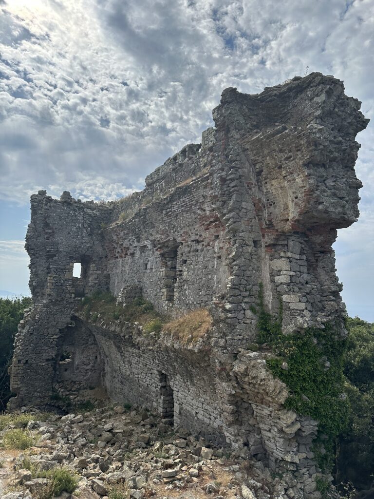
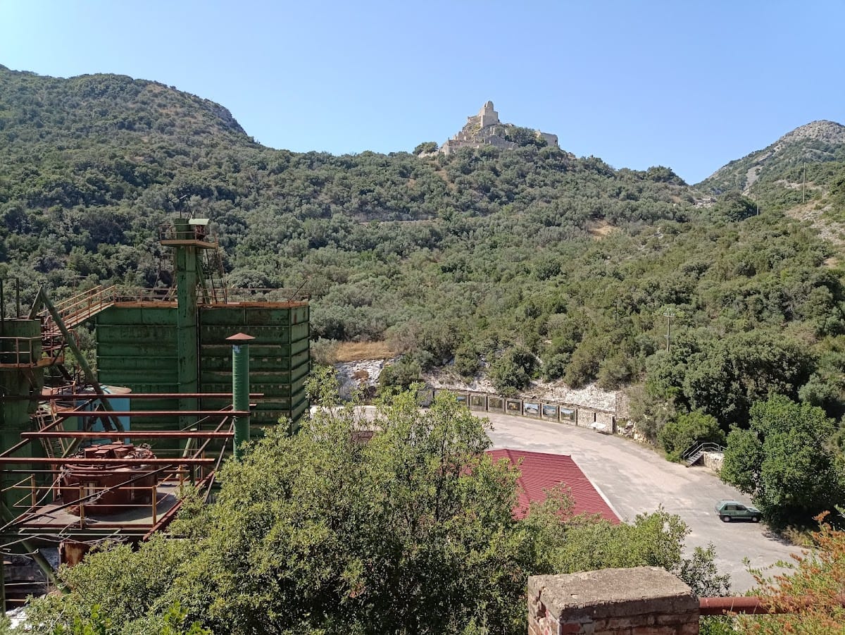
Rocca San Silvestro occupies the crest of Monte Rombolo, at about 331 metres above sea level, on a limestone hill in the San Silvestro mining district. The settlement has a roughly triangular, concentric plan shaped by the rocky summit, restricted building space, security needs, and the separation of residential, seigneurial, and industrial functions. Two fortified levels organized the site. The upper level contained the lordly and military center, including the guard tower, while the lower level held the miners’ homes, communal facilities, and productive areas.
Walls and fortified center
The final outer circuit measures about 400 metres and encloses approximately one hectare. It is built of local limestone rubble laid in courses, with narrow splayed arrow slits and foundations resting largely on exposed bedrock. The walls were altered through several building phases. An earlier circuit was incorporated into houses, while later construction moved the entrance and extended the enclosure with rougher masonry and crenellations. The most precise sections are associated with specialized master masons; later work carried out by residents under their direction is generally less finely finished.
Seigneurial quarter
The seigneurial quarter occupied the central and northern high ground behind an inner curtain wall. It included a two-story quadrangular residence, courtyards, rooms, storage areas, stables, and cisterns. A marble-paved surface belonged to the earliest phase of the residence, and part of it has been restored. The quarter formed the administrative and residential center of the lords within the fortified settlement.
Guard tower
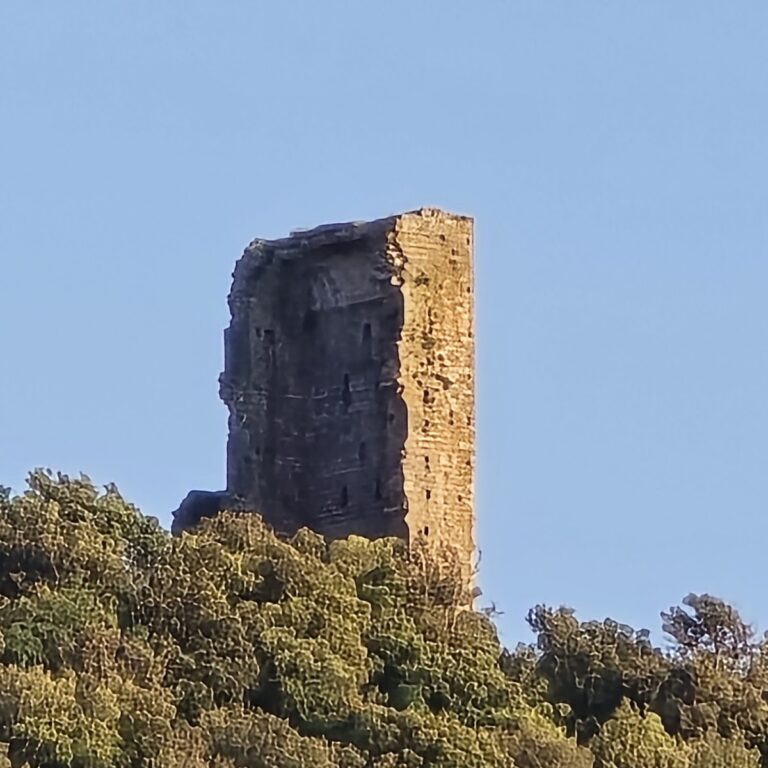
The Romanesque guard tower stood at the settlement’s highest point. It measures approximately 4 by 5 metres and consists of rubble masonry faced with carefully squared blocks. Its present entrance is about 3 metres above ground level. Repeated collapses around the tower make that entrance difficult to reach, while its position placed it within the upper defensive center.
Fortified entrance
The monumental entrance was approached by a visible stone staircase and entered through an arched portal about 2 metres wide. The surviving elements include the jambs, threshold, hinge sockets, and housing for the bolt. The threshold is lower at its center, apparently allowing animals to pass while preventing carts from entering.
Steps cut into the rock continue through the access passage. A mill or Nine Men’s Morris board was carved into the third step near the guard post, and similar game markings survive in paving stones immediately before and behind the gate. The guard post stood in the structure to the left of the entrance, open toward the gateway and furnished with a stone bench.
Church and cemetery
Church of San Silvestro
The church of San Silvestro is a single-nave, trapezoidal Romanesque building with one apse, the rounded or polygonal end of the sanctuary. Its full elevation survives, although the roof is missing. The roof probably consisted of timber trusses supporting two slopes. Light entered through a cross-shaped window in the façade and two narrow windows around the apse.
The church was enlarged between the late twelfth and early thirteenth centuries as the population grew. A church dedicated to San Silvestro is first recorded in 1281. Continued ecclesiastical use after the settlement was abandoned helped preserve the building in comparatively good condition and later gave the settlement its modern name.
Cemetery
The cemetery lies in front of the church within an enclosed area. Most people were buried directly in the ground, and limited space led to the disturbance and reburial of earlier remains. Three masonry tombs beside the church probably belonged to the seigneurial family.
Excavation identified the remains of more than 600 individuals. The analyzed population had an average height of about 1.65 metres for men and 1.55 metres for women, with an average age at death of approximately 40 years. Frequent arthritis probably reflected mining work and also affected women. Parasitic diseases were associated with animal contact and contaminated meat, while tooth abrasion was linked to coarse, poorly refined flour. Overall health was considered better than that of other contemporary Tuscan populations, possibly because of the settlement’s isolation and low population density.
Residential quarter
The residential quarter expanded along the eastern side of the hill from the second half of the thirteenth century. Narrow lanes cut into the rock generally ran parallel to one another between house blocks. The main road connected the gate, church, and tower, while smaller lanes led to individual homes. Steep sections were crossed by steps or ramps, and only some stretches were paved.
Houses usually had one or two stories and averaged about 27 square metres. Living rooms had beaten-earth floors, clay or mortar hearths, and niches in the walls. Ground floors commonly served as stables or storerooms and often had separate entrances. Two-pitched roofs were covered with slabs of local schistose limestone.
Two-house complex
A two-house complex dating from the twelfth century stood immediately south of the citadel and shared a paved private courtyard. By the middle of the fourteenth century, part of the courtyard had become a vegetable garden. Its southeastern corner contained the settlement’s only known latrine. The arrangement and comparatively elaborate construction suggest that the residents were socially prominent and may have belonged to the lords’ household or family.
Oil production and water management
Oil mill
The oil mill lies directly below the church and seigneurial quarter. Animal traction powered the crushing of olives, producing a paste that was placed in layers of cloth or plant fiber and compressed in a wooden press. The resulting oil served both as food and as fuel for lamps, making it an important resource for the mining community.
Cisterns
Several cisterns of different sizes occupied the higher parts of the outer settlement. Some were communal and others private, forming part of the water-management facilities that supported the residential and productive areas.
Mining and metalworking areas
The industrial zone occupied artificial terraces on the western and northwestern side of the settlement, below and close to the fortified seigneurial quarter. The terraces had originally been quarries for building stone. Their exposed position suited lead processing because harmful fumes required well-ventilated workplaces, while the separation from the houses reduced risks from fire and toxic emissions.
Copper and lead furnaces
Clay and porphyry furnaces processed copper and silver-bearing lead, with hand-operated bellows supplying air. Copper production began with chalcopyrite from the Lanzi and Temperino valleys. The ore was roasted repeatedly to reduce its sulfur content and then smelted in furnaces at approximately 700 to 800 degrees Celsius.
Silver-bearing lead came from galena and was produced in clay furnaces. Lead left the settlement in ingots, probably traveling to Pisa, where cupellation, a refining process that separates silver from lead by heating, removed the silver. The processed metals moved through the Manienti valley toward the lowlands near San Vincenzo and then to their destinations.
Forge and bloomery
A forge at the foot of the castle operated from the eleventh century to the first half of the thirteenth century. Semiprocessed iron was reheated in a clay hearth supplied by a hand-operated bellows and hammered on an anvil set on a wooden base. The forge could also temper and carburize tools.
A bloomery furnace, a furnace that produces a porous iron mass without fully melting the metal, stood near the lime kiln and dates from the twelfth century. It used hematite brought mainly from Elba together with local limonite and sulfides. The furnace and forge now form part of an experimental archaeology area where historical methods of copper and silver-bearing lead smelting are reconstructed and studied.
Lime kiln and ceramic kiln
A lime kiln cut into the rocky ground lay southwest of the castle. It produced slaked lime for mortar but was abandoned at the beginning of the fourteenth century, after which red clay was used for wall construction and maintenance. A separate ceramic kiln stood southeast below the citadel and was initially also used for baking bread.
Communal bread oven
One of the later structures was a communal bread oven outside the houses above the guard post. Built at the end of the thirteenth century, it was large enough to bake the weekly bread supply of several families in a single firing. Its clay baking floor connected to a lower opening through a channel that collected ash. After the settlement was abandoned in the late fourteenth century, the oven chamber was reused for storing work tools and household equipment.
Additional areas for mineral production and processing, charcoal making, and limestone quarrying lay outside the main walls. Together with the houses, church, cemetery, defenses, cisterns, and workshops, these remains preserve the physical organization of a medieval mining village rather than an isolated fortress.
Nearby sites