Rheinfels Castle: A Medieval Toll Castle and Fortress on the Rhine


Site at a Glance
- Rating
- 4.5
- Popularity
- Medium
- Country
- Germany
- Primary era
- Early Modern
- External website
- Open
- Eras represented
- Medieval, Early Modern
- Civilizations
- Holy Roman Empire
- Site type
- Military
- Remains
- Castle
On this page15 sections
History
Rheinfels Castle is a ruined medieval spur castle in Germany above the town of St. Goar, built in 1245 by Count Diether V of Katzenelnbogen as a toll station for ships travelling upstream on the Rhine. Its position above the river gave it both a defensive role and control over a valuable route. A siege in 1256 failed, probably because of opposition to the tolls imposed on river traffic, and the castle acquired a reputation for being impregnable. Later embellishments by the chronicler Wigand Gerstenberg are not supported by contemporary evidence.
The Katzenelnbogen residence
During the thirteenth century, the County of Katzenelnbogen was divided into Upper and Lower Counties. Rheinfels became the residence of the Lower County. Between 1360 and 1370, Count Wilhelm II substantially enlarged the inner castle. Around 1370, he also built Neukatzenelnbogen, later known as Katz Castle, on the opposite bank of the Rhine. The two castles allowed tolls to be collected from ships travelling in both directions.
After the two Katzenelnbogen counties were reunited in 1402, Rheinfels continued as a residence. Court life reached its height there in the fifteenth century under Count Johann IV and his son Philipp. During Philipp’s rule, the round principal defensive tower, or bergfried, was raised to a total height of 54 metres.
Philipp’s sons died young, and in 1479 the county and castle passed to Landgrave Heinrich III of Hesse-Marburg, who was married to Philipp’s daughter Anna. A long inheritance dispute with the House of Nassau followed. Rheinfels and Marburg eventually passed to Wilhelm II of Hesse, who reunited the Hessian territories. A landgrave was a territorial prince whose rank was comparable to that of a duke, while a landgraviate was the territory governed by a landgrave.
Renaissance residence and Hessian divisions
Landgrave Philipp the Magnanimous of Hesse converted Rheinfels into a Renaissance castle. After his death, it became the seat of the short-lived Landgraviate of Hesse-Rheinfels under his son Philipp II. The younger Philipp repaired and enlarged the complex, continuing its development as both a residence and a fortified stronghold.
During the Marburg succession dispute, the Imperial Aulic Council, a court of the Holy Roman Empire, awarded the Lower County and Rheinfels to Hesse-Darmstadt in 1623. Landgrave Moritz of Hesse-Kassel rejected the decision, and forces commanded by Ferdinand of Bavaria besieged Rheinfels in 1626. After heavy fighting, the castle surrendered on 2 September and was transferred to Hesse-Darmstadt.
Landgrave Georg II of Hesse-Darmstadt restored the castle, but Hesse-Kassel recaptured it in 1647. An agreement dated 14 April 1648 divided Rheinfels and the town of St. Goar between the two Hessian landgraviates.
The Hesse-Rheinfels fortress
In 1649, Landgrave Ernst of Hesse-Rheinfels-Rotenburg made Rheinfels his residence. Between 1657 and 1674, he transformed the complex into a major fortress directed against France. He lived there until 1692 and established the younger Hesse-Rheinfels branch, later called Hesse-Rheinfels-Rotenburg.
Ernst and his wife received the Jesuit and Bollandist scholars Godefridus Henschenius and Daniel Papebroch at Rheinfels in 1660. Papebroch described a strongly fortified castle with comfortable residential rooms and a richly decorated chapel. Heraldic inscriptions referred to Ernst’s return to Catholicism and the transfer of Hersfeld Abbey to him.
Ernst’s continuing financial difficulties led him to promise King Louis XIV of France, in secret, that he would transfer Rheinfels in exchange for an annuity. Landgrave Karl of Hesse-Kassel discovered the plan, seized the castle, and placed its defence under Georg Ludwig of Schlitz, known as von Görtz. He was rewarded with a governorship for life.
During the War of the Palatine Succession, a conflict between France and a coalition of European powers over disputed territories and dynastic claims, French forces under Lieutenant-General Comte de Tallard attacked Rheinfels in December 1692. The Hessian-Kassel garrison resisted two assaults. The French suffered approximately 4,000 dead and 6,500 wounded, while the defenders lost 564 men and had 885 wounded. A relief army under Landgrave Karl arrived on 3 January 1693, causing the French to withdraw. The successful defence led to Georg Ludwig’s appointment as governor for life.
Later ownership and destruction
The Treaty of Utrecht in 1713 confirmed Hesse-Kassel’s possession of Rheinfels and St. Goar. After another legal dispute, the castle was transferred in 1718 to Landgrave Wilhelm the Younger of Hesse-Wanfried, who adopted the name Wilhelm of Hesse-Rheinfels. Hesse-Kassel retained garrison rights at the fortress during wartime.
After Wilhelm’s death in 1731, his half-brother Christian of Hesse-Wanfried inherited Rheinfels. A French-led attack in 1734 returned the castle to Hesse-Kassel, and a family agreement in 1735 definitively renounced Hesse-Wanfried’s garrison rights there. When Christian died in 1755 as the last male descendant of the Hesse-Wanfried branch, Hesse-Eschwege and Hesse-Rheinfels, together with St. Goar and Rheinfels, passed to Hesse-Rotenburg. They remained associated with that branch, with interruptions, until 1815.
French forces attacked Rheinfels during the Seven Years’ War, a European conflict fought from 1756 to 1763, on 1 December 1758. The fortress surrendered without a fight. During the French Revolutionary Wars, the garrison under Major General Philipp Valentin von Resius abandoned the fortress without resistance on 1 November 1794 after receiving a false report of an imminent French assault. French revolutionary troops entered on 2 November, and von Resius was later sentenced to death. The sentence was commuted to life imprisonment.
The French destroyed the fortress in stages. The forward fortifications were blown up in 1796, followed by the palace and the bergfried in 1797. In 1812, the ruins were sold as French state property to the St. Goar merchant Peter Glass. Much of the salvaged stone was reused in the construction of Ehrenbreitstein Fortress near Koblenz.
In 1815, the last Landgrave of Hesse-Rotenburg ceded St. Goar and Rheinfels to Prussia in exchange for the principalities of Ratibor and Corvey. After a period of quarrying, Prince Wilhelm of Prussia, later Emperor Wilhelm I, purchased the ruins in 1843 and prevented further destruction. The town of St. Goar has owned Rheinfels since 1925. Restoration work took place in 1963 and 1964 and again during the 1990s. Since 2002, the castle has formed part of the UNESCO World Heritage property Upper Middle Rhine Valley, a cultural landscape recognized for its fortified river corridor, historic settlements, and cultural landscape.
A 99-year leasehold agreement with the owners of the adjacent hotel led Georg Friedrich, Prince of Prussia, to seek the castle’s return in 2018. The Koblenz Regional Court rejected the claim in 2019, and an out-of-court settlement in January 2020 recognized the town of St. Goar’s ownership.
The castle’s name appears in medieval and early-modern records in many forms, including Rinefels, Rynvels, Rinvelz, Ryuels, Rinuels, Rynfels, Rinfelsch, Rheynfelsch, Rhinfelz, Reinfelsch, and Reinfelß. The form Rheinfels became established during the eighteenth century, although Rhynfels and Rhinfels continued to appear in English and French prints into the nineteenth century.
Remains
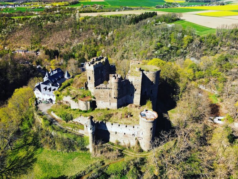
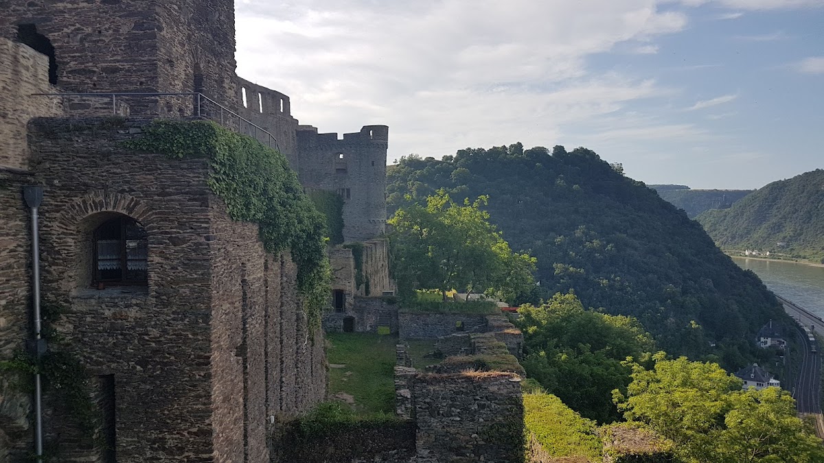
Rheinfels occupies a ridge between the left bank of the Rhine and the Gründelbach valley above St. Goar. It is a ruined spur castle whose historical fortress area was much larger than the surviving ruins, which cover about one-fifth of the former complex. Early seventeenth-century plans and drawings by Wilhelm Schäfer, also known as Wilhelm Dilich, make it possible to reconstruct the layout and appearance of the thirteenth- and fourteenth-century core castle. Approximately three-quarters of the present ruins derive from the major fortress expansion of the mid-seventeenth century.
Core castle and residential buildings
Clock Tower and inner entrance
The northern approach to the inner castle passes through the approximately 21-metre-high Clock Tower. Built around 1300, it served as both a gate tower and a defensive structure, and it is the highest surviving point of the complex. A second gate from roughly the same period leads into the thirteenth-century core castle. Inside are a spiral stair tower and an inner courtyard, whose former buildings included stables, kitchens, a bakery, a herb garden, and a brewery. The courtyard is now largely ruined.
Darmstädter Bau
Beyond the Clock Tower stands the broad front of the three-storey palas, the principal residential and ceremonial hall of a medieval castle. Known as the Darmstädter Bau, it was built in half-timbering with pointed gables. Red sandstone framed its window and door openings.
Former bergfried and Frauenhaus
The former bergfried, the principal defensive tower of a medieval German castle, had a diameter of 10.5 metres and walls 3.5 metres thick. Its total height reached 54 metres. In the fifteenth century, a narrower round tower in the form of a Butterfassturm, or butter-churn tower, was added above it. The Frauenhaus, traditionally the women’s residence, now houses the castle museum. Its former extensions included a round tower at the corner facing the Rhine and a stair tower on the courtyard side.
Cellars and courtyard remains
Great Cellar
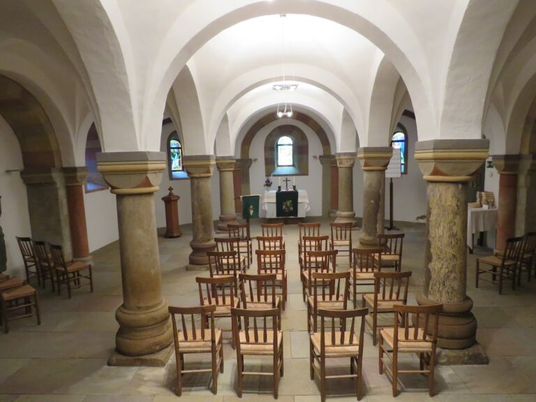
The Große Keller, or Great Cellar, occupies the former neck ditch between the palace and the western hillside. A neck ditch is a ditch cut across the connecting ridge or spur. The cellar’s vaults were constructed in two clearly visible phases between 1587 and 1589. The space is approximately 24 metres long and about 16 metres wide and high, with walls up to 4 metres thick. It can accommodate about 400 people.
A built-in masonry wine vat held approximately 180,000 litres and had walls sealed with tallow. By 1647, it was no longer filled, and ordinary wooden barrels were used instead. The cellar was completely renovated in 1997 and serves as a venue for concerts, theatre performances, and other events.
Marstallhof and artillery tower
The fourteenth-century south-western shield wall leads into the Marstallhof, the largely destroyed area of the inner bailey. A shield wall is a particularly strong defensive wall designed to protect a castle’s most vulnerable side. The former stable building connected the north-western curtain wall with the Büchsenmeisterturm, or master-gunner’s tower. A small wall remnant of the stable and a stump of the tower survive in the complex, while a reconstructed pillory stands in the forecourt.
Fortress works and underground galleries
The fourteenth-century Mantelmauer, or enclosing curtain wall, and the Hohe Batterie, added around 1660, form part of the circuit through the former fortress works. The outer bailey was separated from the core castle by the Great Neck Ditch and a massive shield wall with visible loopholes.
The seventeenth-century fortifications also include underground mine galleries excavated near the walls. These passages were designed to allow explosives to be placed beneath besieging forces. They extend for approximately 200 metres and are low, dark, and branching in places.
Chapel and surviving environment
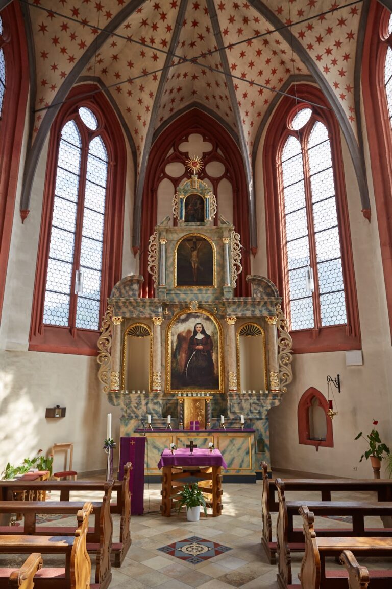
In 1660, the chapel had a gilded ceiling covered with golden inscriptions on a dark ground. Passion scenes decorated the walls, and the landgrave’s coats of arms appeared beneath the singers’ gallery. After the fortress was destroyed, all four chapel walls were reportedly still standing.
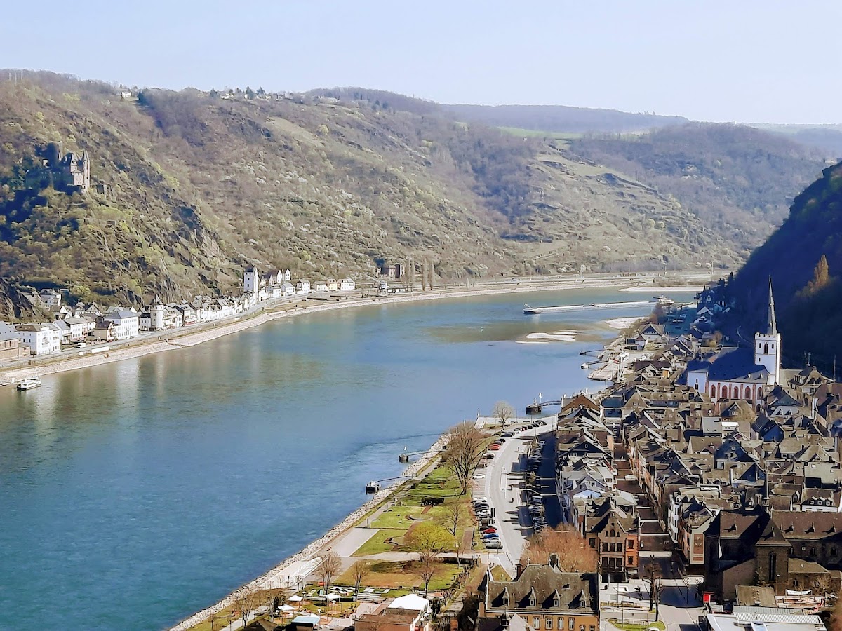
The Clock Tower provides views over St. Goar and its harbour, across the Rhine to St. Goarshausen and Katz Castle, northward toward Maus Castle, and westward into the Gründelbach valley. An interpretive path addresses the castle’s walls, former social life, warfare, weapons, plants, and animals. Quartzite and slate at the site formed from Devonian sediments, while the ruins support mosses, lichens, ferns, Mediterranean plants, swifts, kestrels, and jackdaws.