Relief of İmamkulu: A Hittite Monument in Türkiye
Site at a Glance
- Rating
- 4.3
- Popularity
- Very Low
- Country
- Turkey
- Primary era
- Bronze Age
- Eras represented
- Bronze Age
- Civilizations
- Hittite
- Site type
- Religious
On this page9 sections
History
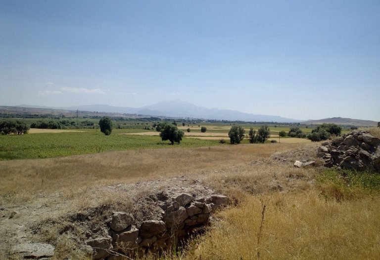
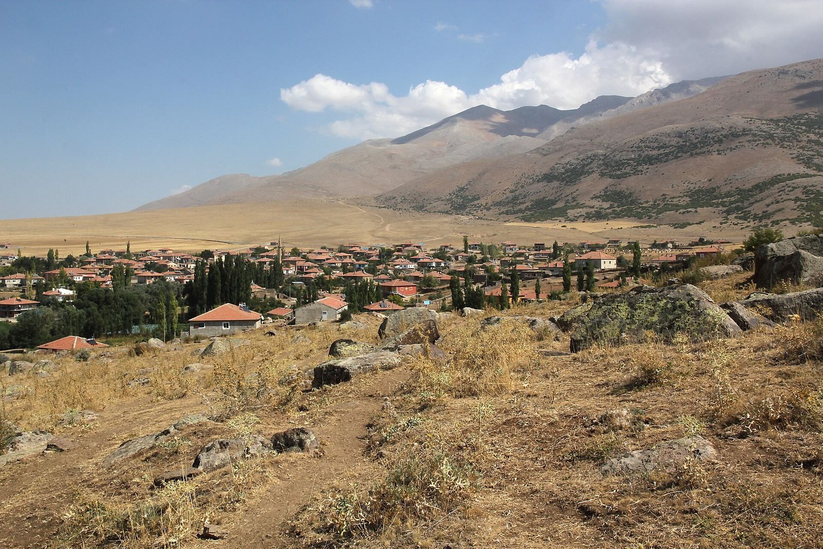
The Relief of İmamkulu is a thirteenth-century BC Hittite monument near İmamkullu in Türkiye, created during the late period of the Hittite Empire. The Hittites were a major Anatolian state of the second millennium BC, and their late imperial period saw the production of royal and religious monuments across central and southern Anatolia. The relief stood at the beginning of the Gezbel Pass, where two ancient routes met as they crossed the Taurus Mountains.
The Gezbel Pass and Hittite routes
One route followed the Zamantı Irmağı from the Hittite heartland through Kayseri and Tomarza. The other came from Cappadocia through Develi, passing the reliefs at Fıraktın and Taşçı. The Hanyeri relief marked the southeastern end of the pass and belongs to the same thirteenth-century BC late imperial setting. Together, these monuments occupied a route through the mountains that connected areas of central and southern Anatolia.
Discovery and interpretation
Kemaleddin Karamete of Kayseri discovered the monument in 1934. Louis Delaporte then published the first report, and Ignace Gelb visited the site in 1935. During their Anatolian work in 1947, Sedat Alp and Ekrem Akurgal recorded the inscriptions. Further studies followed, including Markus Wäfler’s description of the relief and its inscriptions in 1975.
Piero Meriggi proposed a reading of the carved signs, and Hans Gustav Güterbock supported it after visiting the monument in 1978. Jutta Börker-Klähn later suggested a different reading for the name of the figure on the left. Kay Kohlmeyer published a detailed discussion in 1983, while Horst Ehringhaus provided additional documentation of the images and inscriptions in 2005. A cast of the monument is displayed outside the Archaeological Museum of Kayseri.
Remains
Boulder and composition
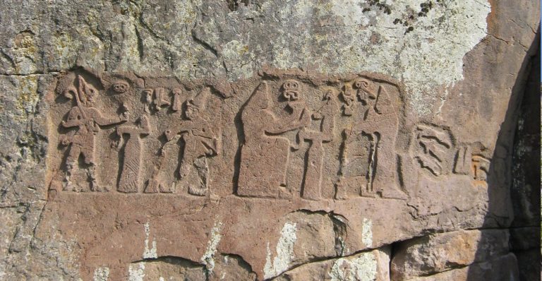
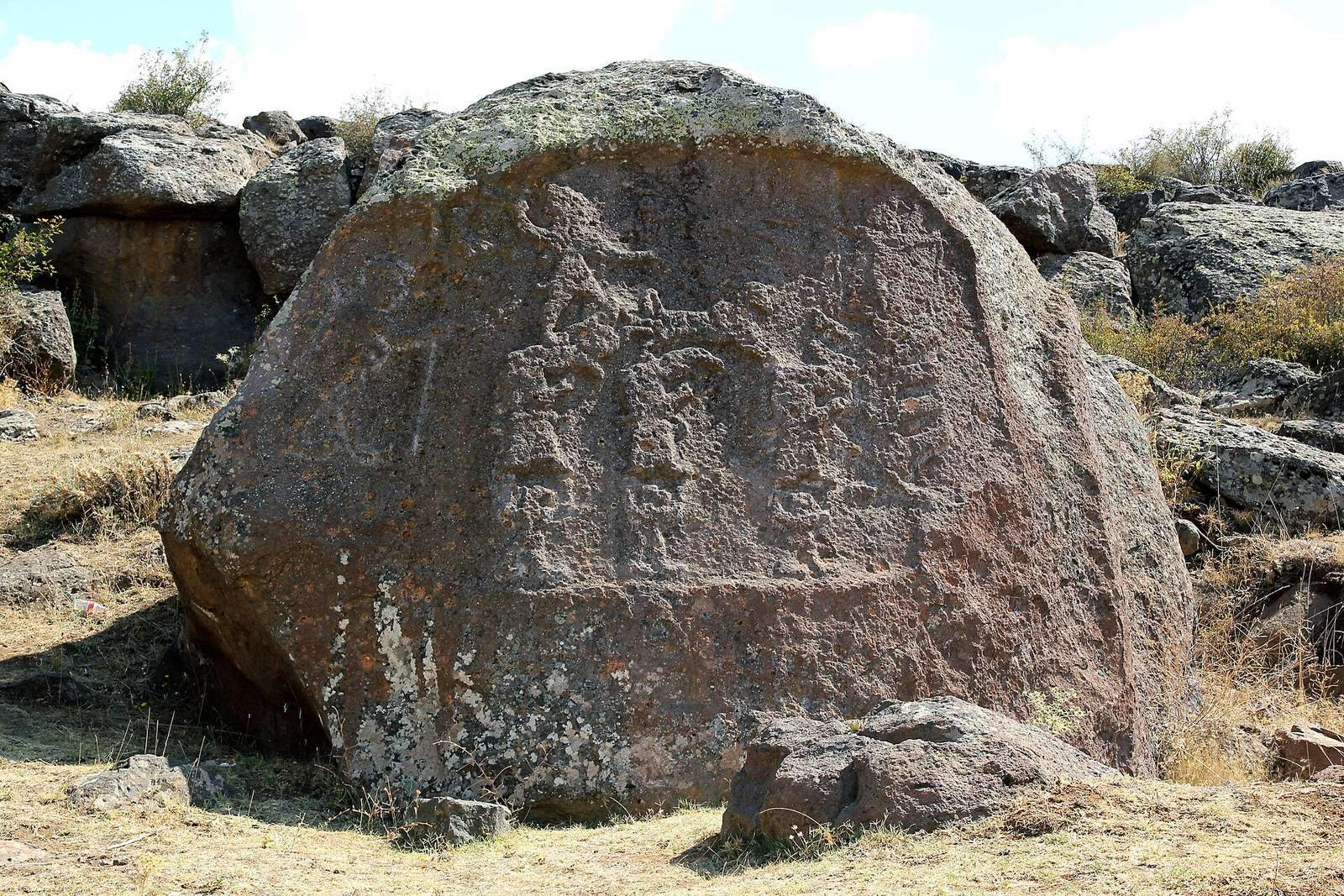
The relief is carved into a large trachyte boulder on the slope of Bey Dağı, a mountain rising to 3,045 metres south of İmamkullu. Trachyte is a fine-grained volcanic stone suitable for monumental carving. The boulder faces west-northwest and has a slightly convex surface that was artificially flattened before the figures were cut. Weathering has heavily worn the surface. The composition measures approximately 3.25 by 2 metres and is divided into three adjacent zones.
Figures and divine imagery
Kuwalanamuwa, the royal figure
The left zone contains a male figure moving towards the right. He probably represents the person who dedicated the monument. He carries a spear in his left hand and a bow in his right, although only traces of the bowstring survive. A sword hilt and part of a scabbard appear at his belt. His clothing and equipment include a round cap with remnants of a horn and pointed shoes.
Luwian hieroglyphs, a pictorial writing system used especially for monumental inscriptions in Anatolia, are carved before the figure’s head. They identify him as a king’s son and give his name as Kuwalanamuwa. A prince with this name also appears in the inscriptions of the Hanyeri relief and the relief at Akpınar near Manisa. These three references may concern the same person, but that identification remains unproven.
The weather god and mountain gods
The central zone is dominated by the weather god, who stands in a chariot moving to the right. In Hittite and related Anatolian religions, the weather god was associated with storms, rain, and agricultural fertility. Here he wears pointed shoes, a short warrior’s kilt, and a horned pointed cap, with a sword at his belt. He raises a mace in his right hand and holds the reins in his left as bulls pull the moving chariot.
Three Luwian hieroglyphs above the raised hand identify him as the weather god of heaven. A fourth sign below them is no longer legible. The chariot and its divine rider stand on the bent necks of three mountain gods. These figures wear long robes and pointed divine caps and carry swords. Beneath them are three hybrid creatures, each combining a feline head with raised human arms. The arrangement resembles the principal divine scene at Yazılıkaya, the Hittite rock sanctuary near the imperial capital of Hattusa.
The goddess and the bird
The upper part of the right zone shows a goddess facing forward, with her head in profile and turned left towards the approaching weather god. Her raised or spread arms hold open her robe. Four or five points appear on her crown or hairstyle, depending on how the worn image is reconstructed, and wing tips project above her shoulders. A six-pointed star may be carved above her right hand.
Her legs are represented without feet in the manner of idols, stylized sacred images, and she stands on a simplified tree. A bird flies leftward between the goddess and the weather god. The goddess is probably Šauška or Ishtar. Šauška was a Hurrian goddess closely identified with the Mesopotamian Ishtar, who was associated with sexuality, fertility, and warfare. The pairing of a weather god with an unveiling goddess, sometimes accompanied by a bird, appears in Anatolian and Near Eastern imagery from the Early Bronze Age onward, including Syrian cylinder seals.
Jutta Börker-Klähn proposed a possible connection between the scene and the Asherdu myth, an ancient Near Eastern narrative involving Asherdu and Elkunirsa. In that interpretation, Ishtar, appearing in the form of a bird, observes the sexual encounter between the weather god and Asherdu, the wife of Elkunirsa. The proposal offers one possible mythological reading of the unusual arrangement, while the carved scene itself remains the principal evidence for understanding the monument.