Kültepe: An Ancient Anatolian Political and Trading Center
Site at a Glance
- Popularity
- Very High
- Country
- Turkey
- Primary era
- Bronze Age
- Eras represented
- Bronze Age, Iron Age, Classical
- Civilizations
- Ancient Greek, Assyrian
- Site type
- City
On this page23 sections
History
Kültepe is the ancient settlement of Kaneš, about 20 km northeast of Kayseri in Türkiye. Its upper mound was occupied intermittently from the middle of the third millennium BCE through the Roman imperial period. The settlement became a major political center in Early Bronze Age central Anatolia and a leading trading hub during the Middle Bronze Age. Its modern Turkish name means “ash hill”; Hittites used the names Kaneš and Neša interchangeably.
Early settlement and the Assyrian trading district
In the Early Bronze Age, Kaneš was one of several competing Anatolian city-states. Its position connected central Anatolia with Malatya and routes leading toward the Euphrates and Mesopotamia. Passes across the Taurus Mountains also linked the region to the Mediterranean.
After 2000 BCE, Assyrian merchants established a kārum, an Assyrian trading district that also served as an administrative institution. Kaneš became the principal center of a network of Assyrian settlements in Anatolia, linked to the city of Assur. Merchants sought silver and gold, among other Anatolian goods, and brought in tin and textiles. They also traded copper, wool, and other commodities, moving goods between larger centers and smaller stations by donkey caravan.
The trading community included Assyrian merchants and their families, as well as Syrian and Anatolian traders. Its population has been estimated at about 500 to 700. Cuneiform, a wedge-shaped writing system impressed into clay, preserves roughly 250 years of commercial and legal records, alongside evidence of family life, marriage, inheritance, and divorce. The records show that Assyrian women could make contracts, manage household and business affairs, own property, and produce and sell textiles. Marriages between Assyrians and Anatolians contributed to lasting social and cultural exchange.
The kārum had its own administration and legal authority, but remained subordinate to Assur and ranked above other Assyrian trading settlements in Anatolia. Assyrian residents followed Assyrian law and administration, while agreements with local rulers covered rights to settle, security, and trade. The principal phases were kārum II and the later kārum Ib. The first ended around 1835 BCE in a destructive fire. The start of that phase and the length of the interval before the later one remain uncertain.
Kaneš under local kings
Labarša is the only securely known king of Kaneš during kārum II; Papala and Kuku may also have ruled. The fire around 1835 BCE has been tentatively connected with an attack by Uḫna, king of Zalpa, who was said to have taken Kaneš’s sacred image to his own city. The episode belongs to an uncertain political reconstruction. Hittite tales also preserve legendary associations: the Zalpa story tells of a queen of Kaneš who gave birth first to thirty sons and later to thirty daughters, while a separate tale about the Akkadian king Naram-Sin lists Zipani of Kaneš among his legendary enemies.
In the political sequence that followed, Ḫurmeli of Ḫarsamna was said to have driven out the invaders and installed Ḫarpatiwa at Kaneš as “chief of the stairway,” a powerful official ranked immediately below the king. Inar, a ruler of Kaneš, later took power and besieged Ḫarsamna for nine years. His son Waršama inherited the throne, but Pitḫana of Kuššara defeated him.
Pitḫana’s son Anitta overcame resistance at Kaneš, strengthened and expanded the settlement, and made it his capital. He later captured Zalpa’s king and recovered Kaneš’s sacred image. Anitta’s account of his campaigns, preserved in an old Hittite copy found at Hattusa, is regarded as the oldest known text in the Hittite language. He claimed the title “Great King” after his victories, which included the destruction of Hattusa. Trade continued under the rulers of Kuššara, but the Assyrian commercial presence ended toward the close of the eighteenth century BCE, in circumstances that remain unclear.
Hittite rule and Iron Age settlement
After the Assyrian trading period, Kaneš became part of the Hittite kingdom and lost political and economic importance. A long break in settlement followed the early Hittite occupation. Hittite ritual texts nevertheless refer to a “Singer of Kaneš/Neša,” and the Hittite language was called Nešili, meaning “the language of Neša.”
The settlement revived during the Iron Age, especially from the tenth to the eighth centuries BCE, when it was an important place in Tabal, an Iron Age kingdom in the region. How occupation ended in this phase is uncertain; destruction during Cimmerian incursions is one possibility.
Hellenistic and Roman settlement
During the Hellenistic period, when Greek culture spread widely after Alexander the Great’s conquests, the settlement revived as a small city called Anisa or Hanisa. A Greek inscription from around 160–150 BCE honors Apollonios, son of Abbas, for helping the community in a legal dispute. It refers to a local council, assembly, magistrates, and civic constitution. The community adopted Greek civic culture but was not a Greek colony. The inscription also mentions festivals for Zeus Soter and Heracles, and a temple dedicated to Astarte.
Kültepe may have lost importance during the transition to Roman rule, perhaps in connection with the Mithridatic Wars, conflicts between Rome and Mithridates VI of Pontus. The site remained occupied in the Roman period, but ceased to function as a major settlement toward its end.
Excavation and the study of the archives
Cuneiform tablets began appearing on the market around 1880–1881. Ernest Chantre excavated at Kültepe in 1893–1894, and Hugo Winckler investigated the site in 1906. Benno Landsberger identified it as the tablets’ place of origin in 1924. The following year, Bedřich Hrozný excavated the lower town and recovered about a thousand tablets, confirming that the Assyrian trading archives came from Kültepe.
Systematic excavations began in 1948 under the Turkish Historical Society, directed by Tahsin Özgüç; campaigns became annual in 1952. Fikri Kulakoğlu took over the direction in 2006. Later work combined excavation and tablet study with methods such as tree-ring dating, geophysical survey, and archaeometallurgy. By 2011, excavations had yielded more than 23,000 tablets from at least 70 archives, and subsequent discoveries have continued to shape interpretations of the site. In 2015, the archives of Kültepe’s Old Assyrian merchants were added to UNESCO’s Memory of the World Register.
Remains
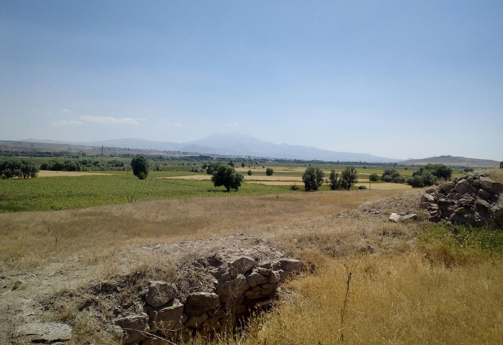
Kültepe comprises a roughly circular mound rising about 20 m above the Kayseri Plain and a crescent-shaped lower town extending around it, especially to the north, east, and south. The mound measures about 520–550 m across, while the lower town covered an area roughly 2 km across. The site stands on a terrace formed by the Sarımsaklı stream, below Mount Erciyes and about 20 km south of the Kızılırmak River; marshland, including the area of Lake Engir, covered its western side. Excavated areas reveal deep layers of successive construction. Both the upper city and the partly excavated lower town had enclosing walls, and soil extraction has damaged ancient structures across substantial parts of the mound.
Early Bronze Age remains
Houses and burials
The earliest identified houses, from Early Bronze Age I, had several rooms, mudbrick walls, and stone foundations. Graves were placed within the settlement, including round forms that generally had two chambers. The layout and construction of these houses provide evidence for the early residential phases on the mound.
Monumental buildings and ritual objects
The oldest identified monumental structure is a megaron, a large hall-centered building, from level 12 of Early Bronze Age III. It may have served as a palace or temple. A hearth stood in its central hall, surrounded by four columns. Alabaster idols found on the floor have disk-shaped bodies with geometric decoration and long necks bearing one, two, or three heads; some also carry a smaller idol on the body. Other Early Bronze Age figures depict a bare-breasted goddess seated on a throne.
A smaller compartmented structure cuts into the walls of a monumental level 13 building dated to the second half of the third millennium BCE. It contained alabaster statuettes with varied attributes and unusually shaped ritual vessels. A monumental building excavated in 2018 also has a room with a large group of idols and statuettes.
Pottery and regional connections
Hand-made painted pottery was characteristic of the Kayseri Plain, while Syrian pottery was imported into the earliest settlement. The Early Bronze Age houses, figures, and pottery differ from material associated with the Hattian culture farther north around the middle Kızılırmak. Some pottery characteristics are shared with finds from Alişar Höyük.
Middle Bronze Age upper city
During the Middle Bronze Age, the upper city occupied the mound, with a central citadel near its middle. The lower city extended east and west from it. The upper city contained palaces, temples, and public buildings, while the lower town held residences and the Assyrian trading district. The kārum occupied a terrace in the lower town’s northeast, within an area about 250 by 300 m.
The Old Palace
The level 8 Old Palace, associated with kārum II, was built after 2024 BCE using reused timber, including wood several centuries old. Its remains extend for about 80 m beneath the walls of a later palace. The complex comprised at least three buildings, expanded over time, and had fortifications about 4 m thick. Its northern part included a large hall paved with stone and adjoining rooms, with kitchens to the south. The palace was destroyed by fire around 1835 BCE, and few objects were recovered from it.
The southern palace
A separate level 8 palace in the mound’s southern part was just under 90 m long. Its plan included a long corridor partly roofed with wooden boards and flat stones, a large courtyard, service rooms, storerooms, and living quarters. An upper floor probably provided residential and reception space for the royal family. It was damaged when a Hellenistic fortification was built over it, leaving sparse remains, and its finds consisted mainly of pottery.
The Waršama Palace
The level 7 palace commonly called the Waršama Palace measured about 120 by 110 m and included the citadel. Its mudbrick, wood, and clay construction rested on stone foundations about 2.5–4 m deep, reinforced with timber beams. A large southern section and a northern building complex formed its plan; the northern complex was at least partly two storeys high. The surviving ground-floor plan includes 42 rooms used for storage, administration, and accommodation. The royal apartments are thought to have been upstairs.
The main entrance on the west had a tower on either side, and a smaller gate opened to the south. The thick walls indicate an upper storey. Timber dating places construction after wood was felled in 1833 BCE, with building work estimated to have taken place in the early nineteenth century BCE. The palace was refurbished in the later eighteenth century BCE and eventually destroyed by fire.
Sanctuaries and public buildings
Four level 7 sanctuaries occupied a precinct southwest of the citadel and shared a ground plan. Two excavated buildings, each about 27 by 22 m and roughly 40 m apart, had corner projections resembling small towers. Their identification as temples is probable; they may be the temples Anitta described in his account. Houses have been excavated south of the precinct and east of the citadel.
A rectangular building from the same period measured 18 by 7.5 m. One room held about three tonnes of raw obsidian, and another contained a dagger inscribed with Anitta’s name. The palace also yielded a letter addressed to Waršama by Anum-Hirbi, king of Mama. A monumental Middle Bronze Age public building has been under excavation in the mound’s southwest since 2019, west of a large stone-paved open area. Some stone walls survive to about 4 m high. Two large underground rooms reached by stairs remain, and two large jars in one room suggest that it was used for storage.
Middle Bronze Age lower town
Streets and houses
Streets in the lower town ran roughly at right angles. Some extended east to west toward the mound and widened into open spaces. Their surfaces were paved in places or made of packed earth, and wastewater drains ran beneath them. The streets were broad enough for wheeled vehicles.
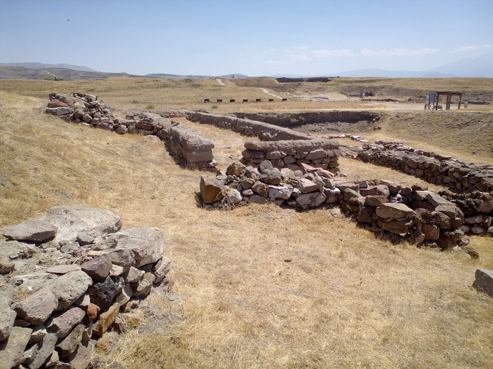
Residential blocks generally held four to eight rectangular houses, most of them two storeys high and about 40–200 m² in area. Houses stood close together, with stone foundations, mudbrick walls supported by timber, and extensive use of wood. Ground floors commonly began with two rooms and could be enlarged when space and resources allowed. Streets and squares separated the blocks, while homes accommodated domestic activities, storage, and work.
Workshops and burials
Workshops contained furnaces, bellows, and moulds for casting tools, weapons, and ingots. Moulds for axes and knives provide evidence of metalworking. Burials lay beneath house floors rather than in a separate cemetery. Finds from them include ivory figures, jewellery made from precious stones and metal, and weapons.
Tablets, seals, and pottery
The trading district was one part of the lower town, and its excavated archives preserve records on clay tablets. Seals and seal impressions show a change in practice between the two main trading phases: hematite cylinder seals were used in level II, while stamp seals became more common in level Ib. Cylinder-seal scenes include deities and worshippers, hunting, warfare, landscapes, and processions of animals, alongside stars and other symbols. Stamp seals bear geometric, floral, and animal patterns, as well as religious and funerary scenes and emblems such as a double-headed eagle. Their imagery includes composite figures such as bull-men, lion-men, griffins, and sphinxes.
Pottery includes storage jars and vessels for drinking and other uses. Painted pouring or drinking vessels, known as rhyta, take animal forms or have animal-shaped handles, depicting creatures such as bulls, rams, lions, antelopes, and birds. Other vessels imitate boats, boots, or human figures. Finds include a lion-shaped vessel, a vessel with a bull-head projection, a boot-shaped vessel, a boat-shaped vessel, a human-face vessel, and a tripod ewer.
Small religious figures were made from bronze, faience, lead, gold, ivory, and clay; moulds for figurines were also found, including groups of divine figures with children. A gold-leaf image depicts a standing god on a lion holding two weapons.
Iron Age and classical remains
Iron Age fortifications and public architecture
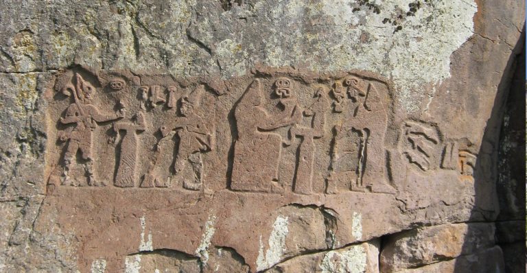
In the Iron Age, a wall enclosed the settlement on the mound. Finds include painted pottery, bronze brooches, and pieces of upright stone slabs carved in relief, known as orthostats. These fragments point to a probable monumental public building.
Hellenistic and Roman features
In the Hellenistic and Roman periods, a wall enclosed the fortified high part of the settlement, reusing sections of the Iron Age defenses. The ancient town was densely built. A building constructed in the third century BCE underwent several restorations, and black-glazed pottery inspired by Attic wares was found at the site.
Parts of the former lower town served as a cemetery. Coins recovered from graves date from 323 BCE to 180 CE, and early medieval graves were also found in the lower town. Most excavated material from Kültepe is held or displayed at the Kayseri Archaeological Museum.