Rapola Castle: An Ancient Hill Fort in Finland
Site at a Glance
- Rating
- 4.6
- Popularity
- Very Low
- Country
- Finland
- Primary era
- Medieval
- External website
- Open
- Eras represented
- Medieval
- Civilizations
- Unclassified
- Site type
- Military
- Remains
- Fort
On this page13 sections
History
Rapola Castle is an ancient hill fort at Rapolanharju near Valkeakoski in Finland, probably constructed during the Viking Age, the period of Scandinavian expansion and long-distance contact from roughly the late eighth to the eleventh centuries. Its founders are uncertain. Local Finnic tribal leaders may have established it to control a northward waterway, or Swedish Viking leaders familiar with the region may have founded it later. The surrounding area was inhabited by at least the seventh century.
A refuge fort in Upper Häme
Rapola is generally understood as a refuge fort, a fortified high place intended mainly for temporary shelter during danger rather than continuous settlement. It may have been used intermittently or seasonally by people from a broad part of Upper Häme, not only by the inhabitants of the immediate area. Defence was probably its principal purpose, although trade, meetings, and judicial proceedings have also been proposed.
The fort has been regarded as the principal hill fort along the ancient Vanajavesi route and, because of its size and position, as a possible central fort for northern Häme and the Vanajavesi lake region. That interpretation has also been questioned. Archaeological evidence indicates activity at Rapola at least during the thirteenth and fifteenth centuries, while possible involvement in conflicts between Novgorodian forces, from the medieval polity centred on Novgorod, and Swedish forces does not establish continuous occupation.
Medieval authority and military use
A papal letter issued at Avignon on 16 June 1340 names a person called Cuningas de Rapalum. He was probably a high-status local leader who held land at Rapola. In the fourteenth and fifteenth centuries, the fort is described as a Swedish military base and support position. The nearby stone church of Sääksmäki was built about 500 metres to the southeast between 1495 and 1505, placing the fort within a landscape that also contained an established medieval religious centre.
Rapola was first entered in a local land map in 1641, when it was described as a ruined fort. This later record reflects the site’s abandoned condition rather than the date of its construction.
Archaeological investigation and protection
Hjalmar Appelgren-Kivalo, Julius Ailio, and Anna-Liisa Hirviluoto began investigating the hill fort from 1886 onward. Appelgren published a plan in 1891, and the investigators regarded Rapola as one of Finland’s most important prehistoric archaeological monuments. Ailio excavated sections of the defensive rampart in the 1920s. His findings led to the later reconstruction of a short section of the former wooden palisade near Voipala Manor.
Further archaeological work took place in 1988 and 1989. During the 1980s, a planned motorway between Hämeenlinna and Tampere threatened the hill and its relationship with Lake Rautunselkä. A campaign led by the Finnish Heritage Agency resulted in the road being rerouted to the western side of the waterway in 1991.
The Finnish Antiquities Act and Nature Conservation Act protect Rapolanharju. The Finnish Heritage Agency’s archaeological site-management unit managed the area from 1989, and much of the ridge entered state ownership in 1993. Since 1994, the protected management area has included approximately 140 hectares of Rapolanharju and its manor surroundings. Administration of the ridge passed to Metsähallitus, Finland’s state enterprise for many state-owned land and water areas, in early 2014. Rapolanharju, Rapola and Voipala manors, and Sääksmäki Church form part of the Vanajavesi Valley national landscape and the Sääksmäki-Tarttila cultural landscape. Together with nearby archaeological remains, the area constitutes Finland’s largest continuous ancient-monument area.
Remains
Rampart and entrances
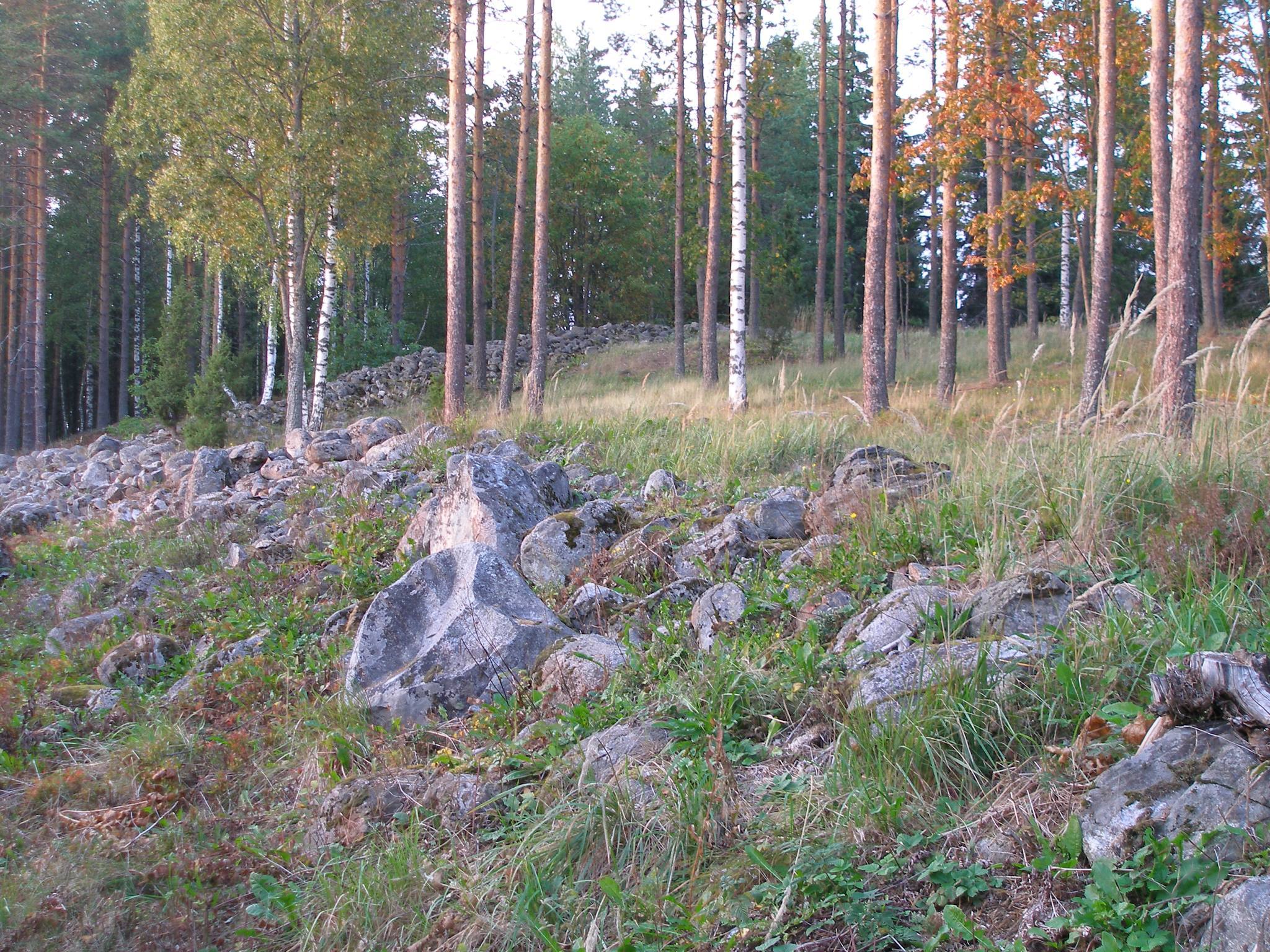
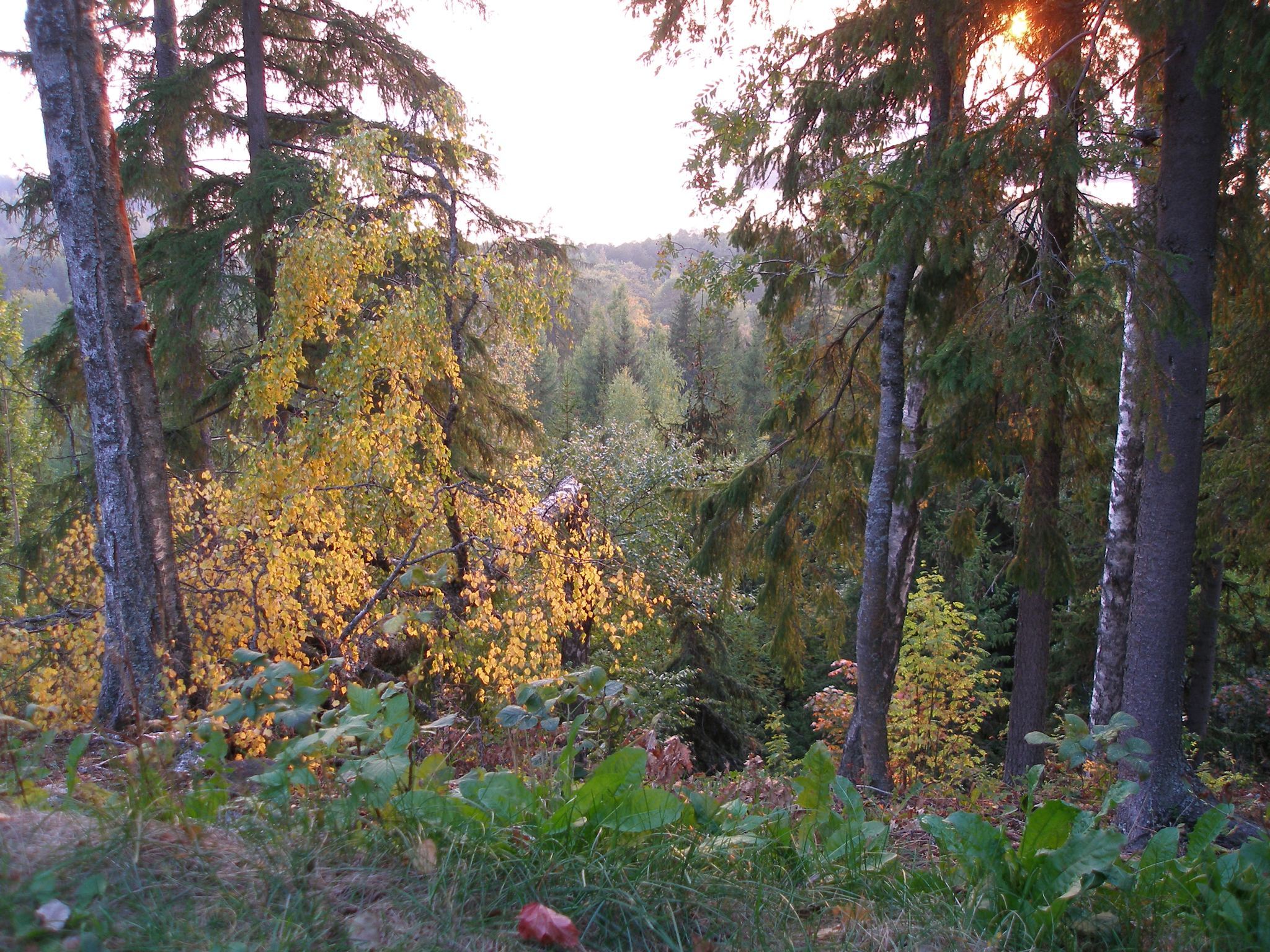
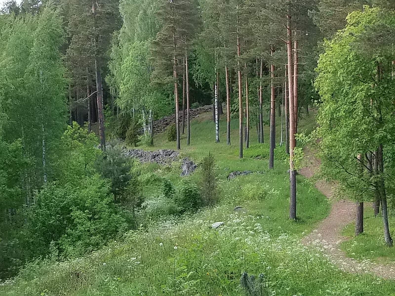
Rapola Castle occupies the southern end of Rapolanharju, a glacial ridge rising about 65 to 70 metres above Lake Vanajavesi and reaching approximately 150 metres above sea level. Lake Rautunselkä lies on one side of the hill and Sääksmäki village on the other. The fortified area follows a north-south-oriented expansion of the ridge about 200 metres wide and 400 metres long. Its enclosed courtyard covered approximately 52,000 square metres.
Ring rampart
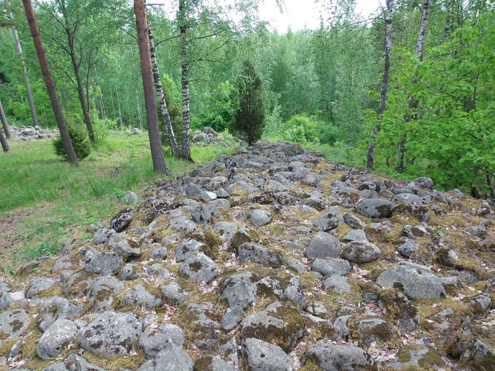
A closed ring rampart about one kilometre long follows the terrain around the hill. The fortification was probably made from logs, sand, and stones. Its wooden wall may have been about ten log courses high, with an upper timber defensive wall approximately two metres tall. Sand and stone packed between timber walls supported the outer structure and created a level platform for defenders. The surviving remains consist of the supporting stonework and sand embankment of this wooden fortification.
Gates and defensive position
At least two gates served the enclosure, one at the northwest corner and another on the southeast side. The rampart was particularly thick at these points, turning each entrance into a passage-like corridor. External defensive works protected the approaches. The hill’s position provided good or adequate visibility toward Tenhola Hill Fort, about 17 kilometres to the southeast, and possibly toward Aulanko Hill Fort, about 30 kilometres away.
Interior and surrounding archaeological landscape
Buildings and hearths
About 80 depressions within the rampart are interpreted as building sites. They have both rectangular and circular ground plans. Thirteen hearth-like fireplaces have also been identified, providing evidence of activity within the enclosure.
Glacial depressions
Two glacial kettle depressions lie within the fortified area. The larger measures about 200 metres in length, 150 metres in width, and 15 metres in depth. The smaller is approximately 50 metres long, 40 metres wide, and 7 metres deep. They may have helped conceal the garrison, horses, or grain reserves. A large hollow in the centre of the bigger depression may have been a well.
Fields, cemeteries, and finds
Ancient field plots occupied the southern slopes of the hill, while a prehistoric field lay southwest of the fort. Cemeteries included the Matomäki and Hirvikallio cemeteries near the fort, as well as another cemetery on the western edge of the ridge dated to the seventh century. Stones interpreted as ammunition for the defenders have been found among the rampart remains. A late tenth-century Ulfberht sword, or a fragment of one, was found in the Rapola area. Ulfberht swords are high-quality early medieval weapons associated with the ninth to eleventh centuries.
Sacrificial stone
A stone with twelve hollows, interpreted as a sacrificial stone, lies in the courtyard of Rapola Manor. It forms part of the wider archaeological landscape around the hill fort, which includes ramparts, building depressions, hearth locations, cemeteries, field remains, and glacial landforms. Only about one percent of the hill-fort area has been excavated, leaving the surviving surface features central to the interpretation of the site.