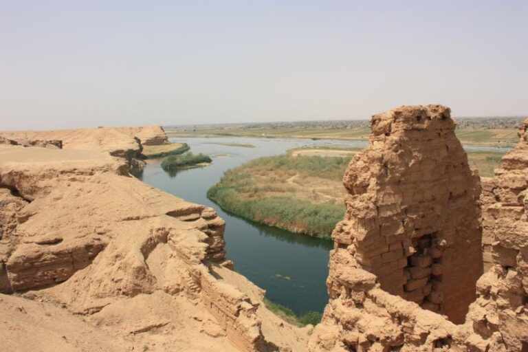
Qalʿat ar-Rahba: A Medieval Fortress on the Euphrates in Syria


Site at a Glance
- Rating
- 4.6
- Popularity
- Very Low
- Country
- Syria
- Primary era
- Medieval
- External website
- Open
- Eras represented
- Medieval
- Civilizations
- Ayyubid, Mamluk
- Site type
- Military
- Remains
- Castle
On this page17 sections
History
Qalʿat ar-Rahba is a medieval Arab fortress in Syria, near Mayadin on the Euphrates. Its earliest foundation is associated with the Abbasid general Malik ibn Tawk during the reign of Caliph al-Maʾmun, between 813 and 833, while the present fortress, al-Rahba al-Jadida, belongs chiefly to the Ayyubid and Mamluk periods. The site occupied a strategic position between Iraq, Syria, and the Syrian Desert, and later became a major military and administrative center along the Euphrates.
Abbasid foundation and the Euphrates province
The pre-Islamic history of al-Rahba remains uncertain. Medieval Talmudic and Syriac writers connected the area with the biblical Rehobot han-Nahar, while some Muslim historians associated it with Furda or Furdat Nuʿm and a nearby monastery called Dayr Nuʿm. The ninth-century historian al-Baladhuri attributed the foundation of Rahbat Malik ibn Tawk to Malik ibn Tawk, an Abbasid commander. The original settlement took its name from this founder, whereas the later fortress was relocated farther west and became known as al-Rahba al-Jadida, meaning New al-Rahba.
Malik ibn Tawk was the first lord of the fortress. After his death in 873, his son Ahmad succeeded him, but the Abbasid governor of al-Anbar, Muhammad ibn Abiʾl-Saj, captured al-Rahba and expelled Ahmad in 883. By the tenth century, the fortress town had developed into a large and densely settled community.
Al-Rahba was described as the “key to Syria and sometimes to Iraq.” Caravans traveling from Iraq toward Syria stopped there first. Routes continued northwest beside the Euphrates toward Aleppo or crossed the desert westward toward Damascus. Bedouin tribes used the settlement as a base for incursions into northern Syria, as a refuge, and as a market. Its position made control of the fortress a recurring objective for rival Muslim powers.
Qarmatian, Hamdanid, and Buyid struggles
In 903, the Qarmatian leader al-Husayn ibn Zikrawayh, a commander of a revolutionary Ismaili Shiʿi movement active in the region, was imprisoned at al-Rahba before being transferred to Caliph al-Mustakfi in Raqqa. At the time, al-Rahba served as the administrative center of the Euphrates province and the headquarters of its governor, Ibn Sima. After al-Husayn was executed, members of the Banu Ullays submitted to Ibn Sima in early 904 and then rebelled. Ibn Sima defeated them in an ambush near al-Rahba in August of that year.
In March 928, Qarmatian forces under Abu Tahir al-Jannabi captured the fortress and massacred many inhabitants. Civil conflict brought further hardship until peace was restored in 942 by the Abbasid commander Adl, who had been sent by the caliphal strongman Bajkam. Adl later became governor of the Euphrates and Khabur regions.
A few years later, al-Rahba entered the Hamdanid sphere and became part of the Euphrates district of the Mosul-based emirate. Its lord Jaman rebelled against the Hamdanid emir Nasir al-Dawla, fled, and drowned in the Euphrates. The suppression of the revolt heavily damaged al-Rahba. Nasir al-Dawla then granted the fortress, its district of Diyar Mudar, and their revenues to his son Abuʾl-Muzzafar Hamdan.
After Nasir al-Dawla was deposed in 969, his sons fought over al-Rahba. Abu Taghlib eventually captured it by surprise, rebuilt its walls, and returned it to Hamdan to prevent a possible alliance between Hamdan and the Buyid ruler Izz al-Dawla al-Bakhtiyar. The Buyid emir Adud al-Dawla seized al-Rahba in 978. In 991, his son Bahaʾ al-Dawla appointed a separate governor after the inhabitants requested one.
Fatimid, Mirdasid, and Seljuk control
By the late tenth century, al-Rahba was the center of the Euphrates district and stood at the edge of the desert. Al-Muqaddasi described its semicircular layout and strong fortifications, as well as irrigated and productive surroundings containing date palms and quince orchards.
During the early eleventh century, Uqaylid rulers from Mosul and the Fatimids of Egypt contested the fortress. The Fatimid caliph al-Hakim appointed Abu Ali ibn Thimal of the Al Khafajah tribe as its lord. Abu Ali was killed in battle against Uqaylid forces led by Isa ibn Khalat in 1008 or 1009. Isa then lost al-Rahba to Badran ibn al-Muqallad, who soon lost it to the Fatimid emir Luʾlu of Damascus. Luʾlu captured both al-Rahba and Raqqa and appointed a governor at the fortress.
A wealthy local resident, Ibn Mahkan, rebelled against the Fatimids and seized al-Rahba, but he needed outside support to hold it. He allied himself with the Mirdasid emir Salih ibn Mirdas, and the two later came into conflict. Following a temporary reconciliation and the capture of Anah in Anbar, Salih killed Ibn Mahkan and became lord of al-Rahba. The fortress was Salih’s first major territorial possession and helped establish the Mirdasid emirate centered on Aleppo and northern Syria.
Salih’s son Thimal succeeded him as emir of Aleppo, and al-Rahba became Thimal’s principal power base. Many of his viziers and lesser officials operated from the fortress. The Fatimids later compelled Thimal to surrender it to their ally Arslan al-Basasiri, a Turkish general who had rebelled against the Seljuks and the Abbasid caliphate.
After al-Basasiri was defeated and killed in 1059, Thimal’s brother Atiyya recaptured al-Rahba in April 1060 and defended it against the Numayrids in August 1061. The Mirdasids lost the fortress in 1067, when the Uqaylid emir Sharaf ad-Dawla defeated its Banu Kilab defenders while Atiyya was away in Homs. The Friday sermon then named the Abbasid rather than the Fatimid caliph, formally expressing the change in allegiance.
In 1086, the Seljuk sultan Malik-Shah granted al-Rahba and its Upper Mesopotamian dependencies, including Harran, Raqqa, Saruj, and Khabur, to Muhammad, the son of Sharaf ad-Dawla. After the Seljuks or their Arab allies lost the fortress, the Seljuk ruler of Damascus, Tutush, recaptured it in 1093. Following Tutush’s death, al-Rahba reverted to the Uqaylids.
Sieges and Zengid rule
Karbuqa of al-Hillah captured and looted al-Rahba in 1096. Qaymaz, a former military slave of the Seljuk sultan Alp Arslan, took control in 1102. After Qaymaz died in December that year, his military slave Hasan assumed command and arrested several local notables because of fears of a coup. During Duqaq’s renewed siege, the townspeople admitted Duqaq into the settlement, forcing Hasan into the citadel. Hasan surrendered after receiving safe passage and a revenue grant elsewhere in Syria.
Duqaq treated the inhabitants well, reorganized the administration, established a large garrison, and appointed Muhammad ibn Sabbak, an Arab of the Banu Shayban, as governor. Jawali, a general of the Seljuk sultan Muhammad I, recaptured al-Rahba from Ibn Sabbak in May 1107 after a month-long siege. The inhabitants suffered heavily, and some disclosed a weakness in the defenses in exchange for promises of safety. Jawali entered and looted the town, after which Ibn Sabbak surrendered.
In 1127, Izz ad-Din Masud ibn al-Bursuqi, the Seljuk atabeg of Mosul, besieged and captured al-Rahba during an attempt to establish dominance in Syria. He became ill and died there. The fortress remained under al-Jawali, a military slave of al-Bursuqi, as a subordinate of Imad ad-Din Zengi. Zengi’s son Qutb ad-Din later captured al-Rahba, and in 1149 his brother Nur ad-Din received it through Seljuk-sponsored negotiations among the Zengid rulers.
Earthquake and Ayyubid reconstruction
An earthquake completely destroyed al-Rahba in 1157. Four years later, Nur ad-Din granted al-Rahba and Homs as a fief, a hereditary or administrative territorial grant, to Shirkuh, who governed the territory through Yusuf ibn Mallah. Abuʾl-Fida stated that Shirkuh rebuilt the fortress on its old site, although the attribution is uncertain and that reconstruction may have fallen into ruin before the end of the twelfth century.
The present fortress was relocated about five kilometers west of the western bank of the Euphrates, away from Rahbat Malik ibn Tawk. After Shirkuh’s death, his territories returned to Nur ad-Din. Saladin, Shirkuh’s nephew and founder of the Ayyubid Sultanate, conquered Nur ad-Din’s domains by 1182 and granted Homs and al-Rahba to Shirkuh’s son Nasir ad-Din Muhammad as a hereditary emirate.
According to the Ayyubid-era chronicler and former resident Ibn Nazif, Shirkuh’s grandson, al-Mujahid Shirkuh II, personally supervised the demolition of the ruined fortress and the construction of a new one in 1207. Al-Rahba became the easternmost fortress and one of the four principal centers of his Homs-based emirate, alongside Homs, Salamiyah, and Palmyra.
Mamluk frontier fortress
Al-Rahba remained with Shirkuh’s descendants for several years after the Mamluk annexation of Ayyubid Syria in 1260. In 1264, Sultan Baybars replaced the Ayyubid governor with a military slave officer from Egypt. The garrison commander and his troops held a high position within the Mamluk military hierarchy.
Under the early Mamluks, al-Rahba became the principal Mamluk fortress along the Euphrates and a major defense against Mongol invasions of eastern Syria. It replaced Raqqa in regional importance, served as an administrative center, and became the terminal station of the Mamluk barid, the state postal and communications network. Refugees from Mongol-ruled territories and residents of the nearby unfortified settlement of Mashhad al-Rahba also settled within the fortified site.
The Al Fadl tribal territory lay near al-Rahba during the Ayyubid and Mamluk periods. About four hundred Al Fadl tribesmen joined the army of the Egypt-based Abbasid caliph al-Mustansir, which Baybars dispatched to recover Baghdad from the Mongols. The campaign failed, and al-Mustansir was killed in a Mongol ambush at al-Anbar.
Ilkhanid Mongol forces severely damaged al-Rahba during their wars with the Mamluks, although Baybars restored the fortress toward the end of his reign. In 1279, the rebel Mamluk viceroy of Syria, Sunqur al-Ashqar, took refuge there with the Al Fadl chieftain Isa ibn Muhanna and sought assistance from Abaqa Khan. When the Mongols failed to help him, Sunqur fled before the approaching Mamluk army while Isa barricaded himself inside the fortress.
An Ilkhanid army commanded by Oljaitu failed to capture al-Rahba after a month-long siege in 1312 or 1313. This was the Ilkhanate’s final attempt to invade Mamluk Syria. In 1320, Isa’s son Muhanna rebelled against Sultan al-Nasir Muhammad and was pursued to al-Rahba. The fortress may have been destroyed during the confrontation.
Ottoman period and decline
After the Ottoman conquest of Syria and Iraq in the early sixteenth century, al-Rahba’s military role declined. The desert route between Palmyra and al-Rahba, formerly the main route across the Syrian Desert, lost much of its importance. The fortress was then used mainly as a refuge for shepherds and their flocks.
In 1588, the Venetian traveler Gasparo Balbi described a ruined fortress with inhabitants living below it. Jean-Baptiste Tavernier mentioned Mashhad Rahba, about 9.7 kilometers southwest of the fortress, during a journey around 1632. From the sixteenth to the eighteenth century, the town also served as the center of the Ottoman sancak of Deyr-Rahbe, an administrative district that included Deir ez-Zor. For much of this period, emirs of Al Abu Risha, descendants of the Al Fadl emirs, held the district as Ottoman governors and desert emirs. In 1797, Guillaume-Antoine Olivier described al-Rahba as a fortress and ruined site.
Excavations took place from 1976 to 1981 under the Syrian General Directorate of Antiquities and Museums, the Institut Français d’Études Arabes de Damas, and the University of Lyon II. Later multidisciplinary surveys covered the fortress, the surrounding desert, and the Euphrates and Khabur valleys. The surveyor J. L. Paillet documented the fortress’s plans and elevations in his 1983 dissertation, Le château de Rahba, étude d’architecture militaire islamique médiévale. During the Syrian Civil War, repeated looting and illegal excavation affected the fortress’s storage areas and courtyards, as well as the medieval settlement below it.
Remains
Fortress layout and defensive construction
The present fortress stands on an artificial mound separated from the Syrian Desert plateau to the west. It rises to 244 meters above sea level, about four kilometers southwest of the Euphrates and one kilometer southwest of Mayadin. The complex is organized as a fortress within a fortress. A four-story pentagonal keep, approximately 60 by 30 meters, forms the strongly defended core. Around it runs a pentagonal outer wall measuring approximately 270 by 95 meters.
Keep and inner defenses
The keep contains a large cistern on its lowest floor. Its walls and the outer defenses carried parapets with merlons, solid raised sections between openings. The keep’s parapets rose 6.5 meters above those of the outer wall, creating a second defensive line from which defenders could fire at attackers who crossed the outer defenses. Corridors and chambers connected the keep with the external fortifications.
Outer wall and bastions
The outer wall has a triangular form, with two parallel corners chamfered and replaced by short curtain walls. Several bastions project from the defenses. The four largest stand on the western and southeastern sides. The largest measures 17.2 by 15.2 meters, while the smallest of these four is approximately 12.4 meters square. A smaller bastion on the northern wall measures 5.2 by 4.4 meters. The bastions supported heavy defensive artillery, while the nearly level plateaus beside the fortress could accommodate siege engines.
Moat and successive phases
A moat surrounds the artificial mound. It is approximately 22 meters deep and 80 meters wide, considerably deeper than the moats of the Ayyubid desert fortresses at Palmyra and Shumaimis. Excavation identified at least eight construction phases, probably beginning in the early Ayyubid period. Different phases employed different building techniques and defensive concepts. Work concentrated repeatedly on the western and southeastern sides facing the desert plateau, while the northern side facing population centers underwent less alteration.
The first phase used mudbrick walls, with the small northern projecting bastion belonging to this stage. The second phase added three larger bastions on the western, desert-facing side and reinforced the walls with roughly cut conglomerate blocks bonded with high-quality mortar. During the third phase, higher-quality mudbrick was used, the western curtain wall was raised, and the southwestern curtain wall was rebuilt with bands of Arabic inscriptions. A large brick dome covered the ground-level chamber of the northwestern bastion, and the outer walls reached their final general form.
The fourth phase added low casemates, protected vaulted chambers or gun positions, to the western and southwestern curtain walls. The fifth phase reinforced the walls, particularly on the eastern side. The southeastern tower was rebuilt, the northeastern tower received an additional wall and a vaulted story, and a sloping bank of large conglomerate blocks strengthened the northern slope of the outer wall. A central building was also erected, probably replacing an earlier structure or courtyard. This extensive work has been associated with Shirkuh II and wider Ayyubid efforts to strengthen Syrian fortresses.
The sixth major phase repaired the eastern and western outer walls after severe Mongol siege damage. A small northeastern projecting bastion was added, and masonry from the fifth phase was reused with new gypsum, limestone, and other materials. The seventh and eighth phases raised the western outer walls. The fortress is now largely ruined, with substantial deterioration caused by erosion.
Medieval settlement below the fortress
Excavations at the foot of the fortress between 1976 and 1978 revealed a medieval settlement enclosed within a quadrangular boundary. Some enclosure walls reached 30 meters in length and four meters in height, with an average thickness of about one meter.
Khan and religious buildings
The settlement included the probable remains of a khan, a caravanserai or lodging place for travelers and caravans, together with a congregational mosque and a small oratory. These structures formed part of the settlement beneath the fortified mound.
Cavalry barracks and water system
Cavalry barracks were also excavated. A canal system supplied fresh water to the fortress and carried wastewater away, linking the settlement’s practical infrastructure with the needs of the garrison and inhabitants.
Archaeological finds
Objects recovered from the fortress and the settlement included pottery sherds, mostly Mamluk coins together with some Ayyubid coins, and numerous feather fletchings from arrows left by Mongol besiegers. The coins relate the occupation of the site to its Ayyubid and Mamluk phases, while the arrow fittings preserve physical evidence of the military conflicts that damaged the fortress.