Mari: An Ancient Mesopotamian City in Syria
Site at a Glance
- Rating
- 5
- Popularity
- Very Low
- Country
- Syria
- Primary era
- Bronze Age
- Eras represented
- Bronze Age
- Civilizations
- Akkadian
- Site type
- City
On this page28 sections
History
Mari was an ancient Mesopotamian city represented by Tell Hariri, near Al-Sayyal in Syria. Founded as a planned settlement around 2900 BC on the right bank of the Euphrates, it occupied a position between river and caravan routes linking the Levant, northern Syria, Anatolia, and southern Mesopotamia. Its earliest substantial phase belongs to the Early Dynastic period, the early urban and political age of Mesopotamia in the third millennium BC.
City I and the first urban foundation
The earliest major urban phase, known as City I, is generally dated to approximately 2900 to 2550 BC. Earlier occupation may have existed, but the foundation of Mari as a new settlement intended to control trade routes is an archaeological interpretation rather than a directly recorded event. City I supported craft production and long-distance exchange, and its position near the Euphrates gave it access to both river transport and overland commerce.
A major destruction occurred around 2750 BC, possibly because of an earthquake. Mari was subsequently weakened or abandoned, although the reasons for this decline remain uncertain. Around 2550 BC, the settlement was refounded on a large scale. Earlier construction levels were levelled, the urban plan was reorganized, and Mari entered a new phase as a political and commercial centre during the latter part of the Early Dynastic period.
City II and rivalry with Ebla
The rulers of City II held the title lugal, meaning king. Local political records from this period are limited, but texts from Mari and Ebla describe prolonged rivalry and warfare over trade routes. Mari’s rulers included Anubu, Ansud, Sa’umu, Išhtup-Išar, Iblul-Il, Enna-Dagan, and Ishqi-Mari, although the order and dates of several reigns remain uncertain.
Iblul-Il extended Mari’s influence across the Euphrates and Upper Mesopotamia. During part of his reign, the rulers of Ebla paid substantial tribute to Mari. The balance later changed, and Ebla and its allies defeated Mari near Terqa. Ebla was destroyed around 2300 BC. Mari may have taken part in that destruction, although later interpretations have also proposed involvement by the forces of Sargon of Akkad, the ruler who founded the Akkadian Empire, a territorial state that extended across much of Mesopotamia and northern Syria.
Mari itself was destroyed and burned around 2300 to 2250 BC. Most historians attribute the event to the Akkadian Empire, particularly Sargon of Akkad. Another reconstruction places the decisive destruction under Sargon’s grandson Naram-Sin, following a revolt against Akkadian rule. After roughly two generations of abandonment, the city was rebuilt under Akkadian authority.
City III and the šakkanakku rulers
The rebuilt city was governed by officials known as šakkanakku, a title that originally described a high-ranking military governor or commander. At Mari, the office later became hereditary, and its holders ruled with considerable independence while retaining the title. During City III, approximately 2250 to 1810 BC, Mari again became a powerful regional kingdom. Its rulers rebuilt palaces, temples, fortifications, and sacred areas, while maintaining relations with the Third Dynasty of Ur, including a dynastic marriage.
The šakkanakku dynasty ended for unknown reasons during the nineteenth century BC. Mari then became the seat of the Lim dynasty, an Amorite ruling house conventionally dated from approximately 1810 or 1830 BC to 1760 BC. The Amorites were West Semitic-speaking tribal and urban groups that became politically dominant across Syria and Mesopotamia during the early second millennium BC.
The Lim dynasty
Yaggid-Lim, formerly the ruler of Suprum, established the Lim dynasty at Mari. His son Yahdun-Lim ruled approximately from 1810 to 1794 BC. He expanded Mari’s territory westward, rebuilt its walls, founded the fortress Dur-Yahdun-Lim, and suppressed revolts by tribal groups.
Yahdun-Lim was defeated and killed during conflicts involving Shamshi-Adad of Upper Mesopotamia. Shamshi-Adad annexed Mari and installed his son Yasmah-Addu as ruler. After Shamshi-Adad’s death in 1775 BC, Zimri-Lim recovered the throne with support from Yamhad and ended the Assyrian occupation.
Zimri-Lim ruled approximately from 1775 to 1761 BC and restored Mari as a major political, diplomatic, military, and commercial power. He allied with Eshnunna and Hammurabi of Babylon, campaigned in the Upper Khabur region, and defeated Qarni-Lim of Andarig around 1771 BC. The kingdom was administered from the royal palace through a central bureaucracy headed by the king, a vizier, economic officials, scribes, and a council. Provinces were centred on Terqa, Saggaratum, Qaṭṭunān, and Tuttul. Queen Shibtu played an important administrative and religious role, particularly when Zimri-Lim was away.
Babylonian destruction and later occupation
Mari’s alliance with Hammurabi deteriorated, partly because of disputes over control of Hīt. Babylonian forces captured the city in 1761 BC and occupied it for several months. The palace was emptied, selected archives and valuables were removed, and the building was burned and systematically demolished in 1759 BC. This destruction ended the Lim dynasty and Mari’s role as a major capital. Some inhabitants may have been deported, although this remains uncertain. Terqa became the capital of a successor state often identified as Hana.
Mari continued to be occupied intermittently after the Babylonian destruction. Domestic activity and burials took place during the Middle Assyrian period, approximately in the thirteenth and twelfth centuries BC. Limited craft activity and burials also occurred during the Seleucid, Parthian, and Roman periods. The settlement disappeared from the historical record during or after the Hellenistic period.
Rediscovery and archaeological work
Mari was rediscovered in August 1933, when a Bedouin excavating Tell Hariri found a headless inscribed statue. Excavations began in December of that year under André Parrot, whose team identified the site as ancient Mari in January 1934 through the statue of King Ishqi-Mari. Campaigns continued from 1933 to 1938, resumed in 1951, and remained under Parrot’s direction until 1974. Jean-Claude Margueron directed the excavations from 1979 to 2004, followed by Pascal Butterlin from 2005 until archaeological work stopped in 2010.
Excavation and conservation clarified three principal urban phases and revealed earlier levels beneath the palace and temples. Research consequently expanded from individual monuments to the organization of the city and its regional setting. Stabilization and restoration of rapidly eroding exposed structures began in 1997, first in the Sacred Enclosure and then in the Grand Royal Palace.
The Syrian Civil War stopped archaeological work in 2010. From 2012, especially around 2014, Mari suffered extensive looting and damage. More than 1,600 looting pits were reported between 2012 and 2018. Fighting and missile strikes in 2017 and 2018 caused irreversible damage to major monuments, including the former palace or temple-manufacture. The excavation house and archives were also destroyed during the conflict.
Remains
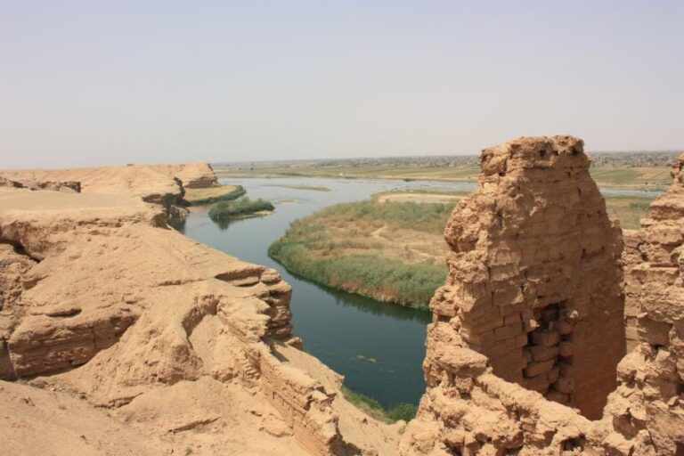
Mari occupied a flood-safe terrace on the right bank of the Euphrates, in a broad valley bordered by limestone plateaus. The surrounding region was arid, so agriculture depended heavily on irrigation. The site is a tell, an archaeological mound formed by successive settlement layers, destruction, rebuilding, and accumulated debris. Its exposed remains now survive in heavily ruined condition.
City I and City II urban plan
Fortifications and canals
City I had a roughly circular or polygonal plan approximately 1,900 metres in diameter. An outer embankment or flood barrier protected the settlement from the Euphrates, while an inner rampart served a more clearly defensive purpose. The two circuits were separated by an area about 300 metres wide that contained gardens and craft activity. The inner defensive circuit was approximately 6.7 metres thick and 8 to 10 metres high, with defensive towers. Some interpretations place its substantial defensive construction in City II rather than City I.
Several canals have been proposed in connection with Mari’s early development. One may have supplied water through the city, another may have irrigated surrounding farmland, and a third may have connected the Khabur and Euphrates systems for transport. Their dates remain uncertain, and the association of all three with the foundation of City I is contested. A canal approximately 7 to 10 kilometres long probably connected Mari with the Euphrates, although its precise course is unknown. The proposed Nahr Dawrin canal, extending for more than 120 kilometres along the Euphrates and linking the Khabur with the river, has also been assigned to an early phase, although later dating has been proposed.
Central buildings and streets
City I remains include a city gate, a street running from the centre toward the gate, residential buildings, workshops, and a large structure with stone foundations measuring approximately 32 by 25 metres. Its rooms reached about 12 metres in length and 6 metres in width, and it may have served an administrative function.
City II retained the general dimensions and outer boundaries of City I but was rebuilt through a rigorously planned project. The settlement was levelled to approximately 1.75 metres, streets were laid out radially, and foundations for houses, temples, and a palace were installed. The palace area was raised on a carefully constructed terrace approximately 1.3 metres high.
Presargonic Palace and Sacred Enclosure
The central monumental area of City II included the building known as the Presargonic Palace. It is now often interpreted as a temple-manufacture rather than a royal palace because it contained the Sacred Enclosure, sanctuaries, and craft installations, but no clearly identifiable throne room or luxurious royal apartments. The actual political centre may have stood nearby in an unexcavated area.
The Sacred Enclosure was the largest excavated City II temple. It was approximately square and organized around a central court that was initially about 16 metres across and later reduced to about 12 metres, when two pillars were added. Rooms surrounded the court. On the south, an approach led through an antechamber to a holy of holies containing a cult statue, an altar or podium, and pilasters. The principal deity remains uncertain. An inscribed torso found in the enclosure invokes Ama-ushumgal, an aspect of Dumuzi, but does not resolve the identity of the main deity.
Massif Rouge and other sanctuaries
The Massif Rouge was a large sacred terrace built from red bricks east of the palace area. Its original rectangular, stepped structure had walls with niches and recessed sections. The first level rose about 5 metres, while a preserved upper level stood about 1 metre high and covered more than 880 square metres. Later additions enlarged the area to more than 1,200 square metres and produced a polygonal outline.
The Massif Rouge was first interpreted as an archaic ziggurat, a monumental stepped terrace associated with a Mesopotamian temple. It was later understood as a high terrace used for sacrifices. It stood beside the temple of the Lord of the Land, probably an aspect or title of Dagan, a West Semitic deity associated with sovereignty and fertility. Together, these structures formed part of a larger sacred complex.
Other City II sanctuaries were dedicated to Ninhursag, Shamash, Ninni-Zaza, and Ishtarat. The temple of Ishtar stood separately on the western edge of the tell, within a residential area near the fortifications.
City II houses, commerce, and craft production
Domestic buildings
City II houses commonly had nearly square plans arranged around a central space and included an upper floor. Kitchens, washing areas, storerooms, and possibly stables occupied the ground level, while living and reception rooms were placed above.
The Red House measured approximately 11 by 12 metres and survived to about 2 metres high because fire destroyed it. Its six rooms included a kitchen and a washroom with drains, and three accounting tablets were preserved inside. The Residence with Craft Installations was only partly excavated but covered at least 500 square metres. It contained craft installations, possible dyeing or baking facilities, possible cultic space, latrines, and administrative tablets.
High Priest’s House and the Souk
The House of the High Priest was a trapezoidal complex measuring approximately 22 by 17 by 12 metres. At least five adjoining units contained storage rooms, probable upper-floor reception areas, and administrative spaces associated with the Sacred Enclosure and Massif Rouge. Tablets from the building recorded grain offerings for cult purposes.
The Souk was a triangular commercial area near the junction of two major roads and close to the Ishtar temple. A small triangular plaza was surrounded by pillars that probably supported a portico, and at least twelve shops or double cells opened onto it.
Workshops and burials
Craft production at City II included pottery kilns, a possible dyeing installation, copper-working hearths, slag pits, tuyères, crucibles, and possible bellows remains. A wheelwright’s workshop contained wheel remains preserved by bitumen.
City I domestic burials included approximately forty graves, probably beneath houses. Five monumental stone tombs with corbelled vaults were found in two groups. City II graves were generally simple inhumations or jar burials. These burial forms belonged to the changing domestic and ritual landscape of the settlement.
City III palaces and royal structures
Fortifications and Grand Royal Palace
City III preserved the general urban arrangement of City II but was repeatedly rebuilt. The outer fortification was reconstructed, doubled along its inner face, and reinforced externally. It eventually reached approximately 10 metres in thickness.
The Grand Royal Palace was built during City III over the earlier temple-manufacture and Sacred Enclosure, with an extension toward the south. It is best preserved in its final eighteenth-century BC form. The palace covered more than 2.5 hectares, or approximately 3 hectares in some reconstructions, although erosion removed its south-western extremity. Estimates of the final arrangement range from about 260 ground-floor rooms and 40 courtyards to approximately 550 rooms when an upper floor is included.
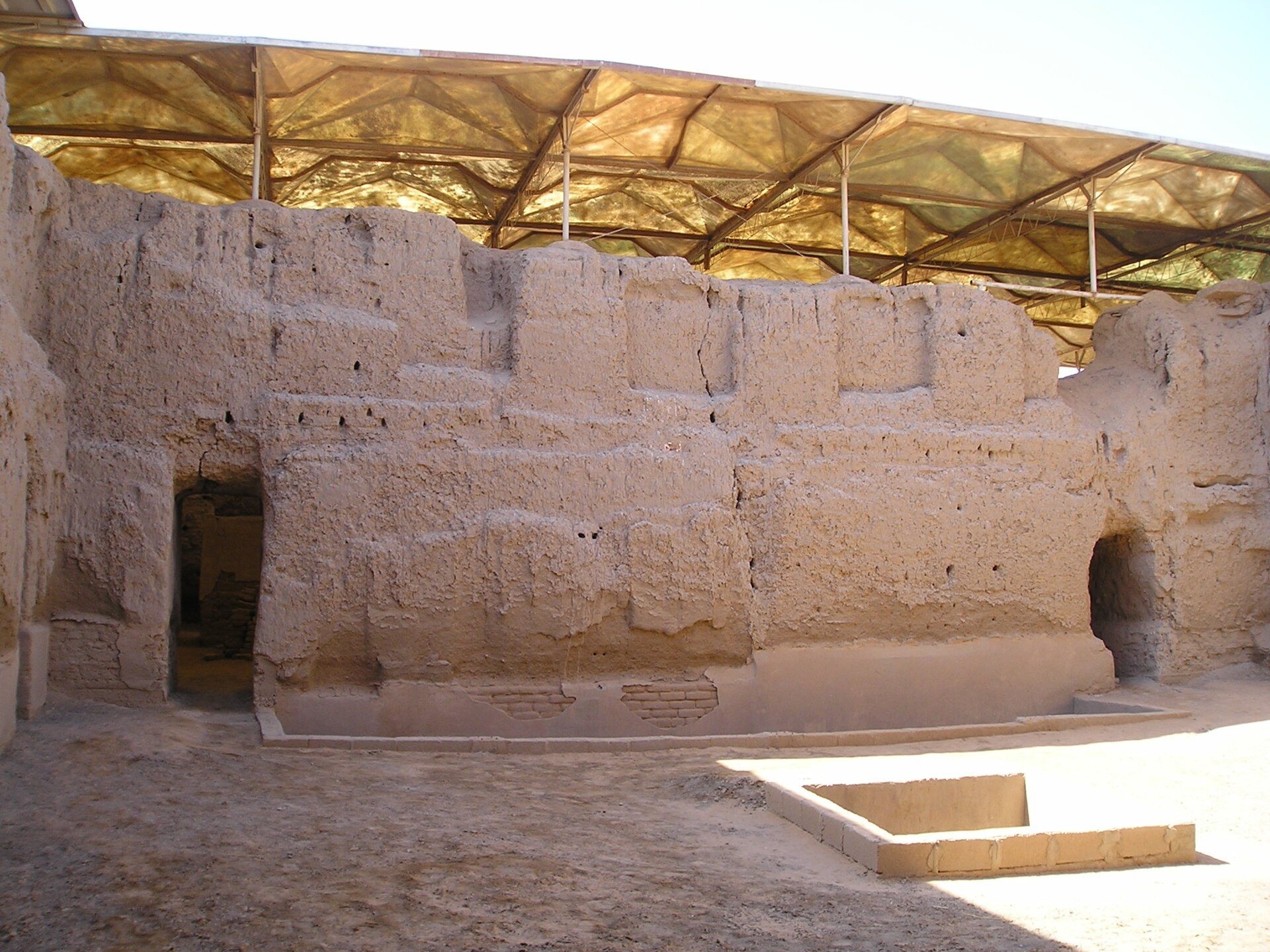
The palace was built mainly of sun-dried mudbrick made from clay and straw. Mud plaster covered the walls, floors were generally earthen, and roofs used wooden beams and reeds. Two large courts organized the building: the eastern Court of the Painted Building, also called Court 131, and the western Court of the Palms, also called Court 106. Administrative offices, archives, storerooms, kitchens, service rooms, reception areas, guest accommodation, royal apartments, a women’s quarter, and sanctuaries occupied the palace, although the precise function of many rooms remains debated.
Painted decoration and palace sculpture
The Investiture Painting was found in the Court of the Palms. It depicts a goddess, probably Ishtar, presenting a ring and staff to a ruler traditionally identified as Zimri-Lim. Worshipping deities, flowing water, fish, date palms, and mythical creatures associated with fertility and royal prosperity complete the scene.
A large painted panel from Room 132 measured approximately 2.8 by 3.35 metres. Its scenes included processions, warfare, Ishtar receiving offerings, and the moon god receiving libations. The surviving fragments are preserved in the Aleppo National Museum.
The Goddess with the Vase is a nearly life-size limestone statue approximately 1.42 metres high. Found broken in the palace chapel, it contains a channel running from an internal reservoir to the vase, showing that it functioned as a fountain. The statue is preserved in the Aleppo National Museum.
Eastern Small Palace and royal burials
The Eastern Small Palace stood east of the Grand Royal Palace. Two underground vaulted tombs, or hypogea, lay beneath its floors. One had two chambers and the other had five, and they may have been intended for members of the royal family. The building remained in use through Mari’s final phases and served at different times as a royal residence or as accommodation for members of the royal household.
City III produced more than 200 graves, including jar burials, simple pit graves, sarcophagi, and a limited number of baked-brick vaulted tombs. The Eastern Small Palace hypogea form a separate group of underground burial chambers within the royal architectural complex.
City III temples and sacred terraces
Lions Temple and High Terrace
The Lions Temple was built during the šakkanakku period on a terrace about 2 metres high. It measured approximately 36 by 20 metres and had an elongated rectangular plan with an in antis porch, a recessed entrance framed by projecting walls. Inscriptions identify its deity as the Lord of the Land, probably Dagan.
Two copper lion protomes, or sculpted lion heads, were fixed to the interior wall left of the entrance. Copper sheets were attached with copper rivets over shaped cores. Along the temple’s north side stood a rectangular High Terrace approximately 40 by 20 metres, reached by a ramp about 30 metres long. It is generally interpreted as a sacrificial terrace associated with the temple.
Ninhursag Temple and foundation deposits
The temple of Ninhursag was rebuilt during the šakkanakku period as a temple-tower following a Syro-Levantine architectural tradition. It is poorly preserved. Mari’s temples also contained foundation deposits consisting of copper foundation nails, small tablets of alabaster and lapis lazuli, and uninscribed silver plaques.
Votive statues from the temples were carved mainly in gypsum and alabaster. Worshippers appear standing or seated with joined hands, often with inlaid eyes. Men commonly wear fringed garments, while women wear varied woollen or fringed clothing and polos headdresses.
Statues, seals, and the royal archives
Royal and votive statues
The headless statue of Ishqi-Mari, formerly read as Lamgi-Mari, carried the inscription that identified the site as Mari. The statue of Ebih-Il, a high official or military commander, is carved in alabaster and is preserved in the Louvre.
Three principal šakkanakku statues are known, those of Ishtup-Ilum, Iddin-Ilum, and Puzur-Ishtar. Iddin-Ilum’s statue was found headless in the temple area and bears a dedication to Ishtar. The steatite figure shows the ruler praying with joined hands; its head and right arm are missing. An Akkadian inscription identifies Iddin-Ilum as šakkanakku of Mari and dedicates the statue to Inanna. It is preserved in the Louvre.
Puzur-Ishtar’s basalt statue bears inscriptions naming him as šakkanakku of Mari and his brother Milaga as a priest. Its horned headdress may indicate divine status, although that interpretation is uncertain. The body is in Istanbul and the head in Berlin, while casts have been used to display a complete reconstruction.
Deposits, inlays, and seals
The so-called Treasure of Ur contained approximately fifty objects, including a lapis-lazuli bead bearing the name of Mesanepada of Ur, a 12.8-centimetre leonine-headed eagle made of lapis lazuli, gold, and copper, and three nude female figurines. The deposit is more probably a foundation deposit than a gift hoard from Ur.
City II yielded shell inlays that had originally been fixed with bitumen to wooden panels, which later decayed. The fragments depict military scenes, prisoners, ceremonies, banquets, and sacrifices, but they cannot securely be identified as representations of particular historical events. Cylinder seals and sealings show banquets, mythological combats, presentations before seated deities, libations, and royal warfare. Jewellery and ornaments also demonstrate Mari’s participation in long-distance exchange.
The royal archives
The royal archives transformed knowledge of early second-millennium Mesopotamian politics, administration, diplomacy, religion, economy, and society. More than 20,000 tablets and fragments were initially reported. After fragments were joined, approximately 13,000 usable texts are commonly counted, most dating to the final fifty years of Mari’s independence, especially the reign of Zimri-Lim.
The tablets include administrative, economic, legal, ritual, literary, school, and diplomatic texts. Some counts include more than 3,000 letters. They were written mainly in Akkadian cuneiform, a writing system impressed or incised with wedge-shaped signs, usually on clay tablets. Personal names and linguistic features indicate that a Northwest Semitic language was widely spoken, while a small number of texts are in Sumerian or Hurrian.
The tablets were initially taken to Paris for copying and photography but remained Syrian property. They were restituted in 2005, and most are held in Syrian museums, especially the Deir ez-Zor Museum. The corpus remains incompletely published.