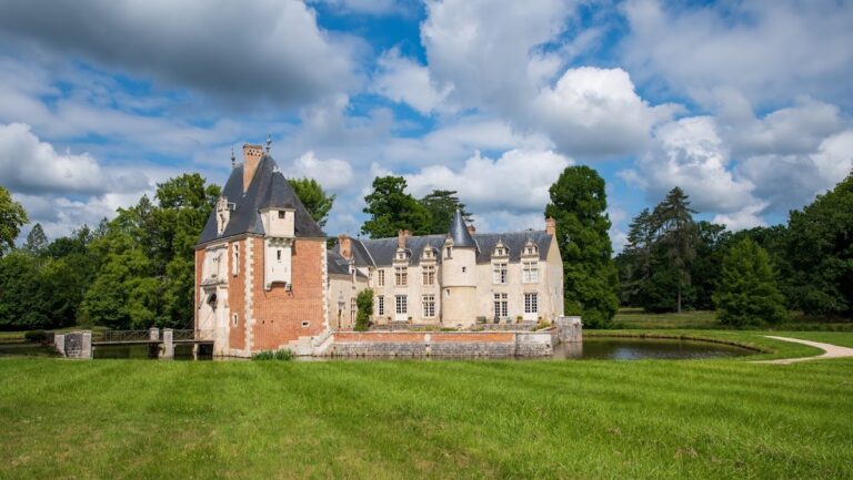
Pont de Beaugency: A Historic Bridge across the Loire
Site at a Glance
- Popularity
- Medium
- Country
- France
- Primary era
- Modern
- Eras represented
- Medieval, Early Modern, Modern
- Civilizations
- French
- Site type
- Infrastructure
- Remains
- Bridge
On this page12 sections
History
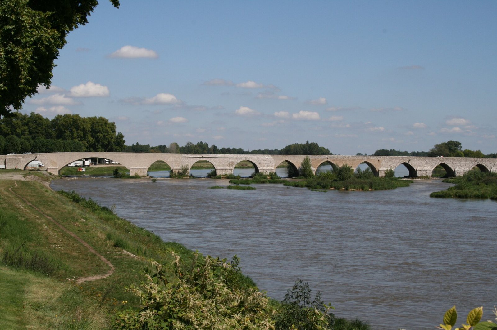
Pont de Beaugency is a 460-metre bridge over the Loire in France, carrying the D925 between Beaugency on the right bank and Lailly-en-Val on the left. The present crossing took shape in the fourteenth century and has been repeatedly altered by floods, military needs and efforts to keep the river navigable.
Medieval bridge and defensive crossing
A bridge may have existed here by the eleventh century, although that early date is uncertain. An act of Simon II of Beaugency refers to a bridge in 1145. The present bridge originated in the fourteenth century, when repeated Loire floods also made repairs to its supports and arched spans necessary.
Originally, the crossing comprised two connected sections divided by a Loire island, with a wooden drawbridge joining them. A flood in 1505 swept away the island and drawbridge. As the Hundred Years’ War, a prolonged conflict between the English and French crowns during the fourteenth and fifteenth centuries, came to an end, the town’s need for this defence declined. The drawbridge was removed and two stepped arches were built in its place.
Floods, ice and changing crossings
In 1608, a flood destroyed the bridge suburb on the left bank. Only 14 of the fourteenth-century arches remained standing, and the crossing no longer connected to that bank. Timber spans set on stone supports restored passage. Ice destroyed this timber bridge in 1677, prompting a masonry replacement with semicircular arches on piers, the bridge’s intermediate supports. The piers were strengthened with piles and foundation platforms, and the island and its defences disappeared.
A flood in 1710 brought down all but two of the masonry arches. Timber spans were installed once again, using both surviving and new supports. They remained part of the crossing until the Second World War (1939–45).
Navigation and nineteenth-century reconstruction
In 1840, a support between the fifth and sixth arches on the right bank was removed to create a suspended opening for navigation. It let boat convoys pass without being separated. Prefectural orders issued in 1841 and 1842 sought to make steam-boat passage safer, since the arches were low and narrow and the river ran swiftly during high water.
During the flood of 3 June 1856, the bridge withstood the water, but the Loire flowed around it on the left bank and badly damaged the levee and approach road. Because the many supports obstructed the river, three proposed rebuilding plans included wider openings and a relief span, an additional opening intended to help water pass. A decision in 1859 approved the relief span and a masonry rebuilding of the bridge. The relief span, now called Pont du Guidon, was built on departmental road 19. Approval of the main bridge plan followed in 1861, but lack of funds delayed the work. In the meantime, maintenance included repairs to the protective stonework and decking.
War damage and modern repairs
During the Franco-Prussian War of 1870–71, French military authorities ordered the suspended span destroyed. A 31.40-metre metal arch replaced it in 1872 and remained until 1945. An inspection in 1921, prompted by problems at Pont Saint-Nicolas over the Loiret, found the foundations vulnerable. Repairs renewed protective stonework, repointed the piers and repaired the masonry.
By the end of the Second World War, many spans were damaged or unusable, and the destruction of one arch had reduced the bridge from 24 arches to 23. A reconstruction contract was approved on 25 March 1947 and awarded to Campenon-Bernard; the work was completed in 1952. The programme rebuilt the navigable opening and a destroyed pointed arch, repaired other spans, strengthened foundations and replaced the section between piers 16 and 26, including temporary timber spans. Unexpected damage required further foundation work and the rebuilding of several supports. To improve water flow at the left bank, workers removed the last semicircular arch, pier 26 and the left-bank end support. They replaced them with a new span, pier 27 and a new end support with wing walls. The works also adjusted the road profile, widened the downstream side, consolidated arches and added mosaic paving.
After Pont Wilson collapsed in Tours in April 1978, inspections of Loire bridges led to a detailed examination of this bridge’s foundations. In September, inspectors found extensive scouring and water movement beneath the supports, especially at pier 15, where collapsed drainage openings exposed foundation decking and piles. Work to strengthen the pier using a temporary enclosure made with sheet piles and injections revealed serious damage to it and neighbouring arches. From 1978 to 1980, the foundations of the fourteenth-century supports were renewed; piers 3–16 and 26 were encased and injected, pier 9 was fully repaired, and arches 8–9 and 9–10 were rebuilt. The work also repaired parapets and masonry joints and renewed waterproofing.
The bridge is owned by the Loiret Department, a local authority, and lies within the Loire Valley UNESCO World Heritage property. A legend retold by Irish writer James Joyce in The Cat and the Devil says that the devil helped build the bridge in return for the soul of its first passerby. The inhabitants sent a cat across instead. The story may explain the town’s nickname, “cats,” though it may instead refer to the former abundance of chestnuts there.
Remains
Overall form and materials
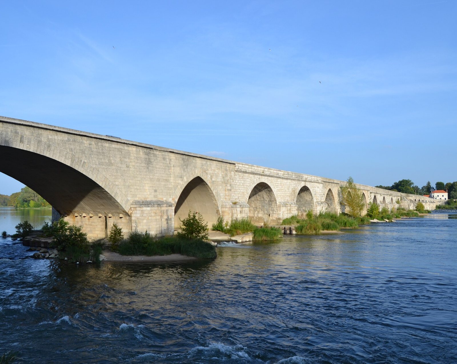
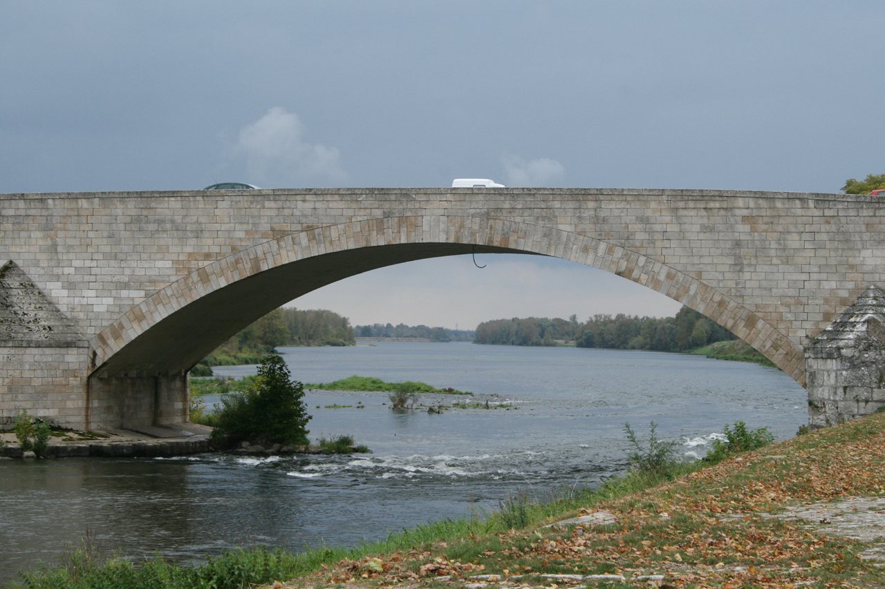
The present bridge has 23 arches of differing shapes and construction. It is built largely of stone, with sections of reinforced concrete and sprayed concrete, which is applied to a surface under pressure. Its arches include pointed and semicircular forms as well as basket-handle arches, shallow arches with a curved profile. The bridge is 460 metres long and has a recorded overall width of 8 metres. The roadway is 6 metres wide, with sidewalks ranging from 1 to 3 metres; the piers are 6–7 metres wide. The northern and southern sections of the earlier crossing measured 11.5 and 9 metres across respectively, and the difference in width remains visible.
Arch sequence and construction
Right-bank and navigable spans
At the right-bank approach, three pointed arches date to the fourteenth century; the first is almost buried beneath the approach embankment. Arch 2 is masonry. Arch 3 has two outer masonry layers and a central masonry layer that was treated with sprayed concrete in 1980. The 30-metre navigable arch was rebuilt in 1948, and its reinforced-concrete structure is dated to 1950. A further pointed arch between piers 4 and 5 was also rebuilt in 1948 and has a reinforced-concrete vault, the curved underside of the span. Two semicircular arches between piers 5–6 and 6–7 were rebuilt in the eighteenth and nineteenth centuries. The latter pair are masonry; repairs in 1980 included partial sprayed-concrete work, drains and repointing.
Central pointed and semicircular spans
Seven pointed arches extend between piers 7 and 14. Arch 8 is masonry, restored in 1950 with reinforced concrete along its arch bands while older masonry remains inside. Five drains sit where each half of the arch begins to curve. Arches 9–10 are reinforced concrete with stone bands along the arches and were rebuilt in 1980; arches 11–12 and 12–13 are masonry. Arch 14 is also masonry, with repairs to its two outer layers using sprayed concrete in 1980 and four drains at each side where the curve begins.
Three semicircular arches lie between piers 14 and 17. Arch 15 is masonry, with sprayed concrete applied to its two outer layers in 1980; the remaining surface was repointed with sprayed mortar, and drains were placed at the base of each half and within the repaired layers. Arch 16 is also masonry. Its upstream layer was repaired with sprayed concrete and small drains, while its central layer was repointed with sprayed mortar in 1980.
Left-bank spans
Five shallow basket-handle arches extend between piers 17 and 26. Beyond them are two semicircular arches between pier 26 and the left-bank end support, rebuilt in 1948. The vaults of arches 17, 19, 21, 22, 24, 26 and 27, as well as the final arch, are reinforced concrete dated to 1950.
Foundations
Older foundations at piers 3–16 and 26 consist of rubble and river-deposited sand resting on marl, a sediment containing clay and calcium carbonate. A later foundation arrangement, used at piers 17–27, has a base of low-cement concrete topped by cyclopean concrete, a mixture containing large stones. Some of these foundations also have a reinforced-concrete footing above.