Piquillacta: A Wari Administrative and Ceremonial Complex in Peru
Site at a Glance
- Rating
- 4.6
- Popularity
- Medium
- Country
- Peru
- Primary era
- Medieval
- External website
- Open
- Eras represented
- Medieval
- Civilizations
- Inca, Wari
- Site type
- City
On this page17 sections
History
Piquillacta is a large pre-Hispanic Wari archaeological complex near Cusco in Peru, in the Lucre Basin of the eastern Cusco Valley. Occupied from approximately AD 550 until around AD 1100, it was built during the Wari expansion into the Cusco region and became one of the largest and best-preserved provincial Wari centers. The Wari, also called Huari, were a major Andean civilization centered near Ayacucho whose Middle Horizon expansion produced planned regional settlements.
Wari expansion and the role of Piquillacta
The complex was constructed after the Wari extended their influence toward the Cusco region. Although the Wari heartland and capital lay near modern Ayacucho, Piquillacta was traditionally regarded as the center of their expansion in this area. Its size and organization have led to interpretations of the site as an administrative, military, and religious center, but its precise function remains uncertain.
Building Piquillacta required at least six million person-days of labor. A fully completed project would have required more than 7.8 million person-days, indicating the importance that the Wari placed on the complex. Excavations at Waro, another Wari settlement about 15 to 17 km farther southeast, revealed a more densely occupied site that may have administered the province. This possibility suggests that Piquillacta had a specialized purpose rather than serving simply as the ordinary political headquarters of the region.
Several interpretations connect the complex with Andean ancestor worship, in which ancestral beings, sacred objects, and relationships of fictive kinship could support political authority. Piquillacta may have hosted large feasts, religious and political ceremonies, temporary residents, or a military garrison. It may also have helped organize communities brought under Wari control. None of these explanations has been conclusively established, although serving vessels, offering deposits, and the arrangement of the buildings support the importance of ceremonial activity. Chicha, a fermented maize beverage, could form part of such feasts and held religious and social value in Wari ceremonies.
Abandonment and later interpretation
The Wari occupation ended through an organized abandonment sometime after the ninth century and probably around AD 1100. Three of the four sectors remained unfinished. Doors were blocked or sealed with clay, valuable objects were removed, and some offering pits were carefully opened. These actions point to a planned departure rather than a sudden evacuation. A later phase brought a major fire, with roof beams and sections of floors collapsing, especially in the second sector. Deliberate burning occurred in at least two sectors. The cause of the abandonment and destruction is uncertain, though it may have been connected with a crisis or decline of the Wari state.
After the site was abandoned, looters entered parts of the complex, including burial areas. No clear evidence demonstrates a later Inca occupation, although one interpretation proposes that some use continued into the Inca period. The original name of the complex is unknown. Its modern name, Piquillacta, is a Quechua expression commonly translated as “flea town” or “flea place,” and it may also have the metaphorical meaning “small town.”
Human remains were found in several contexts associated with construction and occupation, but the small number of investigated burials does not support firm conclusions about Wari mortuary practices. Some individuals had artificially modified skulls, and one examined skull had three healed trephinations, surgical openings in the skull that had healed during the person’s lifetime.
Archaeological investigations
Modern archaeological knowledge of Piquillacta developed gradually. Luis Valcarcel identified the site archaeologically in 1927 while focusing on two groups of green-stone figurines. Luis A. Pardo produced the first detailed plan in 1937. Emilio Harth-Terré surveyed the surface and published plans in 1959, but interpreted the complex as Inca and proposed that it was a large state granary.
John Rowe was the first researcher to identify Piquillacta as Wari through architectural comparisons with the Wari capital near Ayacucho. Surface investigations by William Sanders in the 1960s divided the site and included excavation of two buildings. Gordon F. McEwan carried out major excavations in 1978–79, 1981–82, and 1989–90, dividing the complex into four sectors for systematic study. Mary Glowacki conducted ceramic research in 1996. Investigations by Peru’s Ministry of Culture in 2017–18 included test pits, trenches, and excavation around the central plaza. The site forms part of Peru’s national cultural heritage, and an exhibition complex operates within the archaeological park.
Remains
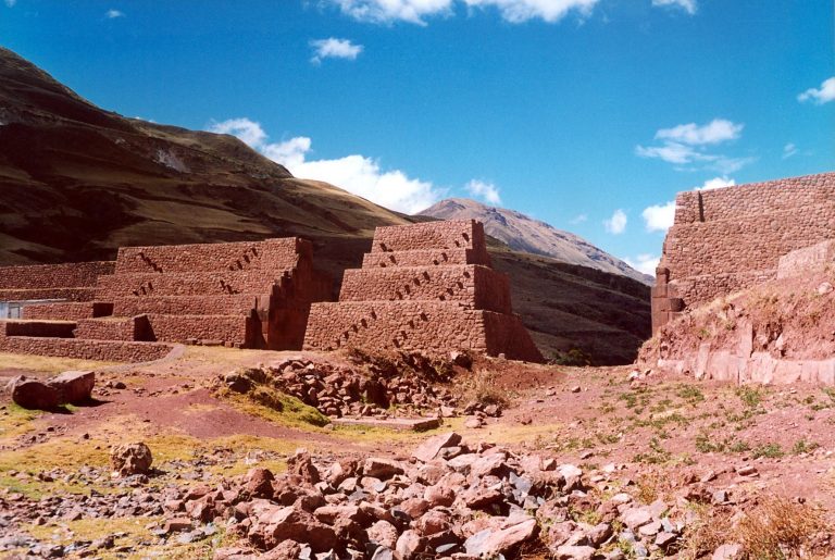
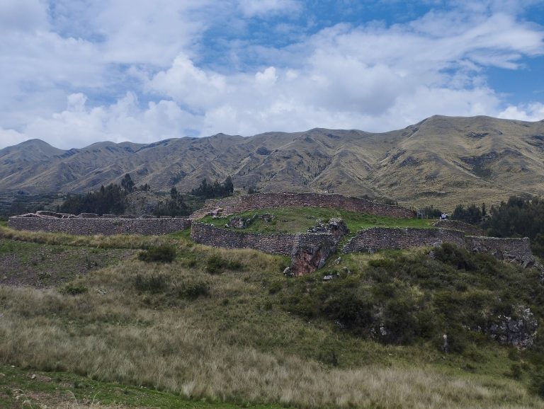
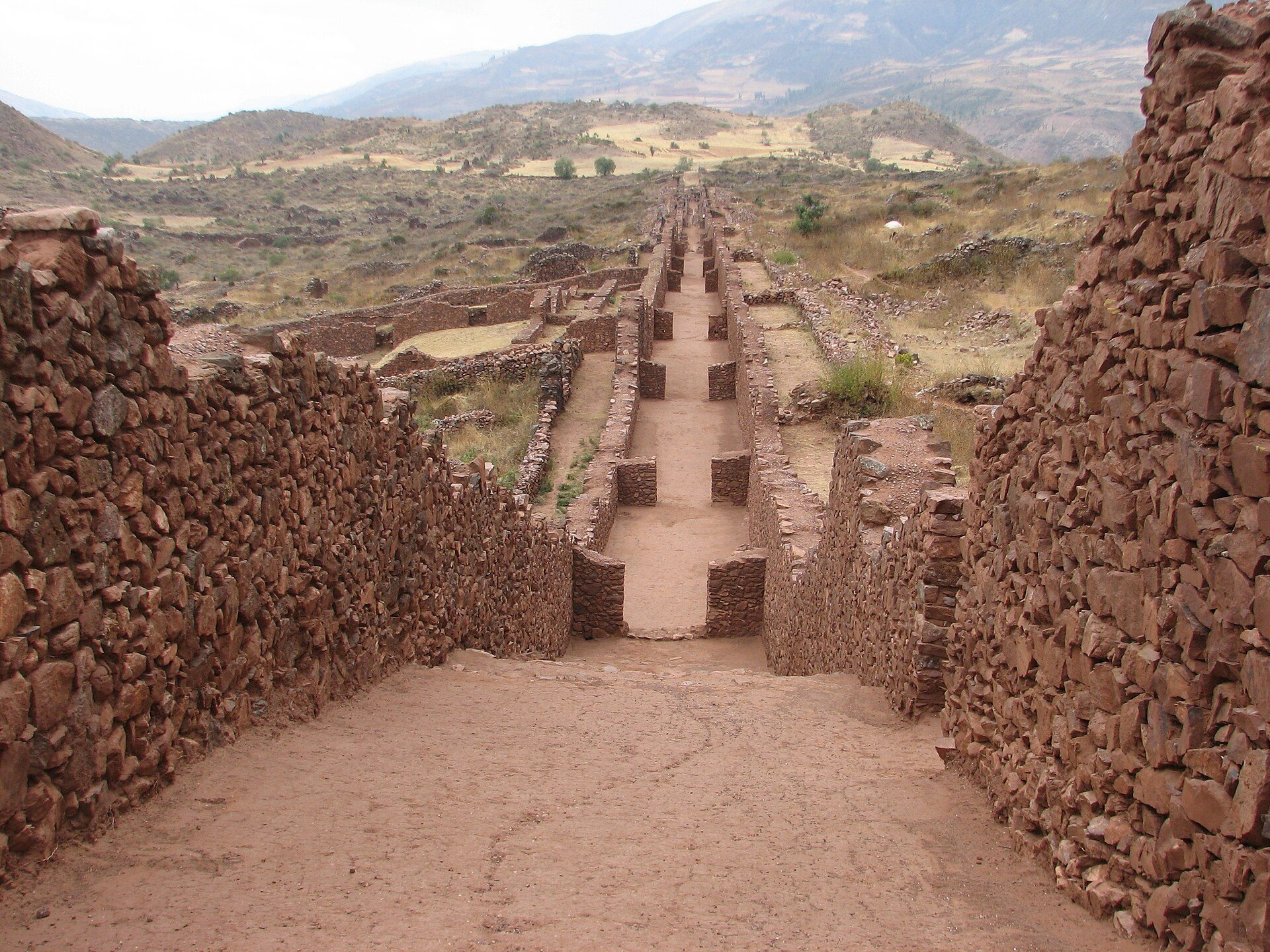
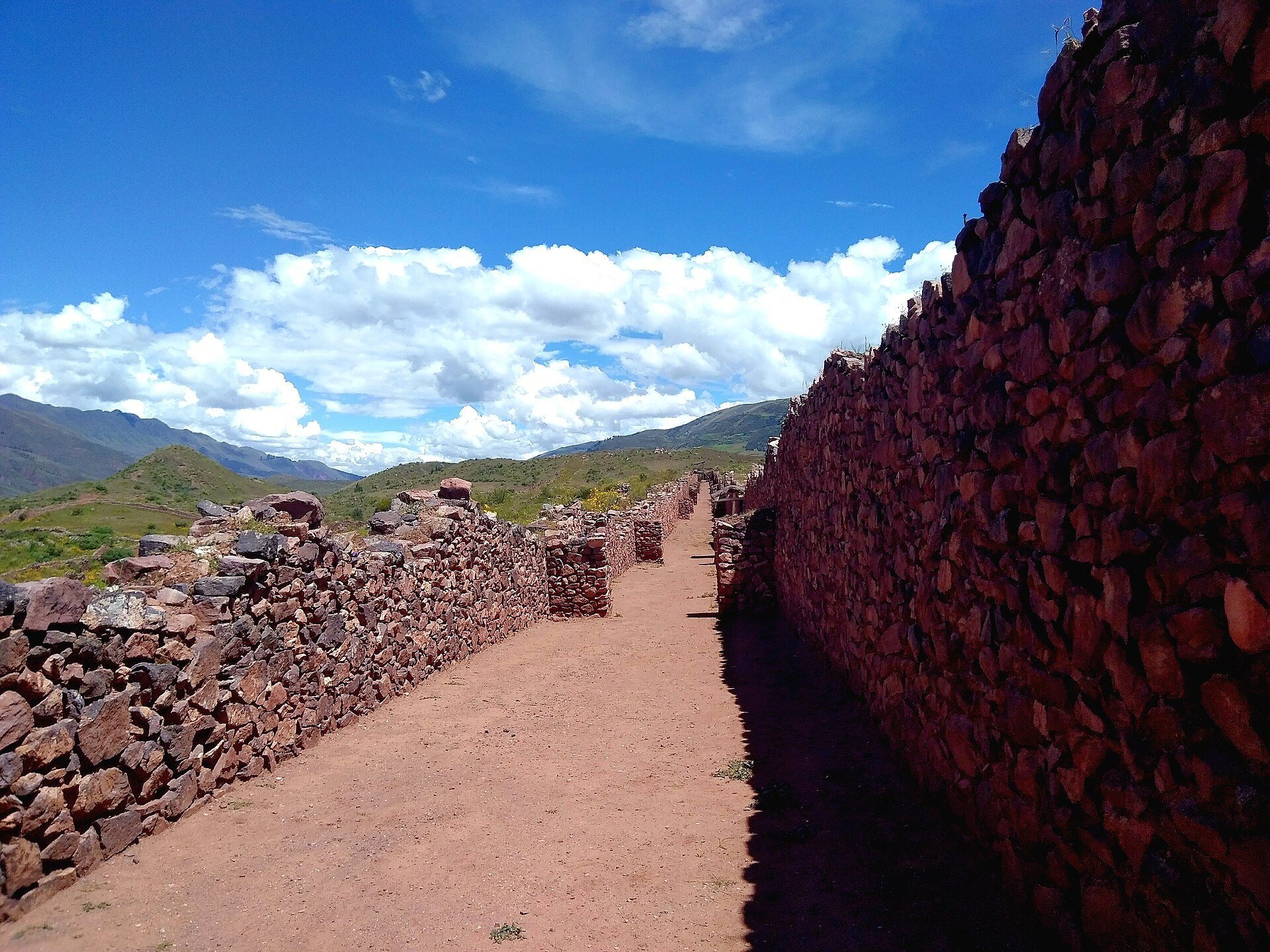
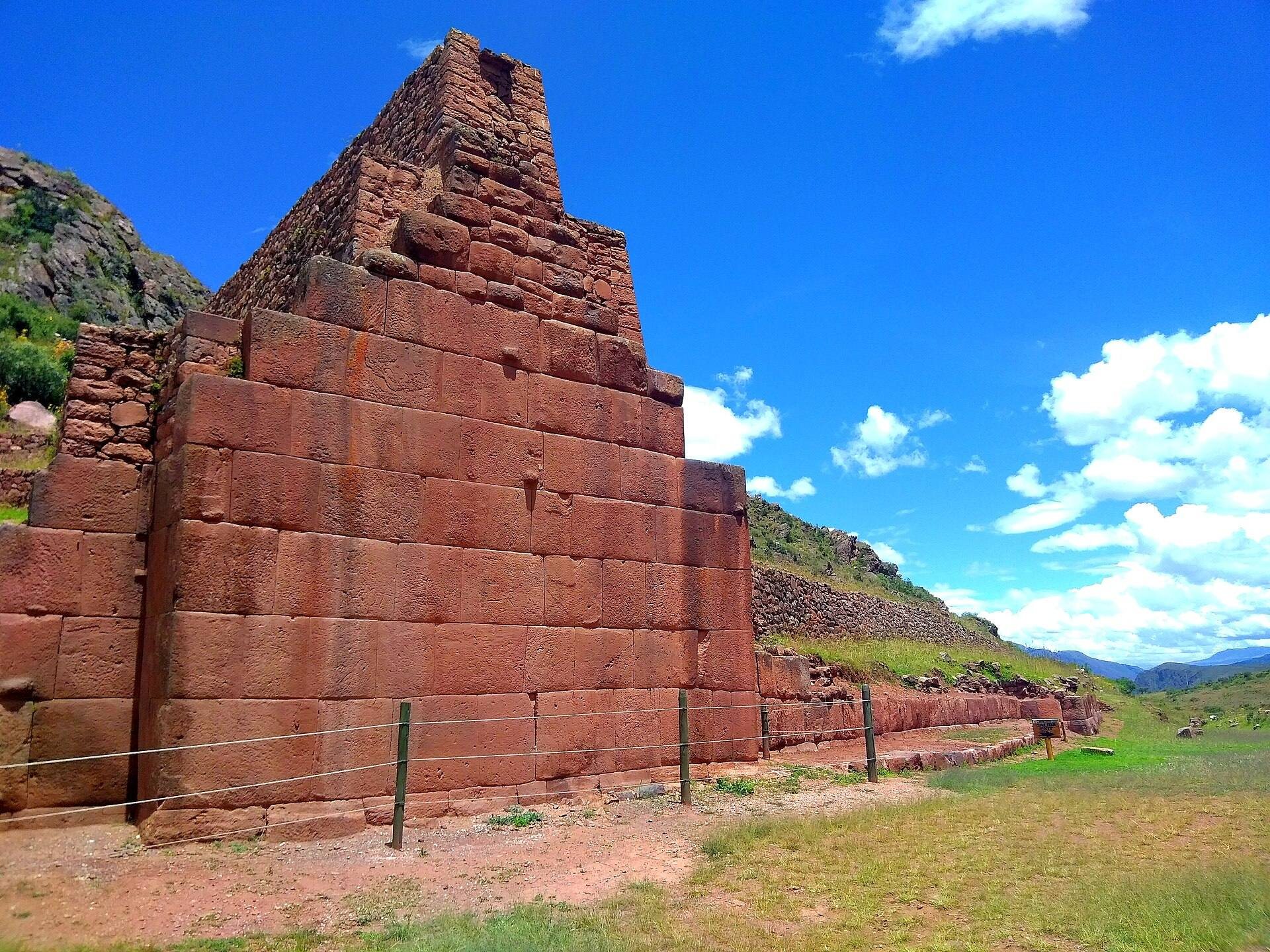
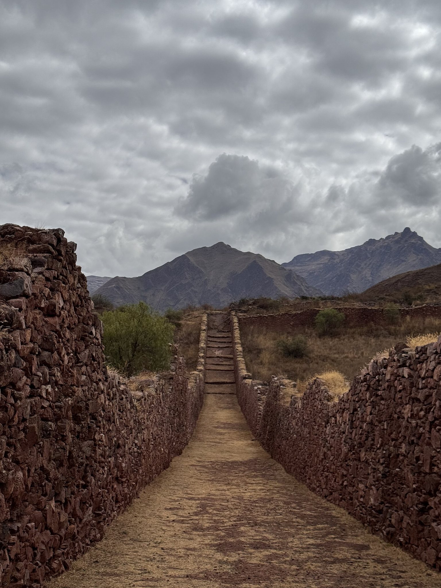
Piquillacta’s central architectural block forms a rectangle about 745 by 630 m on a steep mountain slope with an elevation difference of approximately 90 m. Its regular plan was imposed on difficult terrain and is most apparent from above. Large enclosed areas adjoin the main block on its northern and southeastern sides. Their surviving walls reach about 10 m, while some walls elsewhere rise to approximately 12 m. The complex contains patios, plazas, narrow rooms, niched halls, roads, enclosures, and hundreds of smaller buildings.
The four sectors
Sector 1
Sector 1 is organized as a strict grid of rectangular units measuring approximately 35 to 40 m on each side. Most units contain internal divisions that create patios surrounded by long, narrow rooms. Some patios include freestanding halls with wall niches. Five units are open spaces, and the sector has no clear roads giving access to most of its structures. It is poorly preserved, with only a few wall fragments surviving to about 2 m above the modern ground surface.
Sector 2
Sector 2 is the most structurally complex part of the central block. It contains patios of different sizes, five large halls with niches, and three roads, including one separating it from Sector 1. These roads reach relatively few buildings, while most doorways open onto intermediate partitions. Long rows of narrow rooms extend toward Sector 3, and wall sections in the northeastern part survive to about 12 m. The sector also contains a sealed offering pit beside the road between Sectors 1 and 2.
Sector 3
Sector 3 contains twelve rectangular buildings grouped at opposite ends of a large open area. Several long terraces were reconstructed on the ancient walls in 1934, probably incorrectly, because they do not conform to the rest of the complex. Two graves were incorporated into the southwestern outer wall. Their position links burial activity with the construction of the sector.
Sector 4
Sector 4 differs from the other sectors. It contains 501 small buildings with rounded corners at their doorways and walls, arranged in rows separated by access alleys. Three small niched halls and six large walled open areas are also present. Buildings in this sector have been interpreted as storage units, temporary workers’ quarters, military barracks, ordinary dwellings, or spaces connected with ancestor rituals. Excavated hearths and domestic debris support some residential interpretation, while the arrangement and associated ritual evidence allow ceremonial or mortuary uses. Later funerary towers, or chullpas, were found at the southwestern end.
Construction and internal spaces
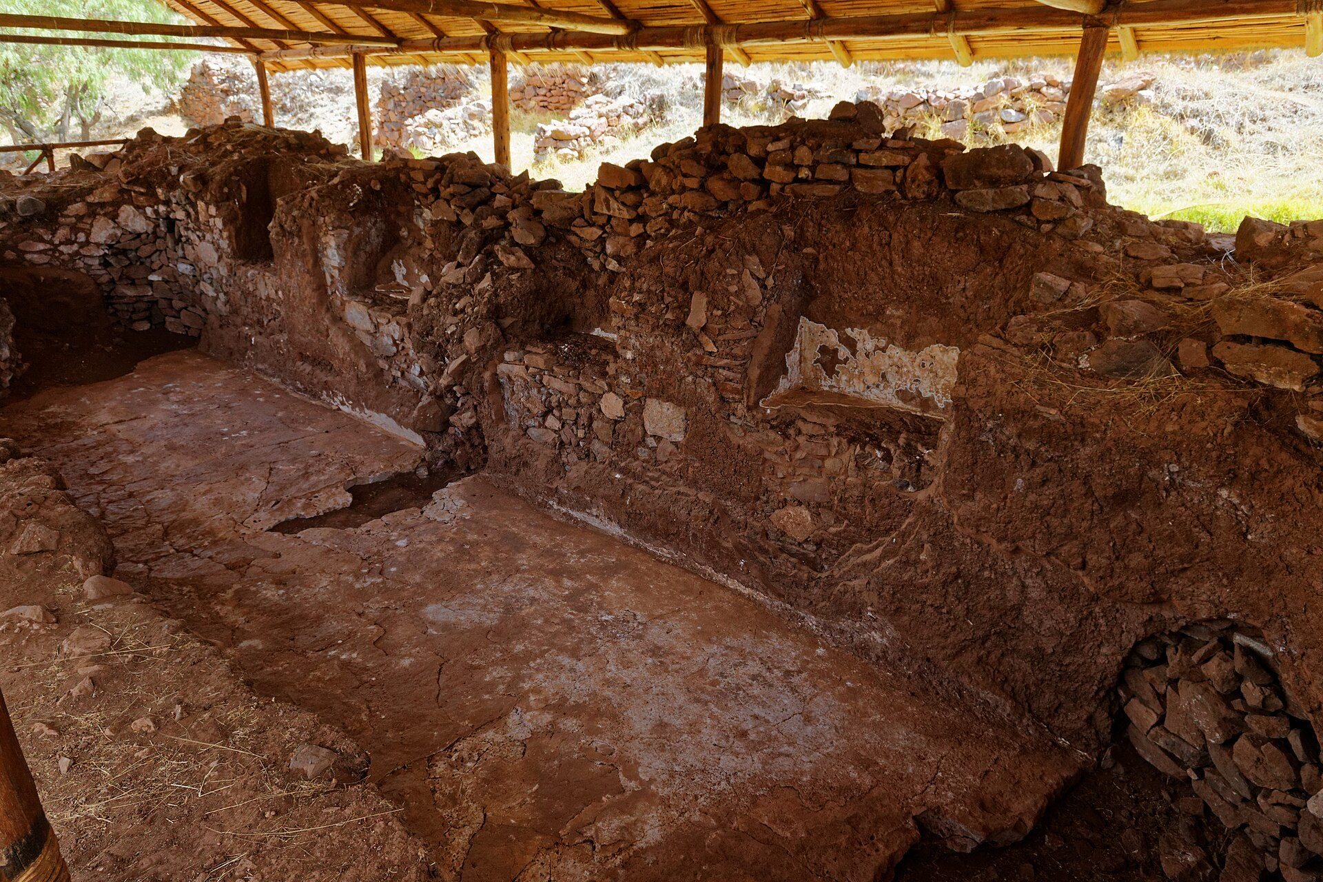
Most buildings were made from red sandstone pieces set with clay and earth mortar. The walls received a thick earth plaster layer about 10 cm thick and a finishing coat of gypsum plaster. Some plastered surfaces may have carried clear human-like motifs. Buildings included two- and three-storey structures. Floors used logs no more than about 8 cm in diameter, tied with cords and covered with clay plaster and gypsum. The floors were supported by projecting stones, continuous ledges, or small niches in the walls. Roofs were probably gabled and thatched, although flat roofs built in a manner similar to the internal floors are also possible.
The largest central patio or plaza may have provided the main setting for public ceremonies and feasting, while smaller patios may have supported more restricted activities. The complex contains eighteen halls with vertical rectangular recesses in their walls. Offering pits beneath some of these halls support a possible religious function, although the exact use of the halls remains uncertain.
Roads and water management
An enclosed ancient road approaches the complex from the southeast. It is approximately 4 to 6 m wide and points toward the Rumicolca gateway. Another route on the opposite side is about 10 m wide, crosses two steep hills and rocky outcrops, and ends at a partition approximately 500 m northwest of the complex’s northwestern wall. Its western wall continues for another 340 m. Its construction suggests that it was not used as an ordinary road.
A sophisticated hydraulic system supplied Piquillacta and nearby agricultural areas. One canal carried flowing water from Chelke stream toward the center at a rate of at least 850 litres per minute. The canal was approximately 16 km long, passed through the Rumicolca aqueduct, and ran underground within parts of the main buildings. It had an inverted-trapezoid section about 80 cm high and 62 cm wide at its upper edge, with stone walls bonded by clay and earth mortar. Where the ground was especially difficult, builders cut a 5 m tunnel through bedrock to maintain the gradient and built a retaining wall up to 8 m high to protect the canal from a collapsing slope.
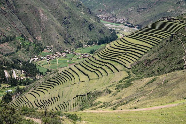
The wider water network extended for more than 48 km around the complex and included stone canals, reservoirs, aqueducts, terraces, and cultivated fields connected with the Lucre River and Chelke stream. The Rumicolca gateway-aqueduct lies less than 2 km southeast of the central complex. Its foundations appear to be Wari, while its later Inca facing used cut and polished stone.
Food remains and ceramics
A large refuse deposit outside the southeastern wall produced approximately 55,000 ceramic sherds and 50,000 animal bones, mainly from camelids. It lay beneath parts of the complex’s foundations and was therefore used, at least in part, during construction. Other excavated deposits contained maize, twenty well-preserved beans, and two grinding stones. Animal remains included camelids, guinea pigs, and other small rodents. Projectile points may have been used for hunting or butchery.
Ceramics represent nine Wari-associated styles. About 60 percent of the collection consists of local imitations of the Ocros style, made from orange clay and commonly covered with orange slip. The forms include bowls, jars with and without necks, face-decorated jars, cups, spoons, spindle whorls, and other small objects. Bowls with straight or convex walls and hanging black-and-white interior designs are especially common. Coarse undecorated dark-brown or black pottery accounts for about 12.7 percent of the fragments. About 7.2 percent belongs to the Chakipampa style, including thin-walled bowls and jars with red slip and decoration based mainly on chevrons or curved rays. At least some Chakipampa vessels were imported from the Wari heartland. Local styles account for about 10 percent of the pottery.
Offering deposits
Turquoise figurine caches
The best-known offerings were discovered in 1927 in two adjacent, unlooted caches. Each contained forty turquoise figurines, approximately 18 to 52 mm high, showing people in varied clothing with individually exaggerated facial features. One figure represents a bound captive. Twenty figures in one cache exactly duplicate twenty in the other. Marine shells and bronze rods accompanied the figurines. One group is now in the Museum of America in Madrid and the other at the National University of San Antonio Abad.
The figurines have been interpreted as ancestors, founders of Wari ruling lineages, or representations of conquered communities. Their meaning remains uncertain, particularly because the bound captives do not fit a simple ancestor interpretation. The blue-green stone used for the figures was not found locally, while turquoise or similar stones, marine shells, obsidian, beads, and bronze objects indicate long-distance exchange or specialized regional production.
The 2004 offering pit
A sealed offering pit discovered in 2004 beside the road between Sectors 1 and 2 measured about 84 cm across and was originally 3.19 m deep. A pointed bronze rod, 41 cm long, had been driven into its floor and covered with earth. At a depth of 2.79 m, excavators found fifty small figurines up to 46 mm high. They were made from cast metal, marine shell, polished stone, and two hammered metal halves. The figures include standing people, bound captives, warriors with shields and axes, and warriors carrying spears. Abrasion on the backs of some heads may represent ritual hair removal.
A crumpled perforated bronze strip lay above the deposit and divided the pit into two sides. One contained two Wari warriors with shields and weapons accompanied by a puma. The other held two supernatural beings and another puma arranged as a mirror image. One being resembles a dragon, while the other combines feline and camelid traits. Each is shown with a human body as prey. The pit was later partly refilled, and intentionally broken shells and heat-damaged animal bones were deposited inside, indicating that a fire had been lit there. A broken ceramic vessel near the surface may relate to the pit’s desacralization shortly before abandonment. A similar offering pit was found in southeastern Sector 2 in 2018.
Burials and human remains
Burials and isolated human remains occur in several parts of the complex. Ten skulls lay beneath the floor of a room in Sector 2, and an incomplete skeleton was found beneath a collapsed wall in Sector 4. Additional bones, some burned, came from hearth remains. One offering pit contained ten skulls and a bronze spike. Another contained bone fragments with green stains suggesting contact with copper objects, together with shell artifacts. Looting removed many objects from burial and offering contexts.
One wall tomb contained an adult man and woman seated during construction, accompanied by small turquoise-colored stone beads. The man was approximately 35 to 45 years old and had a healed facial fracture, cranial deformation, and gum disease. The woman was approximately 35 to 50 and had frontal flattening of the skull, more cavities, and greater dental wear. A second wall tomb contained a seated body that later fell over. Other remains included a woman approximately 17 to 20 years old and part of a young man approximately 16 to 18 years old.