Pisac Archeological Park: Inca Royal and Ceremonial Complex
Site at a Glance
- Rating
- 4.8
- Popularity
- High
- Country
- Peru
- Primary era
- Medieval
- External website
- Open
- Eras represented
- Medieval
- Civilizations
- Inca
- Site type
- Military
- Remains
- Citadel
On this page17 sections
History
Pisac Archeological Park is an Inca archaeological complex on a mountain ridge above Pisac in Peru. The surviving complex was probably built around 1450, during the reign of Pachacuti, the Inca emperor associated with major imperial expansion and the creation of royal estates and monumental centers in the fifteenth century. Its functions probably included royal residence, administration, ceremony, religion, refuge, agriculture, and defense, while its association with Pachacuti and his panaca, the dynastic group that preserved an Inca ruler’s memory and property, gave it a commemorative role.
Before and during Inca rule
Occupation of the ridge and surrounding area began before the Inca period. Lucre and Killke pottery points to earlier settlement, including a probable community between the Quitamayo and Chongo tributaries of the Vilcanota River. Its inhabitants cultivated the flood plain and hillside terraces before moving closer to the road linking Cusco and Urcos as threats from other groups declined.
The Inca complex was constructed no earlier than 1440, although its precise building date remains uncertain and it is generally placed around 1450. Its position may have protected the southern entrance to the Sacred Valley and the route from the Inca Empire toward the eastern forest region. That route led toward Antisuyu, the eastern quarter of the empire, and the complex may therefore have helped defend Cusco against groups from the eastern Andes. Its combination of residential, agricultural, administrative, ceremonial, and military features suggests that it served several purposes rather than functioning solely as a fortress.
Pisac was not used as Manco Inca’s final defensive refuge against the Spaniards. During his rebellion in 1534, Manco Inca, an Inca ruler who led armed resistance against Spanish rule in the 1530s, first occupied Calco, about 18 kilometers downstream, and later withdrew to Ollantaytambo. His movements suggest that Pisac was considered too close to Cusco for prolonged resistance.
Colonial and modern history
Spanish chroniclers did not mention the complex, despite its size and proximity to Cusco. Viceroy Francisco de Toledo, the Spanish Crown’s chief representative in Peru during the sixteenth century, established the modern town of Pisac in the valley below during the 1570s. The colonial settlement therefore occupied a different zone from the high Inca complex.
Ephraim George Squier gave a detailed modern description of Pisac after visiting in the late nineteenth century and publishing his account in 1877. Charles Wiener visited soon afterward and described his explorations in 1880. Their writings brought the ruins to wider scholarly and public attention.
Pisac and several other archaeological parks in the Sacred Valley received national cultural-heritage protection under a 1983 law. The Pisac National Archaeological Park was established that year, and its boundaries were formally defined by National Directive Resolution No. 429-2002 on 17 May 2002. The park covers 9,063 hectares. On 12 February 2016, a rockfall killed one visitor and injured two members of her family. Heavy rain followed by strong sunshine was believed to have loosened the rocks. Because the accident took place away from the Inca structures, the archaeological park closed until 1 September 2016 while repairs were undertaken.
An annual Willka Raymi celebration takes place at the complex on 24 August. This Andean religious and cultural festival is associated with the sun and indigenous tradition. Local tradition also tells of Inquill, the daughter of a chief, and Asto Rímac, a prince challenged to build a bridge over the Vilcanota River in a single night so that he could marry her. When Inquill looked back while climbing a hill, the two were transformed into stone, according to the story. A statue at the site is associated with the legend, and the bridge was traditionally regarded as important to the area’s defense.
Remains
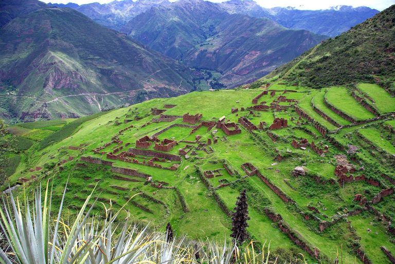
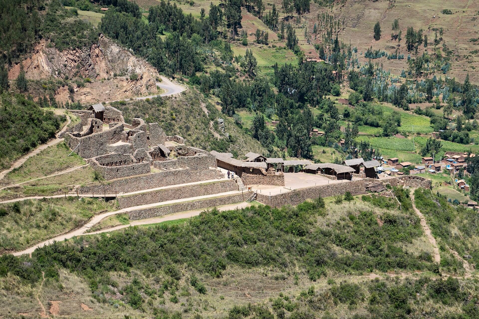
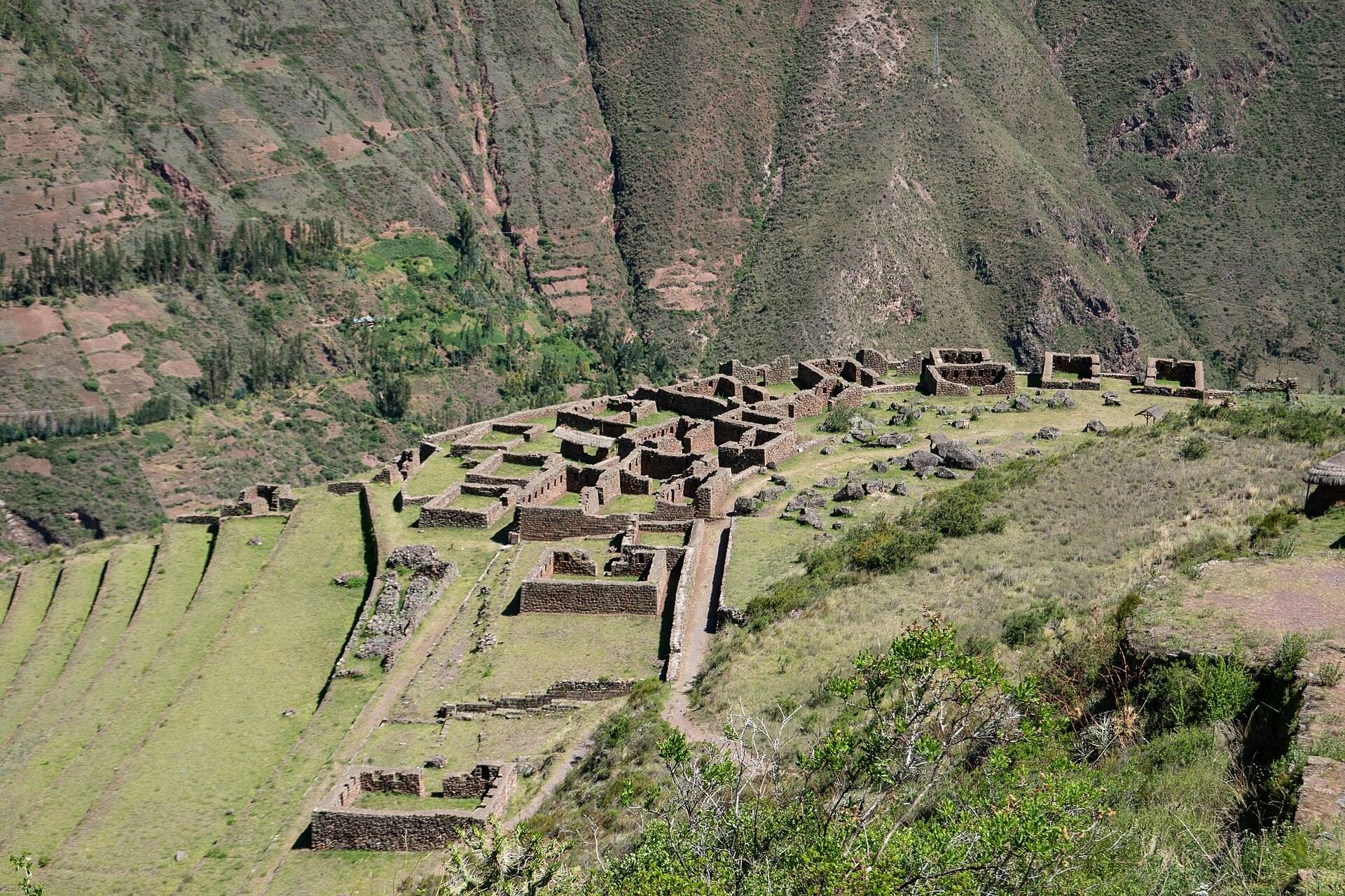
The complex extends for approximately 1 kilometer along a mountain ridge between the Kitamayu River to the west and the Chongo River to the east, both tributaries of the Vilcanota. Its elevation ranges from about 3,446 to 3,514 meters above sea level. Natural slopes divide the settlement into seven principal areas, arranged broadly from north to south as Qantus Raqay, Qallaq’asa, Inca Qonqorina, Intiwatana, P’isaqa, Hospitalniyoc, and Kanchis Racay. Narrow paths, canals, and two rock-cut tunnels connect them. Most of the present names come from later tradition, historians, and archaeologists rather than from preserved Inca names.
Including the lowest terraces around Patapatayoc and modern Pisac, the complex covers about 65.5 hectares. The upper terraces and buildings occupy about 24 hectares, while the seven principal architectural areas cover approximately 4.3 hectares. Together, the paths, terraces, dwellings, waterworks, towers, storehouses, cemetery, and ceremonial buildings form a ridge-top settlement integrated with an agricultural landscape.
Ridge-top buildings and residential areas
Qantus Raqay and Qallaq’asa
Qantus Raqay, also called Qanchis Racay or Kanturaqay, stands at about 3,446 meters on the edge of a precipice. Its three levels contain rough-stone buildings with pirka walls, made from small and medium-sized stones bonded with mud. The walls originally carried clay plaster. Overlooking the route toward the Paucartambo region and Antisuyu, the area probably served as a military garrison or wartime shelter.
At about 3,514 meters, Qallaq’asa occupies a steep hillside. Its 23 residential buildings are made from rough fieldstone joined with adobe and descend across the slope. Their relatively coarse construction has been interpreted as evidence that they housed lower-status workers. The area’s name refers to a passage or tunnel linking it with Intiwatana.
P’isaqa and Inca Qonqorina
P’isaqa lies approximately 200 meters directly below Intiwatana on a broad semicircular ledge. About 30 buildings occupy the area, including residences with finer masonry than those in the other residential zones, suggesting an association with an elite population. P’isaqa also contains its own baths.
Inca Qonqorina is an administrative area on the ridge immediately above Intiwatana. A path from Tianayoc reaches it through a tunnel about 3 meters long. Nearby, Tianayuc is a seat cut from a single rock and large enough for two people. The remains of a tower stand above the Kitamayu gorge.
Intiwatana and ceremonial structures
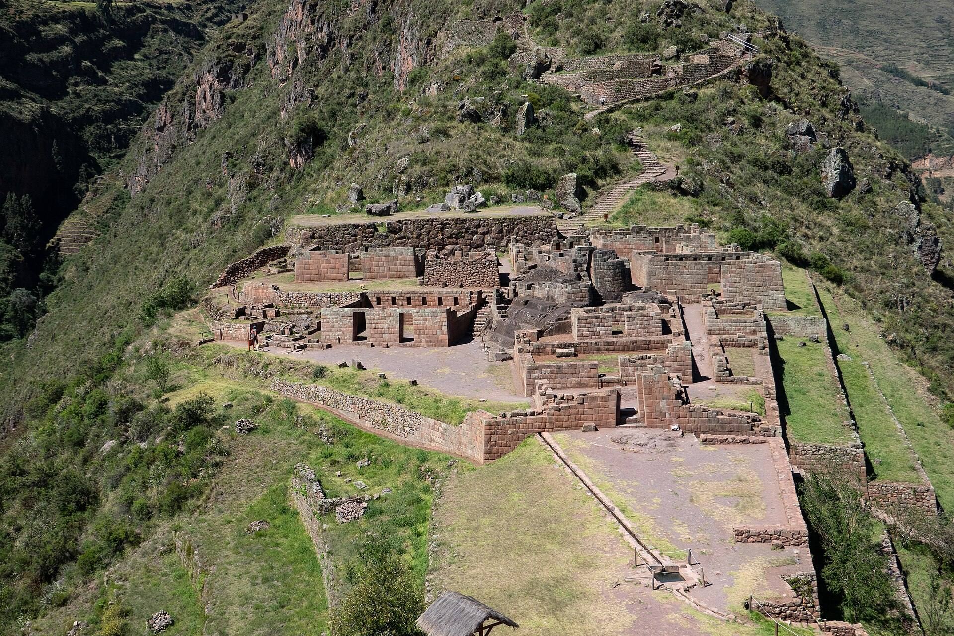
Intiwatana is the principal ceremonial and religious area. It occupies a small ridge with views on both sides and centers on a carved ritual stone housed within a D-shaped building. The structure has one straight lateral wall, a south-facing main entrance, and finely fitted blocks of pink granite. An Intiwatana, commonly translated as “hitching post of the Sun,” is a carved stone associated with the sun.
The stone was probably used for astronomical observation, especially to follow the sun and identify the start of important agricultural seasons. On 21 June, the sun rises directly above an eastern peak, while on 21 December it rises above another peak. The stone was damaged during the Spanish campaign against indigenous religious beliefs, and later vandalism destroyed part of it. The area is now closed to the public.
Five other buildings or temple walls surround the Intiwatana building. One was probably dedicated to the moon. A sacred chacana, an Andean cross-shaped religious symbol, stands in front of the ritual stone, while several ceremonial baths drain into an underground canal.
Defensive structures and communications
Walls, gateways, towers, and tunnels
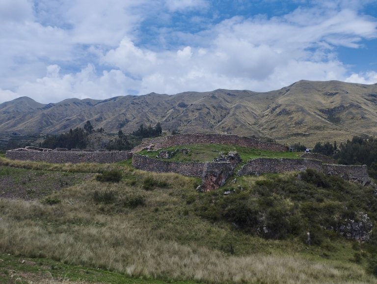
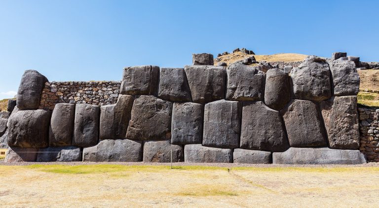
A large protective wall at the northern foot of Qallaq’asa is built from large dressed stones and has four gateways. Amaru Punku, on the route south toward Intiwatana and P’isaqa, is the only gateway retaining its lintel, and its hinges remain visible. Another route crosses the eastern hillside through a doorway without a lintel.
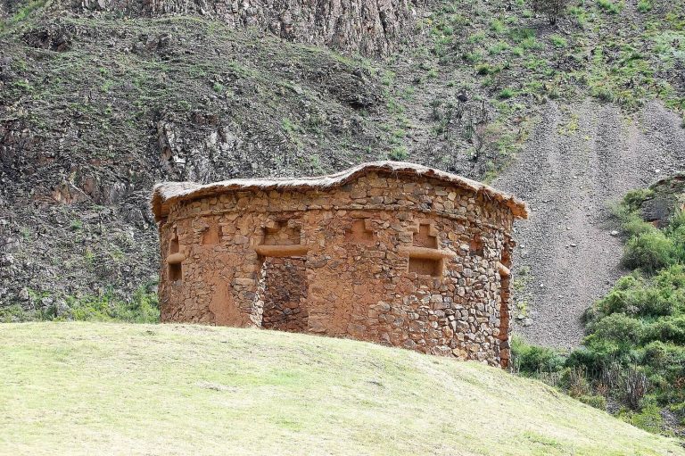
Coriwayrachina lies on the ridge south of Intiwatana. It contains several towers, or pucaras, used for communication or observation, together with very steep terraces that probably had a defensive purpose. More than 20 towers occur across the complex. Some are conical Habitaculo towers, built with carefully carved, jointed stones and connected to water channels. The more nearly conical Atalaya towers appear to have served as watchtowers.
A 16-meter tunnel on the eastern slope links the lower Qallaq’asa route with the path to Intiwatana. It was made by enlarging a natural fissure through the cliff. The resulting teardrop-shaped passage is only wide enough for one person at a time, giving it defensive value. A second tunnel, about 3 meters long, connects Tianayuc with Intiwatana. The complex also contained suspension bridges. At Paccháyoc, the bridge bases survive, and another bridge stood on the western side of the Intiwatana area.
Water management and agricultural terraces
Water channels and baths
The complex contains at least five water-supply channels, more than two irrigation channels, and more than three agricultural drainage channels. These systems fed fountains and baths and supported cultivation across the ridge. Water from a small lake at about 4,500 meters was carried by canal to four purification baths near the river between Qantus Raqay and Qallaq’asa, then onward toward Qantus Raqay. Another supply began at a spring on the left bank of the Kitamayu, where water was collected in a basin.
Spring water crossed the river on the Antachara aqueduct, approximately 20.7 meters long and 20 meters high. It then crossed a second aqueduct about 20 meters long and 7 meters high, supported by three large pillars. From there, the channel continued along the cliff face and through a canal toward the Intiwatana ceremonial area. Additional channels carried water from Inca Qonqorina toward the main canal and from Intiwatana toward P’isaqa.
Terraces and cultivation
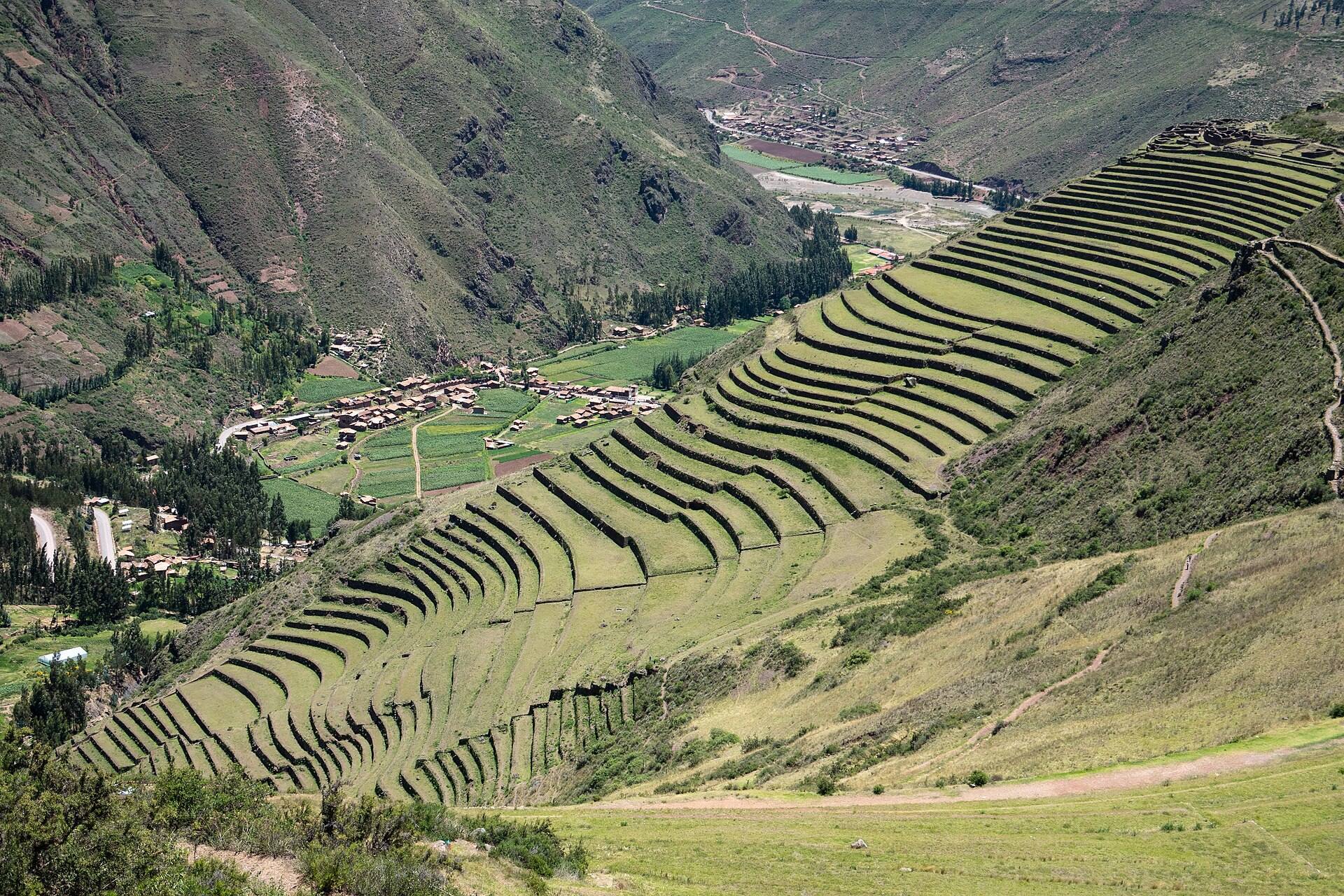
Approximately 500 agricultural terraces cover the mountain spur. Some rise about 6 meters, while individual terrace walls are generally 600 to 750 millimeters thick and made from roughly fitted fieldstones. The terraces reduced erosion, expanded arable land, retained moisture, moderated nighttime temperatures, and made cultivation possible at higher elevations. Terraced areas were measured at about 3 degrees Celsius warmer than unterraced slopes, with conditions comparable to those roughly 600 meters lower.
At least 14 terrace forms occur between about 2,995 and 3,450 meters above sea level, and many terraces remain in use. The Andenes Acchapata terraces closest to modern Pisac comprise about 40 levels descending toward the valley floor and river. Gravel backfill in the lower levels helped conserve water while allowing drainage after heavy rain.
Storehouses and cemetery
Hospitalniyoc
Hospitalniyoc lies on the eastern slope below Coriwayrachina. Its six adobe storehouses are equal in size, each consisting of a single rectangular room. Their hillside position, shade, ventilation, cooler temperatures, under-flooring, and drainage helped preserve perishable goods such as grain and potatoes for two years or more.
T’antana Marka
T’antana Marka lies across the Kitamayu ravine from the baths, on an almost vertical mountain slope. The cliff contains the looted tombs of one of the region’s largest pre-Columbian cemeteries, with more than 3,500 tombs and estimates reaching 10,000. The tombs were cut into the rock, and grave robbing and destruction have left only small openings in many of them.
Burials placed mummies in fetal positions with personal belongings and food, reflecting Inca beliefs about reincarnation. After the Spanish conquest, grave robbers removed jewels, metals, and precious stones from the tombs.
Western bath complex
A bath complex occupies a western plateau beside the Kitamayu River. It contains four purification baths and forms part of the wider water system that supplied the settlement’s ceremonial, agricultural, and domestic needs.