Tipón: An Inca Administrative and Ceremonial Settlement in Peru
Site at a Glance
- Popularity
- Medium
- Country
- Peru
- Primary era
- Medieval
- Eras represented
- Iron Age, Medieval
- Civilizations
- Inca
- Site type
- City
On this page23 sections
History
Tipón is an archaeological complex near Oropesa in Peru, built chiefly by the Incas in the fifteenth century. It became an important ceremonial, administrative, and religious center, although its original purpose remains uncertain.
Early occupation
Settlement at Tipón extends back to around 1000 BCE, during the Andean Formative period, when settled farming and early ceremonial centers were developing. The archaeological sequence includes Marcavalle around 1000 BCE and Chanapata around 800 BCE. Qotakalli activity dates to about AD 700, while Wari occupation lasted approximately from AD 700 to 1200 and Killke occupation from around AD 900 to 1200. The Inca phase began in the thirteenth century and continued until 1572.
Pinagua and Inca rule
Before Inca rule, Tipón was an important settlement of the Pinagua people, who may have been connected to the regional Ayarmaca kingdom. Pinagua resistance to the Incas is associated with the reigns of Inca Roca and Viracocha Inca. Pachacuti, a later Inca ruler, brought the Pinagua decisively under Inca control in the mid-fifteenth century.
Construction of the complex is generally dated to the fifteenth century. It may have been an imperial estate, or a residence and estate for Inca elites, established under Pachacuti or his son Topa Inca Yupanqui. Tipón was an Inca llaqta, or administrative settlement. Its varied local climates, fertile ground, and dependable water may also have made it a place for agricultural experimentation.
Names and historical traditions
The site has been associated with the names Muyna and Moyna, but its original name is unknown. Tipón appears in the sixteenth-century will of Tomasina de la Vega, an early owner of the Quispicanchi estate. The will names lands of Tipón and Guaypar, as well as land within old enclosures. The name’s origin is unresolved. One proposed derivation is timpuee, meaning “boiling place,” perhaps alluding to a concentration of people or activity.
A local tradition says that Wiracocha, the Andean creator deity, ordered the terraces to be made as a garden. This deity is distinct from Viracocha Inca, an Inca ruler. A separate reading of the sixteenth-century chronicler Garcilaso de la Vega links Tipón to a royal residence for Yawar Waqaq, commissioned by his son Viracocha Inca after Yawar Waqaq was overthrown during a Chanka rebellion. The proposed residence was placed between Muyna and Quespicancha, near the Tucay River. Later interpretations place Viracocha Inca’s flight from the Chankas in the Sacred Valley rather than at Tipón. They retain an association between Yawar Waqaq and the site, but the identification of Tipón as the palace remains uncertain.
Excavation and recognition
Excavation and restoration at Tipón have taken place since the 1970s, and the principal monumental fountain was restored in 1999. Peru designated the site a National Archaeological Park in 1984, and it is recognized as Peruvian cultural heritage. In 2006, the American Society of Civil Engineers named it a Historic Civil Engineering Landmark.
Remains
Setting and enclosure
Landscape and layout
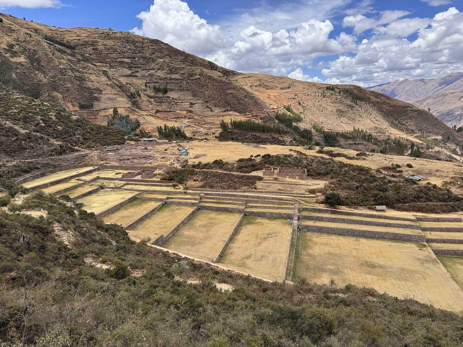
The 239-hectare complex lies near Oropesa, in the community of Choquepata, southeast of Cusco. Its features occupy elevations of about 3,250 to 3,960 metres. Two ravines, each carrying a stream, border the site; they meet at its foot and drain toward the left bank of the Huatanay River. The upper area is crossed by an Inca road. Archaeologists distinguish agricultural and urban areas, ceremonial spaces, storehouse areas, and cemeteries. Pukara, Intiwatana, and Sinkunakancha are among the named sectors. Basalt and andesite, two local volcanic rocks, were worked to varying degrees for terraces and enclosures.
Outer wall
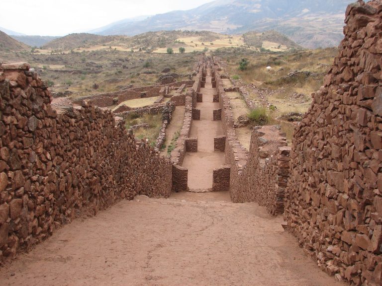
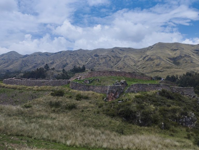
A roughly six-kilometre wall follows the hills around the complex in stepped sections. It reaches about eight metres high, measures up to two metres across at the top and four to six metres at the base, and partly rests on a natural rocky slope. Its stonework is generally irregular, with polygonal facing in some sections. The construction may reflect Killke or Wari influence, though the wall’s original purpose is unknown. A hole resembling a doorway in its northeastern stretch also has no known function.
Terraces and water system
Principal terraces
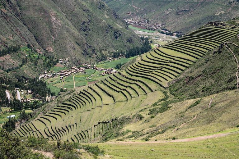
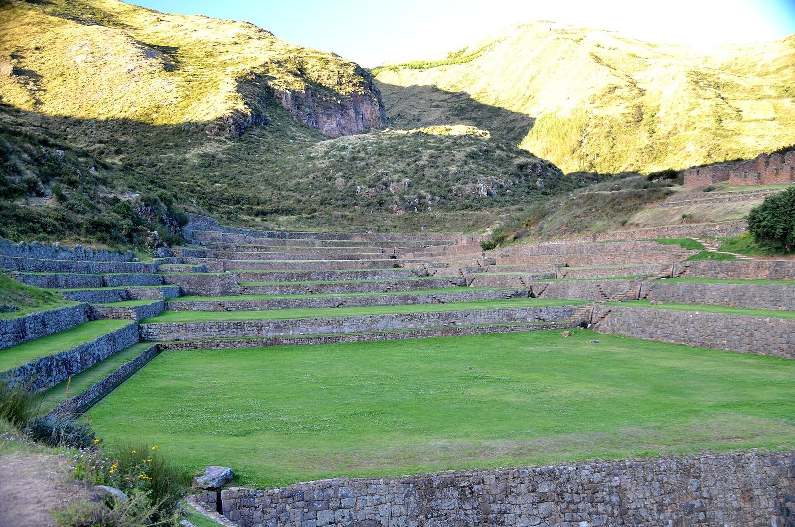
Terraces cover about 100 hectares within the outer wall, including roughly 50 hectares below one or more canals diverted from the Pukara River. Many terrace walls are poorly preserved. The group of 13 principal terraces occupies about three hectares in the southern part of the park, in a shallow ravine running northeast to southwest between elevations of approximately 3,380 and 3,460 metres. Their retaining walls, generally U-shaped, are carefully cut and fitted in some stretches and more roughly built in others. They stand from one to five metres high, averaging about 2.5 to three metres. Fertile soil fills the terraces, held in place by the stone walls.
Canals and drainage
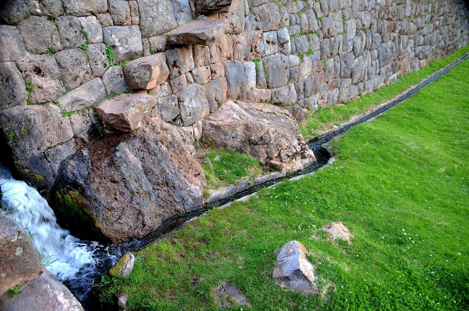
Three canals divert water from the Pukara River at the northern end of the park, at around 3,790 metres, and carry it toward lower fields and buildings. Their intakes lie outside the wall; the channels cross it where steep ground offers a more defensible passage. The main canal follows a stone-lined route about 1.4 kilometres long, much of it restored or well preserved. It winds along the hillside using retaining walls, sections cut into or built up across slopes, and sharp bends around rock. It irrigates fields near Intiwatana and the ceremonial plaza, then continues north of the principal terraces to Patallaqta. Before reaching Intiwatana, it crosses an aqueduct, a raised channel carrying water, and then passes underground through the compound. It also runs within building foundations and supplied four baths before feeding fountains and outlets. Another aqueduct uses a rocky outcrop and projecting rock formations to carry water toward Intiwatana; one of the three canals runs along an intact stone aqueduct.
The principal terraces draw on the Tipón spring and the Pukara River canal. Eleven receive spring water, while the upper two are supplied from the river channel. Water from the monumental fountain feeds three canals, which can be operated separately or together; drop structures carry water between levels while controlling its flow. Branches serve the nearby residential areas of Sinkunakancha and Patallaqta. Channels cut into stone at the foot of each terrace collect rainwater and underground seepage, then direct it into side drains that descend in cascades designed to reduce splashing. The system combines surface water and groundwater management, and is the only irrigation system from the Inca period still in operation. Its stone-lined channels, controlled drops, spring collection, and flow management have been compared with works at Machu Picchu, with similarities interpreted as evidence of technological transfer.
Monumental spring fountain
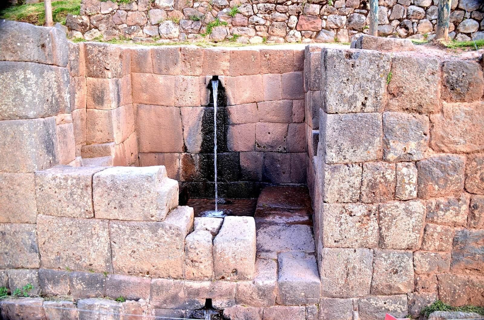
The main monumental fountain stands on terrace 11, where it gathers water from a natural spring. Seven underground conduits extend in different directions to collect groundwater. The flow divides into two jets, then four, and joins again at the head of the canal system. Its steady supply is described as high quality and flows throughout the year. Built of basalt and andesite, the fountain also sends channels west toward the monumental terraces and east through the elite housing area before the water divides into four jets.
Ceremonial fountain
A separate ceremonial fountain occupies the southeast side of terrace 8. Water reaches it from the monumental fountain through an underground canal. Its jet falls into a stone basin, from which the water drains into the lower canal system. The fountain’s design principles have also been compared with fountains at Machu Picchu and Wiñay Wayna.
Buildings and settlement areas
Cancha Inca
East of terrace 12, near the spring that supplies the monumental fountain, Cancha Inca is a small group of buildings arranged in a U around a central patio. Its structures retain trapezoid-shaped niches and windows.
Iglesia Raqui
East of terrace 6, Iglesia Raqui is a restored building that may have served as a storehouse. Its doors, windows, and niches are arranged to allow substantial air circulation. A large rectangular room has three trapezoid-shaped openings on its first level and six openings at the rear of the second level, facing north. The building stands at the top of the grand stairway on the southwest side of the principal terraces, with a three-step water drop beside the stairway.
Sinkunakancha
Sinkunakancha, a residential area just above terrace 1, extends about 90 metres from east to west and includes a large semicircular structure at its eastern end. Its buildings adapt to the slope through terraces, cut-and-fill construction, which levels ground by excavating higher areas and building up lower ones, and retaining walls. Their layout is less regular than the common Inca arrangement of three or more buildings around a central patio.
Intiwatana
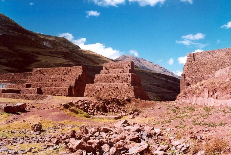
Intiwatana, meaning “place where the sun is tied,” occupies a rocky promontory at about 3,525 metres. At its eastern end, a small natural truncated pyramid capped with rocks is surrounded by four square terraces and a simple stone stairway. Across from it is a patio with two triple-jamb niches, recessed openings framed by three nested borders. A lengthwise street to the west of the pyramid separates spaces with rectangular rooms facing the feature. The rooms have finely worked stone and trapezoid-shaped niches. The canal runs underground through this sector and supplies its residents.
Pukara
The Inca urban area of Pukara lies inside and near the northwestern outer wall, beside the Pukara River. It consists of buildings and stone terraces. Fragments of Killke pottery point to settlement there before the Inca period. Most enclosures use simple masonry, with polygonal stonework more common at the corners. Door and window openings are trapezoid-shaped, and interior walls were plastered with a mixture of clay and straw. Terraces follow the ground, with rectangular forms in the north and east and crescent-shaped ones in the southeast. Local farming continues there, and cultivation has likely persisted since Inca times.
Ceremonial spaces and summit carvings
Ceremonial plaza
The U-shaped ceremonial plaza lies southwest of the aqueduct and opens to the south. It measures about 35 by 23 metres and has finely worked andesite masonry, with large trapezoid-shaped niches in its northern wall. Two channels from the aqueduct supply the plaza. The northeastern channel empties into a small enclosure that may have held a ceremonial fountain.
Cruzmoqo
At about 3,960 metres, Cruzmoqo is the highest point in the park, and the outer wall encloses its summit. Terraces there are built with finely cut square and rectangular stones. Most of the park’s 29 rocks and stones bearing petroglyphs, or images engraved into rock, are concentrated at Cruzmoqo. The summit carvings include mirrored double spirals, arrows, dotted lines, and small cavities. Carvings on the southern slope also show animal and human figures. Differences in erosion suggest that the summit images may have been made at different times. Cruzmoqo may also have served as a signaling, communications, or observation station on the route toward the Vilcanota-Urubamba Sacred Valley.