Minturnae Archaeological Park and Ponte Real Ferdinando: Roman City and Historic Bridge



Site at a Glance
- Rating
- 4.5
- Popularity
- Low
- Country
- Italy
- Primary era
- Classical
- External website
- Open
- Eras represented
- Classical, Modern
- Civilizations
- Kingdom of the Two Sicilies, Roman
- Site type
- City
On this page25 sections
History
Minturnae Archaeological Park and Ponte Real Ferdinando is a historic site in Italy, at Minturno, preserving the remains of a Roman maritime colony founded in 296 BC beside the Garigliano and a nineteenth-century bridge across the same river. Minturnae developed during the Roman period as a port, market, and road settlement linked to the Via Appia, while the Ponte Real Ferdinando later expressed the industrial ambitions of the Kingdom of the Two Sicilies.
Before the Roman colony
Minturnae was first mentioned in connection with the First Latin War, fought between Rome and the Latin League from 340 to 338 BC. After the Aurunci, an Italic people of the region, revolted against Rome, Minturnae was destroyed along with the Auruncan centers of Ausona and Vescia. The exact circumstances and date of that destruction remain uncertain.
A settlement attributed traditionally to the Aurunci has been placed in the fifth or fourth century BC. Its existence and location are disputed. It may have occupied the later Roman site, or it may have stood near the hill that later contained medieval and modern Minturno. A sanctuary dedicated to Marica, an Italic deity associated with the mouth of the Garigliano, provides evidence of pre-Roman religious activity in the wider area.
Foundation and republican expansion
The Via Appia reached the later city in 312 BC. This major Roman road connected Rome with southern Italy and gave Minturnae a direct land route through the region. In 296 BC, or possibly in 296 to 295 BC, Rome refounded Minturnae as a maritime colony together with Sinuessa. The colony helped maintain and protect Roman communications with Campania, and its inhabitants held Roman citizenship.
The settlement expanded greatly during the third and second centuries BC. Its position beside a navigable river, close to the coast and a suitable landing place, encouraged shipping, trade, and links along the coast of Latium. Minturnae supported shipbuilding, produced transport amphorae, exported local wine, and processed and traded fish. The Via Appia and the river port together made the colony a regional commercial center.
Minturnae also shared Rome’s military obligations. During the Second Punic War, the conflict between Rome and Carthage from 218 to 201 BC, the city supplied resources for the Roman war effort. In 191 BC, during Rome’s war against Antiochus III, Minturnae attempted to obtain exemption from providing men and supplies for naval service.
Religious events were closely connected with public life. In 207 BC, lightning struck the Temple of Jupiter and the sacred grove of Marica. Roman authorities interpreted lightning strikes as divine signs. Another strike affected the Temple of Jupiter and the shops around the forum in 191 BC.
The prosperity of Minturnae also depended on enslaved labor. Literary and inscriptional evidence records the crucifixion of 450 enslaved people at the city after the Sicilian slave revolt of 133 BC. Inscriptions listing municipal personnel indicate that approximately 80 percent of those officials and workers were enslaved.
Crisis and Augustan reorganization
In 88 BC, the people of Minturnae supported Marius, the Roman general and statesman who opposed Sulla during the civil conflicts of the late Republic. The local authorities first imprisoned Marius and arranged for an enslaved man to kill him. The attempt failed, and Marius was eventually allowed to leave by sea for North Africa.
A major fire damaged or destroyed the forum sometime after 65 BC and before the early imperial reorganization. Lightning may have caused the destruction. Another unresolved possibility is that Sextus Pompey sacked the city between 41 and 39 BC during the conflicts that followed the assassination of Julius Caesar.
Under Augustus, Rome’s first emperor, Minturnae underwent extensive urban reorganization and was probably recolonized with veterans of Julius Caesar. Public buildings were added or renewed, the Via Appia received monumental treatment, and the forums, temples, theatre, and aqueduct were constructed or rebuilt. The division of the surrounding land also appears to have been rearranged, while the city’s territory extended across both banks of the Garigliano.
Imperial prosperity and late antiquity
Minturnae retained colonial status during the first century AD. Under the emperor Vitellius, the city apparently supported the usurper and later emperor Vespasian before changing its allegiance. Building activity resumed during the second century, especially under Hadrian and possibly Antoninus Pius. The baths and macellum, a public market building, were constructed, while the curia, basilica, theatre, private houses, and other public structures were altered or redeveloped. Repairs and restorations continued into the sixth century.
The settlement remained an urban center in late antiquity and had become an episcopal see by the end of the fifth century. Bishop Celius Rusticus signed the Roman synod of 499. A cathedral must therefore have existed, although its remains have not been identified.
During the sixth century, Minturnae gradually lost population. The surrounding plain may have become increasingly marshy and unhealthy. In 590, Pope Gregory the Great dissolved the diocese and incorporated its territory into the diocese of Formia. The city was probably destroyed around AD 600, although the circumstances are uncertain. Its population then withdrew to the hill settlement of medieval Traetto, now Minturno.
From the seventh century onward, the ruins were quarried for building stone used at Traetto and later at Cassino. This reuse reduced the quantity of ancient fabric that survived above ground. Systematic excavations began in the 1930s under Jotham Johnson and continued from the 1960s through the 1980s, revealing the principal buildings of the Roman city. Investigations in the castrum area along the Via Appia resumed in the 2000s. In July 2024, the archaeological park and its associated cultural remains became part of the UNESCO World Heritage property “The Appian Way, Queen of Roads.”
The Ponte Real Ferdinando
The Ponte Real Ferdinando belongs to a much later phase in the history of the Garigliano crossing. Francesco I of the Two Sicilies commissioned the bridge in 1828, and his son Ferdinando II completed it in 1832. Designed by the engineer Luigi Giura, it was named after Ferdinando II, king of the Kingdom of the Two Sicilies from 1830 to 1859.
The bridge was the first iron-chain suspension bridge in Italy and one of the earliest of its type in Europe. Its construction represented an advanced use of industrial architecture in the Kingdom of the Two Sicilies. On 29 October 1860, it became involved in the conflict between the Kingdom of Sardinia and the Kingdom of the Two Sicilies.
During the Second World War, the bridge was connected with the Allied advance across the Gustav Line, the German defensive system in central Italy. German demolition engineers blew up the suspended structure on 14 October 1943. The masonry structure survived and remains the principal physical element of the historic bridge.
Remains
Urban setting and defenses
The Roman city occupied the right, or northwestern, bank of the Garigliano, near the river mouth and the Tyrrhenian coast. Its earliest Roman layout centered on a rectangular or square castrum, a fortified settlement or military camp, covering about three hectares. Polygonal masonry enclosed the castrum, whose original defenses included four square corner towers. Surviving sections lie east of the theatre and at the southern end of the excavated area.
The Via Appia crossed the castrum from west to east and served as the city’s principal east-west street, or decumanus maximus. It passed in front of the main public buildings, including the forums and temples. During the third or second century BC, a larger defensive circuit extended the settlement westward and southward. Built from regularly cut tuff blocks, it included towers set about 15 metres apart and a western gate. Parts of this later circuit survive, especially on the northern side.
Republican civic center
Republican forum
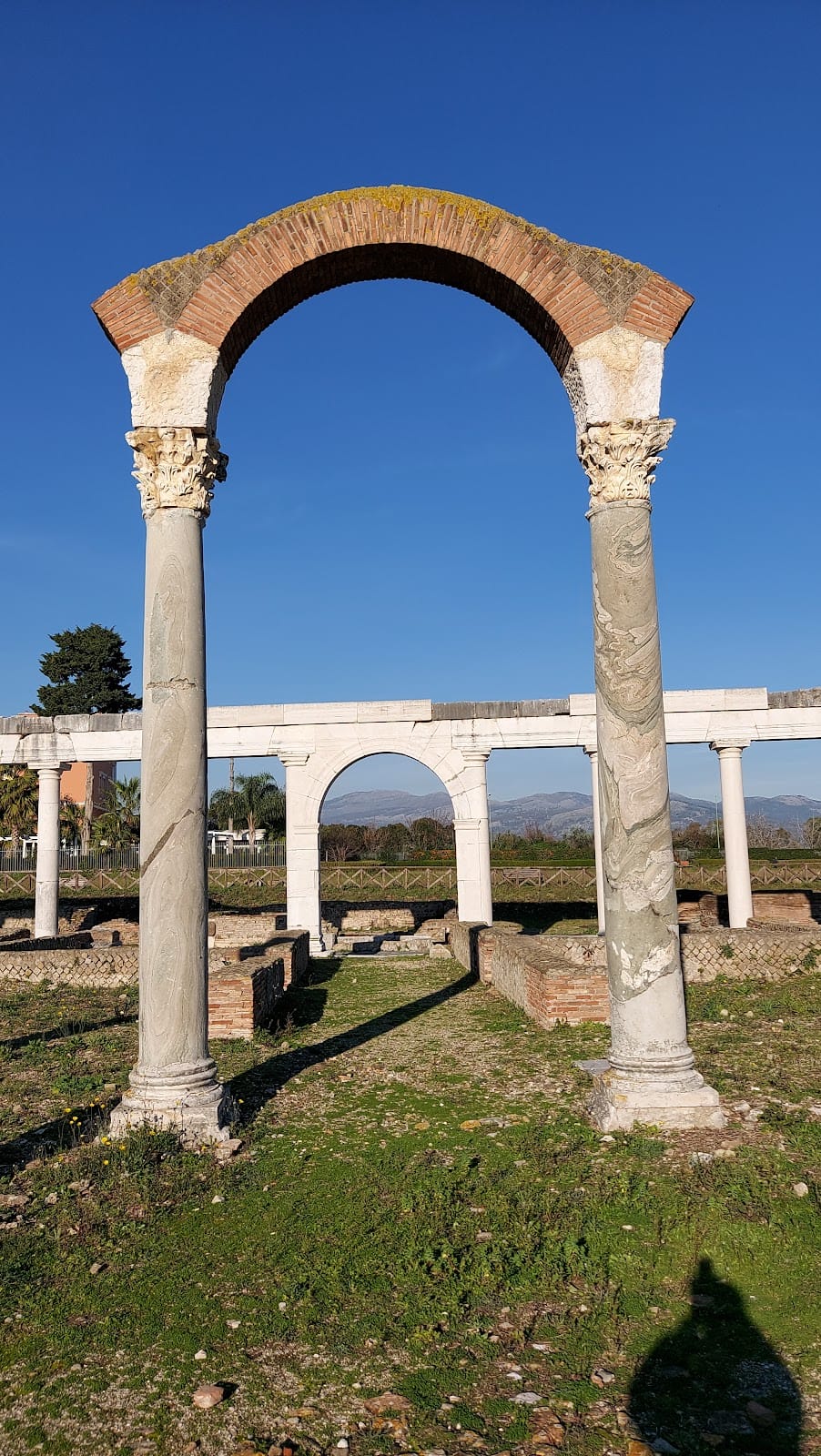
The republican forum lay north of the Via Appia. In one reconstruction, it formed a rectangle approximately 63 by 50 metres in size. A raised portico with two rows of columns enclosed three sides. Its tuff pillars or columns carried terracotta decoration, while the ends facing the Via Appia formed closed ornamental facades.
The forum changed through several building phases. It was probably rebuilt after a fire thought to have occurred around 191 BC, then destroyed again by a fire after 65 BC and before about 45 BC. During the Hadrianic period, walls and a propylon, a monumental entrance structure, enclosed the area. Well chambers were added at the southern ends of the eastern and western porticoes.
Capitolium
The Capitolium stood in the western part of the republican forum. Its foundations indicate a temple probably built in the Tuscan order, a Roman temple form with a broad, comparatively simple arrangement of columns. Three sacred chambers, or cellae, were dedicated to Jupiter, Juno, and Minerva, the Capitoline Triad and principal state deities of Rome.
After the later fire, the temple was rebuilt in limestone, and the surrounding portico was renewed. The surviving foundations preserve the position and general scale of this central republican monument.
Temples of the eastern forum area
Temple A occupied the eastern part of the republican forum and faced the Via Appia. It belongs to the early imperial period. Its construction has been placed under Augustus and Tiberius, or around AD 30. The temple may have been dedicated to Roma and Augustus and may have contained a statue of Augustus or Tiberius.
The podium of Temple A incorporates 29 reused dedicatory inscriptions, probably first attached to altars. Most date from about 90 to 64 BC and mention freedmen involved in local cults. Their reuse in the podium connects the early imperial building with earlier religious activity in Minturnae.
Temple B stood east of the republican forum on foundations associated with the earlier castrum. It was a single-chamber tuff temple within a large sacred enclosure, or temenos, surrounded by porticoes. A small temple was later added to its east, and another stood at the southern end of the western portico. Temple B belongs to the imperial forum complex and used opus reticulatum, a Roman wall technique in which small stones were set diagonally into a concrete core.
An inscription found near the foundations suggests, without proving, that Temple B was dedicated to deified Julius Caesar. The forum also produced ceramic fragments dating from the third and second centuries BC, including coarse and finer wares probably made at Minturnae.
Imperial civic center and theatre
Imperial forum
The imperial forum developed on the opposite side of the Via Appia from the republican forum and incorporated the foundations of the former castrum. Its remains include broad stretches of paving made from large stone slabs, a long eastern portico, the so-called L-shaped street, and buildings associated with civic administration.
A curia, the meeting building for the city council, and a basilica, a large public building used for civic, judicial, and commercial activities, stood on the eastern side. Both were built during the early imperial period and remodeled in the middle of the second century AD. Together they formed the administrative and assembly center of the city. Public latrines and another temple were excavated at the southeastern corner.
Southeastern temple and Temple L
The temple at the southeastern corner of the imperial forum was probably built at the end of the first century AD. It stood on a podium and contained three sacred chambers. Its deity is unknown.
Temple L, also associated with the imperial forum, is known chiefly through its vaulted substructures. It dates from the latter part of the first century AD. The identity of the deity worshipped there is unknown.
Theatre
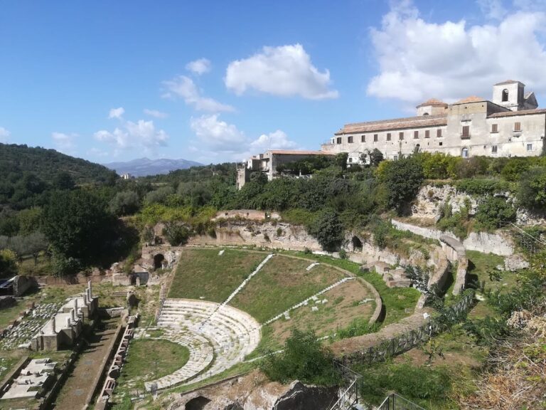
The theatre stood immediately north of the forums and was built during the early imperial period, probably under Augustus or Tiberius. Its seating area could accommodate approximately 4,600 spectators. The building incorporated part of the earlier city wall into its stage front, or scaenae frons. Its design included the stage, orchestra, and curved seating area, with two principal entrances reached by streets running from the Via Appia along the western and eastern sides of the forum.
During the Hadrianic or middle imperial period, the stage front was rebuilt and redecorated. This work required the northern portico of the forum to be moved. The surviving theatre structures continue to be used for performances including comedies, operas, and concerts.
Antiquarium
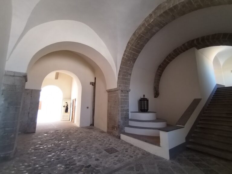
Since 1984, the Antiquarium has occupied the ambulatory and substructures beneath the theatre seating. The right ambulatory, known as the statue gallery, contains sculptural material from Minturnae and its monuments. Among the pieces are statues of Augustus and Livia, statues of Muses from the theatre, Hellenistic originals, and Roman copies of Greek originals.
The left ambulatory contains a lapidarium with marble architectural decoration, particularly material from different phases of the theatre, together with statues of togati, figures wearing the Roman toga. The museum also houses inscriptions, votive offerings, coins, sculptures, and other archaeological material from the city and its territory.
Market, baths, and water supply
Macellum
The macellum stood west of the imperial forum. A row of shops and another building separated it from the forum. The northern part was entered from the colonnades along the Via Appia, while a central entrance led into an interior courtyard surrounded by an arched colonnade. Its construction and decoration place the building in the second century AD.
Baths
The baths lay south of the macellum and contained several bathing rooms with surviving mosaic decoration. Their walls do not follow the alignment of the market, suggesting that parts of the bath complex belonged to an earlier construction phase.
Three rooms retain brick pilae supporting floors raised above a hypocaust, an underfloor heating system through which hot air circulated. They are identified as a caldarium, or hot room, a tepidarium, or warm room, and possibly another heated room. A frigidarium, or cold room, and an outdoor natatio, a bathing pool with surrounding steps, also survive. The principal entrance probably faced the imperial forum, although access through the macellum may also have been possible.
Aqueduct
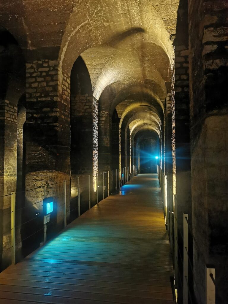
An aqueduct built under Augustus or Tiberius brought water from a source approximately 11 kilometres away in the present-day Aurunci Mountains. It entered Minturnae through the western gate and supplied the city’s fountains and nymphaea, or ornamental water basins.
River crossings, port, and sanctuary
Roman bridges and port
An ancient bridge called the pons Tirenus or pons Teretinus carried the Via Appia across the Garigliano directly from the castrum. Wooden piles and remains of concrete survive as archaeological evidence of the crossing. Another road probably led toward Arpinum along a long embankment and crossed the river by a second Roman bridge.
The river port and quay extended along the Garigliano. About 200 metres of dock or quay structures built in reticulated masonry have been identified. Finds near the modern bridge include amphorae, ceramics, votive offerings, marble sculptures, keys, bolts, lead, hooks, and fishing weights. Together, these objects reflect commercial, craft, and fishing activity. Coins from the port range approximately from 270 BC to AD 450, with the period from 27 BC to AD 192 most strongly represented.
Sanctuary of Marica
About one kilometre downstream from Minturnae, between the city and the sea, stood the sacred grove of Marica, known as the Lucus Maricae. The sanctuary occupied a site near the mouth of the Garigliano and included a temple.
Its origins reach back to the pre-Roman period. A tuff temple was built around 500 BC and rebuilt in the late first century AD. It may later have been rededicated to Isis, an Egyptian deity whose worship spread through the Roman world. The sanctuary appears to have fallen out of use after the reign of Marcus Aurelius.
Ponte Real Ferdinando
The Ponte Real Ferdinando crosses the Garigliano at the boundary between Lazio and Campania. Its original suspended structure depended on iron chains, but the suspension span was destroyed by German demolition engineers in 1943. The surviving masonry structure is now the principal physical element of the bridge and preserves part of Luigi Giura’s nineteenth-century crossing.