Paisley and Johnstone Canal: An Industrial Waterway for Passengers and Freight
Site at a Glance
- Popularity
- Medium
- Country
- United Kingdom
- Primary era
- Modern
- Eras represented
- Modern
- Civilizations
- British
- Site type
- Infrastructure
- Remains
- Canal
On this page9 sections
History
The Paisley and Johnstone Canal was an industrial waterway in the United Kingdom, linking Glasgow, Paisley and Johnstone. Built in the early nineteenth century, it carried passengers and freight as the completed part of a larger plan to connect Glasgow with Ardrossan Harbour and the Ayrshire coalfields.
Proposal and construction
Hugh Montgomerie, 12th Earl of Eglinton, proposed the canal in 1791. He hoped that a deep-water harbour he planned at Ardrossan would become Glasgow’s main port. The River Clyde was too shallow for large ships to reach Glasgow, while transporting heavy goods by road was difficult. Coal owner William Dixon supported the scheme as an outlet for his colliery, and Eglinton and William Houston expected improved access to industrial markets for their coal and iron mines.
An Act of Parliament incorporated the Glasgow, Paisley and Ardrossan Canal Company in 1806. It authorized a canal from Ardrossan to Tradestown, near Glasgow, and a branch to the coalworks at Hurlet. The company could raise £140,000 through 2,800 shares priced at £50 each; Eglinton, Lord Montgomerie and Lady Jane Montgomerie subscribed £30,000. John Rennie, Thomas Telford and John Ainslie were engaged to design the canal, survey its route and estimate costs. Work began in 1807. The passenger boat The Countess of Eglinton was launched on 31 October 1810 for service between Paisley and Johnstone, and the canal reached Port Eglinton in Glasgow in 1811. Although first called the Glasgow, Paisley and Ardrossan Canal, it later became known as the Glasgow, Paisley and Johnstone Canal.
The Ardrossan extension was abandoned after its first 11-mile level section used up the available funds. Initial estimates had badly underestimated the cost, and completing the project was expected to require another £300,000. Eglinton had already spent £100,000 on the harbour; his grandson, the 13th Earl, eventually completed it at a total cost of £200,000. Further investment proved hard to secure, in part because Houston had already gained a canal connection between his mines and Glasgow and Paisley.
Passenger and freight traffic
Before passenger service began, the poet Robert Tannahill died by suicide during a period of depression. After an Edinburgh publisher rejected a group of his poems, he burned many of his writings. His body was found in the Candren Burn tunnel beneath the canal on 17 May 1810. On 10 November that year, during Martinmas Fair, The Countess of Eglinton overturned at Paisley wharf as passengers crowded aboard while others were getting off. The boatmen could not push it away from the wharf, and the weight of the crowd caused it to capsize. Cold water, steep sides and the fact that few people could swim contributed to 84 deaths, 52 males and 32 females.
Canal travel grew popular. From 1830, shallow-draft wrought-iron fly-boats, fast passenger craft, carried about 60 people on 12-mile trips. They averaged 8 miles per hour including stops, reached 10 miles per hour and made 14 journeys a day without their wash damaging the banks. The 70-foot-long, 6-foot-wide boats had light iron-rib frames covered with thin metal plates and cabins protected by oiled cloth. With 90 passengers aboard, their draft, the distance from waterline to hull bottom, was 19.25 inches. On the Glasgow-to-Paisley stretch, they covered 7.75 miles in 50 minutes, hauled by two horses that were changed every four miles. This kind of fast canal boat spread to waterways elsewhere, and engineer John Scott Russell later explained its speed and limits.
Freight also brought regular business. Basin charges were 2 pence per ton, while charges for each ton carried per mile varied from 2 to 5 pence according to the type of cargo. In 1840 the canal carried 76,000 long tons of goods. High construction costs meant it never paid a dividend; after 20 years of operation, its accounts showed a debt of £71,208, 17 shillings and 6 pence.
Railways and closure
An Act of 1827 authorized the canal company to build a railway from the Johnstone basin toward Ardrossan. Planned to extend 22 miles and 3 furlongs, it had to begin at the harbour end because the canal did not continue beyond Johnstone. The railway reached Kilwinning before funds ran out. Horse-drawn carriages carried up to 22 people. Fares began at 1 penny per mile and rose in 1837, after a government duty was imposed, to 8 pence for 6 miles. In the three years before September 1839, it carried an average of 30,000 passengers annually, while coal from Eglinton’s mines formed its main freight.
In the 1840s, the company’s railway became the Ardrossan Railway, with its debt transferred to the new company. A rival railway opened in 1840 under the Glasgow, Paisley, Kilmarnock and Ayr Railway Company. It connected with the Ardrossan Railway near Kilwinning and later took over that line, its debts and the harbours. The canal competed with railways for decades. Improvements to the Clyde eventually allowed ships to reach central Glasgow, weakening Eglinton’s hope that Ardrossan would serve Glasgow as Liverpool served Manchester.
The Glasgow and South Western Railway Company, successor to the Glasgow, Paisley, Kilmarnock and Ayr Railway Company, bought the canal in 1869. An Act of 1881 closed it, and much of its route was used for the Paisley Canal railway line. That line closed to passengers in 1983. Rails between Elderslie and the original Paisley Canal station were removed in 1986, and the station became a steakhouse. Passenger services resumed in 1990 between Glasgow Central and a new Paisley Canal station. Much of the disused trackbed beyond Paisley was later developed as a route for walking and cycling.
Remains
The completed canal ran from Port Eglinton in Glasgow to Thorn Brae in Johnstone. Its original plan envisaged a route of nearly 33 miles. The first approximately 11 miles were designed as a contour canal, following the land at a level gradient without locks. The plan then called for eight locks to climb to a summit near Johnstone and 13 more to descend to sea level at Ardrossan Harbour. The proposed channel was 30 feet wide at the top, 18 feet at the bottom and 4 feet 6 inches deep.
Basins and canal facilities
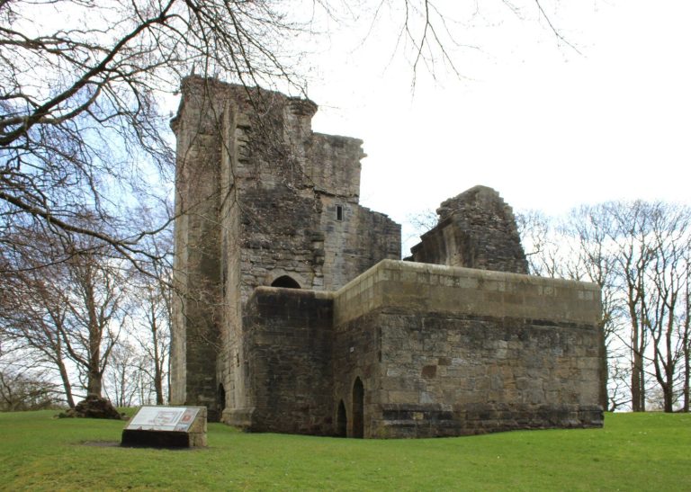
Enclosed basins where boats could load, unload or wait served Paisley and Johnstone. A wharf stood on the north bank of the White Cart near Crookston Castle. An inn was built at Port Eglinton in 1816.
River Cart Aqueduct
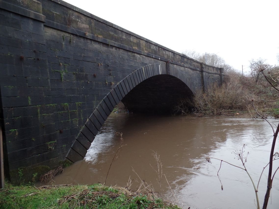
The River Cart Aqueduct, which carries a route over a river, remains in use by the railway. The railway crosses it at an angle.
Tannahill’s Hole and Candren Burn
Tannahill’s Hole was a deep pit through which stream water passed into a covered channel beneath the canal. The Candren Burn tunnel also ran under the canal.
Surviving canal stretches
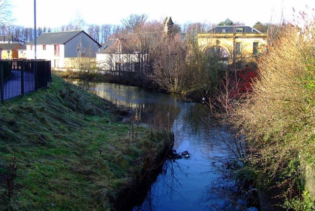
Short stretches of the canal remain around Millarston and Ferguslie Mills in Paisley. Houses on Tenters Way and Cromptons Grove face across canal remnants, and traces of the route can be seen in fields between Hawkhead and Rosshall.