Main Market Square in Kraków: Medieval Market and Civic Centre
Site at a Glance
- Popularity
- Very High
- Country
- Poland
- Primary era
- Medieval
- Eras represented
- Medieval, Early Modern, Modern
- Civilizations
- Austria-Hungary, Habsburg, Kingdom of Poland, Polish–Lithuanian Commonwealth
- Site type
- Economic
- Remains
- Market
On this page21 sections
History
Charter and medieval market
The Main Market Square is a historic trading and civic centre in Kraków, Poland. It was laid out on 5 June 1257, when the city received Magdeburg rights, a system of urban law that provided for local self-government and regulated municipal affairs and commerce. The charter followed the destruction of Kraków during the Mongol invasion of 1241, a campaign that brought Mongol forces into Central Europe. The new market was intended to serve residents and merchants travelling along trade routes.
Three municipal officials, or reeves, Gedko Stilvoyt, Jakub of Nysa, and Dytmar of Wrocław, planned the square on a regular grid, adapting it to traces of earlier settlement at Okół. The market became the city’s principal trading place. It initially belonged to the ruler, but in 1358 Casimir III the Great transferred the ruler’s rights to most properties there to the city. Kraków’s membership in the Hanseatic League, an association of trading towns, from 1387 formed part of the city’s wider commercial life.
The square is mentioned from around 1300 under names including Rynek, Ring, Circulus, and Forum. It later became known as Rynek Główny, or Main Market Square. Ring referred to the street that ran around the market. Between the 14th and 18th centuries, distinct parts of the square were associated with different trades. The Chicken Market probably ran from Sławkowska Street to Floriańska Street. The Salt Market, noted in 1343, occupied the northwest corner between the Cloth Hall and the outlet of Szczepańska Street. The Coal Market lay between the Town Hall and the area from Wiślna to Bracka streets, while the Lead Market extended from Bracka Street to Grodzka Street.
Jewish merchants traded in the square from at least the 15th century and rented rooms in aristocratic buildings, including the Grey House. The Jewish Market was situated between St. Adalbert’s Church and the outlet of Sienna Street, opposite the Grey House; a market serving Jewish traders was established near Sienna Street in the early 17th century. A place beside the Cloth Hall’s south wall, probably opposite Bracka Street, was called Na Goldzie. In the 17th and 18th centuries it was also known as the dais or the theater.
Trade, civic life, and royal ceremonies
The square and its surrounding buildings developed as a commercial and civic centre from the late 13th century through the 14th century. From the mid-16th century, townhouse ground floors increasingly accommodated shops, storage rooms, and money changers. A bank office operated in the Pod Krukiem townhouse, and a post office was established in the Montelupi townhouse.
The square formed part of Kraków’s Royal Road, a ceremonial route from the city’s northern entrance through the Old Town to Wawel, the royal residence. Royal entries, homages, triumphs, and parades took place there during the Renaissance and early Baroque periods. In 1364, Casimir III held the Congress of Kraków in the square. Konstanty Ostrogski led a victory parade there in 1514 after campaigns against Muscovy, and Jan Tarnowski celebrated another victory in the Muscovite wars in 1531.
On 10 April 1525, Albert Hohenzollern, Duke of Prussia, paid homage to Sigismund I the Old, king of Poland and grand duke of Lithuania. In 1683, Jan III Sobieski celebrated his victory at the Battle of Vienna in the square. Kraków ceased to be the capital of the Polish-Lithuanian Commonwealth, the state formed by the union of Poland and Lithuania, when Sigismund III Vasa moved the capital to Warsaw in 1596. The city nevertheless continued to host royal coronations and funerals.
The square also served as a place of public punishment, including executions accompanied by torture. One recorded execution was the beheading of Andrzej Wierzynek, grandson of Mikołaj.
Political change and the modern city
On 3 May 1791, soldiers swore allegiance to the Constitution of 3 May in the square. On 24 March 1794, military commander and political leader Tadeusz Kościuszko swore an oath to the nation and took command of the Polish armed forces, beginning an uprising against foreign rule known as the Kościuszko Uprising. In 1809, Prince Józef Poniatowski entered Kraków, and Polish troops occupied the square’s guardhouse. Balls were held in the Cloth Hall in Napoleon’s honour.
The square saw military events during the Kraków Revolution of 1846 and the Spring of Nations, a wave of European revolutions and uprisings in 1848. In 1918, Austrian eagles were piled beside the Town Hall to mark the recovery of Polish independence. By Senate resolution, the Town Hall was demolished between 1817 and 1820, leaving its tower. In 1882, Austrian authorities introduced townhouse numbering and divided the square’s frontages into four lines, A–B, C–D, E–F, and G–H, each bounded by streets or the square.
Kraków’s first horse-drawn narrow-gauge tram line crossed the square in 1882, which later became the city’s principal tram junction. Authorities decided to remove the tracks in 1951 despite opposition from specialists. The last standard-gauge tram crossed on 27 June 1952, and narrow-gauge service ended on 13 February 1953; the tracks were dismantled several years later.
Occupation and public memory
During the German occupation, the square was renamed Adolf-Hitler-Platz in 1940. The Adam Mickiewicz Monument was destroyed, and commemorative plaques were removed from buildings. The square’s prewar name returned on 18 January 1945, and the monument was rebuilt after the war.
On 21 March 1980, Walenty Badylak, a retired baker and veteran of the Polish underground Home Army resistance, chained himself to a well and set himself alight. His protest challenged the communist government’s refusal to acknowledge the Katyn massacre, the 1940 killing of Polish prisoners by Soviet forces, as a war crime. The square also became a central setting for mass demonstrations by Solidarity, a Polish trade-union and pro-democracy movement.
Car traffic was barred from the square on 4 January 1979. As part of Kraków’s Historic Centre, it entered the UNESCO World Heritage List in 1978; in 1994, it was included in Poland’s Historic Monument designation for the city’s historic urban complex. Archaeological investigations revealed foundations of the former weighing houses, incorporated into an underground museum that opened in 2010. The nativity-scene competition, begun in 1937, remains a tradition associated with the square.
Remains
Plan and urban setting
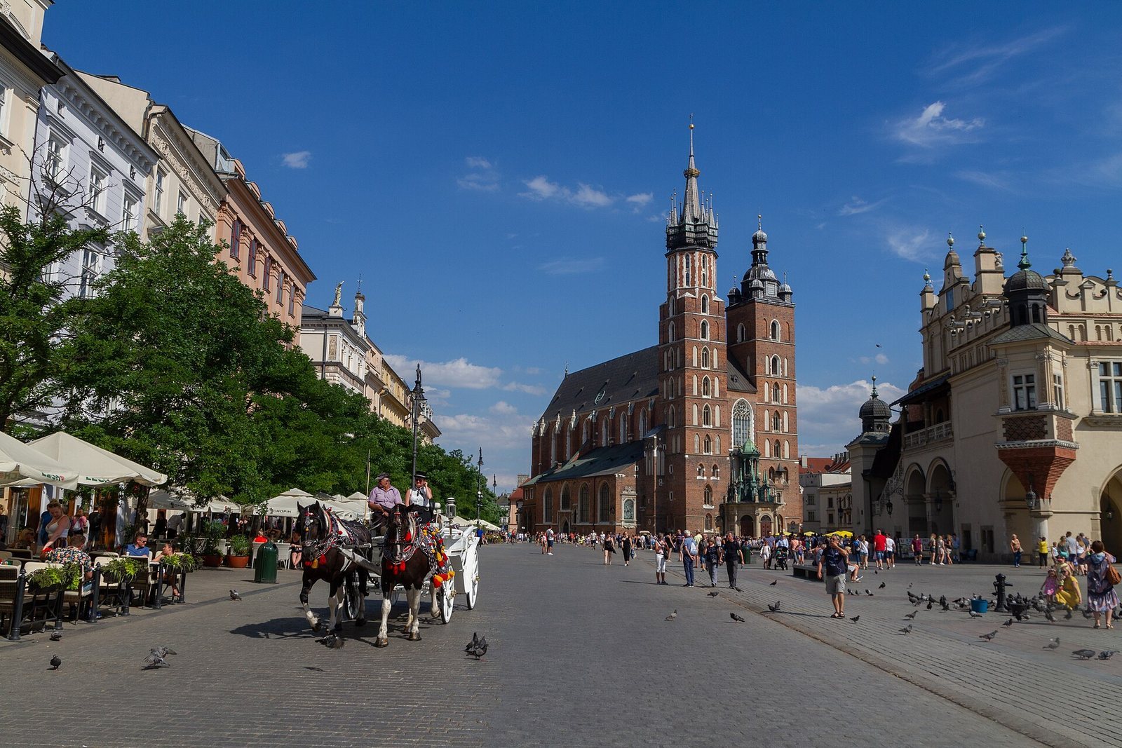
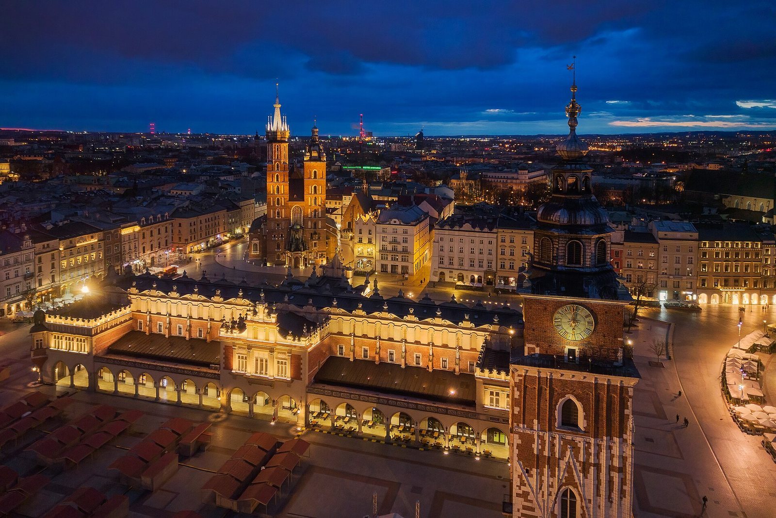
The square measures about 200 by 200 metres and covers roughly four hectares, occupying four blocks in Kraków’s grid-planned Old Town. Eleven principal streets meet it. Three parallel streets lead away from each side, except for Grodzka Street, which probably predates the 1257 charter. Świętego Jana, Sienna, Bracka, and Szewska streets cross near the centre at the Cloth Hall’s cross, dividing the area into four administrative quarters known as Sławkowski, Butchers’, Grodzki, and Potters’.
The Royal Road crosses the market on its way from the northern fortifications through the Old Town and Okół to Wawel. St. Mary’s Square, around St. Mary’s Basilica, adjoins the market to the east, while the smaller Mały Rynek lies farther east. The southern part of the square follows the form of the earlier settlement at Okół. Its level has risen by more than five metres in places since its establishment, a change particularly apparent near St. Adalbert’s Church and St. Mary’s Basilica.
Churches
St. Adalbert’s Church
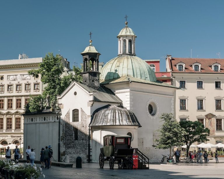
St. Adalbert’s Church stands in the southern part of the market, near the funnel-shaped opening of Grodzka Street. The small church dates to the 11th century and predates the 1257 charter. Originally Romanesque, it contains a small archaeological museum in its cellar.
St. Mary’s Basilica
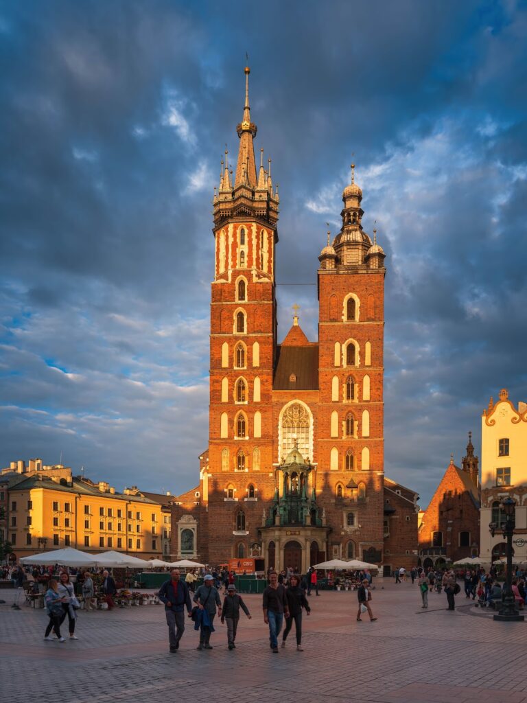
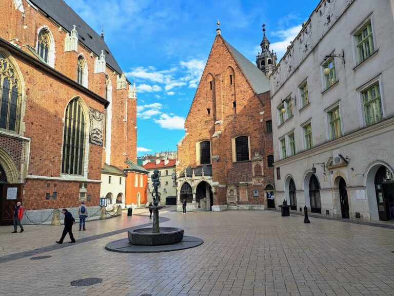
St. Mary’s Basilica occupies the northern part of the square’s eastern block. A parish church stood here from 1223; the original Romanesque building was destroyed in the Mongol raid of 1241. The present Gothic church was built in the 14th century. Its towers rise above the square, and its altar was made by the late-medieval sculptor Wit Stwosz. A short trumpet signal, the heynal, is played hourly from the highest tower.
Market and civic structures
The Cloth Hall
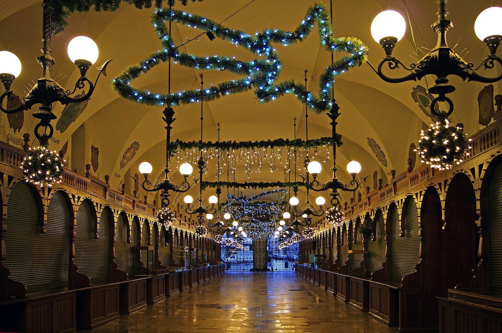
The Cloth Hall stands at the centre of the square. Established as a cloth-trading centre in the 14th century, it was rebuilt in the Renaissance style after a fire in 1555. Carved masks decorate its attic parapet, and arcades were added in the 19th century. A surviving line of stalls runs between rooms used for measuring cloth at the north and south ends; the northern room later became known as Syndykówka. The ground floor remains in commercial use, while the upper floor houses a gallery of the National Museum.
The Rich Stalls
The Rich Stalls were built east of the Cloth Hall in the second half of the 13th century for the sale of luxury goods. The complex contained 64 chambers and had a form similar to the Cloth Hall. Its underground area, on the Sienna Street side, covers about 1,200 square metres.
The Town Hall and weighing buildings
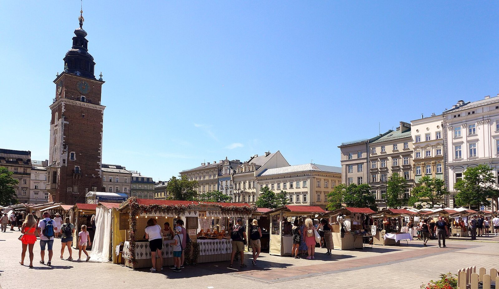
The Town Hall complex included a notary’s house and a granary, and the Town Hall itself occupied nearly a quarter of the square. Its surviving tower stands beside the Cloth Hall. The Great Weigh House, also called the Lead Weigh House, stood between the Cloth Hall and St. Adalbert’s Church. The Small Weigh House, where wax was weighed, stood east of the Rich Stalls. Excavated foundations of both weighing buildings are incorporated into the underground museum.
Water, paving, and underground spaces
Reservoirs and paving
Wooden water reservoirs stood near the square’s corners and received water through a supply system. Archaeological investigations have revealed their remains. The first paving was laid in the second half of the 14th century.
Cellars and subterranean remains
Underground spaces beneath the square include a passage connecting the Town Hall Tower and the Cloth Hall, as well as a medieval hall beneath the Cloth Hall’s main hall. The latter is about 100 metres long and five metres high. Cellars beneath St. Adalbert’s Church and the Rich Stalls on the Sienna Street side also form part of the underground remains.
Townhouses and palaces
Buildings around the square
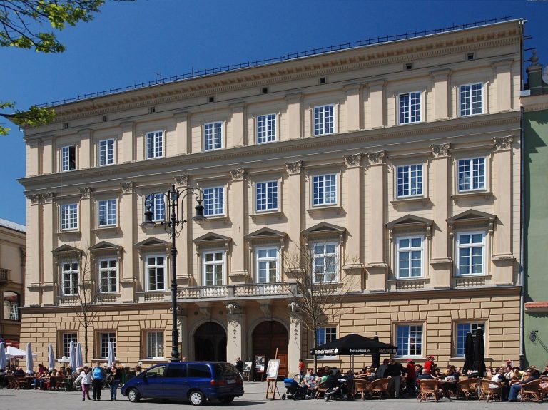
Historic townhouses and palaces line the square. Named examples include the Margrabska townhouse, Pod Krzysztofory Palace, Zbaraski Palace, the Grey House, the Hetman’s townhouse, the Montelupi townhouse, the Palace Under the Rams, and Spiski Palace. Spiski Palace was built in the late Baroque style around the turn of the 17th and 18th centuries. The Hetman’s and Margrabska townhouses, the townhouse Pod Ewangelistami, and the Grey House were remodelled around the same period.
Historic interiors and cellars
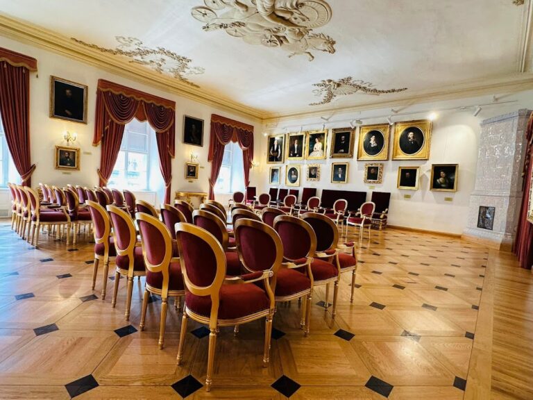
Many buildings around the market are several centuries old. Although many took on Neoclassical appearances, older fabric remains visible in doorways, architectural details, and interiors. Medieval cellars now house pubs, restaurants, and cabarets; the Palace Under the Rams contains the Piwnica pod Baranami cabaret.
Monuments and commemorative features
The Adam Mickiewicz Monument, first erected in 1898 and later rebuilt, stands near the Cloth Hall and St. Adalbert’s Church. Other features include a monument to cabaret creator Piotr Skrzynecki, a sculpture by Igor Mitoraj, plaques marking Poland’s accession to the European Union, the Kościuszko Uprising, and the 1525 Prussian Homage, and a well named for Walenty Badylak. A knife historically used to mutilate condemned prisoners hangs in a passage through the Cloth Hall.