Nybster Broch: An Iron Age Atlantic Roundhouse in Scotland
Site at a Glance
- Rating
- 4.7
- Popularity
- Very Low
- Country
- United Kingdom
- Primary era
- Iron Age
- Eras represented
- Iron Age, Medieval
- Civilizations
- Unclassified
- Site type
- Military
- Remains
- Fort
On this page14 sections
History
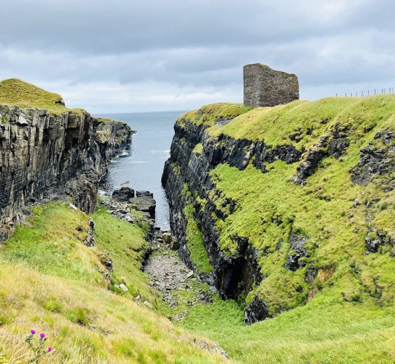
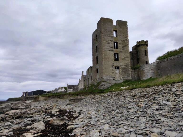
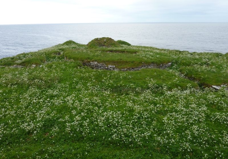
Nybster Broch is an Iron Age Atlantic roundhouse in the United Kingdom, at Nybster on the east coast of Scotland. Built as part of a coastal complex during the Iron Age, it occupies a sea-facing promontory above the North Sea and is generally classified as an early broch. A broch is a substantial Iron Age stone tower found only in Scotland, while an Atlantic roundhouse is the broader class of prehistoric circular stone buildings concentrated along Scotland’s Atlantic and northern coasts.
Early Defences and the Broch
The earliest defensive phase consisted of a stone wall about 2.5 metres thick, blocking the landward approach to the promontory. This wall was later incorporated into a secondary wall about 5 metres thick, built behind a deep ditch cut into the bedrock. The original passage was destroyed and replaced by a new entrance that included a guard cell, a small chamber beside an entrance passage associated with controlling access.
A blockhouse probably predates the broch and may belong to the first century BC or slightly earlier. It formed part of a promontory fort, a defended settlement or enclosure on projecting land that could use steep slopes or water as natural protection. The blockhouse was later associated with the broch complex, whose solid-based tower represents a subsequent stage in the development of the site.
Nybster Broch lacks intramural cells and a scarcement ledge, features commonly associated with brochs. Intramural cells are small chambers built into a wall, while a scarcement ledge is an inward-projecting ledge that can support an upper wall or floor. The absence of these features has led to its classification as an early broch rather than a typical example of the form.
Later Reuse and Burial Activity
Smaller buildings spread across much of the cliff after the broch was constructed. The cell-like buildings near the eastern tip are interpreted as evidence of later Pictish reuse. Pictish communities occupied parts of northern and eastern Scotland during the later first millennium AD, and Pictish reuse means that an earlier Iron Age structure was occupied or adapted by them.
After the collapse of the broch wall, stone cists were inserted into the remains. A stone cist is a small stone-built burial container or chamber. The cists may have held Pictish or Viking burials, but no burials survived. Their insertion indicates that the ruined structure continued to be used after its original defensive and domestic functions had ended.
Excavation and Changing Interpretation
Sir Francis Tress Barry excavated Nybster Broch in 1896. Barry, a landowner and former mining-industry worker, was an early archaeological user of photography and concentrated particularly on tracing the arrangement of the structures. His work is represented by surviving photographs and paintings by John Nicolson, although few excavation records remain.
Spoil from the 1896 excavation was left on the site. Two spoil heaps remain east of the broch, while heaps on the western side were still present during the first half of the twentieth century and were mistaken for defensive works during the 1960s. A ditch about 6 metres wide was recorded west of the blockhouse in the early twentieth century but could no longer be identified in the 1960s.
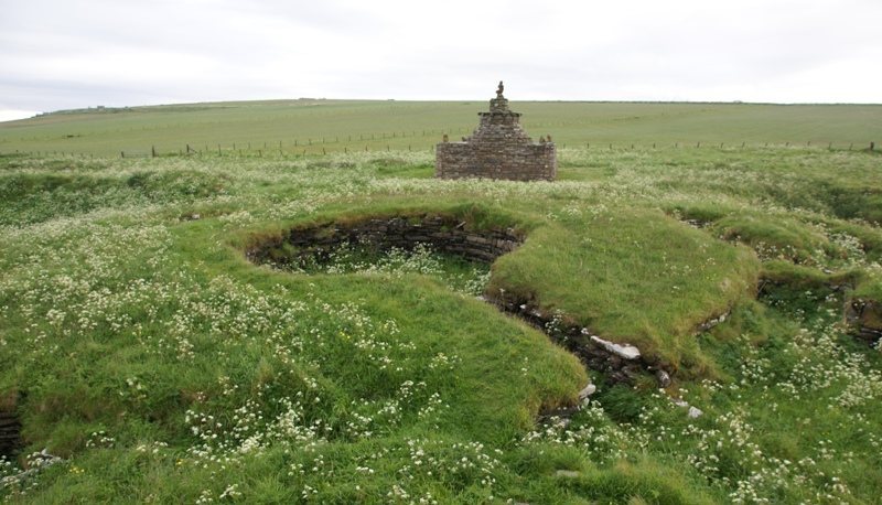
John Nicolson built a monument to Francis Tress Barry, known as Mervyn’s Tower, on the spoil heaps east of the broch during the twentieth century. Its construction destroyed several subsidiary buildings. The monument was later moved to the west side of the blockhouse to reduce the risk of its collapse and to protect the broch and associated buildings. Preliminary investigation took place in 2005, followed by further excavation in 2011. The later work examined the collapsed broch wall, the sequence of defences, and the cell-like buildings at the eastern end of the promontory. Nybster Broch is protected as a Scheduled Monument, a site given legal protection because of its national archaeological or historical importance.
Remains
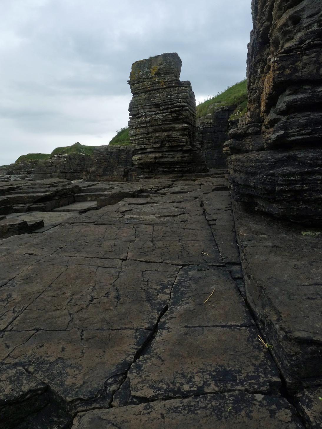
The complex occupies a sea-facing cliff about 55 metres long and 37 metres wide on its landward side. The broch stands within a defended arrangement that includes the earlier blockhouse, a substantial secondary wall, a ditch, and later buildings spread across the cliff. The broch entrance faces northeast towards the sea, while the blockhouse extends across the full width of the promontory.
Broch and Defensive Works
The Broch
The broch is circular and solid-based, meaning that its lower wall is solid rather than containing internal galleries or chambers. Its interior is approximately 5 metres in diameter, enclosed by a massive wall about 8 metres thick. The surviving wall reached 1.6 metres at its highest point in 1910, although the full original height cannot be established from the remains.
The entrance is 0.9 metres wide and extends 4.3 metres into the wall. About 3 metres along the passage are opposing sockets for door bars. Inside the broch are remains of a hearth, internal divisions, and storage tanks. The wall collapse later became the setting for stone cists, which altered the use of the structure after its original occupation.
The Blockhouse
The blockhouse crosses the entire width of the cliff. Its passage runs southwest to northeast through the structure, from the landward side towards the sea. The walls are about 3 metres thick at the ends and 4.5 metres thick at the centre, where the entrance is located. The passage measures 1.1 metres across at the southwest end and widens to 1.2 metres at the northeast end.
This is a ground-galleried blockhouse, a structure whose wall has two parallel faces with a passage between them at ground level. The entrance passage contains sockets for the bolts of two doors. On the inner, seaward side, a five-step stairway lies both south and north of the passage. Each stair begins at ground level and rises to the surviving height of the blockhouse.
The Secondary Wall and Guard Cell
The later defensive wall was built on bedrock. Excavation exposed its collapsed stonework, large blocks, and areas where the bedrock had been worked. A narrow passage behind the wall was formed by vertical slabs. When closed, this passage also blocked the adjacent stairway, whose lower section included a stone pivoting element.
The guard cell incorporated into the wall had a paved floor. It was reached from inside by a stairway that rose onto the wall before descending into the chamber. A quern stone, used for grinding grain or other materials, had been built into the cell wall. The defensive sequence also included the destruction of the original entrance and its replacement by the passage associated with the guard cell.
Later Buildings and Excavated Deposits
The Large Oval Building OB4
The later buildings across the cliff vary from oval and circular forms to irregular plans. One of the excavated examples, the large oval building OB4, contains cells at its northeast and southwest ends. Its surviving floor areas include several paved surfaces and multiple hearths, some of which show repeated use. Trenches cut by Tress Barry’s 1896 excavation remained visible along the walls.
A fishbone object was found beneath the southern cell of OB4, and small bone fragments lay beneath paving stones inside the building. These remains belong to the material recovered from the later occupation of the cliff complex, alongside hearths, animal remains, tools, pottery, and other objects.
The Smaller Buildings OB2E and OB2W
OB2W contained a hearth made from a stone slab surrounded by a ring of oval beach stones. Other hearths, including triangular and rectangular examples, had been removed during the 1890s excavation. In one corner of OB2E, a collapsed stack of slabs concealed several layers of burned material.
The deposit in OB2E contained animal bones, fish bones, stone tools, pottery sherds, and a fragment of Roman glass. It appears to represent a midden, a refuse deposit built up through past occupation. The material lay above thermally damaged slabs and partly within a stone arch, beneath which further burned layers survived.
Artefacts and the Cist Deposit
Finds from the 1896 excavation included a second-century Roman Samian-ware pottery sherd, bone and stone objects, a bone comb with a long handle, and remains of quern stones. Samian ware was fine Roman tableware, usually red-slipped and often mould-made or decorated. Work in 2005 recovered numerous pottery sherds, bone objects including needles and awls, and a bronze spiral ring from the broch and surrounding buildings.
The 2011 excavation produced an egg-shaped serpentine pendant from a deposit associated with the later cists. The site also yielded burned materials, animal and fish bones, stone tools, pottery sherds, a Roman-glass fragment, and other bone objects. Together, these finds preserve evidence for activity at the broch and its associated buildings across several phases of use.
Mervyn’s Tower
Mervyn’s Tower was originally positioned east of the broch on excavation spoil heaps. It was later relocated to the west side of the blockhouse, changing its position in relation to the broch and the associated buildings. The monument’s first construction destroyed several subsidiary buildings, while its later movement was intended to reduce the risk of collapse and protect the archaeological remains.