Nemyriv Hill Fort: A Scythian-Period Hill Fort in Ukraine
Site at a Glance
- Rating
- 4.7
- Popularity
- Low
- Country
- Ukraine
- Primary era
- Iron Age
- Eras represented
- Stone Age, Iron Age, Medieval
- Civilizations
- Kievan Rus, Scythian
- Site type
- Military
- Remains
- Fortified Town
On this page13 sections
History
Nemyriv Hill Fort is a multilayered archaeological site in Ukraine, near Nemyriv in Vinnytsia Oblast, whose principal settlement was founded by Scythian-period communities in the 8th century BC. It developed as an eastern Podolian or Southern Bug regional expression of the forest-steppe culture of the Scythian period and became an influential administrative, economic, or cultic centre. Located on the left bank of the Southern Bug, about 10 kilometres from the river, the site preserves evidence of occupation from the 4th millennium BC to the medieval period.
Early settlement and Iron Age development
The area was first settled in the 3rd millennium BC by communities of the Trypillia culture, a prehistoric farming tradition known for settled villages in eastern Europe. A middle-stage Trypillia settlement from the beginning of the 4th millennium BC has also been identified at Nemyriv. The earliest Iron Age layers belong to the Chernoles culture, a forest-steppe tradition of the region north of the Black Sea.
The major fortified settlement was established in the 8th century BC, with one archaeological dating placing its foundation around 740 BC. Other chronological summaries place the Scythian occupation broadly between about 700 and 500 BC, or within the period from approximately 800 to 750 BC for its early phase. Much of the later population was associated with the Holigrad group of the late Gava-Holigrad culture of the eastern Carpathian region. Cultural influences from the Basarabi and Bîrsești-Ferigile traditions, as well as from the East Hallstatt cultural sphere of Central Europe, show that the settlement was connected to communities beyond the Southern Bug region.
These cultural connections may have resulted from migration, the movement of captured women and craftspeople, or voluntary movement along established trade routes. During the Early Scythian period, the inhabitants practiced agriculture and stockbreeding. Nemyriv became one of the largest Scythian settlements between the Dniester and Dnieper and served as an important centre within the surrounding region.
Trade and decline
Nemyriv maintained especially close commercial relations with Greek cities. These contacts continued to the middle of the 7th century BC, when pottery from Rhodes and Samos reached the settlement in exchange for wheat and furs. The site also traded with the North Pontic region, including the Greek city of Olbia. These links connected the fortified settlement to wider exchange networks around the Black Sea.
Occupation declined around the end of the 6th century BC or during the transition from the 6th to the 5th century BC. By the beginning of the 5th century BC, the Scythian-populated area of Podolia had been abandoned. Settled communities may have withdrawn beyond the Carpathians after repeated attacks by nomadic Scythians, although the precise course of this movement remains uncertain.
Medieval settlement and modern investigation
In the 10th century AD, the Ulichi, an East Slavic tribal group associated with the Dniester and Southern Bug regions, established a settlement called Myriv on the site. By the end of that century, the Ulichi had become part of Kyivan Rus, the medieval East Slavic polity centred on Kyiv. The settlement was destroyed during the Mongol invasion in the 13th century and was later rebuilt elsewhere. The site was first mentioned under the modern name Nemyriv in 1506.
From 1862, the hill-fort territory belonged to Count Grigory Stroganov, who removed local peasants from the land and carried out destructive excavations in search of valuable objects for his collection. Illicit treasure hunting also damaged or destroyed archaeological materials. The first scientific expedition took place in 1909 under Professor S. S. Gamchenko, followed by excavations led by Professor A. A. Spitsyn in 1910. G. D. Smirnov began further work in 1941, but the excavations were interrupted by the war.
Postwar research included the Southern Podolian Expedition of the Leningrad Branch of the Academy of Sciences of the USSR, directed by M. I. Artamonov in 1947, 1948, and 1955. An expedition from Kharkiv University, directed by A. A. Moruzhenko, worked at the site in 1966, while P. I. Khavlyuk of the Vinnytsia Pedagogical Institute led investigations of the ramparts in the late 1980s. More than 3,700 square metres have been excavated, revealing residential, utility, and production structures from Trypillia, Scythian, and Slavic cultural horizons. Nemyriv Hill Fort is designated an archaeological monument and an immovable monument of national significance of Ukraine, under reference number 020018-N.
Remains
Fortified landscape
Outer enclosure
The hill fort covers more than 145 hectares and has an approximately oval plan, extending up to 1.5 kilometres along its longer axis and up to 1.2 kilometres along its shorter axis. A small stream crosses the site from west to east, dividing it into unequal northern and southern sections. The northern area occupies about two-thirds of the site, while the southern area covers about one-third and contains marshland and low hills.
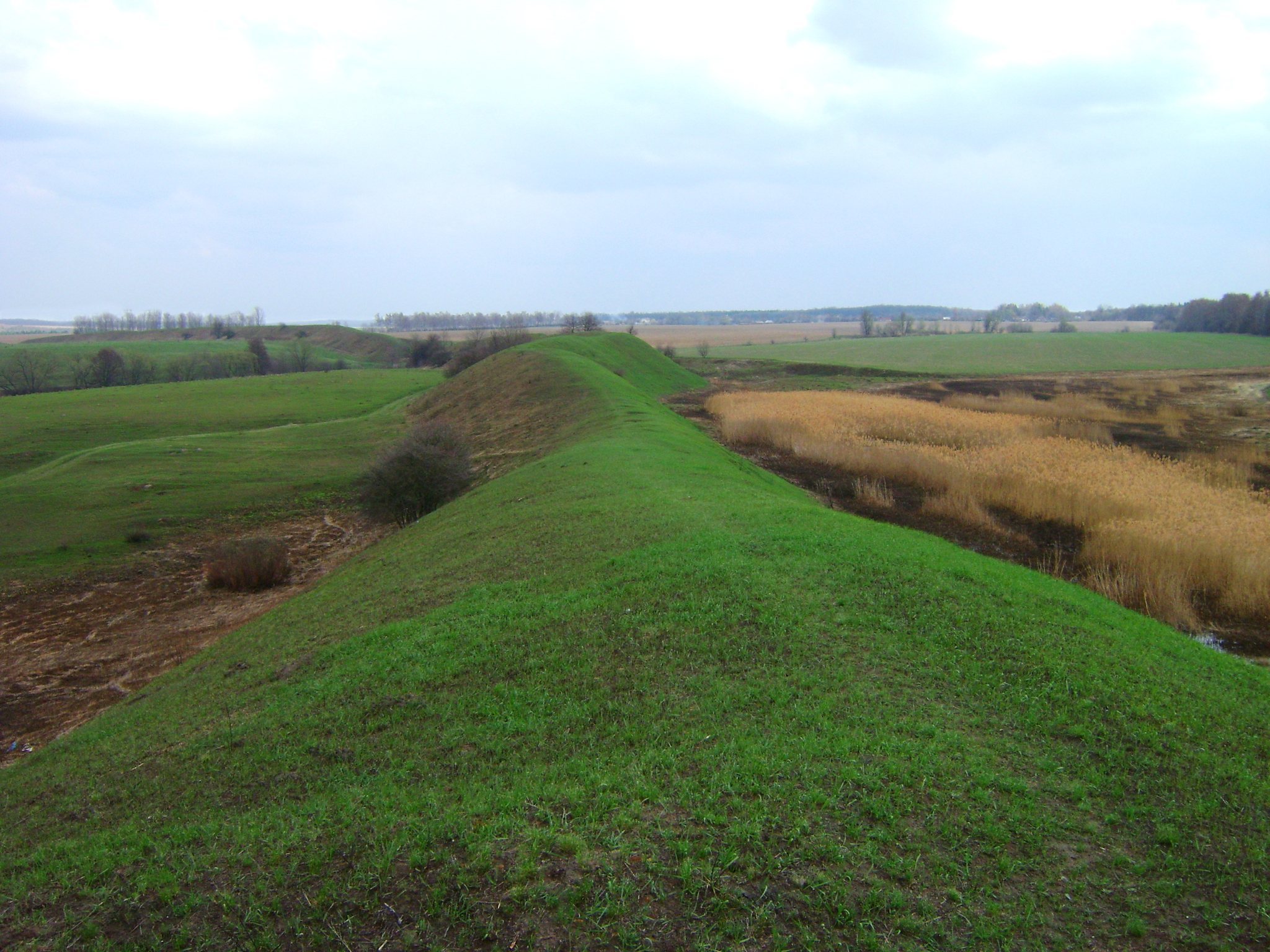
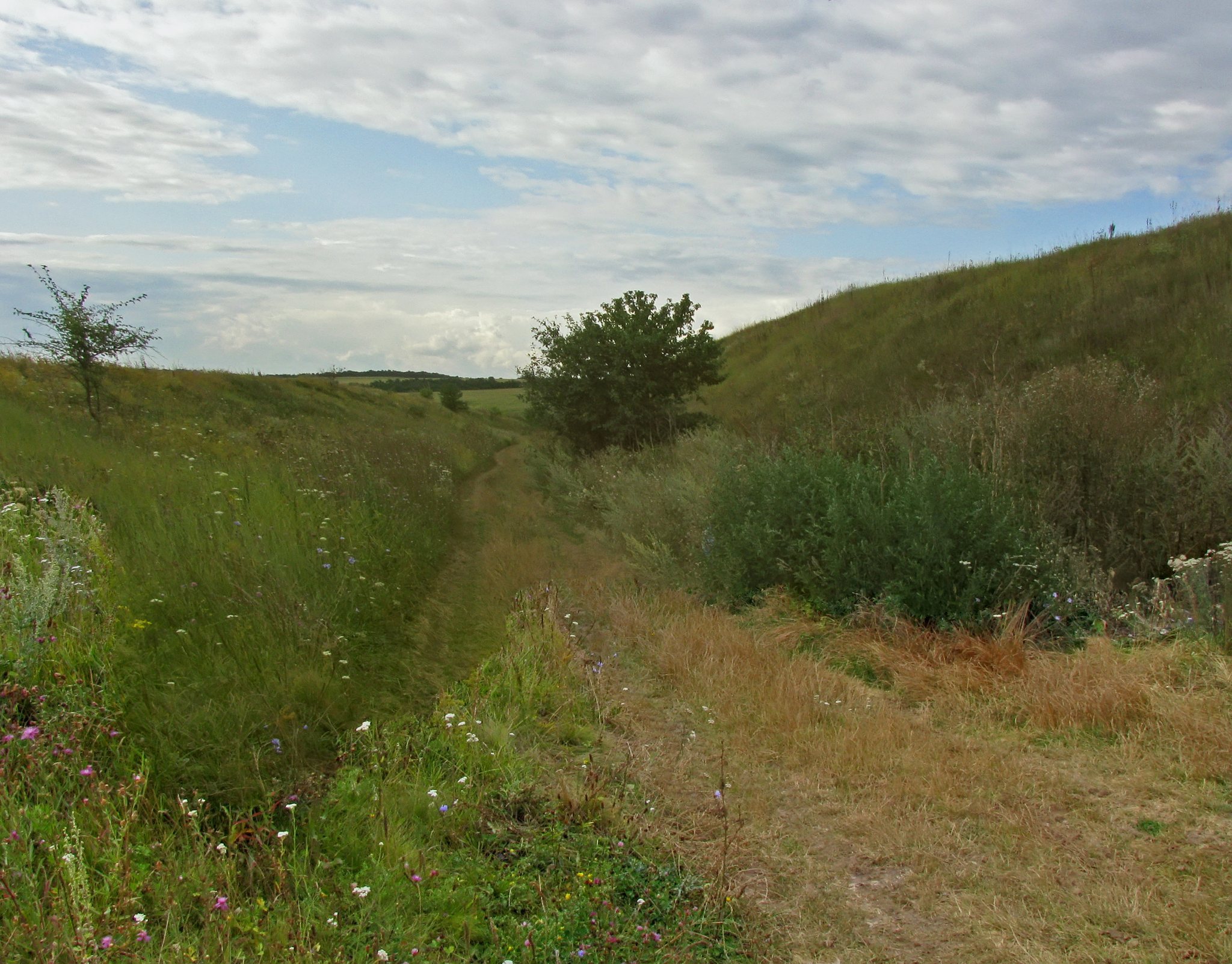
The northern section lies beside the stream’s high, steep bank and is divided by two ravines into three areas. A large earthen rampart and ditch enclosed the settlement for more than 4 kilometres, with the perimeter also described as about 4.5 kilometres. Some stretches had a second rampart. The enclosing earthwork was interrupted at eight points, including six openings for streams and ravines. Openings for the main stream reached 60 metres in width, those for smaller streams reached 30 metres, and settlement entrances measured up to 10 metres. Wooden structures blocked these gaps.
The rampart generally survives at 5 to 10 metres high, with some sections measuring 7 to 9 metres high and about 32 metres wide. Its original height is thought to have exceeded 30 metres. The ditch reached 7 metres in depth, measured up to 26 metres wide at the top, and was about 10 metres wide at the bottom. Large stones and logs reinforced the base of the rampart. The defended slope had an incline of about 45 to 71 degrees, with especially steep terminal sections.
Central citadel
The most densely occupied part of the settlement was its central inner fortification, or citadel, a strongly defended area within the larger site. It stood on the highest part of the northern bank, with ravines adjoining it to the east and west. A rampart and ditch protected it on the north, while smaller ramparts followed the ravines, whose slopes had been artificially cut. The remainder of the enclosed area was more lightly built and was used for livestock enclosures. It may also have provided refuge for people from nearby settlements during wartime.
Buildings and household features
Residential structures
Seven rows of dwellings occupied the citadel in a staggered, chessboard-like arrangement. The houses were spacious, round-plan semi-subterranean structures built with posts and framing. They measured about 21 metres in length, 12 metres in width, and 3 metres in height. A central post supported each conical roof, which was made from straw or reeds. Vertically set logs formed the walls, and clay covered their surfaces. Each house had an open hearth lined with clay at the centre of its earthen floor.
Storage and ritual deposits
Grain pits and ash pits lay between the houses. The ash pits contained fragments of clay vessels, bronze ornaments, bone and stone artefacts, horse harness, and agricultural and domestic tools. Some objects carried Scythian animal-style decoration, an artistic tradition based on stylized images of horses, livestock, wild animals, reptiles, and birds.
A cultic ash pit stood within the central fortification. Its contents and position probably connected it with a household-hearth cult. Three burials dating to the Scythian period were also found inside the citadel. Elsewhere on the site, excavated semi-subterranean houses, utility pits, and hearth bases belong to the Trypillia, Scythian, and Slavic cultural horizons.
Pottery and craft evidence
Locally made vessels
Pottery made by local craftspeople includes bowls, pots, and ladles with carefully proportioned forms and black burnished surfaces. Grooves decorate many of the vessels. Other ornament was applied by hand or with stamps, using parallel incisions filled with white paste to create fine patterns against the dark surface. Together with the tools, ornaments, harness, and animal-style objects from the pits, these vessels illustrate the domestic and craft activities carried out within the fortified settlement.