Nagae-Sakurayama Kofun Cluster: Early Kofun-Period Burial Mounds in Japan
Site at a Glance
- Rating
- 4.3
- Popularity
- Very Low
- Country
- Japan
- Primary era
- Classical
- External website
- Open
- Eras represented
- Classical
- Civilizations
- Unclassified
- Site type
- Burial
- Remains
- Necropolis
On this page10 sections
History
The Nagae-Sakurayama Kofun Cluster in Zushi, Japan, is a group of two keyhole-shaped burial mounds built during the fourth century, in the early Kofun period. A kofun was a monumental burial mound used in Japan mainly between the third and seventh centuries, and its form often expressed the status and political connections of regional leaders. The identities of the people buried at Nagae-Sakurayama remain unknown.
Discovery and investigation
The mounds were identified in 1999 after woodland on a ridge along the Zushi and Hayama boundary was cleared for a planned mobile-phone transmission tower. An archaeological enthusiast had suspected since around 1994 that the ridge contained a kofun. Fragments of haniwa, clay funerary objects placed on or around burial mounds, were recovered from the construction area, prompting a formal investigation and the cancellation of the tower project.
The first mound became known as Nagae-Sakurayama Kofun No. 1. A possible second mound approximately 500 meters to the west was initially difficult to recognize because no artifacts had been found there. A test excavation in June 1999 confirmed that it too was a kofun, and it was designated No. 2. The boards of education of Zushi, Hayama, and Kanagawa then investigated the terrain jointly. No. 1 was surveyed in July 1999, No. 2 was surveyed in February 2000, and excavations in April and May 2000 established the boundaries of the mounds. The Kanagawa Archaeological Foundation carried out the 2000 investigations on commission from the three boards. Further excavations began in fiscal year 2006 to establish the precise size and structure of both mounds.
Historical importance
The two mounds are the only known keyhole-shaped tumuli on the Miura Peninsula and rank among the largest early Kofun-period mounds in the Kanto region. No earlier kofun are known around the peninsula, and mound construction there did not resume until approximately the middle of the fifth century or later, about a century after this cluster was built. The order in which No. 1 and No. 2 were constructed remains uncertain because their forms and excavated artifacts have not established a definite sequence.
The scale of the mounds, their pot-shaped and cylindrical haniwa, the stepped construction confirmed on No. 1, and the stone facing of No. 2 give the cluster a more fully developed form than other early Kanagawa kofun, including the Akibayama Kofun Cluster. These characteristics are interpreted as evidence that the people buried here had stronger connections with the central Yamato polity than occupants of other early mounds in Kanagawa. The Yamato polity was the early centralized power based in the Kinai region around present-day Nara and Osaka, whose influence is associated with the spread of standardized keyhole-shaped tombs.
The ridge occupied a historically important position overlooking routes between the Kinai region, Sagami, and the Boso Peninsula. From the Miura Peninsula, maritime traffic toward the Boso Peninsula passed within the wider setting associated in tradition with Yamato Takeru, a semi-legendary Yamato military prince said in ancient chronicles to have traveled through eastern Japan. The area later lay along the ancient Tokaido route until the Nara period. The placement of Nagae-Sakurayama has been compared with the somewhat earlier Mashido-Otsukayama Kofun near Hiratsuka, another large mound located at a transport junction rather than in a major production plain.
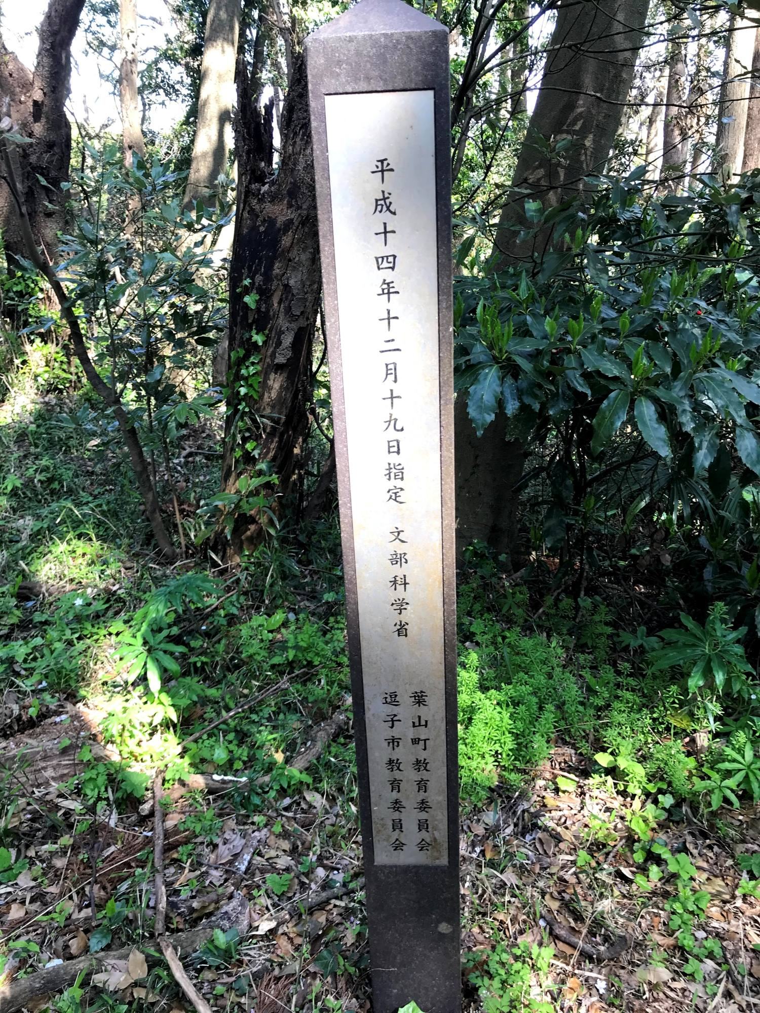
The Nagae-Sakurayama Kofun Cluster became a National Historic Site on December 19, 2002. The designation recognized its unusually large scale, close resemblance to standardized Kinai-style keyhole mounds, rarity in the Kanto region, and good preservation after the mounds remained undiscovered until 1999. Zushi City and Hayama Town cooperate in preserving and maintaining the tumuli.
Remains
The cluster occupies small peaks along a ridge on the boundary between Zushi City and Hayama Town. Both mounds extend across the municipal boundary and stand approximately 500 meters apart. Each has the characteristic keyhole plan, with a circular rear section joined to a projecting rectangular front section. The mounds were formed by cutting the hill’s bedrock and adding earth fill, but their construction details differ in important ways.
Nagae-Sakurayama Kofun No. 1
Form and construction
No. 1 has a total length of 90 meters, making it the largest known kofun in Kanagawa Prefecture. It stands at an elevation of 127.3 meters. The rear circle measures 51 meters in diameter, while the projecting front section is 39 meters long. The front points south-southwest and the rear points north-northeast, giving the mound a broadly northeast to southwest axis.
The mound was shaped from the hill’s bedrock and then built up with earth. A terrace approximately 2 meters wide demonstrates stepped construction, with three steps around the rear circle and two tiers on the front section. Haniwa were arranged in a circle across the level surface at the top of the rear section. The finds include pot-shaped haniwa, cylindrical haniwa, and fragments of Haji ware, an unglazed earthenware pottery made in ancient Japan. No grave goods have been recovered.
Burial area and condition
A depression approximately 7 meters long in the center of the rear section has been identified as a burial chamber. It contained a wooden coffin covered with clay. Parts of the northern and eastern sides have collapsed. The irregular outline of the rear section was once attributed to later collapse, but investigation indicates that it may already have been irregular when the mound was built.
Nagae-Sakurayama Kofun No. 2
Form and orientation
No. 2 is approximately 88 meters long and stands at an elevation of 101.5 meters. Its rear circle measures 54 meters in diameter, and its front section is 34 meters long. The mound follows an approximately east to west alignment, with the front section to the west and the rear section to the east. Its construction was also based on cutting the hill’s bedrock and adding an earthen embankment. Stepped construction has not been confirmed.
Stone facing and finds
Unlike No. 1, No. 2 was covered with fukiishi, stones laid over a burial mound to protect and reinforce its earthen slopes. The lower part is faced mainly with yellow mudstone, while the upper part uses mainly white sandstone. The mudstone bears traces of marine organisms and appears to have been transported from the coast. Some of the sandstone is considered to have come from river gravel along the Sagami or Tama rivers.
Fragments of pot-shaped and cylindrical haniwa, together with pottery, were recovered from No. 2. These finds correspond to the haniwa types associated with the fourth-century construction of the cluster. Trees now cover the mounds and restrict the views, but No. 1 overlooks the Zushi urban area, Tokyo Bay, and the Boso Peninsula beyond the bay, while No. 2 overlooks Sagami Bay and Mount Fuji beyond it.