Fâ: A Gallo-Roman Archaeological Site and Museum in France
Site at a Glance
- Rating
- 4.4
- Popularity
- Low
- Country
- France
- Primary era
- Classical
- External website
- Open
- Eras represented
- Stone Age, Iron Age, Classical, Medieval
- Civilizations
- Carolingian, Celtic, Merovingian, Roman
- Site type
- City
On this page17 sections
History
The Museum Gallo-Roman site of Fâ in Barzan, France, preserves the remains of a major Gallo-Roman settlement whose monumental development reached its height in the second century AD. The site lies within the ancient territory of the Santons, a Celtic people of western Gaul, and the Roman city is probably identifiable as Novioregum. The wider settlement extended across parts of Barzan, Talmont-sur-Gironde, and Arces-sur-Gironde and may also have been the Portus Santonum mentioned by the geographer Ptolemy, although that identification remains uncertain.
Before the Roman city
Human occupation in the area began long before the Roman period. By about 3500 BC, a settlement stood on the La Garde plateau, approximately 800 metres east of the museum. The plateau rises about 50 metres above its surroundings and overlooks the Gironde estuary. Its later fortified settlement had ditches and angled entrances that exposed approaching attackers to the defences.
A Bronze Age deposit found at Les Piloquets in 1980 contained bronze axes dating to about 1800 BC. At the location of the later city, pre-Roman occupation continued through several phases from the end of the first Iron Age into the Roman period. By about the seventh century BC, the Santons had established a monumental sanctuary there. Fifth-century BC Gallic and Hispanic pottery, together with Gallic coins from the late second century BC, points to commercial activity and perhaps an emporium, a centre for exchange and trade, before Roman rule.
Roman development and prosperity
Rome conquered the territory of the Santons in 58 BC. The settlement that developed at the Fâ became a major port and commercial centre linked to Mediolanum Santonum, the Santon capital at present-day Saintes. Its probable identification with Novioregum is supported by its role within the regional urban network, while the possible connection with the Portus Santonum of Ptolemy remains an interpretation rather than a certainty.
Major construction probably began under the Flavian emperors, who ruled Rome from AD 69 to 96. During the second century, under the Antonine emperors, the city reached its greatest prosperity. Its theatre, avenues, port, warehouses, baths, and sanctuaries formed a substantial urban complex. The Antonine Itinerary, a Roman road-listing document, places Novioregum on the route between Saintes and Bordeaux, about 15 leagues from Saintes and 12 leagues from Tamnum. Depending on the measurement system, the distance from Saintes is about 35 kilometres, while Tamnum has been tentatively associated with the area near present-day Consac.
The settlement retained its importance until the end of the third century. Its decline followed for reasons that remain unknown. Silting of the port has been proposed as one possible cause, but it has not been demonstrated. The city was apparently abandoned during the fourth century.
Reuse and early investigation
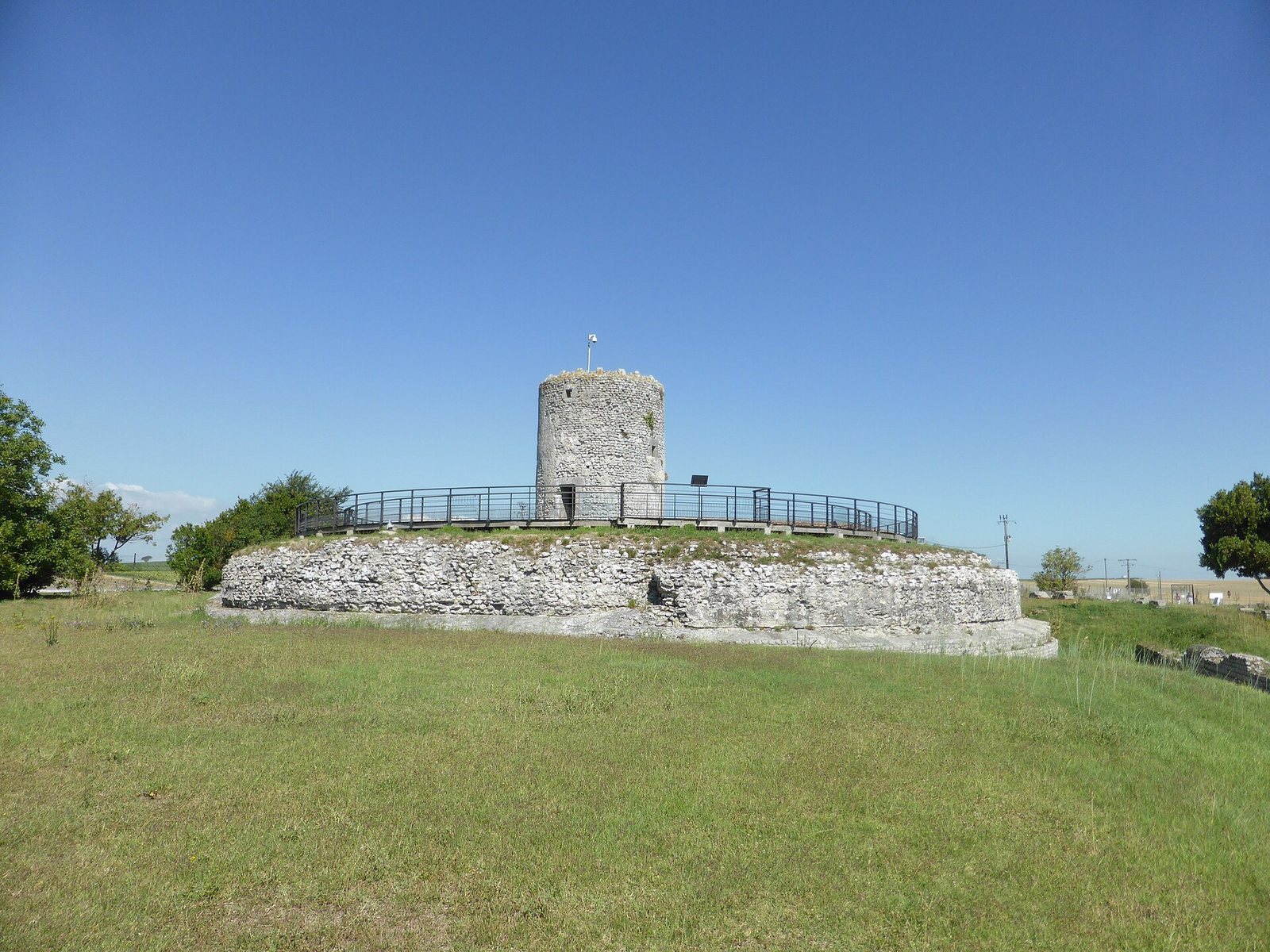
After abandonment, the ancient city became a source of building material. Decorative architectural elements were incorporated into local houses and churches, while Roman column shafts were reused as well rims. One third-century shaft was made into a baptismal font for the church at nearby Epargnes. A windmill was built in the sixteenth century on the podium, or raised base, of the principal temple. This structure gave the locality the name Moulin du Fâ, probably derived from the Latin term fanum, meaning a temple.
Occupation did not end entirely with the Roman city. Huts, altered structures, storage pits, wells, and burials from the Merovingian and Carolingian periods show activity during Late Antiquity and the early Middle Ages both within and around the settlement.
Claude Masse, a royal engineer serving Louis XIV, described the ruins in detail in 1708. The theatre was still partly visible, but neighbouring inhabitants later quarried it for stone, removing the parts that stood above ground. In 1844, Auguste Lacurie, an archaeologist and secretary of the Archaeological Society of Saintes, proposed that the ruins were Novioregum. The identification was disputed for many years. Deeper ploughing during the nineteenth century exposed further remains and encouraged archaeological investigation.
Archaeology and museum development
Excavations between 1921 and 1939 uncovered the circular temple, Roman baths, and part of the theatre. Work stopped when the Second World War began and was not resumed at that time. Léon Massiou’s excavations from 1921 to 1924 also revealed the aqueduct and baths. Louis Basalo continued work on the aqueduct and baths between 1935 and 1957 and found a votive stele about 20 metres from the principal sanctuary. The site received historic-monument protection in 1937 and 1939.
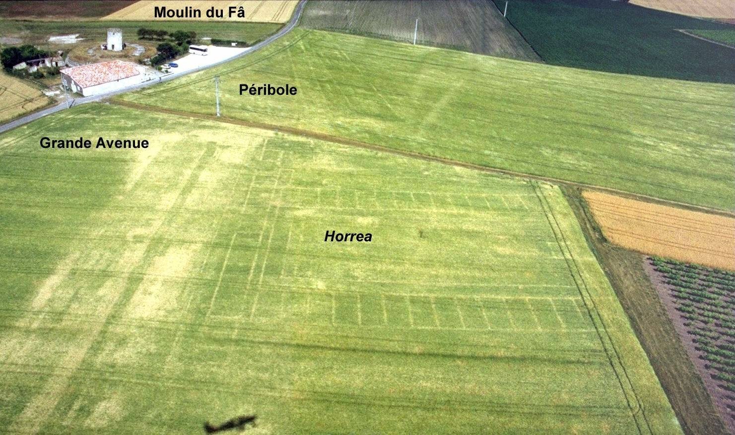
During the severe drought of 1975, aerial photography by Jacques Dassié revealed that the ancient settlement was much larger than previously understood. Barzan acquired the privately owned site in 1993, and the ASSA Barzan association was established to manage and develop it. Organised archaeological excavations began in 1994 under the supervision of the universities of Bordeaux and La Rochelle.
Work at the sanctuary from 1994 uncovered two successive temples, a large pit that may have been used for sacrifices, and construction markers associated with the temple platform. Investigations of the forum began in 1999. Excavations of the baths from 1998 to 2004 and of the warehouses from 2002 to 2009 clarified the scale of the urban and port facilities. Further sanctuary work between 2006 and 2008 revealed two successive perimeter enclosures. Excavation of the theatre resumed in 2007 and continued until 2017, after which the remains were reburied for conservation.
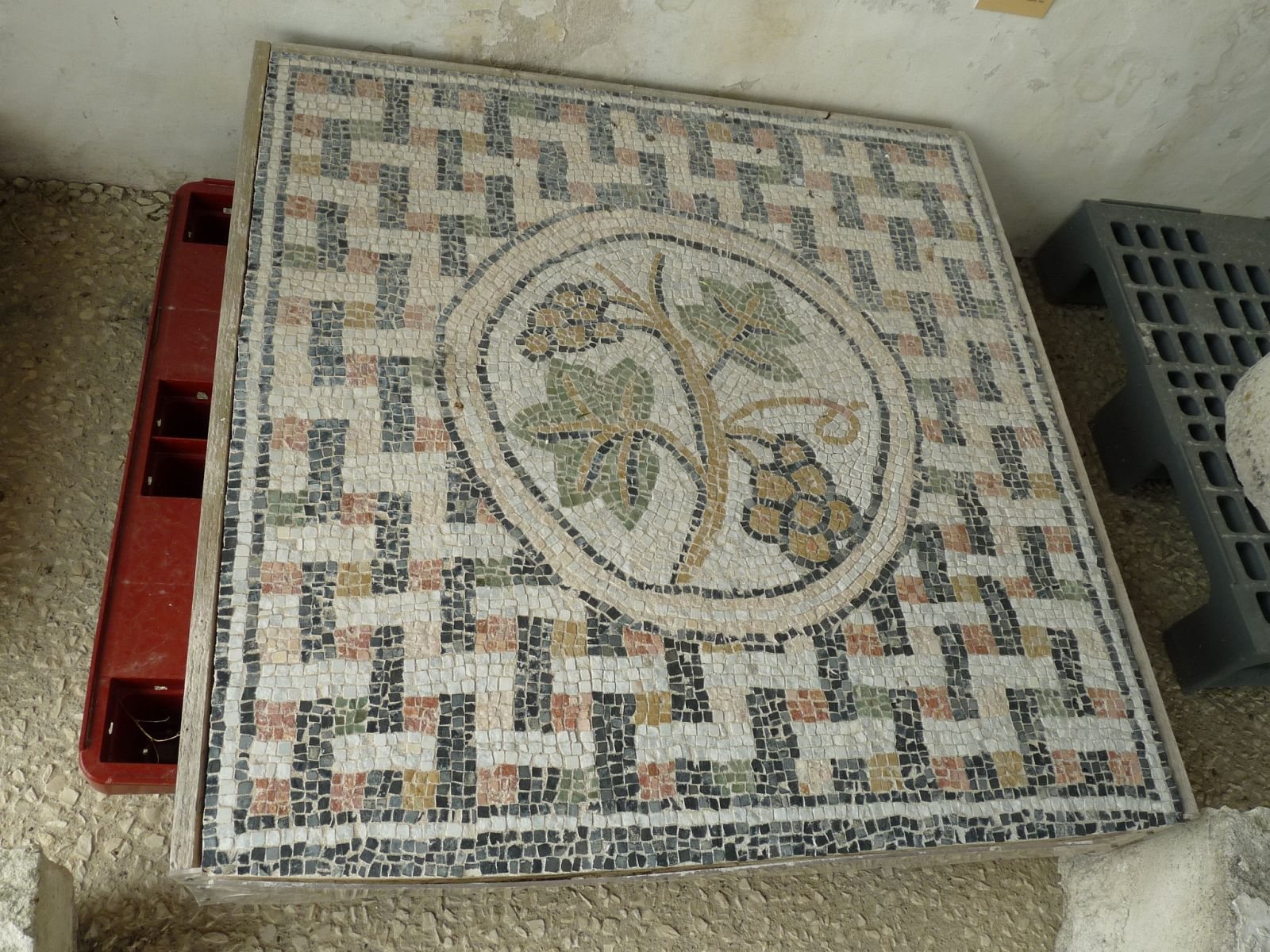
A museum opened in December 2005 in the former Fâ farm. It contains finds from recent excavations, reconstructions, a one-tenth-scale model of the Roman city, and an interactive installation that explores the ancient settlement virtually.
Remains
The archaeological site occupies a plain that slopes gently towards the Gironde estuary and is enclosed by a crescent of hills. The wider ancient city covered an estimated 140 hectares, while the currently interpreted archaeological area encompasses nearly 40 hectares. Its urban structure included a principal east-west street, a north-south street, public buildings, sanctuaries, warehouses, a theatre, baths, a forum, and a port.
Sanctuaries
Principal circular temple
The principal sanctuary centred on a monumental circular temple built in the second century AD within a rectangular enclosure measuring approximately 106 by 92 metres. The enclosure passed through two phases, with the later phase receiving a more monumental form. The temple had a surrounding colonnade with an estimated total height of 16 metres. At its centre stood a round cella, the chamber containing the cult focus, approximately 20.80 metres in diameter and estimated to have reached 35 metres in height. A 7.7-metre-deep entrance porch carried columns across its facade. The temple was reconstructed and enlarged during the second century.
Other temples and sanctuary evidence
Excavation revealed an earlier sanctuary phase and a large pit that may have been used for sacrifices. Aerial surveys at the eastern end of the principal decumanus, the main east-west Roman street, identified three further temples. One was a fanum with a square central chamber and surrounding enclosure. Another followed a Celtic tradition and had a six-sided central chamber. The third was a classical Roman temple with a rectangular masonry platform and no surrounding enclosure.
Baths, water supply, and theatre
Northern bath complex
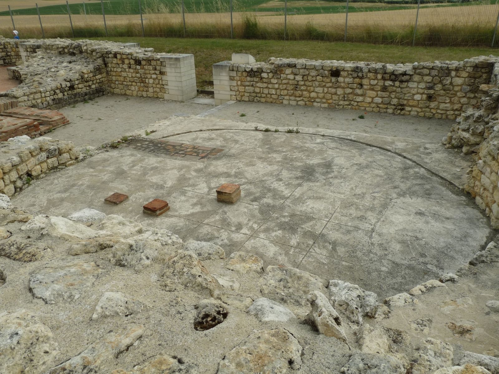
The northern bath complex is among the largest known in Gaul. Its water system included a rectangular well approximately 3 by 4.4 metres across and 16 metres deep. A lifting mechanism served the well, and collapsed wooden machinery remains inside it, where it is under study.
Roman theatre
The theatre occupied the eastern side of the city on the flank of La Garde. Its semicircular structure had a radius of at least 50 metres and measured approximately 81 metres in diameter. Radiating walls divided the cavea, the seating area, which contained stone seats. The building could accommodate about 5,000 spectators. Much of the structure above ground was later quarried, and the excavated remains were reburied after the modern investigations ended in 2017.
Streets, warehouses, forum, and port
Urban avenues and warehouses
The principal decumanus was about 10 metres wide and can be traced for approximately 400 metres. It formed the main organising line of the urban network and had a markedly monumental character. Aerial photography also revealed an avenue about 500 metres long, lined with large warehouses. East of the principal sanctuary stood public warehouses characteristic of port cities. These horrea included buildings approximately 60 metres long and 45 metres wide, with several storage cells exposed by excavation.
Forum and port
The forum was identified near Le Trésor, between the ancient port and the sanctuary and along the former cardo maximus, the principal north-south street. Aerial evidence was confirmed by test excavations, including work carried out in 2015. The ancient port lay near La Combe du Rit, south of the Roman city and close to the forum. Aerial photography and flooding in 1999 revealed the port area, which served as a landing place for seagoing vessels, while its structures have not yet been excavated. The warehouses and fifth-century BC Greek and Hispanic ceramics support the possibility of a trading role on an ancient tin route linking the British Isles with the Mediterranean.
Aqueduct
The aqueduct began at the Chauvignac spring, approximately 3 kilometres east of the site in the commune of Chenac-Saint-Seurin-d’Uzet. About 100 metres were explored in 1939. Its elevation is lower than that of the baths and temple, so the complete water-supply system remains unresolved.
Objects and interpretation
A votive stele found near the principal sanctuary bears the inscription “C(aius) Caecilius Galeria Civilis Marti,” probably a dedication to Mars, the Roman god of war. A small statue of Cupid, the Roman god of desire, was recovered from a test excavation near the forum and is displayed in the museum. The museum also houses the bronze axes from the Les Piloquets deposit on loan from the Royan museum, together with archaeological remains, reconstructions, and the scale model of the Roman city.