Archaeological Site of Munigua: A Roman Municipium in Spain



Site at a Glance
- Rating
- 4.6
- Popularity
- Low
- Country
- Spain
- Primary era
- Classical
- External website
- Open
- Eras represented
- Iron Age, Classical
- Civilizations
- Iberian, Roman
- Site type
- City
On this page23 sections
History
Archaeological Site of Munigua is the remains of a Roman municipium in Spain, near Villanueva del Río y Minas, where Roman public architecture developed mainly during the first to third centuries AD. Known also as Mulva and formally as Municipium Flavium Muniguense, the settlement grew from a pre-Roman community in Baetica, the Roman province that covered much of modern Andalusia. Its prosperity rested on copper and iron mining, metal processing, and the production and export of wine, especially olive oil.
Pre-Roman Origins and Roman Expansion
The earliest ceramic material from Munigua consists of Punic sherds dating to the seventh century BC. These fragments do not by themselves prove that a settlement existed at that time, but other ceramics show occupation on the upper hill from at least the fourth century BC. An Iberian community developed there before Roman urban construction transformed the slopes.
Mining activity took place during the first century BC and the first half of the first century AD in areas later occupied by the baths, forum, and Houses 1 and 5. By the middle of the first century AD, population growth encouraged residents to move from the upper slopes into lower areas. Earlier domestic remains were incorporated into later houses and public buildings, linking the developing town to its earlier occupation.
Munigua became a Roman municipium between approximately AD 70 and 80, when Emperor Vespasian granted it Latin civic rights. A municipium was a town incorporated into the Roman civic system while retaining a degree of local administration. Latin rights provided recognized municipal status without necessarily granting full Roman citizenship to every resident. The elevation under Vespasian prompted a major building program, and most of Munigua’s public and religious architecture belongs to the resulting Flavian period, although some surviving structures originated in the Augustan period.
The town’s economy combined mineral extraction with agricultural production. Copper and iron were mined and processed, while wine and particularly olive oil were produced for export. Slag from metalworking was reused extensively in walls and road surfaces. Munigua’s prosperity increased during the reign of Tiberius, and revenues from mining probably helped finance its public buildings. The settlement may also have served as a cultic and administrative center for the surrounding mines.
Municipal Center and Period of Prosperity
Munigua functioned as a regional administrative and economic center for nearby farms, huts, and hamlets. Its territory may have reached northward into the Sierra Morena, the mineral-rich mountain range north of the Guadalquivir valley. The large public buildings and extensive cemeteries support an interpretation of Munigua as a center serving a wider population rather than only the inhabitants of the hilltop.
The city reached its architectural peak during the second century. Its public buildings occupied terraces on the hill, while residential areas extended from the summit down the slopes. The western Terrace Sanctuary, the Podium Temple, the forum, the baths, the portico, and several substantial houses formed an urban complex adapted to the uneven ground.
The city wall was constructed approximately in the last third of the second century AD, but it was already in ruins during the third century and was never completed because its western side remained open. Its course followed the boundaries of the necropolises, and parts of the southern and eastern burial grounds were incorporated within the pomerium, the sacred boundary of a Roman city. This arrangement was unusual because burials were generally kept outside that boundary.
Decline and Later Occupation
Munigua’s decline was probably connected with the deterioration of mining, especially from the late second century onward. An earthquake at the end of the third century damaged or destroyed the forum, houses, and two-story portico. The settlement was not necessarily ended by one catastrophic event. Much of the city appears to have deteriorated gradually from the third century, while its urbanized area had contracted to about 4.5 hectares by the Constantinian period, the fourth-century era associated with Constantine and his dynasty.
From the late third or early fourth century, much of the city was abandoned and the remaining population withdrew toward the hills. Human activity continued there until the end of the fourth century. Later activity concentrated along the north-south cardo maximus, the main north-south street, where several Late Roman shops were established. Handicrafts and small-scale commerce became the dominant economic activities, although imported pottery indicates that the settlement retained some economic vitality.
Parts of the former residential district were converted into a necropolis during the fifth century. Grave finds show that a settlement survived at least until the seventh century, possibly because the site offered a defensible retreat. Islamic-period activity is attested from the eighth century onward. Pottery from several layers belongs broadly to the eighth or ninth through the twelfth century, but it is uncertain whether these remains represent continuous resettlement or shorter strategic occupations. Several graves dated broadly from the late seventh to the ninth century follow an Islamic burial rite, although their limited grave goods show that local traditions partly persisted. The occupants may have been Arab or Berber settlers, or converted members of the earlier population.
Rediscovery and Archaeological Investigation
The ruins entered written notice in the sixteenth century after two inscriptions were discovered. In 1565, Ambrosio de Morales described inscriptions from Mulva in a letter to Alfonso Chacón. Rodrigo Caro appears to have established the written identification of Mulva with Munigua in the seventeenth century.
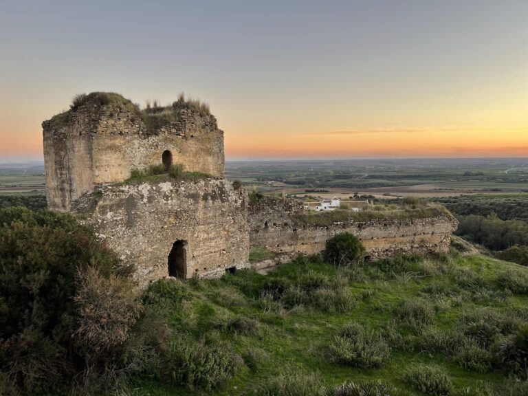
Tomás de Gusseme, Sebastián Antonio de Cortes, and José de Cuentas Zayas investigated the ruins in 1756. The remains were initially understood as a castle, but Gusseme argued that the large building was more likely a temple or senate house. Systematic archaeological work began in 1956 under the Madrid Department of the German Archaeological Institute, initially directed by Wilhelm Grünhagen. Early campaigns focused on the public buildings, baths, pre-Roman settlement, and eastern necropolis. In 1967, research shifted toward domestic buildings and their relationship to public architecture. That year Theodor Hauschild identified parts of House 1 and House 6, and he became excavation director in 1984.
The eastern necropolis was investigated through 1958, the southern necropolis in campaigns from 1977 to 1983, and House 2 in work that began in 1974 and continued through 1996. Geophysical surveys took place in 2002, 2003, and 2005, while excavation and research by the German Archaeological Institute have continued since 1956. Munigua was designated a Historical-Artistic Monument and an asset of cultural interest under the name Castillo de Mulva by a decree of 3 June 1931. The decree mistakenly placed the monument in the province of Cordoba rather than Seville.
Remains
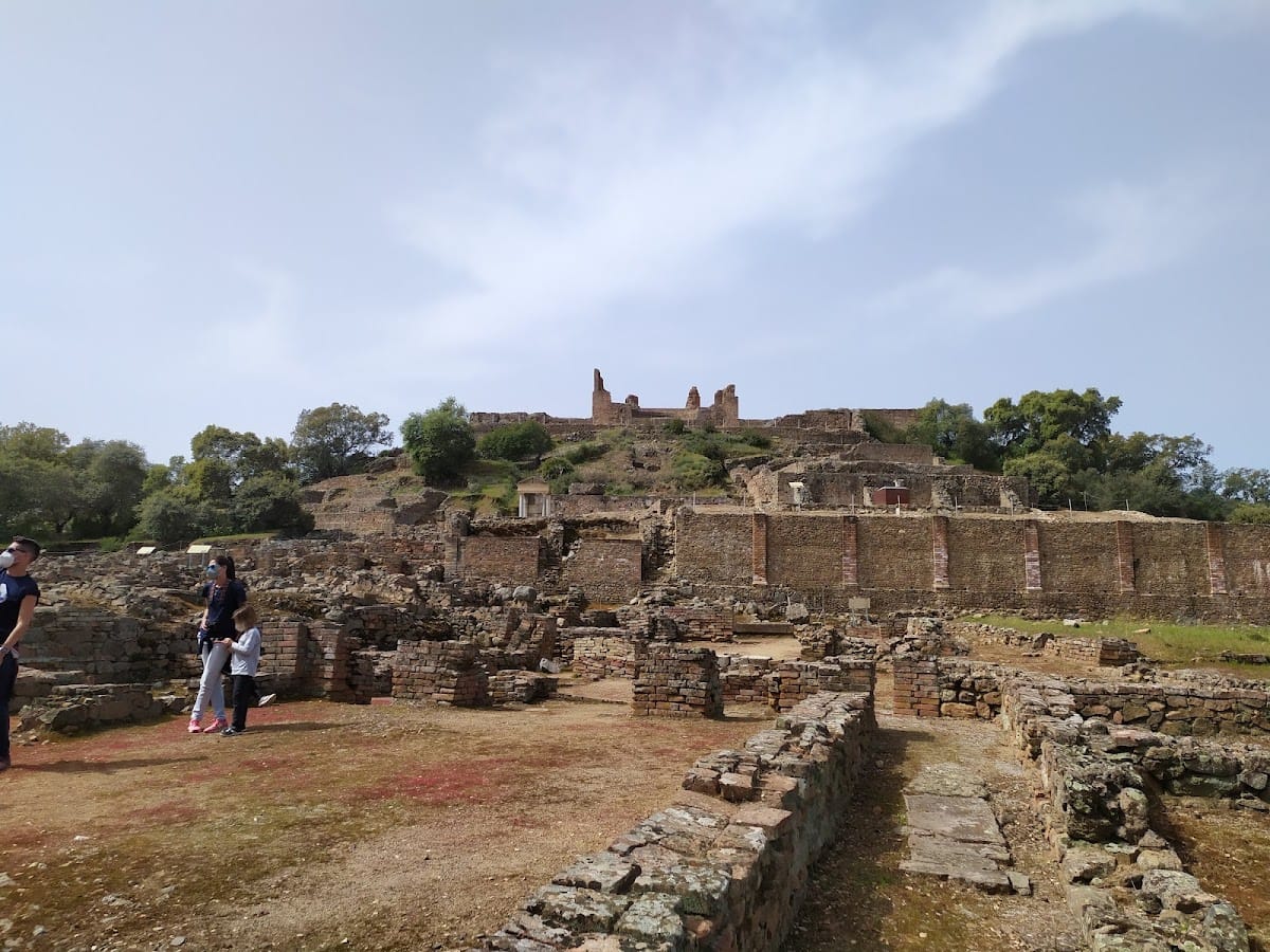
Munigua occupies a hill whose public and residential buildings spread from the summit down its slopes. The excavated houses vary in size and follow the existing urban layout, generally including upper floors and repeated remodeling. Terraces, retaining walls, streets, public buildings, houses, industrial installations, and cemeteries together show how the settlement adapted Roman urban forms to steep ground.
Sanctuaries and Public Architecture
Terrace Sanctuary
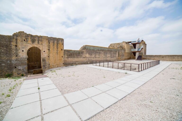
The western Terrace Sanctuary is a symmetrical complex about 35.2 meters wide and 54.53 meters long. Three superimposed platforms formed its structure. Its stepped western rear wall survives exceptionally well and rises almost 9 meters, while retaining walls in some western areas once stood more than 10 meters above the original ground level.
The sanctuary faces east and follows a symmetrical central axis aligned with the landscape. Matching gates opened onto ramped streets on the north and south. The ramps reached the first terrace and then the central terrace, where a semicircular exedra framed the eastern view. On the upper terrace stood an approximately square cella, the principal enclosed room of a temple, with niches framed by pilasters along its sides.
Marble covered the eastern facade, while stucco covered the northern and southern facades. The lower areas were mainly white and gray, with red and green used higher up. Rubble buried much of the building, but sections of wall, in places about 6 meters high, remained visible from antiquity and suffered relatively little damage. The complex resembles Republican terrace sanctuaries in Latium, particularly those at Praeneste and Tibur, although its eastward orientation differs from those examples. It was probably associated with Fortuna and Hercules, but that identification is not conclusive. Construction belongs to the early Flavian period, around AD 70, after a date no earlier than the late Neronian period.
Podium Temple
The Podium Temple stands between the forum and the Terrace Sanctuary, partly over earlier walls. Construction probably began shortly after the sanctuary. Pottery places it in the second century, although another proposed date places its construction at the beginning of that century. The temple occupied an intermediate quadrangular terrace on the eastern side of the hill and faced south-southeast, unlike the east-facing sanctuary.
The building stood on a podium and was approached by several stairs. Four columns probably stood before its facade, but its deity is unknown. The earlier structures beneath the Terrace Sanctuary had been occupied from the beginning of the first century AD until shortly before the sanctuary was built. They were deliberately leveled for the new complex rather than destroyed by a natural disaster. By no later than the seventh century, the sanctuary had ceased to serve a cultic purpose and had been converted to non-religious use.
Forum Buildings and Portico
The forum occupied an artificial terrace on the eastern side of the municipal hill and was reached by Forum Street. Because the ground sloped, a large eastern retaining wall and added earth were needed to form a level surface. The forum centered on a small square enclosed by a portico. It was originally a confined space surrounded by tall buildings rather than the open-looking area visible after the collapse of its walls.
The retaining wall was nearly 5 meters high and about 1.20 meters thick. Its construction shows an earlier portico phase and a later southern addition. The earlier masonry combined rubble that was partly well mortared and partly dry laid, and a substantial yellow-brick corner pier joined the two walls. The collapse of the retaining walls, particularly on the east, displaced ancient wall lines and makes the original plan difficult to reconstruct.
A building inscription states that Lucius Valerius Firmus, twice a duumvir, one of the two annually elected chief magistrates of a Roman municipality, paid for and dedicated the temple, forum, portico, exedra, and municipal archive. The forum was probably destroyed suddenly by the earthquake of the late third century. A body found beneath collapsed debris supports that interpretation. The north side contained remains identified as a council building, a shrine to Dis Pater, and the tabularium, or municipal archive. The shrine included a horse-statue base inscribed with the deity’s name and that of Lucius Aelius Frontus of the Quirina tribe. A basilica occupied the southern side and provided space for administering justice and concluding commercial and civil contracts. The central Forum Temple was surrounded by porticoes on three sides, but its deity is unknown.
Two-Story Portico and Hall
The two-story portico stood opposite the forum on Forum Street. It passed through three phases. First came a ground-floor structure, followed by a second story with a single-pitch roof supported by columns along the front. The ground floor was later converted into a private dwelling. The upper story was probably connected with the Podium Temple, since the two tall structures were reached by the same staircase. The portico collapsed in the earthquake at the end of the third century and was later divided into smaller rooms.
The associated two-story hall measured about 14.20 meters in length. It was 3.22 meters wide at the south end and 3.45 meters at the north. Its rear and north walls, as well as several pillars, were founded directly on bedrock. The floor consisted of dark stone chips mixed with lime mortar. Three southern pillars had square recesses cut into the natural rock, probably to hold portrait statues of emperors. Its date remains uncertain, ranging from the early Imperial period to the Hadrianic period, the era associated with Emperor Hadrian from AD 117 to 138.
Aedicula and Mercury Shrine
The Aedicula stood in the southern forum area, in the Plaza of the Aedicula and at the southern end of the two-story portico. It was probably dedicated to Mercury. Proposed dates range from before the middle of the first century to the first half of the second century, while later studies favor the Flavian period. Built directly on bedrock and positioned before the portico, it was constructed after that building.
The shrine had a U-shaped plan resembling that of the Podium Temple and stood on a podium. Corinthian columns preceded its side walls, and their capitals supported the architrave and pediment. Sandstone and sandstone conglomerate formed its architectural elements, all covered with stucco. A large, roughly worked stone table on its north side may have been associated with the shrine.
An altar found in place before the exedra carried a dedication by Ferronius, made in fulfillment of a vow. An inscription dedicated to Mercury by Lucius Fulvius Genialis, an augustal priest associated with the municipal imperial cult, came from the building’s collapse debris. Statues of Vespasian and Titus may once have stood before the portico pillars beside the shrine. They were removed before Titus died in AD 81.
Baths and Industrial Installations
Public Baths
The baths occupied the northeastern corner at the base of the municipal hill and formed part of the same urban block as the forum. The creation of the forum cut into their southern side. Built in the middle of the first century AD, the complex was remodeled at the end of that century and altered repeatedly during the second and third centuries.
Red brick and mortar-reinforced corner pillars formed the building, which stood about 4 meters high. Wall paintings and sculptures decorated the rooms. A large draped statue found in 1960 may have come from the forum rather than the baths. Other furnishings included a marble sarcophagus decorated with erotes and three high-quality bases with inscription panels ornamented with bead-and-reel and vine designs.
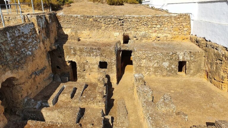
The entrance was through the frigidarium, or cold-water room. The apodyterium, or changing room, lay to its west, with the nymphaeum, a monumental fountain or water shrine, beyond it. North of the changing room was the caldarium, or hot-water room. Its floor has been lost, exposing the hypocaustum, the underfloor heating system through which hot air circulated from the furnaces. Later rooms north of the cold-water room included a well.
The nymphaeum opened onto the changing room and was built around AD 100. A lead pipe supplied it, and water probably flowed down steps in its apsidal end. A base above the pipe may have supported a statue, probably the nymph statue found in the cold-water room and now held by the Archaeological Museum of Seville. The fountain was remodeled around the middle of the second century and may then have acquired another function.
Earlier Industrial Area
Industrial installations beneath the baths were probably connected with iron production and remained in use until the middle of the first century AD. They were remodeled several times during the second and third centuries and were probably converted into living quarters from the fourth century. The wider mining landscape includes an extensive Roman copper mine overlying a much older mine attributed to the Turdetani and dated to approximately 2000 BC. Interconnected ventilated tunnels and deep shafts formed the mine system.
Residential District
House 1
House 1 had a concrete foundation supporting brick walls. Its construction includes opus testaceum, brick-faced construction, and later opus mixtum, masonry combining brick with other materials. The first phase, dated to the first century AD, contained an olive press and several smelting furnaces, which were probably not all used at the same time.
A second phase, dating from the late first to the second century, created a private residence with 22 rooms. The rooms were arranged around a long sequence of entrance hall, colonnaded court, and dining room. The entrance block was slightly offset from the main axis. Its front room faced a possible principal street and stood at ground level without a closure, suggesting an open forecourt.
House 2
House 2 lay north of the settlement beside the forum and was reached by a narrow ramp. A columned room probably formed a basement supporting an upper story. Other rooms have been interpreted as an olive-press workshop, a shop opening onto the street, a central area for commerce and storage, residential rooms, and further commercial spaces. A possible stair ramp led to the upper floor.
The site had already passed through at least two earlier phases, perhaps beginning with a press and later including iron production in several bloomery furnaces. The first house phase dates no earlier than the middle of the first century AD, and a second major phase followed roughly 100 to 150 years later. That phase probably collapsed in the earthquake of the second half of the third century. The building was partly restored in the early fourth century, continued through a final phase from the fifth to the seventh century, and remained occupied into the Islamic period.
Houses on the Street of the Baths
Houses 1, 5, and 6 on the Street of the Baths were built between the late first and early second centuries. Houses 1, 2, and 6 may have belonged to local elite families because of their proximity to Munigua’s administrative and religious center. House 6 was a separate residence with more than 22 rooms, arranged in a manner similar to House 1. It was probably built shortly afterward, and an initial partition wall made the two buildings difficult to distinguish.
Necropolises and Burial Evidence
Roman Cemeteries
The southern and eastern necropolises were regularly used from the first through the fourth centuries AD. They contained both inhumations, generally with the body placed on its back, and cremations, with grave goods accompanying the dead. The city wall affected their layout by enclosing portions of both burial grounds within the pomerium.
The eastern necropolis was enclosed by a wall and probably formed a distinct burial precinct on level ground. Five rich cremation burials discovered in 1973 belonged to this type of enclosed complex. In the southern necropolis, the body was commonly burned in an ustrina, a designated cremation place, before the remains were transferred elsewhere. Grave goods were usually added after cremation because they show little or no burning.
Four burial arrangements were used. Some remains were placed without protection in grave pits, while others were deposited in urns or other containers. In a bustum, the cremation pyre and final grave occupied the same place. Other deposits were placed in the waste pits of ustrinae, where pyre debris and fragments of offerings accumulated without the cremated remains. Small ceramic pieces in the soil entered the cemetery with the earth and were not grave goods.
Grave goods indicate 26 female burials, five children or adolescents, and one male burial, while the remaining individuals could not be sexed archaeologically. Jewelry and toilet equipment, including tweezers, mirrors, and perfume bottles, accompanied female-associated burials. Weapons, tools, clothing fittings, and belt buckles were associated with male burials. Toys, amulets, and small finger or arm rings occurred with children. Coins were rare and consisted exclusively of asses, and they did not occur in urn burials. Beads were sometimes interpreted as children’s goods, but they also frequently accompanied female burials.
Islamic-Period Graves
Later graves followed a partly preserved Islamic burial rite. The deceased lay on the extended right side, with the head slightly reclined and the face directed south. The arms rested alongside the body. Small amounts of grave goods remained in these burials, indicating a combination of Islamic practice and earlier local customs.
Objects and Inscriptions
Finds from Munigua include Greek, Roman, Iberian, and Arab pottery fragments, Islamic terracotta vessels and oil lamps, an Arabic coin, and numerous sculptures. An inscribed bronze tessera of hospitality records a legal hospitality agreement involving the quaestor Sextius Curvius Silvinus and the people of Munigua. Together with the inscriptions from the forum, shrine, and cemeteries, these objects illuminate the settlement’s civic institutions, religious practices, trade, and changing population over many centuries.