Morat Castle: A Medieval Fortress and Administrative Seat in Switzerland



Site at a Glance
- Rating
- 4.5
- Popularity
- Low
- Country
- Switzerland
- Primary era
- Medieval
- External website
- Open
- Eras represented
- Medieval, Early Modern, Modern
- Civilizations
- Duchy of Savoy, Holy Roman Empire, Swiss
- Site type
- Military
- Remains
- Castle
On this page14 sections
History
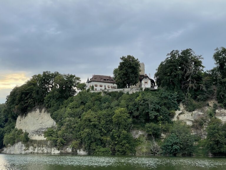
Morat Castle is a medieval fortress and former seat of lordship in Murten, Switzerland, above the southeast shore of Lake Morat. Its present basic layout took shape in the thirteenth century, especially after 1255, when Peter II, Count of Savoy, established the arrangement that survives in altered form. The castle occupied a strategically important position near the route linking the Roman Empire with the territory of present-day Germany, and a section of Roman road found near Löwenberg indicates the importance of this route.
Early medieval origins
Morat may already have been a fortified estate in 515, although the document that makes this claim is a Carolingian-era forgery. Its Latin form, muaratum, nevertheless points to a fortified area in the Early Middle Ages. Later tradition associated the foundation of a fortress at Morat with Louis the Pious, the Carolingian emperor who ruled much of the Frankish realm in the early ninth century. One tradition places this foundation in 814, but documentary evidence does not support the date.
Morat entered the Frankish realm after the Burgundian kingdom was defeated at Autun in 532. It later belonged to the Kingdom of Upper Burgundy, founded in 888, and then, from 930, to the united Kingdom of Burgundy. King Rudolf III of Burgundy held court at Morat in 1013. After his death in 1032, Odo II occupied the settlement during his conflict with Conrad II over the Burgundian succession. Conrad, supported by allied forces, captured Morat after a siege in August 1034 and largely destroyed it.
Medieval lordship and Savoyard rebuilding
In 1079, King Henry IV granted Morat to Burkhard of Oltigen, Bishop of Lausanne, in recognition of his support. The bishops of Lausanne and, particularly, Berthold IV, Duke of Zähringen, probably helped develop the regularly planned town beside the castle during the 1170s and 1180s.
A castle at Morat appears in 1228. In 1255, the town placed itself under the protection of Peter II, Count of Savoy. He established the castle’s present basic layout and is credited with commissioning the surviving donjon, the principal fortified tower of a medieval castle, along with two halls. Savoyard building activity had ended by the temporary Habsburg takeover in 1283.
Fourteenth-century building records refer to a main tower, four additional towers, and two drawbridges. Repairs and alterations followed in 1343–1349, 1375–1379, 1404–1408, and 1444–1451. Further changes to the interiors and windows took place in 1476–1480, showing that the castle continued to be adapted after its main medieval construction phases.
From Savoyard fortress to shared lordship
The castle apparently escaped major damage during the 1476 Battle of Morat, one of the Burgundian Wars, the late-fifteenth-century conflicts between the Swiss Confederacy and Charles the Bold, Duke of Burgundy. After the Treaty of Fribourg, Morat passed from Savoy to the Swiss Confederacy and was jointly claimed by Bern and Fribourg. Compensation payments settled the dispute in 1484.
Representatives of the two cities, known as Schultheissen, a civic magistrate or chief municipal representative, then lived in the castle for five-year terms. The fortress was converted into a château, or more residential lordly seat. Bernese influence is regarded as the principal reason for the Reformation in Morat and its lordship. The Reformation was the sixteenth-century religious movement that divided Western Christianity and established Protestant churches in many parts of Europe.
Administrative use and modern restoration
The joint lordship established an archive in the castle in 1544 and a prison in the donjon in 1550. Additional works took place in 1686–1687, 1730–1731, 1752–1756, and 1776–1777. French troops devastated the castle in 1798, ending the joint lordship. The town then converted the complex into a barracks. In 1803, it again became a seat of authority, housing the district administration and the prefect’s residence.
In 1832, the government stored two four-pounder cannons with ammunition and 5,000 rifle cartridges in the castle because it feared an uprising against the existing constitution. Residential facilities were improved from 1907 to 1912. The castle was placed under protection on 5 October 1912, with Albert Naef serving as an expert and Henri Broillet designing a restoration intended to reveal older elements. This work took place from 1916 to 1920. Further restoration and changes of use followed in 1939–1940 and 1971–1972.
Morat Castle is listed as a class B Swiss cultural property of regional significance, under inventory number 2259. It currently houses the prefecture, including the administrative office of the Lake District and its civil registry office.
Remains
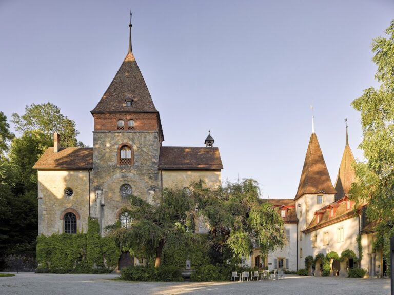
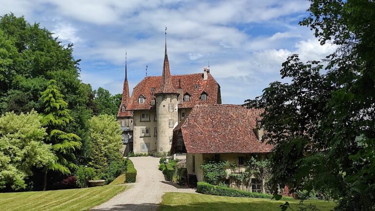
Morat Castle is a hilltop spur fortress west of Murten’s historic old town. It stands on a spur rising up to 36 metres above the southeast shore of Lake Morat and is approached from the town side. The complex is organized around a courtyard, with a three-winged palas, the main residential or ceremonial building of a medieval castle, occupying the principal residential area. The walls use roughly dressed, medium-sized ashlar blocks, while later additions and alterations are visible in the differing forms of the buildings and openings.
Residential and defensive buildings
The palas and residential wings
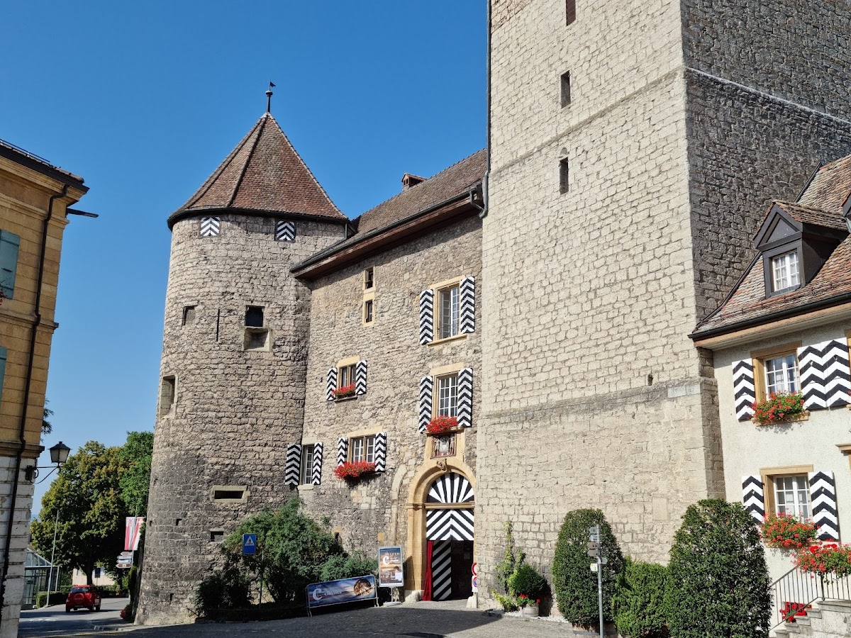
The palas forms three sides of the residential complex. Its east end in the south wing probably dates from the mid-thirteenth century. A second residential building stands between the west and south towers. It retains thirteenth-century parts and is set at a slight angle to the palas, giving the complex an overall pentagonal plan.
The courtyard side of this second residential building preserves a round-headed opening that is probably Romanesque. Later work introduced varied window and door forms, most of them rectangular and attributable to the Baroque period. Several blocked older window openings remain on the upper floor of the south side of the palas. Scattered chimneys and some late Gothic elements mark the roofs.
The donjon and east annex
The massive donjon occupies the northeast side of the residential group. It is square in plan, carries a pyramidal roof, and has a line of window openings directly below the roof, with a few narrower openings elsewhere. Its upper part is visibly later than its lower part, and comparable additions appear elsewhere in the complex.
A later annex adjoins the east side of the donjon. The north wing, which joins the donjon toward the northeast, formerly served as a stable and barn. These buildings preserve the relationship between the castle’s residential quarters and its service functions.
The surviving towers
Semicircular corner towers protect the west and southeast sides of the palas. A fourth structure, the southeast stair tower, provides access from the courtyard. Opposite the palas stand the west tower, also called the archive tower, and the south tower. Both of these towers, as well as the stair tower, have conical roofs.
A high tower formerly stood toward the lakeshore. Historical views show a square, crenellated lower structure, meaning one with alternating raised sections and openings, supporting a broad, round, crenellated upper section. They may also show an additional round tower with a conical roof. A wall containing a round tower and a projecting turret separated this structure from the castle. Its precise affiliation remains uncertain, since it may have belonged either to the castle’s outer enclosure or to the town wall near the Mill Gate. A residential building now occupies approximately its former location on Ryf.
Courtyard, entrance, and outer defenses
The courtyard and water supply
The courtyard measures approximately 20 by 20 metres and lies 2.5 metres above Rathausgasse. It contains a fountain basin and a cannon, while the former cistern remains visible. These installations occupy the central open space between the castle’s residential and defensive buildings.
The Renaissance gateway and bridges
Entry to the courtyard passes through a Renaissance gateway in the administrative building. Constructed in 1539–1541 between the south tower and the donjon on the town side, it has a keystone and the coat of arms of the canton of Fribourg, flanked by two axe-bearing knights.
The approach formerly crossed a drawbridge. A stone bridge was built in 1561, although part of the drawbridge was retained, and the crossing was converted entirely to stone in 1868. Earlier drawbridges had required repeated work at intervals of roughly 20 to 40 years.
The southern enclosure
The castle formerly possessed southern outer-enclosure walls, which were still present in 1734 and probably protected the nearby Upper Gate. They extended along the west side toward the courtyard entrance and obstructed direct access from the gate to the castle. Their remains belong to the complex of medieval and early-modern defensive works that also included the towers, fortified enclosures, drawbridges, and administrative buildings.