Mixco Viejo: A Postclassic Maya City and Chajoma Capital in Guatemala
Site at a Glance
- Rating
- 4.7
- Popularity
- Low
- Country
- Guatemala
- Primary era
- Medieval
- Eras represented
- Medieval
- Civilizations
- Maya
- Site type
- City
On this page22 sections
History
Mixco Viejo is a ruined Postclassic Maya city in northeastern Chimaltenango, Guatemala. Built by the Chajoma, a Maya polity within the Kaqchikel linguistic sphere, the city probably began during the twelfth century and developed on a ridge above the Pixcaya and Motagua river region. Archaeologists now identify it as Jilotepeque Viejo, the capital of the Chajoma kingdom, rather than the Poqomam capital called Mixco Viejo in colonial records.
Chajoma Capital
The city’s occupation was relatively short, producing an unusual unity of architectural style. Most excavated objects and earlier building phases date to the last few centuries before the Spanish conquest. Around 1450, the Chajoma moved their capital from Ochal to Jilotepeque Viejo under their king Lajuj No’j. The new position offered greater security from hostile neighbors, particularly the Kaqchikel kingdom of Iximche.
Iximche nevertheless defeated the Chajoma, and Jilotepeque Viejo became subject to the Kaqchikel kingdom. Shortly before the Spanish conquest, the Chajoma, led by their lord Achi Q’alel, rebelled against Iximche. They may first have joined the Spanish alongside Iximche and may later have participated in the Kaqchikel uprising against the Spanish in 1524. After the lords of Iximche broke with the conquistadors, they took refuge at Jilotepeque Viejo.
A Misidentified City
The name Mixco Viejo resulted from confusion in the interpretation of colonial records. The Chajoma ruins lie within the Kaqchikel linguistic area and far from the colonial settlement of Mixco. They also have not produced the fine polychrome pottery associated with the Poqomam. Robert M. Carmack was the first scholar to raise substantial doubts about the traditional identification.
The historical Mixco Viejo, now distinguished as Mixco Viejo (Chinautla Viejo), was a separate city near modern Mixco and the capital of the Poqomam kingdom. In 1525, Pedro de Alvarado’s forces, led by the Spanish conquistador and colonial commander, besieged that city for more than a month. After prisoners revealed a cave entrance, the Spanish captured and burned it, then relocated its inhabitants to the colonial settlement of Mixco. These events were later incorrectly connected with Jilotepeque Viejo.
Conquest and Abandonment
Jilotepeque Viejo was abandoned after the Spanish conquest, and its inhabitants were moved to San Martín Jilotepeque. The city was never reoccupied. Its abandonment preserved the arrangement of its plazas, platforms, temples, residences, and ballcourts, while later archaeological work revealed distinctive burial practices and evidence of the city’s political and ritual life.
Archaeological Investigation
Karl Sapper visited the ruins in 1896 and published a description and map in 1898. A. Ledyard Smith examined the site in 1949 and published an account in 1955. The principal excavations took place from 1954 to 1967 under Henri Lehmann for the Musée de l’Homme of Paris, with restoration carried out by Lehmann and Francisco Ferrus Roig. The investigators initially believed that they were excavating the Poqomam capital described in colonial records. Archaeological investigations resumed in the late 1990s.
Guatemala’s Ministry of Education declared Mixco Viejo a protected archaeological zone under Ministerial Accord 1210 on 12 June 1970. The 1976 Guatemala earthquake destroyed part of the earlier restoration, although some of the damage was later repaired. Artefacts from the excavations were returned to Guatemala from the Musée de l’Homme in 1998.
Remains
Ridge-top Layout and Construction
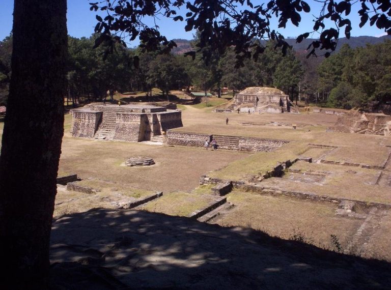
The ruins extend for more than 1 kilometre along an approximately 880-metre-high ridge about 4 kilometres from the junction of the Pixcaya and Motagua rivers. Deep ravines and tributaries of the Pixcaya surround the ridge. In places, the city’s cliffs were made steeper and reinforced with retaining walls, strengthening the naturally defensible setting.
The settlement contained 15 archaeological groups and more than 120 major structures. These included temples, palaces, residential buildings, plazas, platforms, altars, and two Mesoamerican ballcourts. Archaeologists identify the main groups with letters from A through L, together with smaller subgroups such as A-X, B-X, C’, and E’. The original principal entrance was on the western side, where the modern approach follows a route resembling the earlier access.
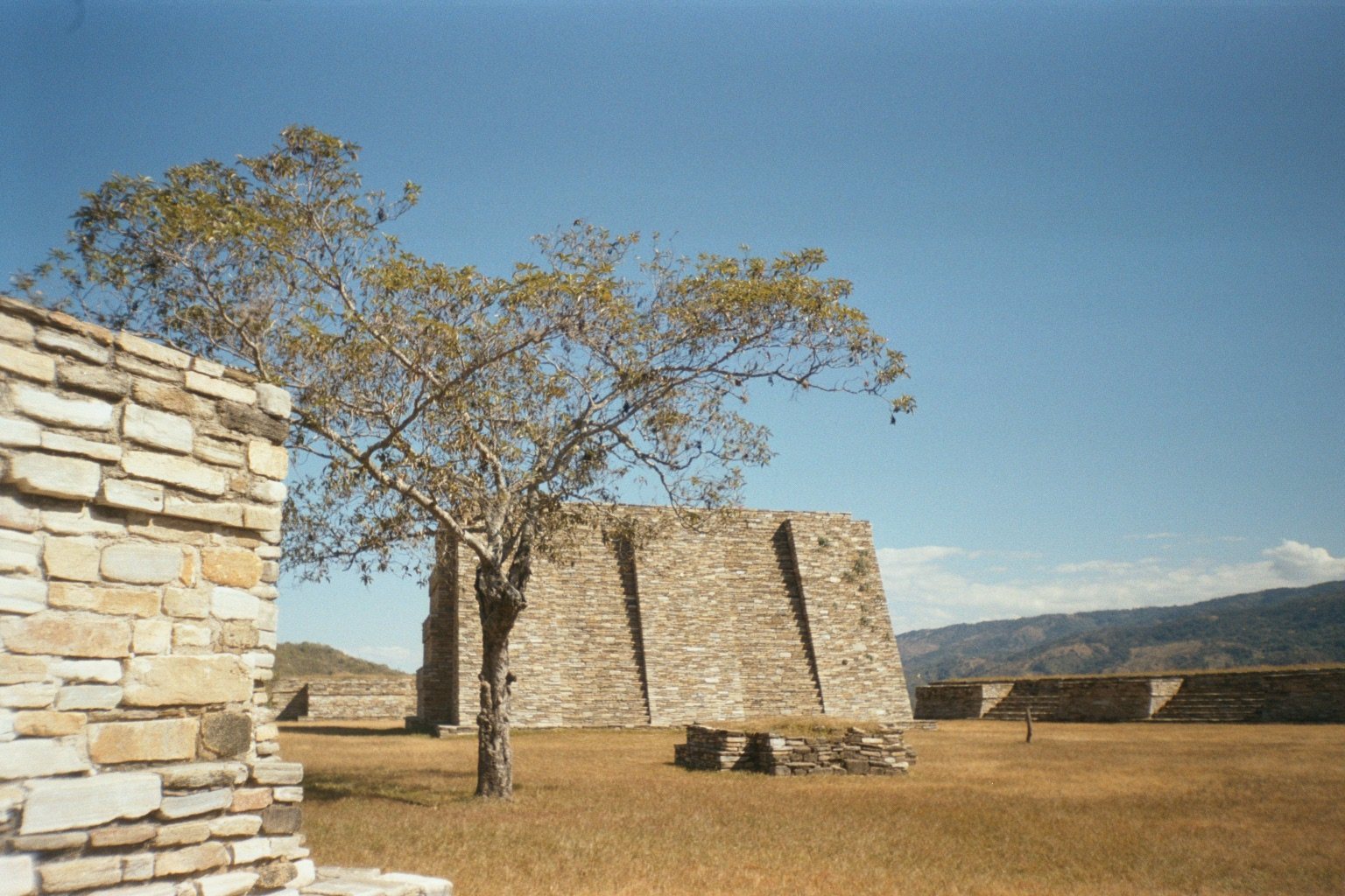
Buildings were made chiefly from slabs of mica and pumice, sometimes covered with stucco, a plaster-like coating for walls and architectural surfaces. Painted stucco once decorated some structures, although only a few poorly preserved fragments survive. Stone sculpture was rare. The principal example is a ballcourt marker showing an open-mouthed serpent with a human head emerging from its jaws.
Group A
Plaza and Platforms
Group A occupies the northern end of the ridge. Its principal plaza contains a pyramid, several platforms, residential buildings, an altar, and Ballcourt A11. A major remodeling, probably during the thirteenth century, created a larger terrace by adding a new retaining wall and filling the approximately 12-metre-wide space between it and the earlier wall. Charcoal beneath the old wall produced a radiocarbon date in the thirteenth century.
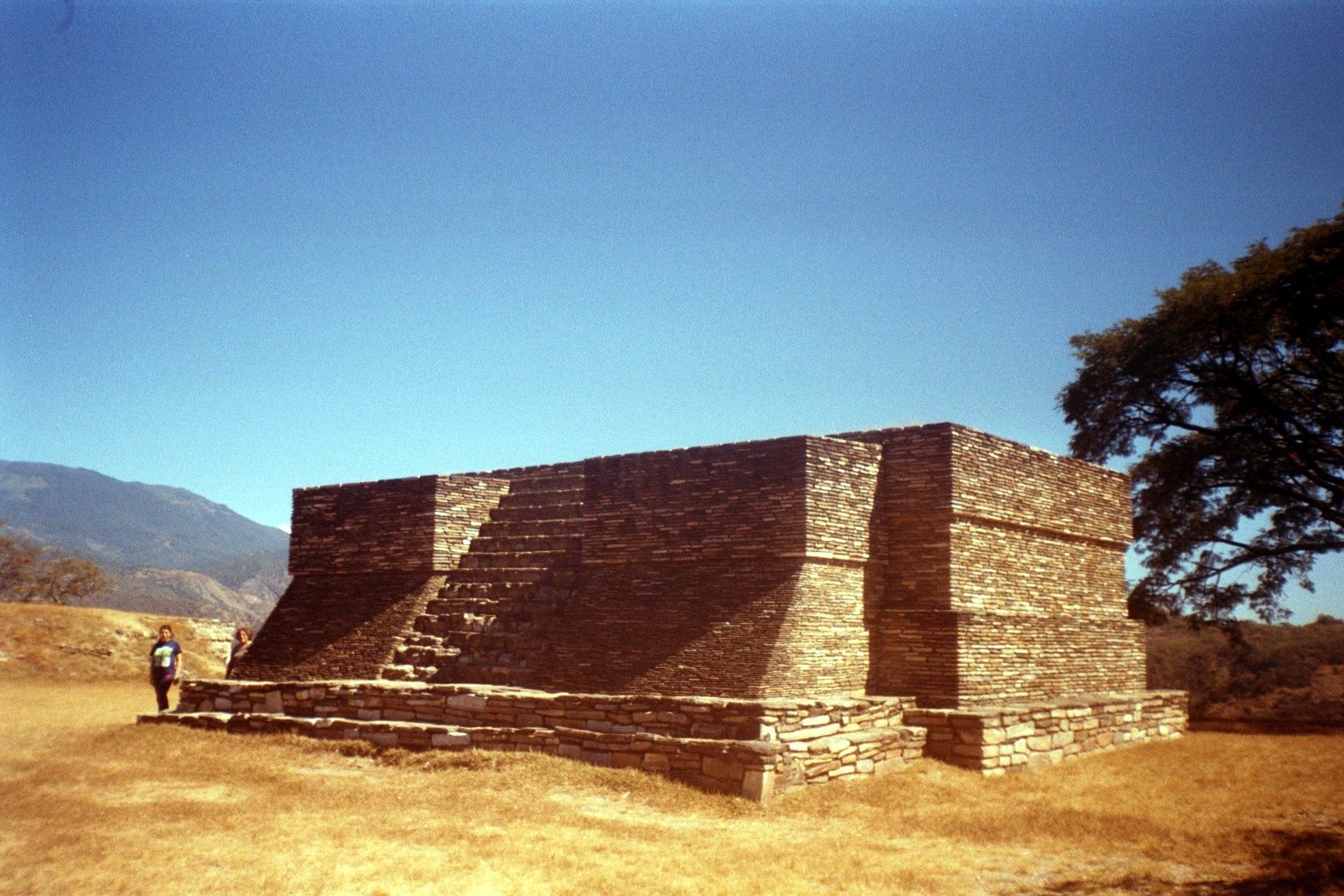
Pyramid A1 rises 6.9 metres and measures 15.4 by 7.25 metres at its base. It faces west across the plaza and has four stepped levels, each ending in a projecting cornice. Two stairways of 27 steps have smooth balustrades, and a summit platform about 60 centimetres high once supported a temple. The pyramid was built over an earlier two-level platform coated with stucco.
Platforms A2 and A3 belong to successive building phases. A2 stands along the retaining wall behind A1, faces west, and has two stairways. Its final form was enlarged after construction of the new retaining wall. A3 closes the northern side of the eastern plaza and faces south. Its final phase expanded 4 metres westward and 2 metres northward, producing two corniced levels and a 1-metre-wide bench along the northern wall.
Platform A4 divides the Group A plaza. It was built during a reorganization that destroyed an earlier building beneath A5. The structure has two levels, faces east, and is approached by two stairways with balustrades. Platform A5 closes the northern side of the plaza and faces south toward the plaza and ballcourt. It has two levels and four stairways, each with nine steps, flanked by steep ramps or balustrades. It covers an earlier north-south platform whose surviving northern wall was 9.1 metres wide. Two funerary urns were recovered from the earlier building.
Platform A6 encloses the western end of the plaza and faces east. It has two levels and two stairways with balustrades, covering a smaller earlier structure whose stairways were destroyed during the final construction. Restoration left part of the earlier rear wall and facade visible. Four funerary urns were found beneath or near its front. Structure A7 is a small square altar in the eastern part of the plaza. Platform A8 lies east of A1, faces northwest, and has two stairways, while a finely paved terrace extends behind it along the retaining wall. Platform A9, east of Ballcourt A11, faces the court and has four stairways of nine steps between corniced balustrades.
Ballcourt A11 and Residences
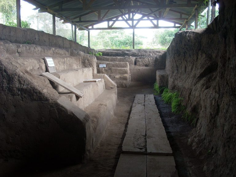
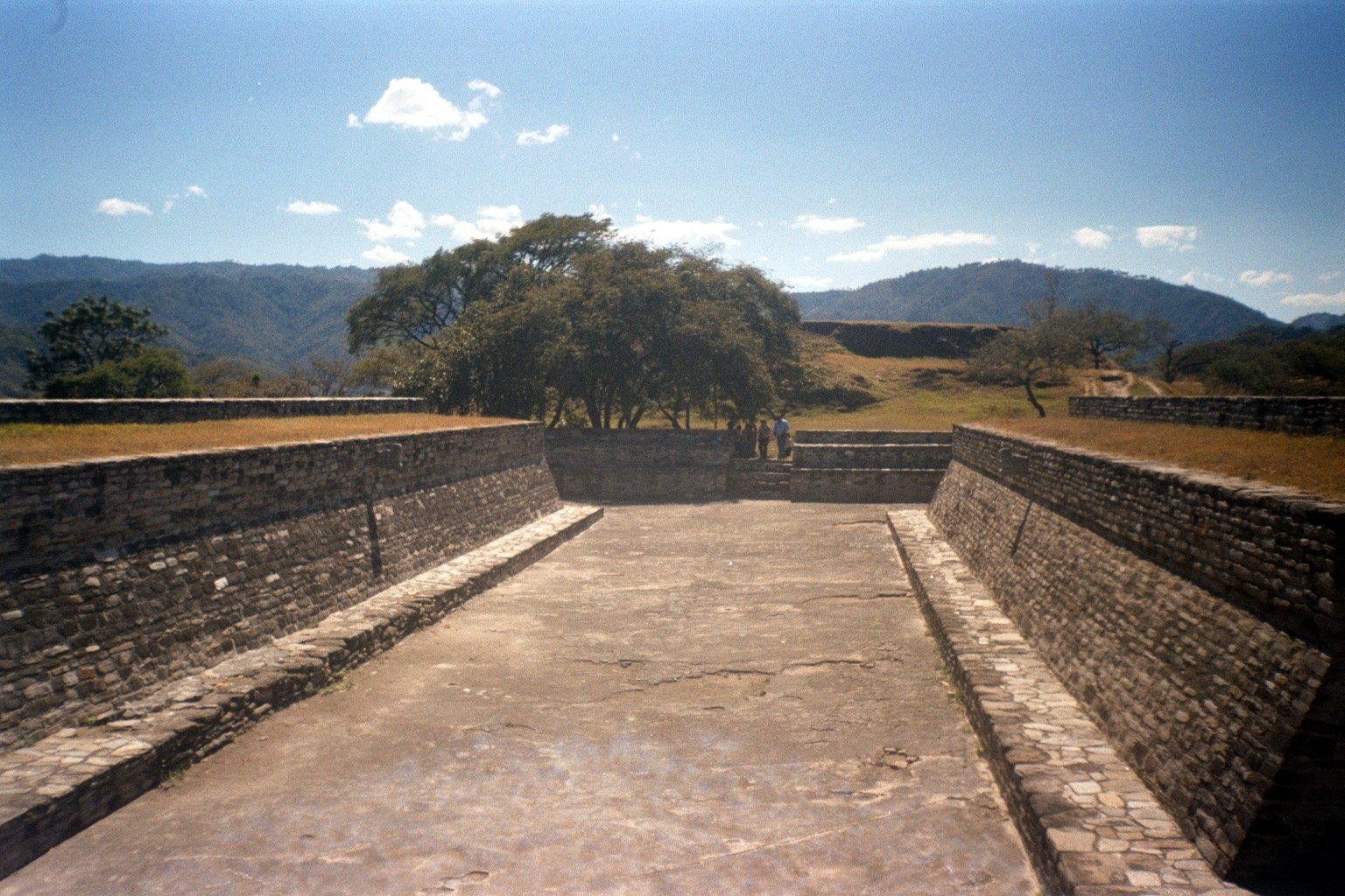
Ballcourt A11 is a sunken, enclosed court aligned north-south along the western side of the plaza. Its playing area measures 37.21 metres from north to south and 9.46 metres between the side benches. The sloping side walls were built from small stone slabs and topped with vertical cornices, while the end-zone walls were vertical. Stairways connected the plaza, the southern wall, and both end zones. Stucco fragments indicate that at least part of the court was coated.
Structures A12, A14, A31, and A32 were residential buildings. A12 survives as a stone outline. A14 stood immediately northeast of A5, while A31 and A32 stood near A5 on the northern side of the plaza. Group A-X contains two subgroups outside the main Group A walls.
Group B
Plaza and Ballcourt B1
Group B lies near the center of the site between Groups A and C. Its northern plaza is enclosed by Ballcourt B1, a double pyramid, and three platforms. A stairway with 28 steps descends the retaining wall toward Group D, and another stairway, arranged in two flights with 18 steps, descends toward Group A.
Ballcourt B1 is an enclosed, sunken court with a capital-I plan and a north-south alignment. Its playing alley measures 44.5 metres from north to south and 9 metres between the side benches. The end zones measure 17.46 metres from east to west. Large stones form the sloping walls and cornices. A drain carried rainwater from the northern end zone beneath Platform B2 and beyond the Group B retaining wall. The court was originally coated with multicolored stucco, much of which has disappeared.
A well-preserved tenoned ballgame marker was found on the western bench. A hole in the upper wall showed where it had stood, while the matching marker was missing and that section of wall had collapsed before excavation. Replicas now occupy the two positions, and the original is held at Guatemala City’s Museo Nacional de Arqueología y Etnología.
Platforms and Double Pyramid
Platform B2 is aligned northeast to southwest and faces northwest across the plaza. It has two stairways with steep balustrades and additional stairways behind it leading toward Group B-X. Double Pyramid B3 consists of pyramids B3a and B3b on a single basal platform. Each pyramid has five stepped levels, a west-facing stairway of 19 steps, broad balustrades, a small altar at the stairway base, and a summit platform for a temple. Both rise 6.17 metres.
The paired form of B3 reflects influence from the Valley of Mexico. A broken plain stela was recovered from the fill of B3a, and a funerary urn was found beneath the rear of B3b. A nearby drain carried rainwater from the plaza toward the area between Groups B and D.
Platform B4 closes the northern side of the Group B plaza. It has one corniced level, a central stairway facing south, a slab-paved top, and a low double terrace at the rear. Platform B5 occupies the northern part of the western side. It has two corniced levels and several stairways, overlooks the Pancaco River valley, and was built over an earlier phase that remains exposed along its rear wall. Pyramid B6 closes the southern part of the western side. Its summit has collapsed, and its final version was built over an earlier pyramid. Structure B7 is a small rectangular building probably used as an altar shrine.
Platform B8 is a range structure with inward-sloping walls and four stairways. It stands about 2 metres from the ravine beyond the Group B retaining wall, and many funerary urns were excavated around its base. Outside the main walls, B-X3 is a steep-sided step pyramid facing west toward the 13-metre-high retaining wall. It has a 15-step stairway, while its summit superstructure, probably made of perishable material, has disappeared. B-X4 is a restored, south-facing range structure with four inset stairways.
Group C
Pyramid C1 and Platform C2
Group C lies southwest of Group B and east of Group E. It contains two plazas, the principal Pyramid C1, Platform C2, smaller platforms, a high-status residential compound, and Pyramid C11. The East Plaza is approached through a narrow alley and an inset stairway outside the retaining wall. The West Plaza lies behind C2 and is enclosed by additional platforms.
Pyramid C1 developed through three successive phases. The earliest was a platform made from cut pumice. The second was a five-level stepped pyramid with two west-facing stairways of 16 steps, a temple, packed-earth walls covered with stucco, a stucco bench, and a floor hollow probably used for burning incense. The temple roof was probably thatched, and part of its rear wall survives to a height of 1.1 metres.
The final version measured 18.25 by 9.75 metres at its base and stood almost 2 metres higher than the preceding phase. It had five corniced levels and one stairway flanked by broad ramps. Parts of the earlier temple survived within its fill, while the final temple superstructure has disappeared. Both later pyramid phases were stuccoed. Some original coating survives, and restoration added new stucco modeled on the earlier surface. The 1976 earthquake reduced the upper part of the restored pyramid to rubble.
A burial in front of the earliest phase contained clay vessels, a necklace of small gold bells, and a copper axe. Later phases contained further ceramic offerings, and an artificially deformed skull was placed beneath the central axis of the final pyramid.
Platform C2 faces C1 and measures 47.3 by 14 metres. It rises 4.4 metres and occupies the highest position of any structure at the site. Its elaborate upper facade has four stairways separated by corniced ramps. Traces of stucco indicate that residential structures once stood on top. Built over an earlier, shorter platform, C2 probably restricted access to C1. Funerary urns were excavated at its base.
Plazas and Residential Compound
Structure C6 is an observation platform on the southern side of the East Plaza, facing south across the neighboring valley. Platform C7 is L-shaped and closes the eastern side and northeastern corner of the plaza, with steps extending along its length.
Structure C8 is a high-status residential compound entered from the alley leading to the East Plaza. Its stucco-floored patio was surrounded by rooms on three sides. The surviving lower walls of the northern and western rooms back onto a ravine. It is the only stuccoed residential building identified in the city. Its fine workmanship and position near C1 led Henri Lehmann to suggest that it may have been the high priest’s residence.
Structure C11 is a small west-facing pyramid temple built from small stone slabs over an earlier pumice structure. Platform C12 is a south-facing pumice platform dividing the West Plaza. Its surface contains a circular area of burnt clay probably used for incense. Platforms C13 and C14 occupy other sides of the West Plaza and the lower part of Group C. Groups C’1 and C’2 are unexcavated mounds east of Group C.
Groups D and E
Group D
Group D is dispersed east of Group B. Pyramid D1 is a west-facing, three-level pyramid on a low base with a single stairway and sloping balustrades. It is poorly preserved, with part of its southern side collapsed, but it was accurately restored. Platforms D2 and D3 have not been archaeologically investigated. D4 is a small central altar, and D5 is a long south-facing range structure with two stairways. Funerary urns were found beneath its rear wall.
Group E
Group E lies west of Group C and is enclosed largely by steep ravines and retaining walls. Pyramid E1, its principal building, has three construction phases. The earliest was a well-preserved pumice structure on a natural rise 2 metres high. A poorly preserved second phase followed, while the final phase encased both earlier structures and the natural rise.
The final E1 had four stepped levels on a basal platform, a west-facing stairway flanked by ramps, and a small altar at its base. Two stones were placed on the altar, one spherical and one perforated, possibly representing a mace or club. Funerary urns were found at the southern base.
Structure E2 is a range structure on the northern side of the plaza that has not been archaeologically investigated. E3 is a square altar facing E1. Platform E4 closes the eastern side of the plaza behind E1. It has two stairways, carefully fitted pumice walls, a slab-paved upper surface, a full-length rear bench, and an area of burnt clay flooring. Beneath its central axis was an offering consisting of two ring-shaped clubs and a stone ball.
Platform E6 closes the western side of the plaza and has four stairways. It supported perishable residences made from maize stalks bound with clay, as shown by impressions in surviving clay wall fragments. The platform itself was once stuccoed. Group E’ is a cluster of small buildings in the depression between the hills supporting Groups C and E.
Other Groups and Defensive Features
Group F lies west of Group E. Its principal feature, Mound F, was probably an observation platform covering the western pass into the city. A retaining wall supported it above the pass, and a circular earth platform may have carried a perishable watchtower.
Group G consists of small structures along the ridge north of Group A. Group H lies northeast of A and includes H1, a platform built on a natural mound. Group I, also known as the Campana Group, is the northernmost group. Group J is a cluster of small buildings immediately southwest of and adjoining Group A. Together with the ravines, retaining walls, and strengthened cliffs, these structures formed part of the city’s organization along the ridge.
Caves and Ritual Spaces
Three small caves occur in the ridge, and two were artificially modified in antiquity. Cueva de La Lola lies below Group A near the Pancaco River. It is 8.7 metres deep, 6.1 metres wide, and about 2 metres high through most of its length. The cave was widened and heightened, and rainwater forms a waterfall there during the rainy season. Part of the cave is formed from green phyllite. It was used for ceremonies associated with water and fertility, and ritual fires continued to be lit there in modern times.
Cueva del Murciélago lies at the southern end of the site. It is 14.3 metres deep, up to 1.5 metres wide, and 1.5 metres high. The cave was artificially widened and still showed evidence of Maya ceremonial use in the late twentieth century.
Funerary Urns and Ceramics
Numerous funerary urns were excavated beneath platforms, pyramids, altars, and all the principal plazas. They held cremated human remains, and their sides commonly had three holes and polychrome decoration in black, red, and cream. The serpent designs belong to a distinctive highland Maya ceramic style known as Chinautla Polychrome.
Elite cremation in urns was unusual in the Postclassic Maya highlands and appears to represent a local tradition. Commoners were buried in simple tombs outside the city center. Fifty-two urns were excavated, but eight were destroyed in the 1976 earthquake, leaving 44 available for study. Twelve had been held at the Musée de l’Homme for about thirty years. The Mixco Viejo artefacts were repatriated to Guatemala in 1998.
Each urn contained the cremated remains of one adult, generally mature or elderly. Young adults were not represented, suggesting that elite warriors may have received different burials. The bodies appear to have been burned whole without special treatment of the skull, although a skull offering was found at C1. Artificial skull deformation occurs among the elite. Animal bones, especially deer, parrots, and birds of prey, were found in a substantial portion of the urns, while only six contained associated funerary offerings.