Kaminaljuyu: A Major Maya Urban and Ceremonial Center in Guatemala
Site at a Glance
- Rating
- 4.5
- Popularity
- Medium
- Country
- Guatemala
- Primary era
- Classical
- Eras represented
- Bronze Age, Iron Age, Classical, Medieval
- Civilizations
- Maya
- Site type
- City
On this page17 sections
History
Kaminaljuyu is a major Maya urban and ceremonial center in Guatemala City, Guatemala, whose occupation began by at least the second millennium BC and continued through the Preclassic and Classic periods. Located in the Valley of Guatemala within the Southern Maya area, it developed from an agricultural settlement into a socially differentiated center with religious and civic institutions, monumental construction, specialized craft production, and extensive regional exchange.
Origins and Preclassic development
The earliest substantial settlement belongs to the Arévalo phase. During the Las Charcas and Providencia phases, Kaminaljuyu expanded beyond a farming community and developed institutions, craft workshops, public buildings, and systems of exchange. The phase sequence also includes Verbena, Arenal, Santa Clara, Aurora, Esperanza, and Amatle. These divisions are based mainly on changes in pottery and other material remains, and their absolute dates remain partly uncertain because relatively few radiocarbon anchors are available.
Kaminaljuyu reached its Preclassic apogee during the period traditionally called Miraflores, now divided into the Verbena and Arenal phases. It became one of the most important political and cultural centers of the Southern Maya area, although its exact size, degree of political integration, and wider regional role remain debated. Its position linked the Pacific coast, the Guatemalan piedmont, the Maya Lowlands, and central Mexico. Trade involved obsidian, salt, fish, shells, cacao, agricultural products, jadeite, feathers, jaguar skins, and other goods. Pacific marine fish in a Late Preclassic dedicatory deposit provides evidence for exchange over considerable distances.
Prosperity was closely connected with the El Chayal obsidian source northeast of modern Guatemala City. Obsidian is volcanic glass that can be fractured into very sharp edges and was widely used for blades and other tools. Material from the area circulated through the Southern Maya area and the Lowlands, although the precise nature of Kaminaljuyu’s control over the deposits is uncertain.
Crisis and transformation
From the second century AD, Kaminaljuyu began to decline. Political disruption, changing trade, environmental stress, and population movement have all been proposed as possible factors. The Miraflores lake and related water systems later experienced reduced water levels, perhaps because of drought, overuse, or both.
During the Santa Clara phase, approximately AD 100 to 200, monuments were deliberately defaced, broken, and discarded. Some of the damaged images represented animals associated with water. Large quantities of pottery were also intentionally broken and deposited, while the population declined sharply, possibly through mass migration. The settlement was greatly reduced during the Aurora phase, approximately AD 200 to 400. The destruction of texts and interruption of construction have sometimes been connected with foreign incursions, but the cause remains uncertain.
A revival began around the fourth or early fifth century. During the Esperanza phase, approximately AD 400 to 550, Kaminaljuyu recovered political and economic strength. Teotihuacan, a major urban and political center in central Mexico, exerted a marked cultural influence. Teotihuacan-style objects, artistic forms, religious concepts, and possibly immigrant elites entered the city, although whether Kaminaljuyu was ever controlled militarily by Teotihuacan remains disputed.
In the fifth century, a Teotihuacan trading enclave at Solano was under Kaminaljuyu’s control before Teotihuacan-associated groups became established within the city. By the end of that century, some of these groups had entered the local elite through marriages with prominent families. Their settlement remained concentrated in a peripheral district. During the sixth century, Kaminaljuyu again became a powerful polity, controlling parts of the Guatemala Valley and extending influence toward the Salama Valley, Chiapas, and El Salvador. Trade with central Mexico declined, and imported goods became more concentrated among the upper elite.
Late occupation and abandonment
In the seventh century, the political unity of the Guatemala Valley broke apart, possibly through invasion, conquest, or socioeconomic crisis. Kaminaljuyu underwent another population decline around AD 700 but remained the region’s principal ceremonial center until late in the Amatle phase, approximately AD 550 to 900. Major ceremonies eventually declined, while residential occupation continued. Final abandonment is generally placed around the end of the Classic period or around 1200 AD.
The modern name was assigned in the 1930s by José Antonio Villacorta, Guatemala’s Minister of Public Education. It replaced the inconsistent use of names such as Miraflores, Arévalo, Providencia, Las Charcas, and La Esperanza for areas understood to belong to one settlement. The name is commonly translated as “Hill of the Dead” or “Mounds of the Ancestors,” although its linguistic origin and meaning are uncertain. Proposed earlier names, including Tulan Tsu, Chih Ka’, and Chiih Witz, are also not certain identifications.
Excavation and preservation
More than fifty archaeological projects have taken place at Kaminaljuyu over roughly a century. Manuel Gamio conducted limited excavations in 1925 and recovered deep cultural deposits, pottery fragments, and clay figurines. In the 1930s, two mounds were cut to enlarge a local football field, exposing a substantial buried structure and prompting investigations by Alfred Kidder, Jesse Jennings, and Edwin Shook.
E. M. Shook mapped the site from the 1930s onward, while Alfred Maudslay and Samuel K. Lothrop recorded sculptures and prepared maps. Heinrich Berlin excavated a major mound in the early 1950s. Pennsylvania State University carried out extensive work in the 1960s under William T. Sanders and Joseph W. Michels. Marion Popenoe de Hatch and Juan Antonio Valdés investigated southern districts during the 1990s, and a Japanese team studied a large mound near the archaeological park.
The early investigations established Kaminaljuyu’s importance in the study of early Maya civilization. Later research in the Pacific coastal region and Guatemala changed ideas about where complex social and cultural developments began, while renewed discoveries in the Southern Maya area brought Kaminaljuyu back into wider discussions of Maya origins. Urbanization has severely reduced the site. An archaeological park of approximately 0.5 square kilometers preserves part of the Classic-period center, while the original ruins field covered roughly 5 square kilometers. Buried and exposed remains continue to be threatened by construction and demolition.
Remains
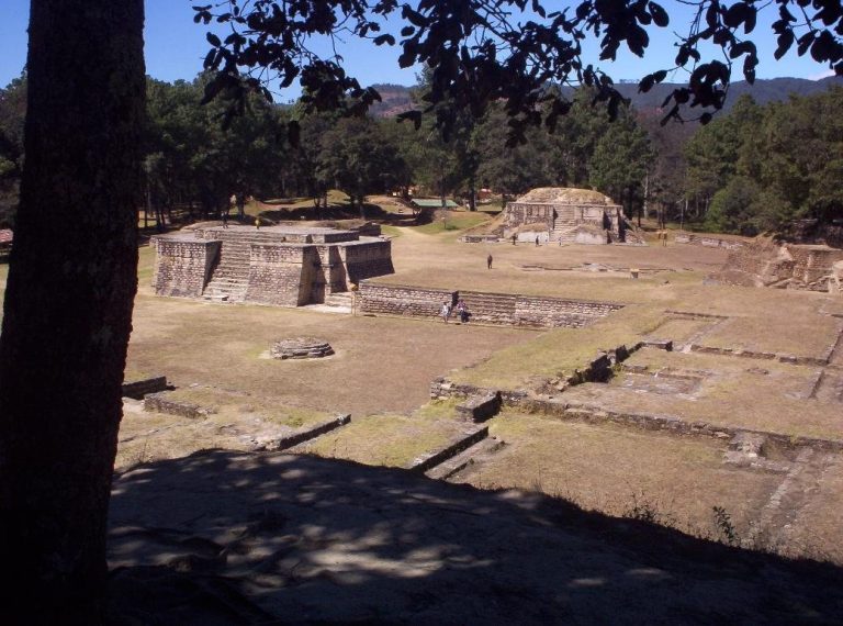
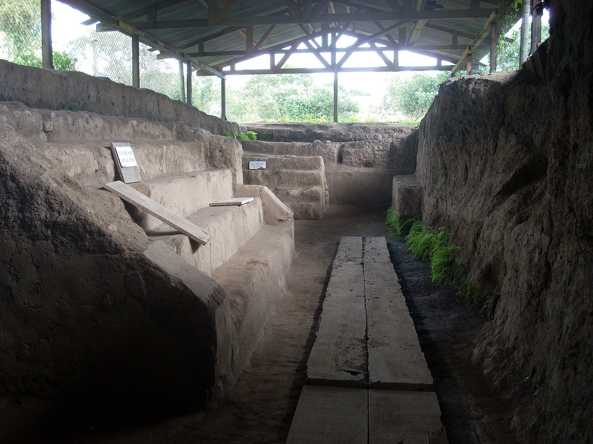
Kaminaljuyu occupied a broad plain beneath the western part of modern Guatemala City, beside the now-extinct Lake Miraflores. Rich volcanic soils, deep layers of hardened volcanic tuff, and ravines known as barrancos shaped the setting. The settlement consisted of platforms, pyramidal mounds, plazas, temples, residences, administrative buildings, ballcourts, canals, reservoirs, drains, and conduits. Buildings were constructed mainly from adobe and wood rather than the limestone common in the Maya Lowlands, and this earth-based construction has contributed to the poor survival of the remains.
Platforms, mounds, and ceremonial buildings
Early scientific maps recorded about 200 platforms and pyramidal mounds. Other descriptions identify approximately 100 platforms and more than 200 mounds across roughly 5 square kilometers. Much of this settlement has been destroyed or buried beneath the modern city, leaving the central acropolis as the principal surviving part.
Early mounds
Large Mounds A and B belong to early construction dating broadly from the second millennium or early first millennium BC through the Middle Preclassic. Mound A contained substantial early cultural material, while Mound B is associated with the Middle Preclassic. Excavations in Mound A revealed the remains of eight people, along with jade beads, shell ornaments, jade earplug flares, numerous shells, a finely made obsidian blade, a tortoiseshell, metates, a whistling jar, a carved tripod vessel, and coarse vessels probably used for food offerings. A metate is a stone grinding surface used with a handstone to process maize and other foods.
Mound E-III-3
Mound E-III-3 was built during the Miraflores period in a sequence of seven structures placed successively over and around earlier constructions. This layered arrangement has been described as an onion-skin sequence. The final mound had a volume of approximately 75,000 cubic meters and contained an estimated 15 million pottery fragments, representing at least about 500,000 vessels.
Two exceptionally rich royal tombs were placed within the mound’s structures and are interpreted as the burials of successive rulers during the Miraflores apogee. Other elite tombs were constructed beneath temple pyramids. During the Middle and Late Preclassic, the main ceremonial and administrative center was organized around a large plaza bordered by pyramids with temples, palaces, and elite residences. Twelve ballcourts have been identified from the Esperanza phase and later Classic phases. A Mesoamerican ballcourt was a formal space used for the ritual ball game.
Water-control systems
Kaminaljuyu’s hydraulic infrastructure included canals, reservoirs, drains, water conduits, and clay pipes beneath streets. An aqueduct approximately 5 kilometers long carried fresh water from a spring to the settlement. The scale of these installations, particularly those in the southern precincts, implies organized labor and an administrative hierarchy responsible for their maintenance. They supported irrigation and agricultural production, although later silting and reduced water supply may have contributed to economic decline.
Miraflores and San Jorge canals
The Middle Preclassic Miraflores canal began south of Lake Miraflores. Its northern section was about 3.30 meters wide and 5.80 meters deep, with a V-shaped profile. The known southern end was more than 7.60 meters wide and about 0.50 meters deep, with a U-shaped profile. Its total length is estimated at 500 to 1,000 meters.
The San Jorge canal ran approximately parallel to the Miraflores canal. It reached about 18 meters in width, 8 meters in depth, and 1,750 meters in length. Secondary channels connected it with intensively cultivated plots, and a hydraulic step reduced the speed of the water.
Mirador canal
The Mirador canal intersected the Miraflores canal. It was about 230 meters long, approximately 2.60 meters wide and 3 meters deep at its northern end, and narrowed to about 1.60 meters in width and 0.35 meters in depth. Its date is uncertain but may fall in the Late Preclassic. Right-angled projections in its walls have been interpreted as sluice gates, while sloping floor sections helped retain sediment.
Sculpture, writing, and imagery
During the Miraflores period, plazas, platforms, and temples carried brightly colored murals, large architectural masks, and eclectic sculptures. The imagery included toads, bats, owls, jaguars, serpents, the Principal Bird Deity, the maize god, the Hero Twins, and a merchant deity. Many monuments also bore hieroglyphic texts, indicating the presence of a literate elite during the Preclassic period. Numerous monuments were later broken, defaced, or lost.
Stelae 10 and 11
Stela 10 is a fragment of a gigantic throne or monument carved from black basalt and dated broadly between 400 and 200 BC. It originally stood near the principal palace. The monument was broken and partly scraped in antiquity before being buried with Stela 11. Its imagery includes a large anthropomorphic jaguar, another deity, a kneeling human figure, and a substantial hieroglyphic inscription.
Stela 10 also shows a decapitation scene. A ruler impersonating an underworld jaguar deity raises a flint axe over a probable captive, while a jaguar deity’s head appears beside him in connection with blood-burning in a sacrificial vessel. Stela 11 depicts a standing male figure in an elaborate costume with several dragon masks and a ceremonial flint-like knife. A celestial dragon appears above him, and two censers stand at his feet. A censer is a vessel used to burn incense or other substances.
Later monuments
Other early monuments include Stelae 15 and 21, Altars 1 and 2, and Monument 65. Assigned to the Arenal phase, Monument 65 shows three seated rulers on thrones. Each is framed by two bound, kneeling, nude captives arranged in lower, central, and upper registers.
Domestic, agricultural, and craft remains
Las Charcas-period pits provide evidence for household activities. Shallow bowl-shaped pits were probably first used to extract building clay and later served for refuse. Bottle-shaped pits were used for cooking, storage, and refuse, and contained carbonized avocado seeds, maize cobs, and remnants of textiles, basketry, mats, and rope.
Las Charcas communities made hand-modeled reddish-brown clay female figurines, sometimes covered with white slip. Many represent pregnant women and may have served as fertility offerings. Their heads received detailed treatment, while arms and legs were often represented as stumps. Ceramic production began during this phase. Early vessels were mainly functional, while later Las Charcas pottery included white vessels with red spider monkeys, dragon masks, and geometric designs. Providencia and Verbena ceramics show connections with other Preclassic regions.
Large areas were devoted to obsidian working and specialized production. Cotton, maize, annonas, avocados, cacao, black beans, palm nuts, plums, and sapodilla were cultivated, while useful trees grew in terraces descending toward the ravines. Burials contained jade, jadeite, shell, tortoiseshell, obsidian, stone, and other materials, including approximately 5,000 jade disks.
Classic-period alterations
Teotihuacan influence appears in fifth- and sixth-century sculpture, ceramics, figurines, and green obsidian. It also appears in talud-tablero platforms and stairways with balustrades. Talud-tablero is an architectural arrangement in which a sloping wall supports a vertical panel. Large quantities of Teotihuacan-style pottery were found in fifth- and sixth-century contexts.
During the second half of the sixth century, elite residences were abandoned and the center shifted to an acropolis containing substantial adobe structures. A sample of objects recovered at Kaminaljuyu is preserved in Guatemala’s National Museum of Archaeology and Ethnology, while many other remains have been damaged or erased by urban development, demolition, and construction.