Tzintzuntzan: Ceremonial Center of the Purépecha Capital
Site at a Glance
- Rating
- 4.7
- Popularity
- Medium
- Country
- Mexico
- Primary era
- Medieval
- External website
- Open
- Eras represented
- Medieval, Early Modern
- Civilizations
- Purépecha, Spanish
- Site type
- City
On this page18 sections
History
Tzintzuntzan is the former ceremonial center of the Purépecha capital in Centro, Michoacán, Mexico, built during the Late Postclassic period around 1450. The Purépecha, also historically called the Tarascans, were a Mesoamerican people whose empire centered on the Lake Pátzcuaro region. Tzintzuntzan served as the empire’s principal religious, political, and administrative center, and its name derives from the Purépecha word Ts’intsuntsani, meaning “place of hummingbirds.”
Formation of the Purépecha capital
Purépecha dominance in the Lake Pátzcuaro region may have begun around AD 1000 and was established by about 1250. Traditional history places the warrior ruler Tarícuri at the center of the early political consolidation. It states that he made Pátzcuaro his capital around 1325, while his nephews governed Ihuatzio and Tzintzuntzan. Political authority later shifted to Tzintzuntzan, although the traditional account assigns exceptionally long reigns to these rulers and remains uncertain in its chronology.
By around 1440, the empire’s administrative bureaucracy had been concentrated at Tzintzuntzan. During the expansion that followed, approximately between 1440 and 1500, the city directed political, economic, and religious life across a territory that included much of present-day Michoacán and parts of Guanajuato, Guerrero, and Jalisco. The Purépecha Empire was the second-largest Mesoamerican empire by territory when the Spanish conquered Tenochtitlan.
The capital extended from Lake Pátzcuaro to the eastern hills. At its height, its population was at least five times that of any other city in the empire and represented about 36 percent of the population of the Lake Pátzcuaro Basin. An estimated 25,000 to 30,000 people lived there when the Spanish arrived in the 1520s. The ceremonial center, called Taríaran, or “House of the Wind,” combined religious functions with defensive purposes and formed the principal monumental complex of the capital.
Spanish conquest and colonial transformation
Tzintzuntzan surrendered without fighting during the Spanish conquest. Epidemics including smallpox and measles had already severely reduced the Purépecha population and probably killed the emperor Zuangua. His inexperienced successor, Tangáxoan II, tried to avoid the destruction that had overtaken Tenochtitlan, but Spanish officials acting without royal authorization eventually burned him at the stake.
During the 1520s, Tzintzuntzan became the first capital of the Spanish province of Michoacán. Franciscan friars arrived to evangelize the Purépecha, and their monastery complex was built partly with stone taken from the ceremonial center’s yácatas. The provincial capital moved to Pátzcuaro by the 1530s. Tzintzuntzan’s population then collapsed, and the city was almost completely abandoned.
Historical knowledge and archaeological investigation
Knowledge of Tzintzuntzan and the Purépecha Empire comes from archaeological evidence and Spanish writings. The principal early account is the Relación de Michoacán, compiled by Jerónimo de Alcalá in 1539 from information supplied by members of the Purépecha elite.
The site was identified in modern historical writing as the ancient Purépecha capital in 1855. Nicolás León carried out the first fieldwork in 1888, while formal excavation began in 1930 under Alfonso Caso and Noguera. From 1937, eleven seasons of work cleaned, consolidated, and reconstructed the main architectural remains. Caso concentrated on Yácata 5 and the northern end of the yácata alignment, although difficult soil conditions complicated stratigraphic and chronological analysis.
Work between 1940 and 1946 completed Yácata 5 and investigated Buildings B and C, burials, and areas near Yácatas 1, 4, and 5. Topographic and stratigraphic studies were used alongside ceramic analysis. Román Piña Chan directed further investigations from 1962 to 1968, including the reconstruction of the front of Yácata 1, work on the wall around the Grand Platform, the discovery of Building D and an altar in Building B, additional excavation at Yácata 5, and exploration of the Santa Ana neighborhood.
A detailed site map was prepared during the 1970s using archaeological evidence and historical records. Efraín Cárdenas led the last stated archaeological study in 1992, when the northwest face of the Grand Platform was restored and the site museum was constructed. The archaeological zone covers at least 1,075 hectares and includes at least 1,000 archaeological features. Mexico’s National Institute of Anthropology and History owns the site. Tzintzuntzan also continues to host annual Indigenous cultural events involving communities around Lake Pátzcuaro, especially song and dance performances.
Remains
The archaeological zone centers on the former ceremonial complex, constructed on a large artificial platform cut into Yahuarato Hill on the northeastern shore of Lake Pátzcuaro. The elevated position overlooks much of the lake and its shores, while the hill contributed to the site’s defensive function. The Grand Platform, its row of five yácatas, the ceremonial plaza, elite buildings, burials, residential areas, and later colonial structures together reveal the organization of the Purépecha capital.
The Grand Platform and ceremonial complex
Grand Platform
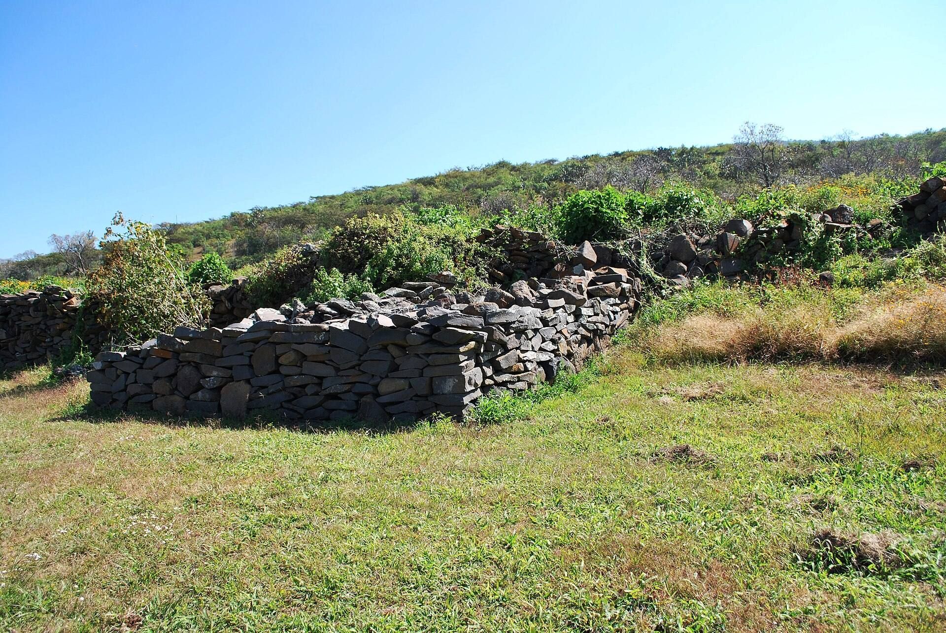
The Grand Platform is a level artificial surface approximately 450 by 250 meters in size, cut into the hillside. The five yácatas and other structures stand on it, and sections of its perimeter were reconstructed during modern archaeological work. The platform held the religious and political elite, their servants, and guards. Rituals dedicated to different deities, the sun, and the moon took place there, along with ceremonies associated with the equinoxes.
Yácata pyramids
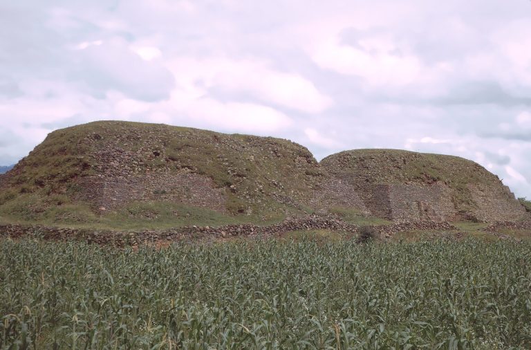
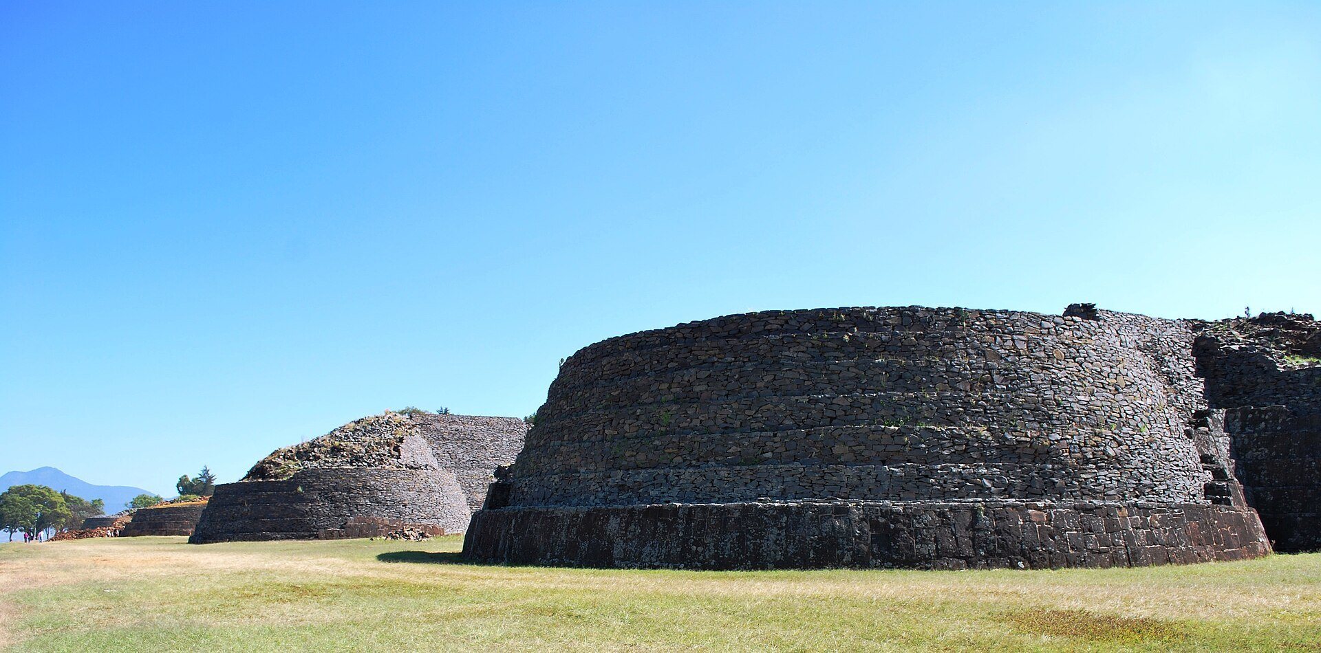
Five yácatas form an approximately north-to-south row along the front of the platform, facing Lake Pátzcuaro. A yácata is a distinctive Purépecha pyramid form with a rounded or semicircular front and a stepped rear platform. At Tzintzuntzan, the structures are roughly keyhole-shaped, with rounded fronts joined at the back by stepped pyramidal platforms.
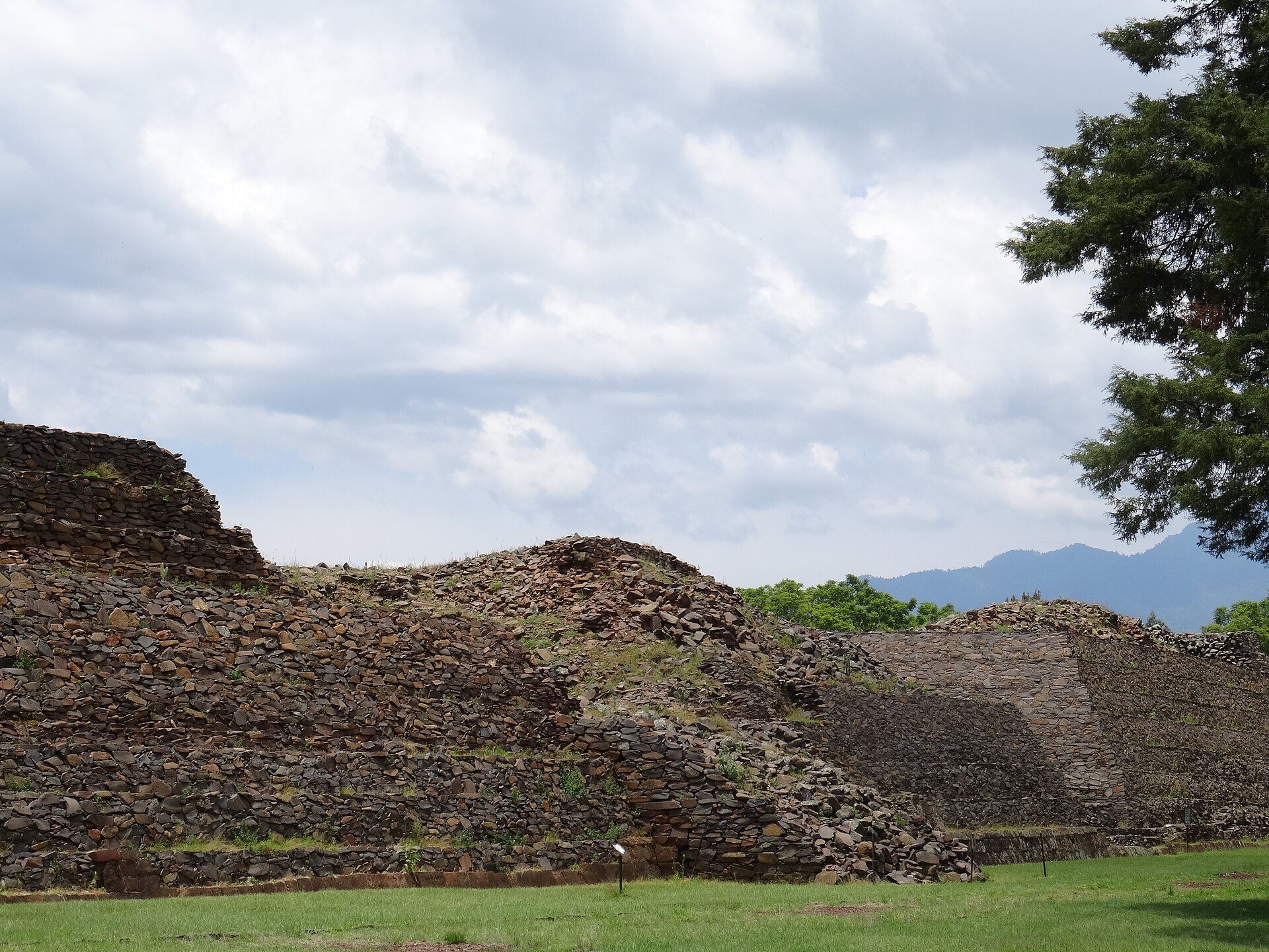
Each yácata has a rubble core faced with fitted stone slabs decorated with spirals, circles, geometric designs, and petroglyphs. Wooden temples once stood on their upper surfaces, where major Purépecha religious and governmental rites were held, including burials. Approximately sixty burials have been excavated, many containing rich offerings and probably associated with rulers and high priests. Three of the yácatas remain unreconstructed.
Earlier pyramidal structures
Openings between Yácatas 3 and 4 expose older pyramidal structures beneath the later monuments. These remains include three sets of stairs and part of a circular wall, representing the first occupation phase of the ceremonial complex. The yácatas and Grand Platform belong to a later occupation phase.
Ceremonial plaza
A large plaza lies behind the row of yácatas and contains smaller structures. It formed part of the principal ceremonial and political area, where religious rites and public ceremonies were conducted. The plaza and the yácata alignment occupy the central monumental zone of the artificial platform.
Elite and administrative buildings
Building B, or El Palacio
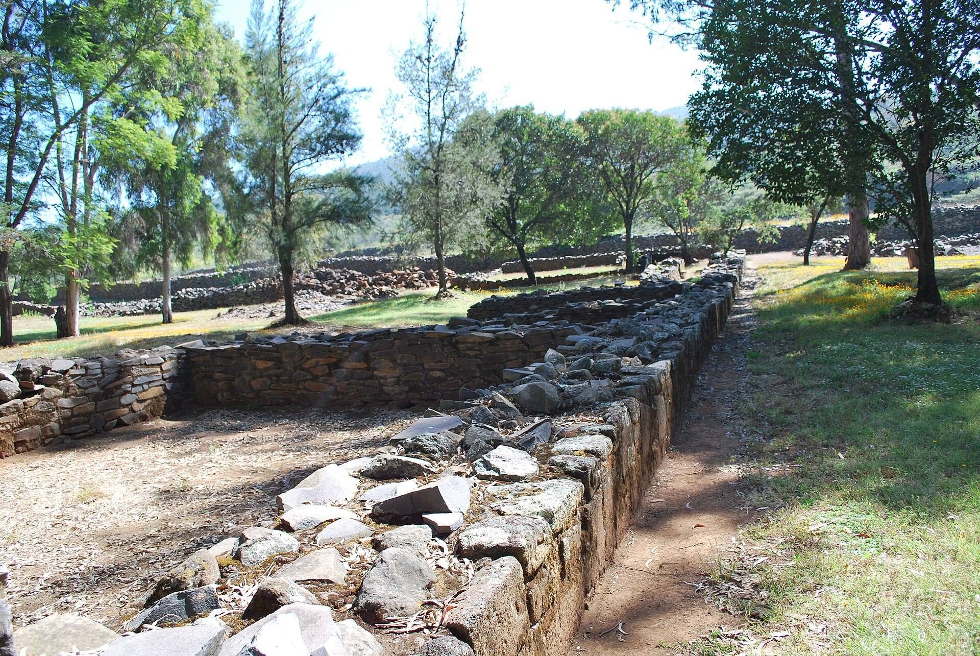
Building B, also called El Palacio, stands at the northern end of the platform. Explored during the 1940s and the 1980s, it contains several burials associated with monarchs and high priests. Its function has been interpreted either as a royal palace or as a residential area for elite priests. One room was used to store the heads of enemies killed in battle.
Building E
Building E stands within a small wooded area on the platform. It was used to store tribute or offering goods and contains evidence of occupation during the early colonial period, linking the structure to the transformation of the site after the Spanish conquest.
Buildings A and D
Buildings A and D are colonial-period structures identified during archaeological investigations. Building A was discovered during work in 1938, while Building D was found during the investigations directed by Román Piña Chan from 1962 to 1968.
Residential and craft areas
City wards and marketplace
The city was divided into approximately 40 wards, each containing about 25 households. Commoners lived in small houses, farmed, and made consumer goods in residential workshops. A marketplace probably operated daily and handled local and imported goods, although its location has not been determined.
Santa Ana neighborhood
Santa Ana, a neighborhood in front of the yácatas, was explored archaeologically. Outside the site’s perimeter, excavators also found an obsidian workshop with associated residential quarters, providing evidence for craft production and domestic life beyond the ceremonial center.
Site museum
The Site Museum of the Tzintzuntzan Archaeological Zone was built and opened in 1992. Its exhibition hall contains religious, decorative, and utilitarian objects from the site, together with historical graphics and a map showing the places in Michoacán from which the displayed objects originated.