Mine Howe: An Iron Age Underground Complex in Orkney
Site at a Glance
- Popularity
- Medium
- Country
- United Kingdom
- Primary era
- Iron Age
- Eras represented
- Iron Age, Medieval, Modern
- Civilizations
- Unclassified
- Site type
- Religious
- Remains
- Sanctuary
On this page16 sections
History
Mine Howe is an Iron Age underground complex in Tankerness on southeastern Mainland, Orkney, United Kingdom. The Iron Age, when iron tools and weapons came into widespread use, has different dates in different regions; Mine Howe is broadly dated to about 200 BC to AD 500. Its origin and intended purpose remain uncertain.
Iron Age use and interpretation
Local tradition held that the mound enclosed a built structure. The name element Howe comes from the Old Norse haugr, meaning a mound or barrow. Deposits in the surrounding ditch indicate activity from the early Iron Age until the middle of the first century AD. The ditch was cleaned and deepened repeatedly before it was filled in.
Mine Howe is often interpreted as a place of religious importance, perhaps a shrine or oracle, meaning a place believed to provide divine guidance. This interpretation remains uncertain. One proposal connects the underground complex with beliefs in deities of the underworld and in reaching the realm of the dead through openings such as springs, pits and shafts.
Excavation and rediscovery
In 1946, Charles Tait and local teacher Alfie Hacus excavated the mound and interpreted the complex as a Pictish dwelling. The Picts were peoples of northern Scotland known from late antiquity and the early medieval period. The excavators closed the shaft with barrels and filled it in. Their work was not published, although the Inspector of Ancient Monuments was notified.
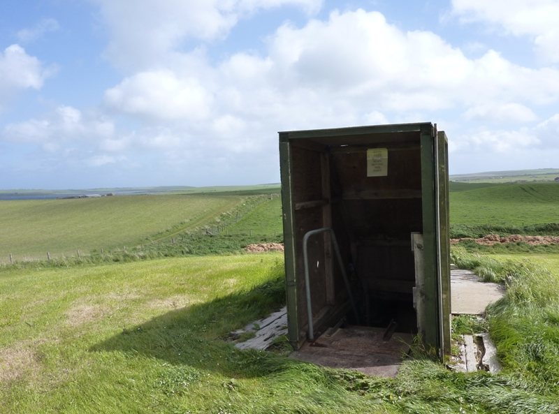
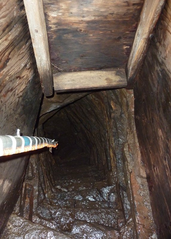
Farmer and landowner Douglas Paterson rediscovered the site in 1999. He cleared accumulated material from the shaft, built a small wooden entrance and stairway, and opened the chamber. In 2000, the British archaeological television programme Time Team carried out further excavation and built a small replica nearby to investigate the structure’s construction. Investigators also examined parts of the ditch and an apparent earthen approach route.
The Orkney Archaeological Trust began systematic investigations in 2000. From 2002 to 2005, the Mine Howe Environs Project examined the area where traces of metalworking had been found.
Remains
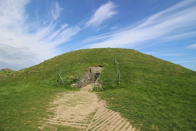
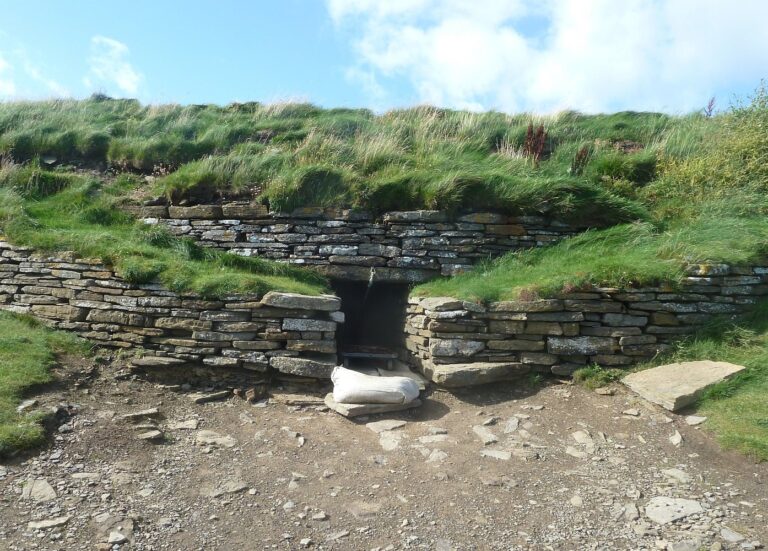
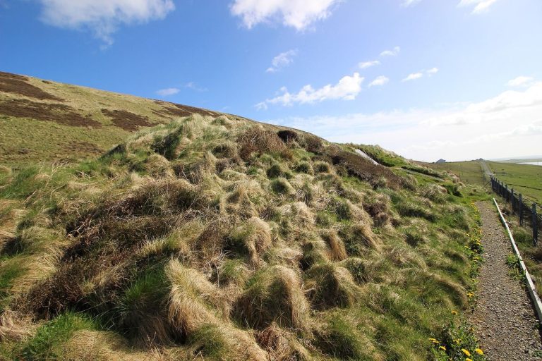
Mine Howe occupies a mound near the farm of Breck and the burial mound Long Howe. An oval ditch surrounds the mound, with an entrance on its western side. The underground stone structure lies beneath the mound, while remains of a metalworking workshop are situated outside the ditch to the west.
Mound and enclosure
The mound
The mound formed as a result of glacial movement and measures about 95 m across and 3 to 4 m high. It provides the setting for the underground complex, whose entrance is at the mound’s summit.
The ditch and western entrance
The oval ditch encloses an area about 41 m from north to south and 37 m from east to west. It was several metres wide and deep, with stone lining along its base and lower walls. A broad opening on the west connected with an apparently earthen approach route; stones reinforced the route’s sides where it crossed the ditch. Later, the ditch filled with layers of domestic refuse, or midden. Finds in these deposits include Roman glass, a metal clothing brooch and pottery from the middle and later Iron Age.
Underground structure
Entrance, stairs and galleries
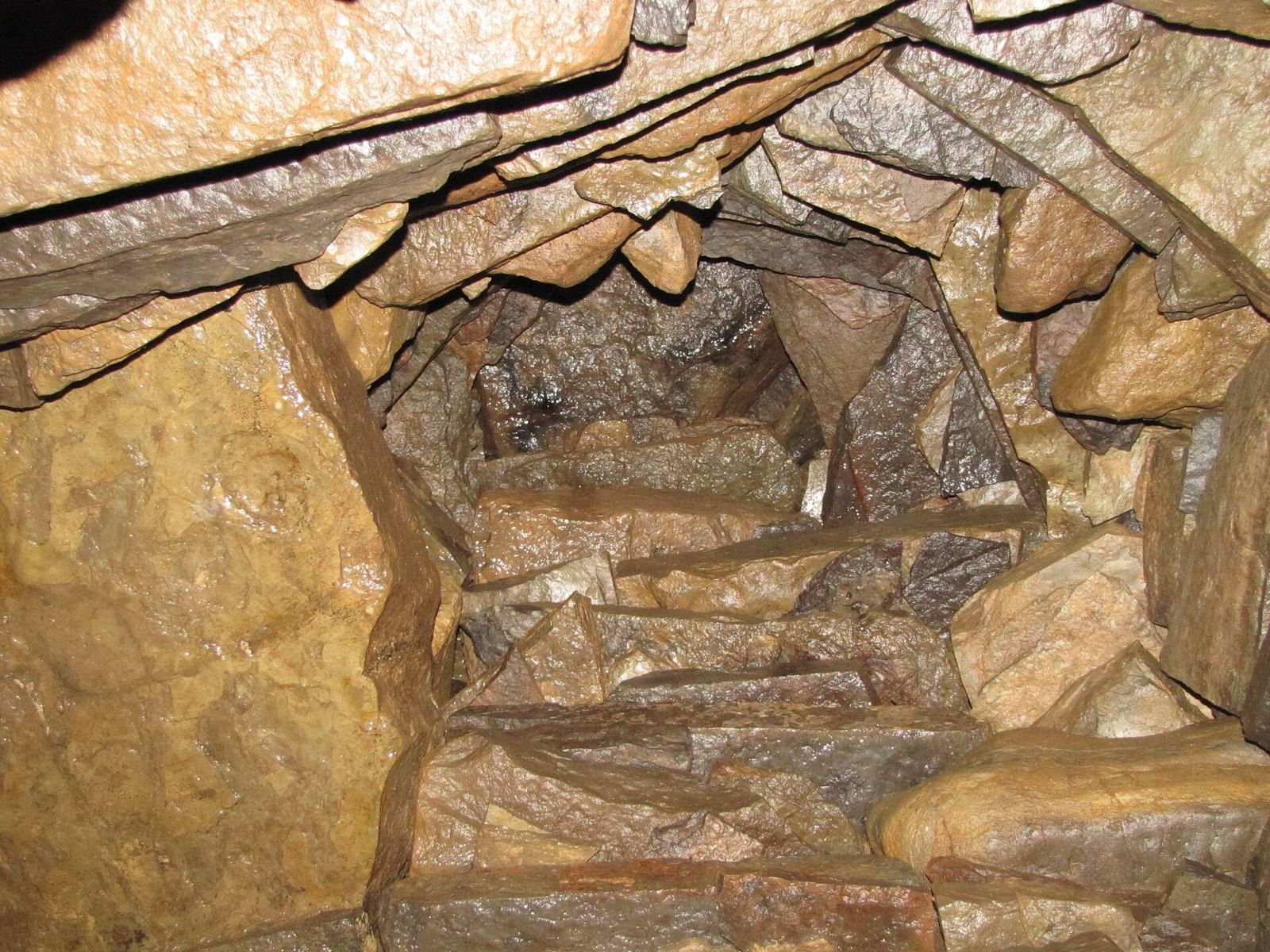
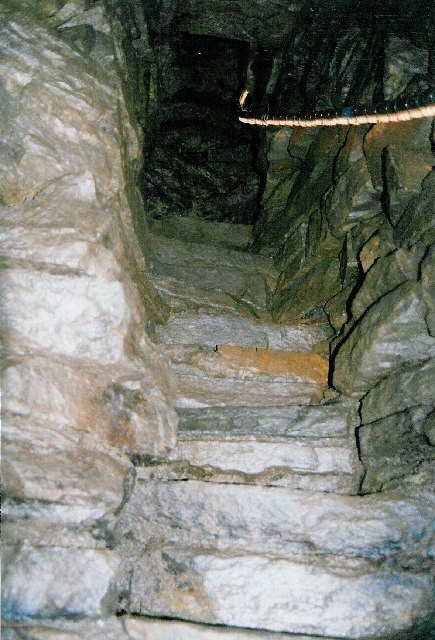
A space 4.4 m in diameter was cut into the bedrock beneath the mound, and a stone structure built without mortar was set within it. An early excavation described a steep, narrow spiral stone stair. The present descent begins with a modern metal stair that drops 1.85 m through unstable soil, thought to consist largely of accumulated refuse. It meets an Iron Age flight of 17 stone steps, which runs north to south and descends a further 2.75 m to a lower floor.
Two short, curved galleries open from this level. The lower begins 0.43 m above the floor and extends 2.4 m; the higher begins 1.42 m above it and extends 2.8 m.
Lower chamber and water tank
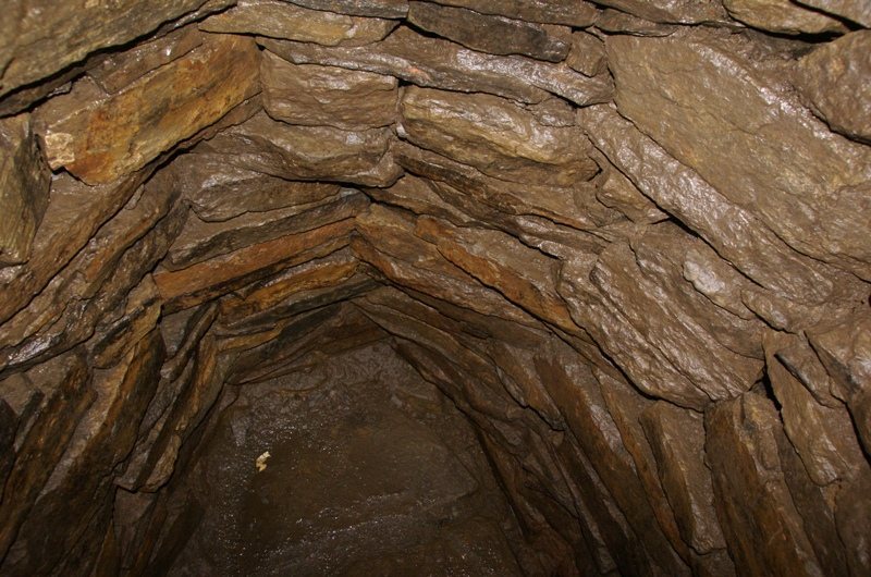
A second Iron Age stairway, with 11 steps, descends 1.9 m from the gallery floor to a lower chamber. Its stone water tank measures 1.3 m in diameter, and stones forming the chamber roof stand 4.1 m above the floor. The chamber is more than 4 m high, with a sandstone roof built in courses that project inward as they rise. Its floor lies about 7.5 m below the mound’s summit. The chamber may have held water from the beginning and may have served as a cistern; it contains water only rarely today.
Metalworking workshop
Smithy and associated burials
The workshop remains lie west of the mound, beyond the ditch. Metalworking took place around a large central hearth during a phase dated to about 100 BC to AD 110, and an ironworking furnace was also identified. Finds from the area include tools, moulds, iron ore and a sword pommel made from whale tooth. A young woman was later buried beneath the smithy floor, with a toe ring on each foot and an antler object on her chest. A second human skeleton lay in a shallow pit without grave goods.
Burial and house remains
Stone burial container
Near the mound’s summit, a small stone-built burial container held dark, charcoal-rich fill and a small quantity of cremated bone.
Pictish house and earlier dwelling
West of the mound are the remains of a Pictish flower-shaped house, a dwelling with compartments radiating from a central space. It was probably built over a roundhouse, a circular dwelling.
Regional parallels
Comparable underground structures are known at the Knowe of Skea and elsewhere in Caithness and Shetland. At the Broch of Gurness, a substantial Iron Age stone tower, a well with steps leading to a water tank was built at the same time as, or possibly before, the tower. A simpler comparable well at the Broch of Breckness was excavated in 1993.