Melilla la Vieja: The Fortified Citadel of Melilla, Spain


Site at a Glance
- Rating
- 4.7
- Popularity
- Medium
- Country
- Spain
- Primary era
- Early Modern
- External website
- Open
- Eras represented
- Iron Age, Classical, Medieval, Early Modern, Modern
- Civilizations
- Carthaginian, Crown of Castile, Phoenician, Roman, Spanish, Umayyad
- Site type
- Military
- Remains
- Citadel
On this page20 sections
History
Melilla la Vieja is a fortified citadel in Melilla, Spain, occupying the site of ancient Rusadir, a Phoenician trading settlement founded in the eighth century BC on the North African coast. Its position on the Alboran Sea connected the settlement with western Mediterranean maritime routes and gave it lasting commercial and strategic importance.
Rusadir under Carthage and Rome
From the sixth to the third century BC, Rusadir was controlled by Carthage while retaining its maritime and commercial role. Rome incorporated the settlement into the province of Mauretania Tingitana in the second century BC. It later became a municipium, a Roman town granted a defined level of civic status and administrative privileges. A defensive wall was present by the first century BC.
After the fragmentation of the Roman Empire, Rusadir was sacked by the Vandals and briefly reoccupied by the Byzantines. A Visigothic presence at Melilla has not been established. By the seventh century, the settlement was in decline, before it was incorporated into the Islamic world.
Islamic Rusadir and the medieval decline
Between the seventh and fifteenth centuries, Rusadir belonged successively to several Muslim powers. In 927, Abd al-Rahman III, the Umayyad caliph of Cordoba, ordered the construction of a substantial stone wall. This strengthened the settlement as a naval base for controlling the Strait of Gibraltar.
Melilla later passed under Almoravid, Almohad, Marinid, and ultimately the Sultanate of Fez. Internal conflicts, pressure from local tribes, and the contraction of trade contributed to its decline. By the middle of the fifteenth century, the population had fallen sharply and the defenses had deteriorated.
Castilian conquest and the first enclosure
On 17 September 1497, Pedro de Estopiñán, a Castilian military commander serving the Duke of Medina Sidonia, captured Melilla with the approval of the Catholic Monarchs, Isabella I of Castile and Ferdinand II of Aragon. The city thereby came under the Crown of Castile.
The 1498 Asiento de Alcalá de Henares authorized reconstruction and the restoration of the fortifications in response to continuing incursions from North Africa. The first defensive arrangement was the temporary Cava y Barrera system, assembled rapidly from wooden structures. Between 1497 and 1556, the first permanent fortified enclosure, known as Villa Nueva, was constructed on the rocky promontory.
Royal military engineers adapted the medieval layout to the use of gunpowder artillery. During the first decades after the conquest, this enclosure was the only inhabited part of the city and contained its principal military, religious, and administrative institutions. Engineers including Gabriel Tadino de Martinengo, Miguel de Perea, Francisco de Medina, Juan de Zurita, Juan Vallejo, and Sancho Escalante strengthened the walls with earthworks, opened artillery embrasures, improved entrances, and modified earlier structures.
Expansion of the defensive system
During the seventeenth and eighteenth centuries, the fortifications expanded through the construction of second, third, and fourth enclosures. The additions responded to changes in artillery, the need to protect the landward approaches, and the growing population and logistical demands of the city.
The second enclosure served as a lower defensive terrace and a route for resistance, transit, supplies, and tactical redistribution. The third enclosure extended the defenses across a stepped platform, while the fourth carried the fortified system onto the mainland between the rocky promontory and the isthmus. Together, these works transformed the original stronghold into a layered military complex.
The siege of 1774–1775
Melilla endured a siege from 1774 to 1775 led by Sultan Mohammed III, also known as Mulai Muhammad. The attack lasted more than 100 days, but the citadel resisted with the aid of its fortifications and maritime support. The siege prompted substantial reforms to the bastions, walls, tunnels, the Alafía wall, and the internal wall walks.
Under Charles II, the last Spanish Habsburg king, and later under the Bourbon dynasty, the defenses continued to be adapted. Wider walls, additional protected chambers, and stronger parapets responded to modern artillery, while some medieval or Andalusi structures were incorporated into the changing complex.
Nineteenth- and twentieth-century changes
During the nineteenth century, external forts including Camellos, Cabrerizas, and Rostrogordo were built as pressure from the Moroccan nationalist movement increased. The fourth enclosure continued to control access across the mainland and protected military stores, exercise grounds, and routes, although its military role gradually declined as the city expanded beyond the walls. Some structures were adapted or reused in newly developed neighborhoods.
The third enclosure also lost tactical importance as urban growth moved beyond the older fortified nucleus, but it continued to serve administrative and logistical purposes into the twentieth century. The Faro de Melilla was inaugurated in 1918. Later in the century, deterioration was followed by restoration and rehabilitation, and former military or service spaces acquired cultural, archival, museum, and interpretive uses.
Archaeology and preservation
Excavations at the Casa del Gobernador between 2000 and 2006 revealed occupation from the seventh century BC to the first century AD. Architectural remains, domestic areas, and more than 200,000 ceramic fragments helped clarify the transition from Phoenician to Punic and Roman cultural and economic influences.
Archaeological work around the Iglesia de la Purísima Concepción in 2022 revealed several phases of construction, alteration, and reuse. The excavations included seventeenth-century burial crypts, a medieval silo, and remains of the earlier Iglesia de San Miguel, whose date may extend into the Islamic period. Work at Fuerte de Victoria Grande revealed ninth-century Islamic and eighteenth-century Spanish occupation layers, including silos, an oven, stakes, a parade ground, and other defensive structures.
Melilla la Vieja was declared a conjunto histórico-artístico on 11 August 1953 and received tourist-protection status in 1958. In 1986, it was declared a Bien de Interés Cultural under Spain’s Historical Heritage Law 16/1985. These protections, together with limited urban encroachment, have assisted the preservation of original structures and continued archaeological investigation. The citadel’s incorporation into the Crown of Castile on 17 September 1497 is commemorated each year through the Día de Melilla, while heritage events such as the Renaissance Market of Carlos V maintain its cultural role.
Remains
Melilla la Vieja occupies a rocky promontory extending into the Mediterranean. Its approximately 2,000 metres of fortification walls enclose about 2.73 hectares, or 27,270 square metres, and rise to roughly 60 metres above sea level. The four enclosures form a sequence from the highest and oldest ground on the rock to the later mainland defenses. Rammed earth is the predominant construction material, supplemented in later walls and buildings by white ashlar, masonry, hydraulic masonry, local stone, brick, and earthworks.
The first enclosure
The first enclosure is the historical and institutional core of the citadel. Its thick walls, circular towers, and underground structures created defense in depth against attacks from land and sea. The enclosure is divided into the eastern Levante Front, the southern Marine Front, the western Land Front, and the northern Trápana Front.
Levante Front
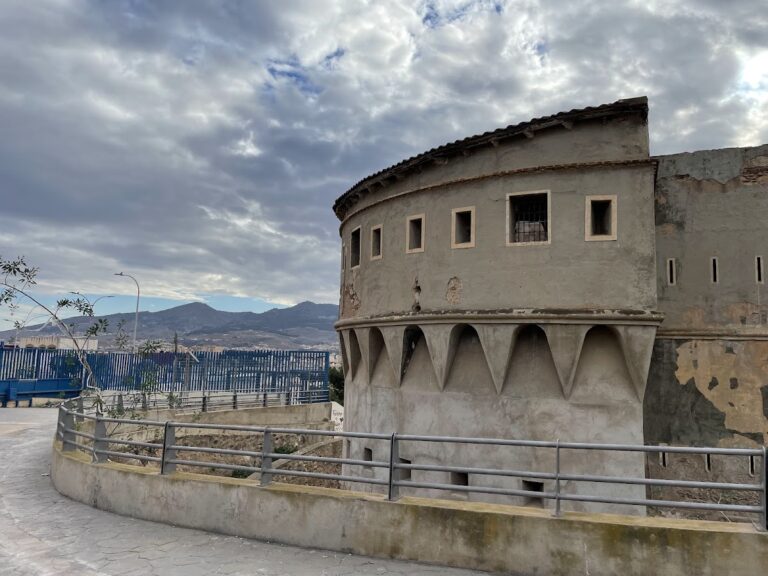
The Levante Front was constructed in the sixteenth century, with its towers initially built in 1515 and reformed in 1527 and 1533. The Torreón del Bonete carries the Faro de Melilla. Nearby are Puerta del Socorro and the hemispherical Torreón del Bonete Chico. The Cuevas del General are rock-cut galleries used for refuge and storage, while the square Torreón de los Bolaños has projecting defensive elements. The hemispherical Torreón del Bernal Francés, the underground storage galleries of the Cuevas de la Florentina, and the circular Torreón de las Cabras complete this defensive front.
Marine Front
The Marine Front was rebuilt between 1677 and 1678 and altered during the nineteenth and twentieth centuries. Its structures include the Torreón de Florentina and Muralla de Florentina, Torreón de San Juan, Cuartel de Santa Ana, Cuartel de la Maestranza, Batería de San Felipe, and Puerta de la Marina. The sea gate controlled access from the water.
Land Front
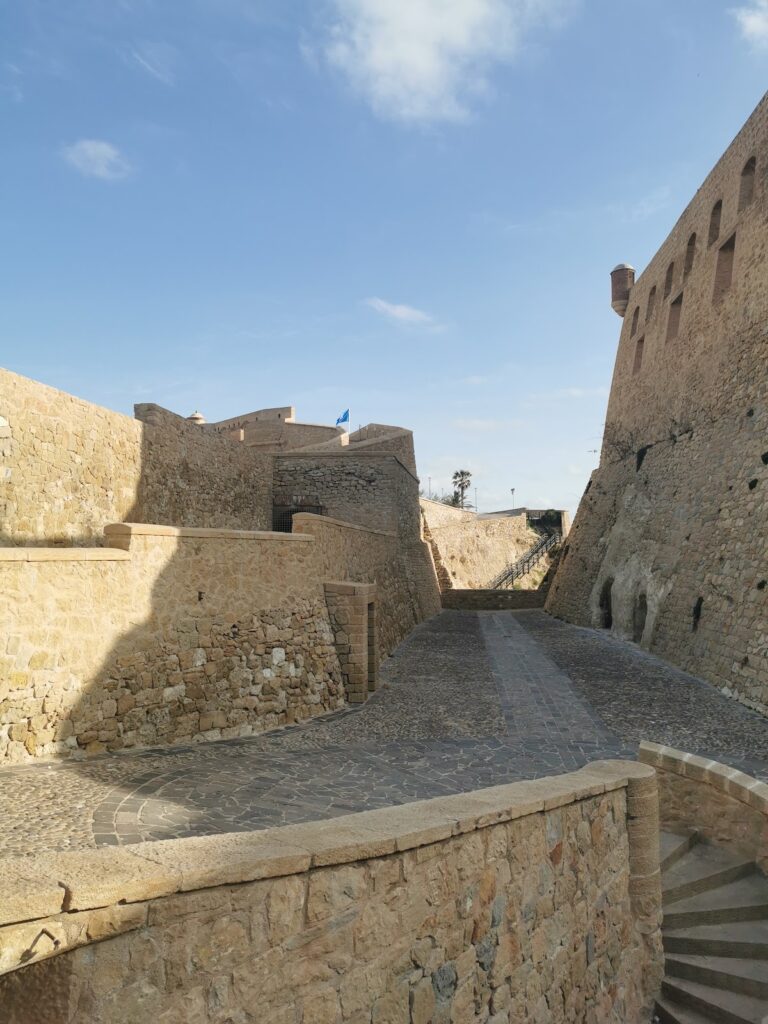
The lower Land Front contains Puerta de Santa Ana, Puerta de Santiago, the Capilla de Santiago, and the Foso de Santiago. The gates and chapel date from the sixteenth century, while the rock-cut fosse dates from 1515. The fosse was filled at the beginning of the twenty-first century, enabling the conversion of the Ensenada de los Galápagos into a beach.
Puerta de Santiago was built in 1549 by the engineer Miguel de Perea and has been repeatedly renovated. Its bent entrance is flanked by towers and crowned by an imperial coat of arms of Charles V, the Habsburg emperor and Spanish monarch whose reign coincided with major Renaissance fortification work. In 2025, the gate became the starting point of the Vía Rusadir, an official Camino de Santiago route originating in Africa. A marker records the distance of 972.09 kilometres to Santiago de Compostela.
Upper defenses and military buildings
The upper Land Front includes Torre de la Vela above Batería de las Puertas, Batería de la Muralla Real, the Vigía de Tierra and Ampolleta Vieja towers, the Baluartes de la Concepción, several artillery platforms, and the Museo Militar de Melilla. Batería de las Puertas houses the Museo Andrés García Ibáñez de Arte Moderno y Contemporáneo.
A bastion, a projecting fortification designed to provide flanking fire along adjoining walls, was constructed in 1669 over a sixteenth-century tower. It was repeatedly restored, especially in the eighteenth and twentieth centuries, while retaining a defensive purpose. It now houses the Museo Histórico Militar de Melilla, whose collections concern the city and its military history.
Trápana Front and religious complex
The Trápana Front contains the sixteenth-century Muralla de las Cruces, restored in the eighteenth century, together with the Cuevas del Conventico, the Iglesia de la Purísima Concepción, and the former Franciscan convent. The Conventico galleries were cut into the rock and used as refuges and storage areas during sieges. Their arrangement follows the natural relief of the promontory.
The Iglesia de la Purísima Concepción began in the mid-sixteenth century over an earlier hermitage. It was initially dedicated to Saint Michael the Archangel and received its present dedication to the Immaculate Conception in 1663. Attached to the former Franciscan convent, the church has a sober Renaissance design with a rectangular plan, three naves divided by Tuscan columns, an ashlar-stone facade, and a bell gable.
Inside are a principal altarpiece with an image of Nuestra Señora de la Victoria, chapels dedicated to the Rosary and Saint Francis, a sixteenth-century baptismal font, and a fifteenth-century Cristo de la Vera Cruz. The church was restored after the Lisbon earthquake of 1755 and the Alboran Sea earthquake of 2016. Rehabilitation completed in 2017 preserved its religious use while allowing cultural and museum functions.
Stores, waterworks, and hospitals
The first enclosure also contains the former Military Government buildings, a Punic-Roman archaeological site in the gardens, and the sixteenth-century Almacén de las Peñuelas. The seventeenth-century Hospital and botica de San Francisco stands on Calle de San Miguel, while the eighteenth-century Hospital del Rey occupies Plaza de la Parada. Beside the former Franciscan convent is the nineteenth-century Antiguo Palomar de Ingenieros.
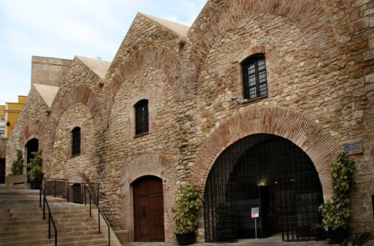
The Almacenes de las Peñuelas were built in 1781 during the reign of Charles III to store provisions and materials for the fortified city. Restoration began in 2007, and the Museo de Historia, Arqueología y Etnografía opened there in 2011, displaying archaeological finds, historical maps, and objects connected with Melilla’s development.
The Aljibes were built in 1571 as part of the citadel’s water-supply and defensive system. Cut into the rock and covered by brick vaults, they used sand-and-gravel filters and consisted of two settling tanks and two linked reservoirs. Each reservoir could hold up to 572 cubic metres. After their closure in 1947, they were restored and partially opened in 1997.
The Hospital del Rey was built between 1758 and 1775 and served for more than two centuries as a military and civil hospital and the city’s principal healthcare centre. It closed in 1929, later underwent prolonged neglect, and was rehabilitated in the 1990s. Since 1997, it has housed the Archivo General de Melilla, the Biblioteca Cándido Lobera, the city’s publication service, and temporary exhibition spaces.
Archaeological remains
Excavations at the Casa del Gobernador reached 4.5 metres below the surface and exposed successive occupation layers. An eastern dwelling dates to the first century BC, while a western house dates to the second century BC and contains three rooms with lower levels reaching back to the seventh century BC. More than 200,000 ceramic fragments were recovered, principally amphorae used to transport products such as garum, a fermented fish sauce widely traded in the Roman Mediterranean. Pre-Roman house walls were also found, some threatened by collapse because of inadequate conservation.
A pre-Roman necropolis discovered in the early twentieth century on San Lorenzo hill was associated with the urban settlement of Rusaddir and provides evidence for local lifestyles and funerary practices. Beneath the Iglesia de la Purísima Concepción, excavations exposed seventeenth-century burial crypts, a medieval silo, and architectural remains from several phases of the church, including possible remains of the earlier Iglesia de San Miguel.
The second enclosure
The second enclosure, also called the Plaza de Armas, lies beyond the first enclosure on a lower natural terrace along the landward approach. Fosses, tunnels, and bastions connect it with the first and third enclosures. Its angular bastions, parapets, casemates, or protected vaulted chambers, and ramped entrances were adapted to gunpowder artillery.
During the seventeenth and eighteenth centuries, the walls were strengthened with ashlar and hydraulic masonry, while tunnels and firing galleries were enlarged. The enclosure later assumed a largely logistical role, holding food, ammunition, and water. Baluarte de San José on the northern flank was begun in 1694 and reformed in 1714. It has a square plan, parapets, and gun positions based on Italian fortification methods. Baluarte de San Pedro, at the northwestern end, dates from the late seventeenth century and has a corner sentry structure with eleven gun embrasures between merlons.
Foso del Hornabeque was excavated in the rock around 1690 and separates the second and third enclosures. A hornwork is an advanced defensive work formed by projecting walls and supporting ditches. The fosse was later converted into an underground communication route associated with the Túnel de San Fernando. The tunnel galleries, excavated in the seventeenth century, enabled troops, carts, and supplies to move between the enclosures under protection from enemy fire.
The third enclosure
The third enclosure developed between the sixteenth and eighteenth centuries as a broader and more open extension of the earlier defenses. It occupies a stepped platform overlooking the Foso de los Carneros and links the upper fortifications with the coastal zone. Its irregular topography placed defenses at different levels, creating fields of fire and cross-fire coverage while protecting routes for troops, supplies, and artillery.
The enclosure contains a large wall with parapets and towers overlooking the fosse, a pre-existing albarrana tower incorporated into the later defenses, a garrison building with courtyards and military stores, and rock-cut tunnels joining different levels. An albarrana tower is a detached or partly detached defensive tower connected to a main fortification by a bridge or projecting structure. Work under Charles II and the Bourbon dynasty widened walls, added casemates, strengthened parapets, and adapted some medieval or Andalusi structures to the evolving defensive complex.
The fourth enclosure
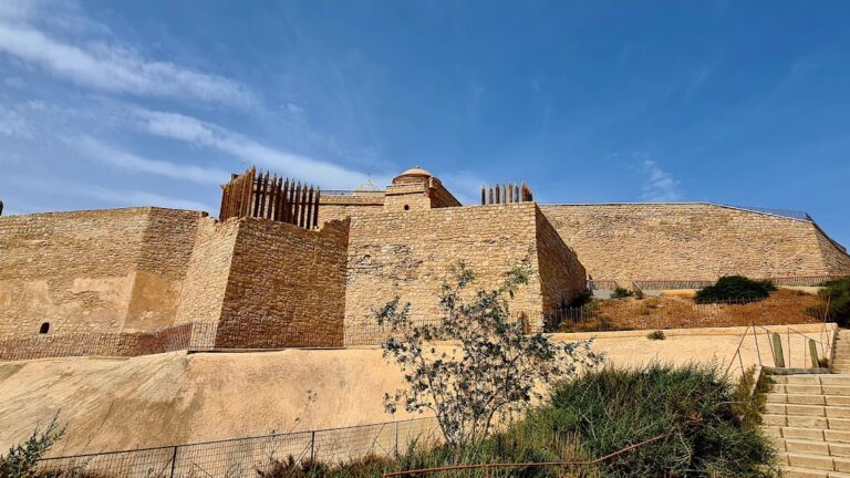
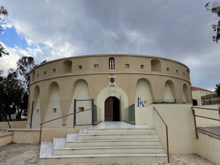
The fourth enclosure is the last major expansion of the citadel. It extends onto the mainland between the rocky promontory and the isthmus, where it formed an advanced barrier and controlled access by land. Its military infrastructure included fortified gates, drawbridges, military roads, firing platforms, earthen parapets, powder magazines, warehouses, ammunition stores, and exercise grounds. The structures were integrated into the terrain, using higher ground for visibility and protection.
An eighteenth-century bastion on the land front was associated with the cannon called El Caminante, whose fire contributed to establishing Melilla’s present geographical limits. Its irregular plan follows the ground. Fuerte del Rosario occupied elevated ground and formed a defensive pair with Fuerte de las Victorias, providing cross-cover over routes from the Rif. Built in masonry, it had strengthened walls and a polygonal eighteenth-century plan designed to resist artillery.
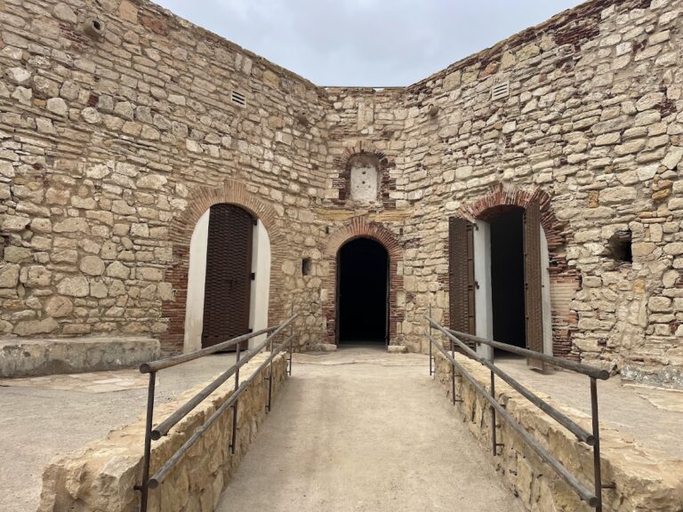
Another rectangular fort used local stone for its walls and solid brick for its arches and vaults. A ramp led to its battery, while underground vaulted spaces provided additional protected areas. Fuerte de Victoria Grande preserves evidence of both Islamic and Spanish occupation. Excavations during restoration and rehabilitation revealed ninth-century and eighteenth-century layers, including silos, an oven, stakes, a parade ground, and other military structures, showing the fort’s changing strategic functions across the two periods.
Nearby sites