Medzhybizh Fortress: A Lithuanian and Polish Frontier Stronghold in Ukraine


Site at a Glance
- Rating
- 4.6
- Popularity
- Medium
- Country
- Ukraine
- Primary era
- Early Modern
- External website
- Open
- Eras represented
- Medieval, Early Modern, Modern
- Civilizations
- Grand Duchy of Lithuania, Kingdom of Poland, Polish–Lithuanian Commonwealth, Russian
- Site type
- Military
- Remains
- Castle
On this page18 sections
History
Medzhybizh Fortress, a Lithuanian-period stone stronghold in Medzhybizh, Ukraine, was rebuilt after 1362 and later developed into a Renaissance and Neo-Gothic complex. Standing at the confluence of the Southern Bug and Buzhok rivers, it became a frontier fortress on routes crossing Podolia and retains evidence of medieval, early modern, and modern transformations.
Early settlement and the Lithuanian reconstruction
The settlement at Medzhybizh is archaeologically attested from the late eleventh century and was first mentioned in writing in 1146. It was associated with Bolokhiv land, a medieval region of Podolia known for fortified settlements and local princely authority. By the mid-thirteenth century, campaigns led by Daniel of Galicia had conquered and destroyed the settlement. Excavations in 2000–2002 found burned defensive structures, a ditch, and human skeletons connected with the earlier stronghold.
After the Grand Duchy of Lithuania recovered Podolia from the Tatars in 1362, the site was rebuilt as a stone fortress under the Koriatovych brothers, Lithuanian princes of the Gediminid dynasty who governed the region. The earlier fortified core became part of the later castle complex. In the fifteenth and sixteenth centuries, the fortress guarded a frontier near the Kuchman and Black routes, historic corridors used for travel, trade, and military movement across Podolia. Tatar attacks were frequent, and in 1516 the defenses helped Stanisław Lanckoroński defeat besieging raiders.
The Sieniawski reconstruction
In 1540, Hetman Mikołaj Sieniawski, a Polish-Lithuanian military commander, commissioned a major reconstruction from Jan Bonk. The project created a new defensive system and enlarged the residential and administrative complex. It also established the long association of the fortress with the Sieniawski family and its descendants.
The sixteenth-century work transformed the stronghold into a complex combining residential, defensive, and service buildings. Renaissance forms were applied over earlier Lithuanian-period structures, while the palace included the principal fortified tower, the entrance defenses, and new wings. The attic contains stylized communion-cup motifs and related symbols associated with Protestantism, reflecting Mikołaj Sieniawski’s Calvinist affiliation.
Ottoman occupation and renewed Polish control
The fortress became involved in the seventeenth-century Polish-Turkish wars and changed hands among Cossack, Polish, and Ottoman forces. In 1648 it was held by the Cossack uprising leaders Maksym Kryvonos and Danylo Nechai. It returned to Polish control in 1649, while Bohdan Khmelnytsky captured it in 1650 and again in 1653. Forces associated with the Hungarian prince George II Rákóczi camped near Medzhybizh in 1657, and Cossacks and other insurgents besieged the fortress in 1702.
Under the Treaty of Buchach in 1672, Podolia passed to the Ottoman Empire. A Polish garrison left the fortress around the turn of 1672–1673, after which an Ottoman garrison took possession. Mikołaj Hieronim Sieniawski recaptured Medzhybizh on 17 October 1673, and Polish troops remained there until September 1678.
The Ottoman garrison numbered about 100 men. In spring 1686, facing supply difficulties and expecting a major Polish offensive, the garrison evacuated and unsuccessfully attempted to blow up the fortress. Polish troops subsequently returned. After Podolia formally came back to the Polish Crown in 1699, Adam Mikołaj Sieniawski commissioned Jean Baptiste Dessieur to repair and modernize the walls, bastions, bridge, well, parapets, loopholes, towers, guardhouse, chapel, and palace rooms.
The Czartoryski estate and nineteenth-century uses
When the last male Sieniawski heir died in 1730, Medzhybizh and the fortress passed through marriage to Prince August Aleksander Czartoryski. The Czartoryski family controlled the estate for approximately the next century. The fortress was then used mainly to administer the estate and periodically to house military units. Its major military importance declined, although artillery positions, combat galleries, grain stores, and a military storehouse continued in use.
Russian military units occupied Medzhybizh from 23 February 1734 to 27 November 1735 during the struggle for the Polish crown between Augustus III and Stanisław Leszczyński. Their command was housed in the fortress, and the garrison caused substantial damage to the complex and its surroundings. In 1759, the earlier wooden bridge was replaced by a masonry bridge resting on ten supports, with a lifting section near the gate.
Adam Kazimierz Czartoryski temporarily moved to Medzhybizh with his household in 1784 after becoming General Starost of Podolia. In 1819, Prince Adam Jerzy Czartoryski established a district school for the local nobility in the fortress. The school continued until the end of the 1841 academic year, when it moved to Chornyi Ostriv. Its operation required alterations to the commandant’s building, residential quarters for 250 pupils, and the Officer’s Tower, where an assembly hall was installed. The naturalist and paleontologist Wojciech Zborzewski taught there from 1819 to 1826.
After August Czartoryski took part in the Polish uprising, the estate was confiscated in 1831. The fortress passed from the Ministry of Public Education to the military authorities in 1844 and was adapted again for military use. These changes introduced Romantic and Neo-Gothic forms. The former Catholic chapel was reconsecrated as an Orthodox church after a petition by the local school inspector and residents. Taras Shevchenko passed through Medzhybizh on 4 October 1846 during an archaeographic expedition, and a memorial plaque commemorating the event is fixed to the Knight’s Tower.
Twentieth-century damage and preservation
During the Ukrainian Revolution of 1917, General Pavlo Skoropadsky established the headquarters of the reorganizing 34th Army Corps in the fortress. After two months, the formation became the First Ukrainian Corps. During the Soviet period, military units occupied the site until the early 1930s. The complex was later converted into an oil plant, causing serious damage. Further deterioration took place during and after the Second World War, and local authorities permitted residents to dismantle parts of the fortress for building materials.
Medzhybizh Fortress received architectural-monument status in 1963. Systematic research began in 1967, when specialists from the Ukrproektrestavratsiya institute prepared restoration documentation. A museum department of the Khmelnytskyi Regional Museum of Local History opened in 1971, becoming the Medzhybizh Regional Historical and Ethnographic Museum-Fortress in 1997.
Archaeological investigation, emergency stabilization, and restoration have continued since the late twentieth century. The church, Knight’s Tower, eastern wing, carriage-house building, and administrative buildings have been investigated and partly restored, while the walls have been strengthened. The fortress became a State Historical and Cultural Reserve in 2001. Its museum exhibitions include historical and ethnographic displays, an exhibition on the victims of the 1932–1933 Holodomor in Podolia, and temporary exhibition halls. The western wall of the main palace building collapsed on 23 December 2014, and restoration financed by the Khmelnytskyi regional budget has continued since 2015. The fortress joined the European fortification heritage route FORTE CULTURA e.V. as an associate member in 2020 and received full membership in April 2022. Archaeological research, restoration, and conservation were continuing in 2023.
Remains
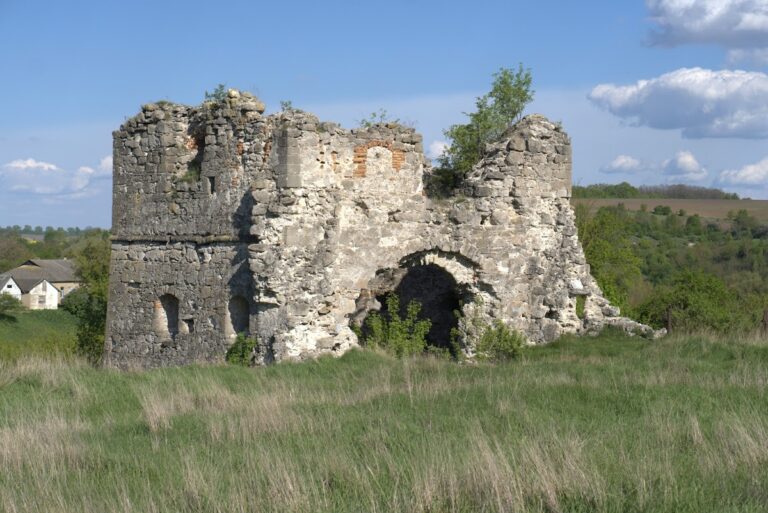
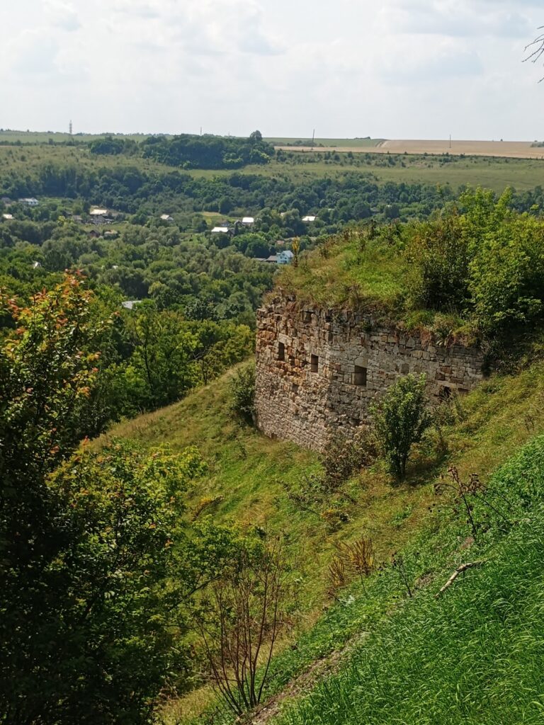
Medzhybizh Fortress occupies a triangular cape formed by the Southern Bug and Buzhok. Its irregular, elongated triangular plan follows the topography, with walls and corner towers projecting beyond the wall lines and a deep ditch protecting the landward side. The courtyard is approximately 130 metres long, up to 85 metres wide, and covers about 0.75 hectares. Walls reach as much as 4 metres in thickness and 17 metres in height. The complex is built mainly of limestone and brick, with mixed masonry reflecting its Lithuanian-period foundations, Renaissance rebuilding, and nineteenth-century alterations.
Early fortifications and later defensive lines
The earliest stronghold occupied the eastern quarter of the present fortress. It was a wooden-and-earth hillfort with timber structures built in log construction and reinforced with stones at the lower level. A ditch as much as 6 metres deep separated it from the western part of the cape. Excavations in 1999 and in 2017–2018 identified possible additional banks and ditches west of the early stronghold, while the rest of the site contained a fortified outer settlement.
The Lithuanian-period fortress had a tower and gate near the river confluence, with walls extending north and west. A western curtain wall, the defensive wall joining towers, and a deep ditch divided the courtyard into two parts. Round towers stood at the corners. The rectangular barbican, an advanced structure protecting the gate, measured approximately 10 by 8 metres and stood about 10 metres high. Its gate had a vertically sliding portcullis, indicated by slots 28 centimetres wide in the masonry, while wooden galleries strengthened the interior defenses.
Sections of the walls are 1.8 metres thick and contain rectangular loopholes covered by stone slabs. Later openings measure approximately 65 by 77 centimetres and 50 by 60 centimetres, while earlier examples measure about 33 by 28 centimetres. Their outer lower surfaces are splayed. The courtyard was progressively raised, by about 3 metres in its upper section and 11 metres in its lower section. This alteration raised the entrance near the pentagonal tower and led to the construction of a bridge over the fifteenth-century ditch.
Palace complex and residential buildings
Palace buildings
The sixteenth-century palace complex combines residential, defensive, and service buildings erected over earlier Lithuanian-period structures. It preserves the central donjon, or principal fortified tower, the barbican, part of the southern tower, and a section of the western wall below ground level. Eastern and western wings dating from the sixteenth to nineteenth centuries surround the complex, together with a three-tier sixteenth-century bastion, a projecting fortification designed for flanking fire. Elements of pre-sixteenth-century construction remain within the palace buildings.
Partial nineteenth-century rebuilding introduced Neo-Gothic features, including decorative crenellated parapets and white lime plaster on the buildings and walls. Late-seventeenth-century external stone buttresses rise to the third floor of the palace. They were added after the thrust of vaults and the pressure of earth fill caused cracks in the walls. Four- to five-metre-high earth taluses, sloping defensive embankments, were also constructed outside the walls and palace to protect them from artillery fire.
Fifteenth-century residences
Two fifteenth-century stone residential buildings were incorporated into the walls. One resembles a three-storey tower and is attached outside the eastern curtain wall. The other, also three storeys high, is set into the southern curtain wall. Both buildings had stone-vaulted floors and folded roofs.
Towers, gates, and bridge
Knight’s Tower
The Knight’s Tower stands in the northwestern part of the fortress and projects beyond the walls to defend the central citadel gate. It has an irregular pentagonal plan, smooth limestone construction, and four defensive levels. A restored hipped roof, a small upper structure, and a weather vane cap the tower. Its artillery loopholes had interior niches with openings designed to vent smoke from cannon fire, and the tower walls reach approximately 4 metres in thickness.
Officer’s Tower
The Officer’s Tower, also called the round tower, began as an earlier stone roundel and was later rebuilt in brick with an octagonal form. Its lower section contains a military storehouse and a masonry well approximately 14 Polish fathoms, or about 25 metres, deep. Grain stores occupied the upper levels. The tower was also altered for the nineteenth-century district school, whose assembly hall was installed there.
Southern tower and entrances
The southern tower incorporates part of a fourteenth-century Lithuanian half-tower. The southern curtain wall, built mainly between the sixteenth and nineteenth centuries, contains loopholes for a four-tiered wooden fighting parapet. During the sixteenth-century reconstruction, the main entrance moved from the southeastern corner to the western wall, where it remains five metres from the pentagonal tower.
A large five-lobed bastion was added to the entrance, and the earlier barbican was enlarged with a rectangular tower whose corners slope outward. The entrance tower gained fourth and fifth levels. A high gate in the southern curtain wall was built in the sixteenth century to receive goods delivered by boat along the rivers. Its lifting mechanism no longer survives, and the gate has been sealed.
The western entrance has an arched bridge over the dry moat and a single lifting section operated by chains. Its bridge piers rest on an earlier stone defensive structure concealed beneath an earth layer. The seventeenth-century external defenses also include the earth taluses and the enlarged artillery positions associated with the fortress’s changing military requirements.
Service buildings and church
Carriage House and administrative buildings
The seventeenth-century stables, later called the Carriage House, stand beside the western curtain wall. Their elongated interior is covered by interconnected vaults supported by the walls and central pillars. The building was restored in 1978. The complex also contains the former commandant’s residence, western administrative buildings, and single-storey residential structures adjoining the northern and northeastern curtain walls. Several of these buildings now hold museum exhibitions and reserve service premises.
Castle church
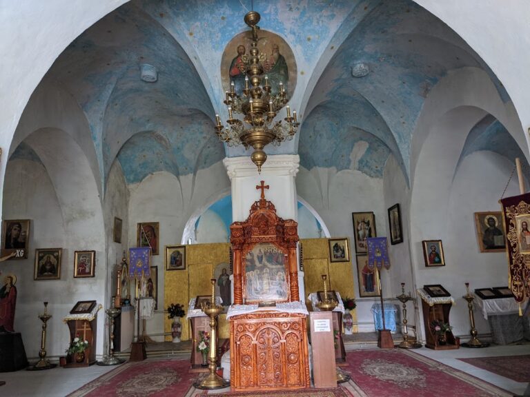
The castle church stands in the middle of the courtyard. It is a rectangular, single-nave limestone building with a hipped roof and a small roof turret. The building was reconstructed and consecrated as the Catholic Chapel of Saint Stanislaus in 1586 or, according to another date, 1591. Later architectural changes followed shifts in religious use and the requirements of successive owners.
During the Ottoman occupation, the church served as a mosque. In the second half of the nineteenth century, it was converted into an Orthodox church for military use. During the Soviet period, it served economic purposes, and restoration followed its transfer to the Ukrainian Orthodox Church of the Kyiv Patriarchate in 2005. The surviving fortress therefore brings together restored, partly restored, altered, buried, and structurally damaged elements dating from the fourteenth through nineteenth centuries.