Horvat Uza: A Multiperiod Fortress in Arad, Israel
Site at a Glance
- Rating
- 4.2
- Popularity
- Very Low
- Country
- Israel
- Primary era
- Iron Age
- Eras represented
- Iron Age, Classical
- Civilizations
- Israelite, Roman, Seleucid
- Site type
- Military
- Remains
- Fort
On this page14 sections
History
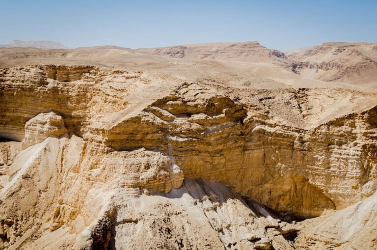
Horvat Uza is a multilayered archaeological fortress near Arad in Israel, built and rebuilt during the Iron Age II, Hellenistic, and Roman periods. Standing above Nahal Qinah on the eastern edge of the Arad Valley, it controlled an ancient route through the wadi between Judah, the Arabah, and the territory of Edom.
Discovery and early interpretation
The earliest activity at Horvat Uza remains uncertain. Proposals have extended it into the prehistoric period, while excavated material places the earliest recovered occupation in the seventh century BCE. The route beside the site continued in use throughout antiquity, helping explain the repeated construction of fortresses at this location.
Alois Musil surveyed the site in the early twentieth century but did not establish its date. Albrecht Alt and Michael Avi-Yonah later recognized a Roman fortress, without identifying the remains of earlier phases. Yohanan Aharoni surveyed Horvat Uza extensively in 1956, prepared a plan of the visible fortress, and assigned it to the seventh or eighth centuries BCE. Pottery from the wadi led him to propose that activity in the wider area might reach back to the ninth or tenth century BCE.
Six excavation seasons took place between 1982 and 1985 under Yitzhak Beit-Arieh and Bruce Carson, with work focused on the fortress, its margins, and parts of the settlement. These excavations established a sequence extending from Iron Age II through the Hellenistic and Roman periods.
Judahite and Edomite phases
During Iron Age II, the later Iron Age period associated with the development of the kingdoms of Judah and Israel, Horvat Uza formed part of the Judahite fortress network in the Negev. Other fortresses in this network included Tel Ira and Arad. The expansion of the fortress and the settlement during the seventh century BCE has been linked to the region’s recovery after Sennacherib’s Assyrian campaign of 701 BCE and the relative stability that followed. The precise political context remains debated, with proposals placing the development under Manasseh earlier in the seventh century or under Josiah later in that century, when Assyrian influence weakened.
The site’s ancient name is not certain. Aharoni suggested that Horvat Uza might be Ramat-Negev, a settlement associated with the territory of Simeon and mentioned in the Arad correspondence. Other interpretations question this identification because Ramat-Negev is described as an older settlement. Horvat Uza is also frequently considered a possible location for Qinah, a town on the border of Judah and Edom, although that identification is not conclusive.
The Iron Age fortress was probably destroyed by fire. Afterward, the area was cleared, ash and pottery accumulated along the western slope, and additional buildings were placed outside the fortress on terraces above the wadi. Ostraca, written documents on potsherds, indicate changing or overlapping Judahite and Edomite use. One administrative text refers to men from several districts of Judah who may have served at the frontier. An Edomite text orders food to be supplied and invokes Qos, the deity associated with Edomite religious tradition. This evidence has been connected with an Edomite presence or takeover near the destruction of the First Temple in 586 BCE or soon afterward, although the exact sequence is uncertain.
Hellenistic and Roman occupation
After an abandonment lasting about three centuries, the fortress was partly rebuilt during the Hellenistic period, the era that followed the conquests of Alexander the Great and was shaped in the region by Greek-ruled kingdoms. Its construction has been attributed either to the Seleucids or, more tentatively, to the Hasmoneans, the Jewish dynasty that emerged from the Maccabean revolt. A coin of the Nabataean king Aretas I or II shows activity at the site in the second century BCE, while the absence of Hasmonean coins leaves the political attribution unresolved.
During the Roman period, a fortress was established on the Hellenistic foundations and remained active through several phases. The occupation includes a first-century CE layer and a later phase from the second or third centuries CE. Coins from Ashkelon under Vespasian, Gaza under Septimius Severus, and Caesarea under Marcus Aurelius provide chronological evidence for activity during Roman rule in the southern Levant. The site was eventually abandoned during the Roman period and survives in a ruined condition.
Remains
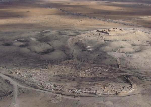
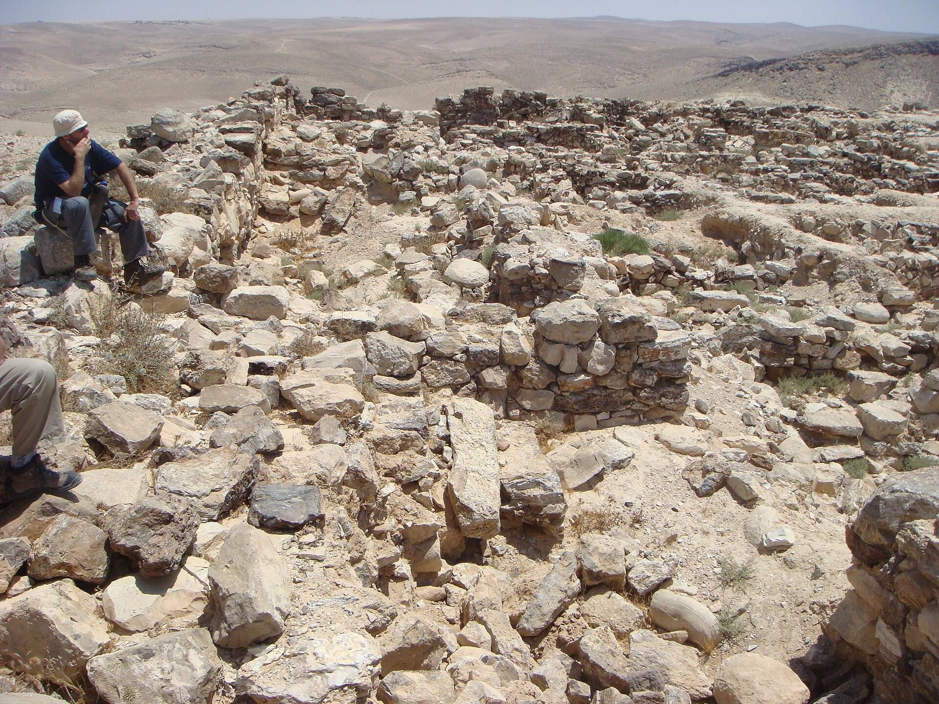
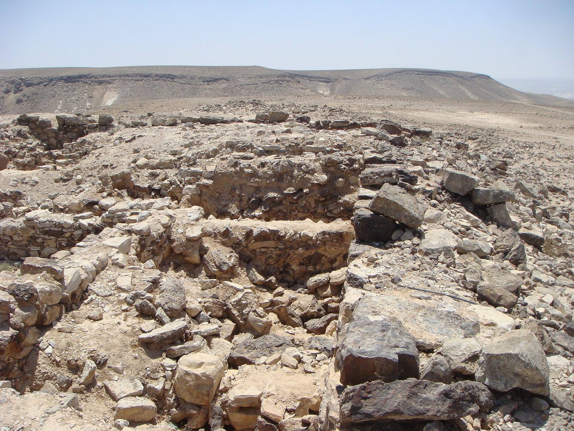
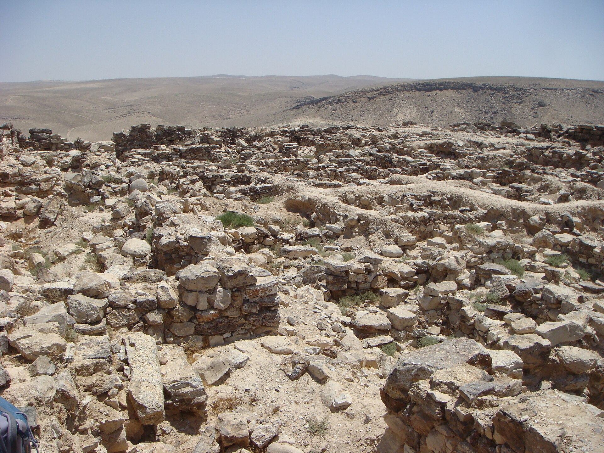
Horvat Uza stands at approximately 537 meters above sea level on the eastern edge of the Arad Valley, above Nahal Qinah. The fortress occupies the higher part of the site, while a settlement extended over roughly seven dunams on the slope to its north. Artificial terraces organized the settlement, and groups of buildings were separated by streets about two to four meters wide.
Iron Age fortress
Walls, towers, and gate
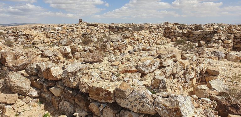
The Iron Age fortress was a rectangle measuring approximately 42 by 51 meters, or about 100 by 120 cubits. A wall roughly 1.5 meters thick enclosed it, with ten square towers placed at the corners and along the sides. The plan resembles those at Tel Arad and Qadesh-Barnea.
Entry was through a northern gate. A street from the gate divided the interior into two building blocks, while rooms were constructed against the inner face of the walls. These casemate rooms, built into the defensive walls, were about 2.5 meters wide and had stone or plaster floors. The gate was asymmetrical. Rooms flanked the passage on its eastern side, while the western side ran beside a complex measuring about 17 by 18 meters. That complex contained three rectangular rooms and an inner courtyard. Other parts of the fortress held installations interpreted as workshops.
Water system and courtyard platform
A drainage channel more than 20 meters long gathered runoff inside the fortress, passed beneath the gate, and carried the water to a rock-cut cistern at the head of the slope. Stone slabs covered the channel.
A built platform of fieldstones stood near the gate in the fortress courtyard. It measured about 1.5 meters in length, one meter in width, and one meter in height, with three steps on its southwestern side. Ash and animal bones beside the platform suggest that it may have been used for animal sacrifice. It has also been interpreted as a bamah, or raised religious installation known as a high place, although that identification remains probable rather than certain.
Daily and administrative activity
The fortress contained cells, ovens, stone basins, lined pits, lower and upper grinding stones, loom weights, and other installations. Together, these features indicate that the garrison supported civilian tasks as well as military activity.
Iron Age pottery dates mainly from the second half of the seventh century and the beginning of the sixth century BCE. The assemblage includes bowls, red-slipped and burnished cooking vessels, flat-rimmed cooking pots, ridged pots, jars, jugs, juglets, and lamps with tall bases. Other finds include iron and additional metal objects, arrowheads, seals, and beads.
Settlement on the northern slope
Terraced building
The settlement north of the fortress occupied approximately seven dunams. One excavated building measured about 14 by 6 meters. Its western wing contained three spaces, with a row of pillars between a paved courtyard and a long room. The building opened onto a street through two entrances in its western wall, while the eastern wing contained one room.
Written evidence
Ostraca from the settlement and fortress preserve Hebrew, Edomite, and Aramaic texts. Most are incomplete. Their contents include personal-name lists apparently connected with food distribution, a military list, a literary text, and an Edomite letter.
One Hebrew administrative ostracon addresses Ahiqam son of Menahem, or possibly Meshullam, who may have commanded the fortress. It lists men associated with Molada, Makkeda, and another uncertain place, and has been interpreted as an order concerning personnel recruited from different parts of Judah. Another text instructs the fortress commander to provide food for the bearers of a letter and invokes Qos. Further Hebrew inscriptions preserve ranked lists of names and titles that may relate to distributing supplies or arranging watches.
Some inscribed sherds may preserve the name “Uza,” together with personal names such as Ahaz and Ataliah. Many Hebrew names contain the theophoric element associated with Yahweh. The texts provide evidence for administration, military organization, food supply, and the several languages used at the fortress.
Hellenistic fortress
The Hellenistic fortress covered about two-thirds of the Iron Age area. A new casemate wall with an eastern tower was built inside the earlier enclosure. On the northern and southern sides, surviving wall rooms were widened to about four meters, compared with approximately 2.5 meters in the Iron Age phase.
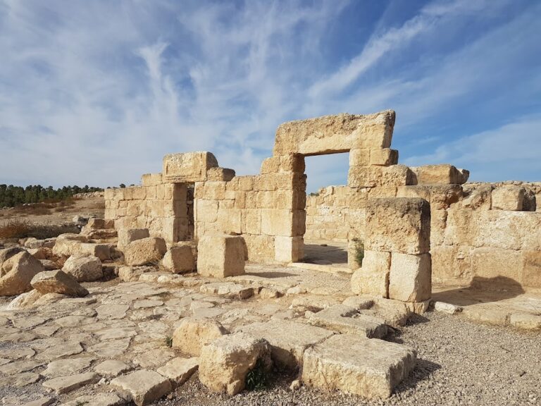
The gate remained in the same position but was altered. Its threshold was raised, residential rooms were inserted into the gate structure, and the opening was narrowed to about 1.75 meters. Broad steps led to the entrance. The courtyard remained largely open, apart from installations such as a granary. Occupation concentrated in rooms along the walls. Finds from this phase include second-century BCE pottery, ostraca, a gaming tablet, a bronze seal, bone implements, and a coin of Aretas I or II.
Roman fortress and compounds
The Roman fortress reused the Hellenistic walls and added new rooms and compounds. On the western side and at the southern corner, Hellenistic casemate rooms were filled with stones to form platforms about two meters above the original ground level. Stairs led to the platform at the southern corner.
Additional compounds were built east and north of the fortress. Their enclosing walls were about one meter thick, and the eastern compound had a gate structure in the middle of its wall. These additions may have functioned as fortified camps beside the main fortress. The surviving Roman remains, like the earlier structures, are in a ruined condition.