Maneičių Hillfort: An Archaeological Site in Lithuania
Site at a Glance
- Rating
- 4.2
- Popularity
- Very Low
- Country
- Lithuania
- Primary era
- Medieval
- External website
- Open
- Eras represented
- Classical, Medieval
- Civilizations
- Unclassified
- Site type
- Military
- Remains
- Fort
On this page10 sections
History
Maneičių piliakalnis is a hillfort in Lithuania, near Maneičiai, with an associated settlement dating from the first millennium into the beginning of the second millennium AD. The hillfort stands in Rukliai Forest within Daugailiai eldership, about 150 metres east of Lake Alaušas. The settlement at its foot belongs to the first millennium AD and places the site within a long period of fortified occupation in the region.
Occupation and local traditions
The hillfort and settlement formed a connected archaeological site, with the elevated stronghold overlooking the surrounding area and habitation extending around its base. Local tradition says that a church once stood on the hillfort and that fortifications belonging to Lithuanian dukes were also located there. These traditions form part of the later historical understanding of the hill, while the archaeological evidence points to its use during the first millennium and the opening of the second.
Investigation and protection
The Institute of History surveyed Maneičių piliakalnis in 1958 and 1970. In 1996, the Cultural Heritage Center, directed by archaeologist Zenonas Baubonis, investigated a 40-square-metre area at the western edge of the settlement. Individual pottery finds were also recovered in 1996 and 2005, and the archaeological material is held by the National Museum of Lithuania.
A Lithuanian government resolution of 19 May 1998 declared the hillfort and settlement a cultural monument, a legally protected heritage site. The protected area covers 77,789 square metres, while the visual-protection subzone covers 1,255,000 square metres. The site has cultural-property code 3612 and is listed as AR1336 in the register of cultural monuments; before 19 April 2005, it was registered under A930KP.
Agricultural ploughing severely disturbed the hillfort and almost destroyed its ramparts. The settlement’s cultural layer, an archaeological deposit containing traces of earlier human activity, was also ploughed until the end of the twentieth century. These changes have affected the preservation and interpretation of the site.
Remains
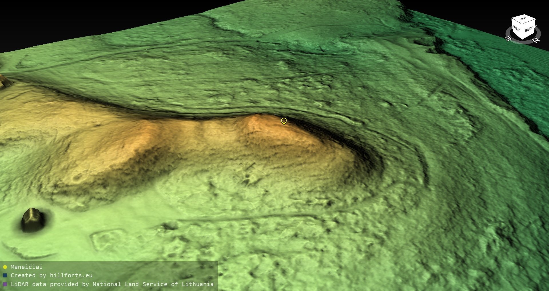
Maneičių piliakalnis occupies an isolated hill with steep slopes about 10 metres high. Its roughly rectangular platform is elongated from north to south and measures approximately 30 by 18 metres. Defensive earthworks surround parts of the platform, while a settlement extends across about seven hectares around the southern, western, northern, and northeastern foot of the hill.
The hillfort
Southern defenses
Along the southern edge of the platform, a rampart 0.4 metres high and 6 metres wide was formed above a terrace. Two metres below the platform, the terrace measures about 9 metres across. Beyond it lies a ditch 6 metres wide and 0.2 metres deep, followed by a second rampart 0.3 metres high and 5 metres wide. A second ditch, 4.5 metres wide and 0.2 metres deep, leads to a third rampart measuring 0.4 metres high and 7.5 metres wide. A third ditch, 6 metres wide and 0.2 metres deep, lies beyond it, followed farther south by a natural rise resembling a rampart and standing 1.5 metres high.
Slopes and entrance
A terrace about 9 metres wide runs along the northern slope, four metres below the platform. Handmade pottery with stroked and rough surfaces has been found on the platform. Nineteenth-century descriptions mention four former ramparts, including two larger earthworks on opposite sides of the platform and smaller ones on the slopes. They also describe an eastern entrance about 6.5 metres wide, protected by ramparts 23 metres long and 1.4 metres high. Ploughing has greatly damaged these defensive features, and deciduous trees and shrubs are now spreading across the hillfort.
The settlement
Surviving occupation layers
The settlement surrounds the hillfort on its southern, western, northern, and northeastern sides. In the western part, surviving cultural-layer deposits range from 10 to 80 centimetres thick and contain handmade-pottery sherds, clay daub, and hearths. In the southwestern area, between the hillfort’s foot and a hollow, an intensive layer contains handmade-pottery sherds and fire-reddened stones from hearths.
Excavated and disturbed areas
The 1996 excavation at the western edge of the settlement exposed a cultural layer up to 20 centimetres thick. Much of the settlement is now fallow land with a young pine grove, scattered deciduous trees, and shrubs. A roughly 15-by-15-metre area between the southwestern foot of the hillfort and the hollow has been ploughed, while vehicle traffic is damaging the surface of a sandy rise in the southwestern part.