Narkūnai Hillfort: A Fortified Settlement Complex in Lithuania
Site at a Glance
- Rating
- 4.5
- Popularity
- Low
- Country
- Lithuania
- Primary era
- Medieval
- External website
- Open
- Eras represented
- Iron Age, Classical, Medieval
- Civilizations
- Grand Duchy of Lithuania
- Site type
- Military
- Remains
- Castle
On this page12 sections
History
Narkūnai Hillfort is a multi-period fortified settlement complex in Lithuania, north of Narkūnai in Utena District Municipality. Known also as Utenis Castle and the Great Hillfort, it was occupied from the first millennium BCE to the second century CE and again from the fourteenth century to the early fifteenth century.
Early occupation and fortification
The earliest defensive works date to the first millennium BCE. They used two rows of wooden posts joined by a woven branch fence. Fires repeatedly damaged the barrier, which was repaired several times. At the beginning of the first millennium CE, the wooden defenses were replaced by an earth rampart. Buildings supported by upright posts stood around the edge of the early summit, and their circular hearths indicate domestic activity within the fortified area.
During the fourteenth century, the hillfort was strengthened again. A visible rampart was constructed from compacted clay mixed with stones and logs, and it supported a wooden defensive wall covered with clay. Utenos Castle stood on the hillfort during this later phase. The Livonian Order, a medieval Catholic military order active in the eastern Baltic, devastated the surrounding area in February 1373 and again in 1375. It burned the castle in early February 1433, marking the end of its medieval occupation.
Investigation and protection
Pranciškus Vilčinskis excavated the hillfort in 1835 and encountered a thick occupation deposit containing burnt clay, pottery fragments, animal bones, and other remains. The Institute of History surveyed the site in 1970. Excavations by Regina Kulikauskienė and Pranas Kulikauskas in 1976–1978 examined 660 square metres in the western part of the hillfort and identified three occupation stages within a cultural layer 3.3 metres thick. A cultural layer is an accumulated deposit containing traces of human activity, including structures, hearths, artefacts, pottery, and animal remains.
The settlement at the foot of the hillfort was investigated in 1959 and again in 1975–1976. Work in its western area exposed a disturbed cultural layer belonging to two periods. Pranas Kulikauskas examined 62 square metres of the fore-hillfort in 1978 and cut through its rampart. Finds from the complex are held by the Utena Local History Museum.
The Government of the Republic of Lithuania declared the hillfort complex a cultural monument on 19 May 1998. The protected territory covers 4.8 hectares, while its visual-protection subzone covers 1,742,000 square metres.
Remains
Fortified complex
Main hillfort
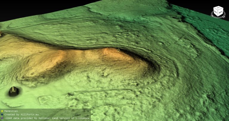
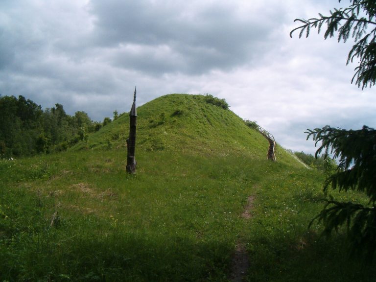
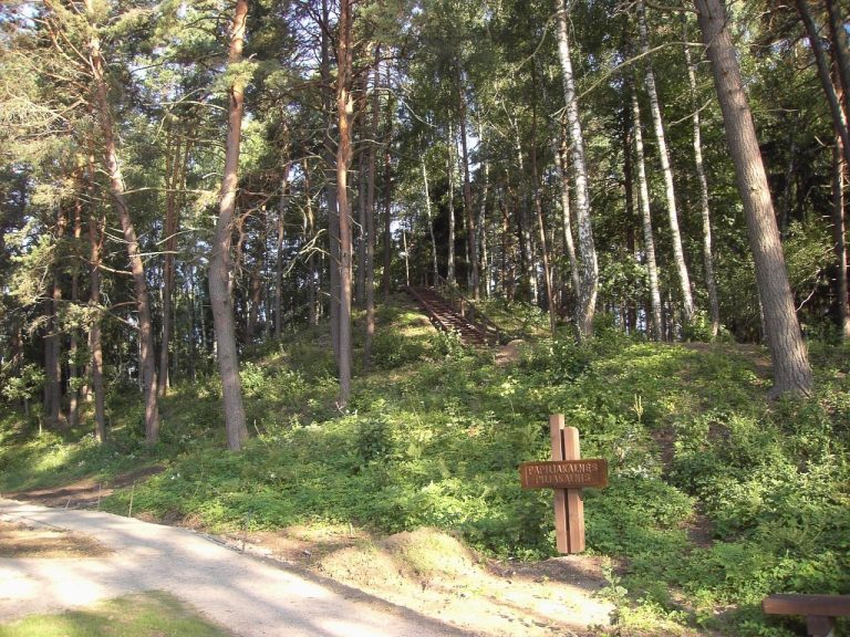
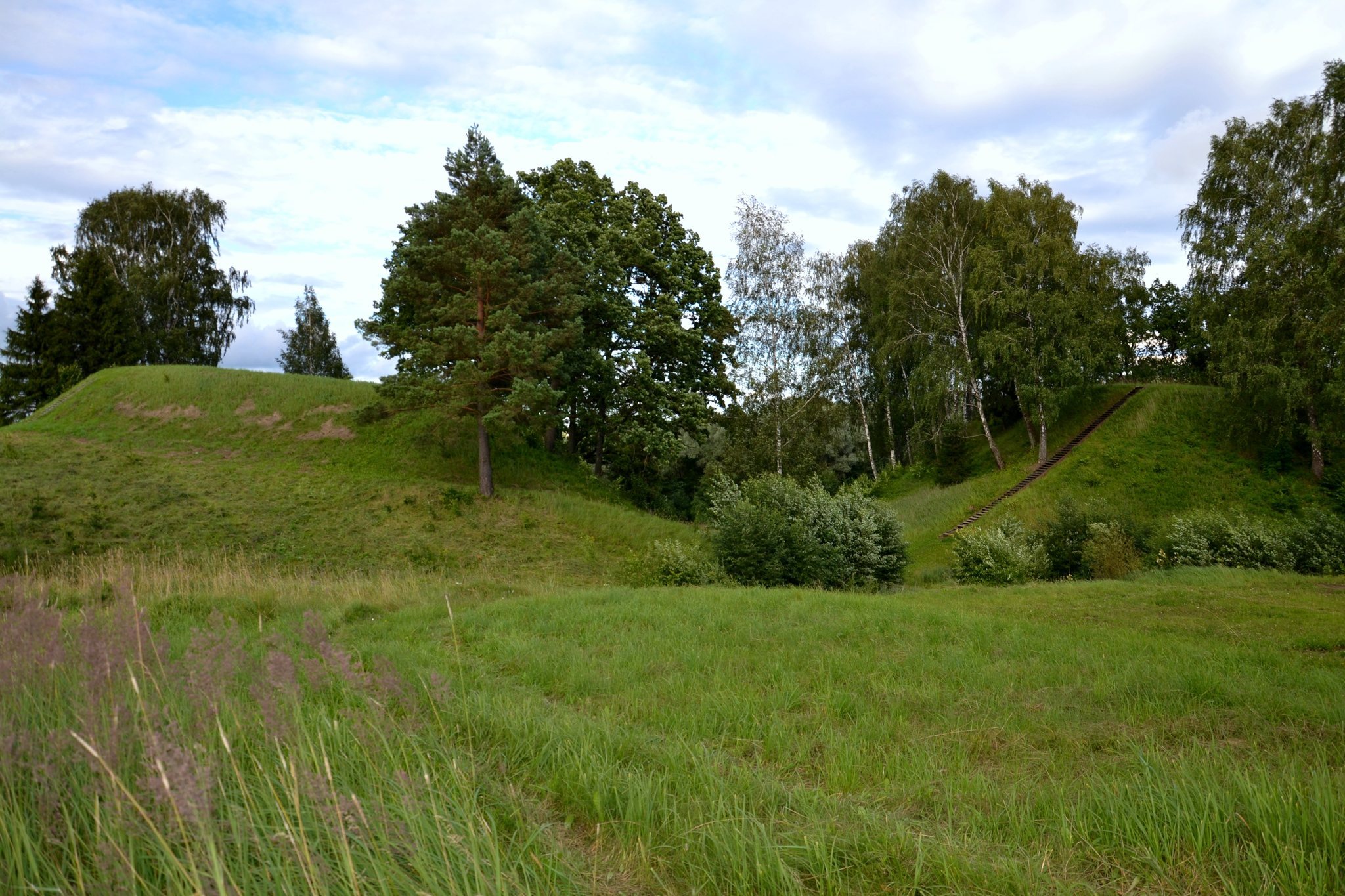
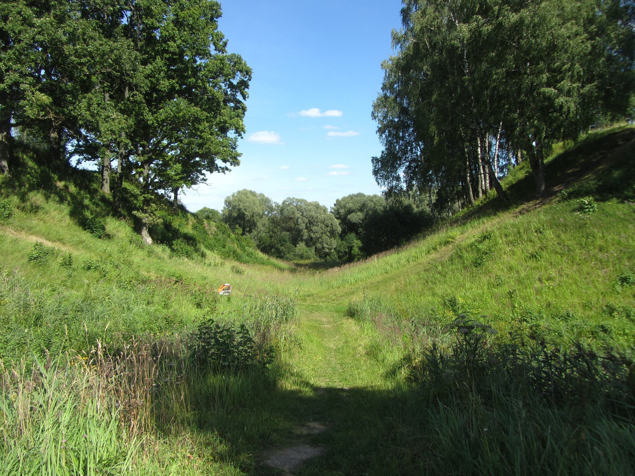
The main hillfort occupies an isolated hill on the left bank of the Utenėlė River. Its elongated, triangular summit runs from north to south, measuring 55 metres in length and 35 metres across at the northern end. A rampart 1.7 metres high and 15 metres wide closes the northern side. Beyond it lies a ditch 60 metres long and 55 metres wide, with a depth of 14 metres and a bottom 9 metres across. The surrounding slopes are steep and about 14 metres high.
Early summit defenses
The earliest fortifications used two rows of wooden posts measuring 8 to 18 centimetres in thickness. The rows stood 40 to 45 centimetres apart, while individual posts were separated by 6 to 12 centimetres. Branches were woven between them to form a fence. Its inner side was reinforced with clay along the summit edge and with a stone pavement 0.8 metres wide. Quadrangular post-built buildings, 6 to 8 metres long, stood along the perimeter and contained circular hearths. A later clay rampart, about 1 metre high, was formed around the summit.
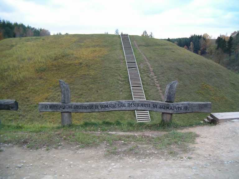
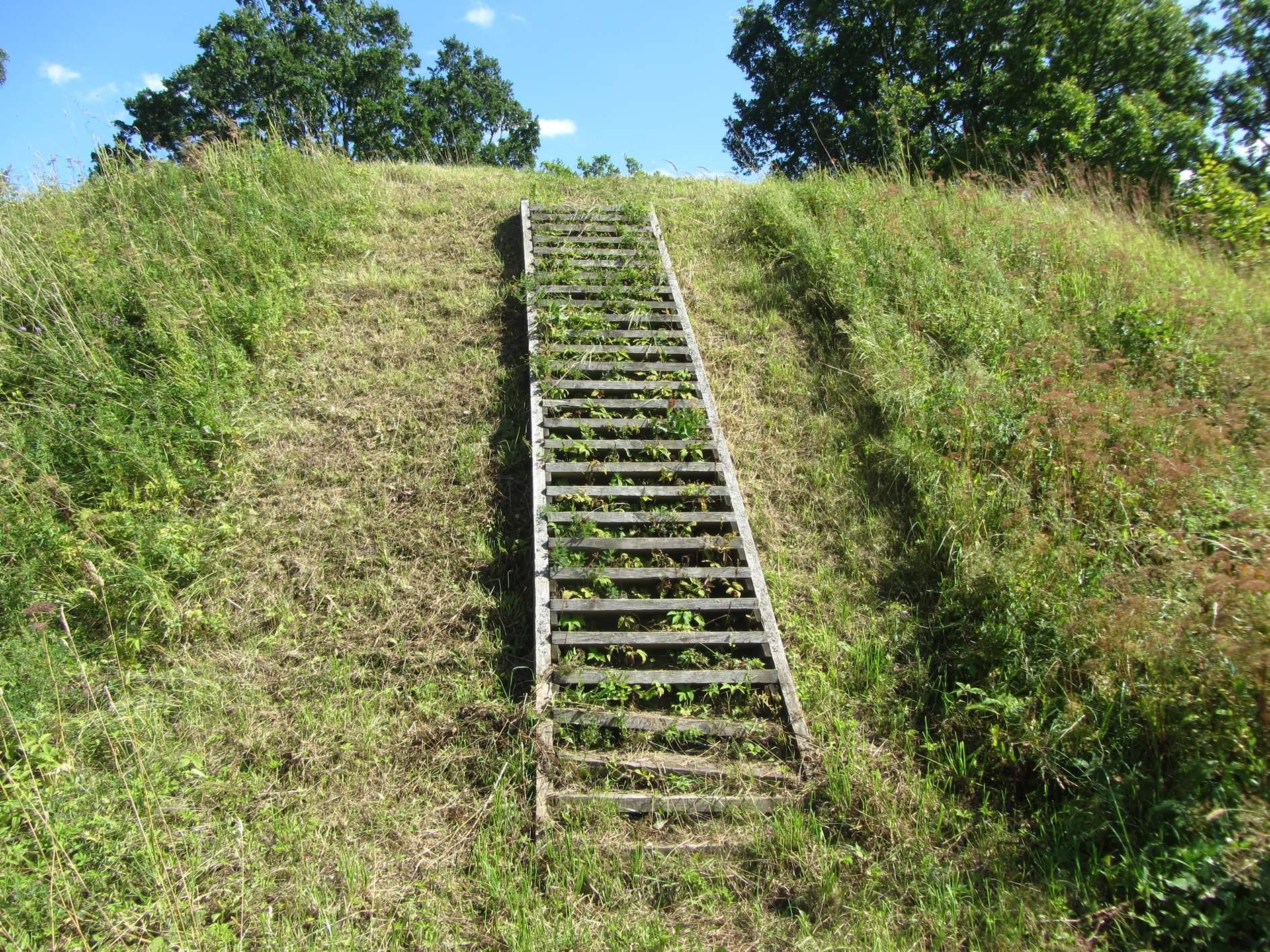
Ploughing has heavily damaged the summit. Grassland now covers it, while scattered trees grow on the slopes. A staircase has been installed on the northwestern slope.
Fore-hillfort
The fore-hillfort, traditionally called Utenis’s Grave or the Small Hillfort, lies north of the main hillfort beyond the ditch. Its semicircular summit runs north to south, measuring 15 metres in length and 25 metres across at the southern edge. A rampart once enclosed its western, northern, and eastern sides. The rampart extended for 60 metres, stood 2.5 metres high, and was 14 metres wide, with an outer slope 4 metres high. It was built from clay in a single construction episode during the fourteenth century, and the fore-hillfort has since been destroyed.
Under the fore-hillfort rampart lay an earlier settlement deposit dating to the beginning of the first millennium CE. It contained an iron pin, part of a stone axe, and stroked pottery. A natural rise at the eastern end of the main ditch measures 15 metres across and reaches 1.5 metres in height. Its surface was raised in the twentieth century during construction of a dam on the Utenėlė stream.
Settlement at the foot
A settlement occupied about one hectare at the western foot of the hillfort. Excavation revealed postholes, hearths, structures, and occupation deposits from two periods. Early layers contained clay weights, a spindle whorl, iron pins, a small chisel, an awl, and handmade stroked pottery. Later layers produced bronze earrings, glass beads, wheel-made pottery, and iron slag.
Archaeological finds and associated places
Artefacts and occupation deposits
Excavation of the hillfort and settlement produced more than 800 individual artefacts. These include iron crossbow bolts and arrowheads, axes, pins, awls, knives, sickle-knives, scythes, spurs, locks, fire-steels, buckles, bronze ornaments, spindle whorls, whetstones, quernstones, daggers, harpoons, needles, gouges, scrapers, whistles, antler axes, and tools for working metal. Clay moulds for casting bronze axelets and bracelets, together with crucibles, indicate metalworking.
The finds also include 45 stone axes, 35 bone spearheads, 40 arrowheads, approximately 10,000 pottery sherds, and more than 7,000 animal bones. The pottery includes stroked, plain, burnished, and wheel-made wares. A copper coin of ancient Rome dates to the second century, while a silver coin of Jogaila belongs to the late fourteenth century.
Cemetery and sacred spring
Narkūnai cemetery lies approximately 750 metres southeast of the hillfort. It dates from the late fourteenth to the early fifteenth century and was investigated in 1976–1977. A spring southwest of the hillfort was formerly regarded as sacred and has been destroyed.