Malia: A Minoan Palace Centre on Crete
Site at a Glance
- Country
- Greece
- Primary era
- Bronze Age
- Eras represented
- Bronze Age
- Civilizations
- Minoan, Mycenaean
- Site type
- City
On this page26 sections
History
Malia is an archaeological site of a Minoan town and palace on Crete’s northern coast in Greece, occupied from at least the middle of the third millennium BC until about 1250 BC. The Minoan civilization was the Bronze Age culture of Crete. Its history is described through Early, Middle, and Late Minoan periods, successive phases of that civilization.
Early settlement and the first palaces
Neolithic settlement remains precede the town’s Bronze Age development. The earliest pottery belongs to Early Minoan IIA, while the oldest securely dated structures are from Early Minoan IIB. At first the settlement was modest in scale. Fire destroyed it at the end of Early Minoan IIIB, after which the area was nearly or entirely abandoned for a time. Occupation returned on a small scale in Middle Minoan IA. By Middle Minoan IIB, the town had expanded and had a substantial palace. Obsidian from Anatolia found in this phase points to connections over a wide area.
A first palace is dated to around 2000 BC, and a later palace was built over it. Around 1700 BC, fire or another destructive event affected several parts of the town. The palace was destroyed at about the same time as those at Knossos and Phaistos, probably by an earthquake. It was rebuilt during Late Minoan IA, then destroyed again at the end of Late Minoan IB, around 1450 BC.
Mycenaean occupation and later destruction
By about 1450 BC, Mycenaeans, a Bronze Age Greek civilization centered on the mainland, were active at Malia. Linear B, a deciphered script used to write an early form of Greek, also appeared. The town was reoccupied and revitalized, though the palace’s destruction marked a major change in its history. A fire destroyed the settlement around 1370 BC. Malia was rebuilt and again prospered before its final destruction around 1250 BC.
Geological investigation has identified evidence of a modest tsunami, thought to have resulted from the eruption of Thera, the ancient name for Santorini. Radiocarbon dates place the layer before the event between 1744 and 1544 BC, and the layer formed after it between 1509 and 1430 BC.
Excavation and World Heritage recognition
The earliest excavations at Malia took place in 1915. From 1919 to 1922, archaeologist Joseph Hazzidakis, then an Ephor of Ancient Monuments of Crete, a regional official responsible for ancient monuments, concentrated on the building called Chrysolakkos. The French School of Athens began work in 1922 under archaeologist Fernand Chapouthier and continued until 1936. Excavations resumed in 1964 under Oliver Pelon and ran until 2012. From 2014, Maud Devolder directed work focused on scholarly publication and restoration.
In 2025, UNESCO included Malia in the serial World Heritage property Minoan Palatial Centres, a group of Minoan palace sites. The inscription recognizes the property under criteria ii, iii, iv, and vi. The listed area at Malia covers 6.736 hectares, with a buffer zone of 226.165 hectares.
Remains
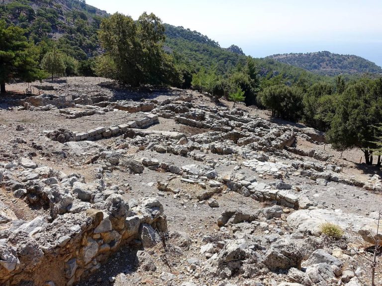
The site lies where the Lasithi mountains meet a fertile plain, about 3 km east and inland from the modern village of Malia. It is roughly 1,200 m from the coast and 20 m above sea level; a marshy strip separates it from the sea and appears to have remained marshland since Minoan times. The excavated town is arranged around a central palace, with residential and working areas connected by streets. The palace’s masonry combines cut stone with mudbrick, wood, and clay, while its visible fabric chiefly reflects its final reconstructions around 1450 BC.
Urban plan
The palace stood at the center of the town, with districts to its north, south, east, and west. Some eastern neighborhoods and houses were set apart from the main settlement during the Second Palace period. Streets linked the different areas to the palace; some had paved surfaces, and underground drains served the town. The settlement was enclosed by walls at least during Early Minoan III to Middle Minoan I.
Malia is about 35 km east of ancient Knossos and 40 km east of modern Heraklion. Its urban area extended from the palace toward the coast. A port may have existed at Mill Beach, but that interpretation remains uncertain.
The palace
Construction and courts
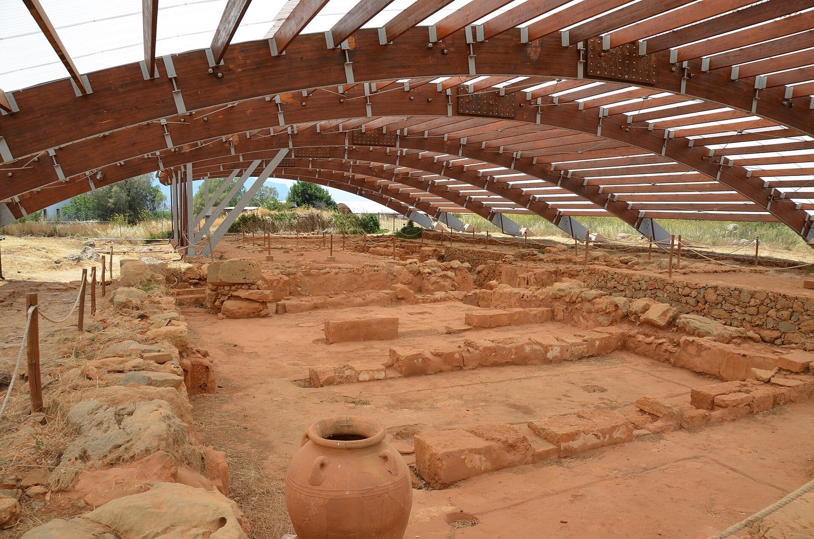
The earliest palace construction dates to Early Minoan IIB. A later palace rose over the first, incorporating some of its structures. Earlier remains are scattered among, or lie beneath, the more visible architecture, most of which belongs to the later palace phase. The monumental buildings used regularly cut stone blocks, sandstone, limestone, mudbrick, wood, and clay. Their projections and recesses make the façades irregular, reflecting construction that developed around a central court as needs changed.
The palace covered about 80 by 100 m and had at least two storeys, five entrances, and three courts: the Central, North, and Northwest Courts. The main entrance was on the north. The central court measured 48 by 22 m and served as a place for gatherings and ceremonies.
Palace rooms and religious spaces
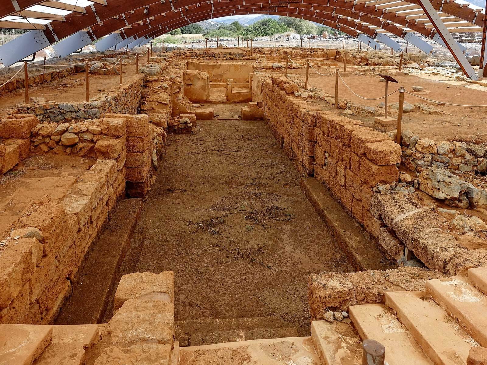
Rooms around the central court served official and residential purposes. The official suite included audience halls known as the King’s Megaron and Queen’s Megaron; a megaron is a large principal hall. A polythyron, a room with multiple doorways, allowed spaces to be divided or opened up. Other identified areas include residential quarters, storerooms, and a room for liquid offerings. A sanctuary had two columns and an altar.
Stores held pottery, oil, and grain. A possible foundation deposit, dated approximately to Early Minoan III–Middle Minoan I, was a stone-slab box containing a ceramic vessel. Finds from palace rooms include a large storage jar, or pithos, decorated with cords, and two Protopalatial swords. One sword had a gold hilt decorated in repoussé, a design hammered into metal from its reverse, depicting an acrobat. Another had a crystal pommel. Other objects include an almond-shaped gold bead and a later stone handle shaped like a leopard.
The Hieroglyphic Deposit and craft room
A room known as the Hieroglyphic Deposit contained clay medallions and other objects inscribed with Cretan hieroglyphs and Linear A, both undeciphered Minoan writing systems. One room has been identified as a workshop because it held molds for bronze tools, obsidian blocks, and other stone used in vessel-making. Workshop activity has also been proposed for other palace rooms.
Other finds from the palace include several kernoi, vessels or stands with multiple receptacles often associated with offerings, an altar, a baetyl or sacred stone, and burnt bones.
The Agora and associated buildings
The Agora
The Agora is a rectangular open area about 30 m north of the palace’s north gate. Built during the Protopalatial period, the phase of the first Minoan palaces, it measures 29.10 by 39.80 m and is enclosed by a wall of large stones. It had three monumental entrances. Traces in the wall may indicate stairs to tiered seating, and storage rooms lay to the southeast.
The Agora’s purpose, along with that of the nearby storage rooms, remains uncertain. Interpretations include a center of authority separate from the palace, perhaps with a council and public assembly, a commercial area, or an athletic complex.
The underground columned crypt
A subterranean building called the hypostyle crypt lies in a corner of the Agora. This rectangular structure has several rooms and was entered by a stairway. Its function is uncertain. It has been considered alongside the Agora and storage rooms in interpretations of the area as a public, commercial, or athletic complex.
Residential and craft districts
Quartier Mu
Quartier Mu, also called the Seals Workshop, lies about 200 m northwest of the palace and covers roughly 3,000 m². Dating to Middle Minoan II, it included Buildings A and B, houses, workshops, and open spaces interpreted as early public squares. A fire destroyed the district around 1700 BC, and it was not rebuilt.
Building A was trapezoidal, covered about 840 m², and was constructed in two phases. Its roughly 50 rooms included reception spaces, storerooms, and a sunken basin often interpreted as having ritual use. Hieroglyphic documents were also found there. The smaller Building B covered about 540 m² and contained storerooms, pottery, hieroglyphic documents, and two large stone anchors that may have been votive offerings. Nearby, smaller two-storey buildings have been identified as artisans’ houses, with workshops for bronze-working, pottery, seal engraving, stone and bone work, metal casting, and toolmaking.
Two tool hoards came from the district. One included a metal drill, a knife-razor, a saw, an axe-adze, and two stone axes. The other contained a metal double axe, an adze, a punch, a drill, and stone tools.
Quartier Nu
North of Quartier Mu and northwest of the palace, Quartier Nu covers about 750 m². Its buildings form three wings around a small court and have two architectural phases. The earliest evidence of occupation dates to Middle Minoan II, while the excavated buildings belong to Late Minoan III. They may have been private residences. Cretan hieroglyphic inscriptions were found in a Middle Minoan IIIB context.
Quartier Delta and Quartier Gamma
Quartier Delta, between Quartier Mu and the palace, contained well-built streets and at least three houses. Two houses dating to the Protopalatial period remained in use during the later palace phase; a third was built during that later period.
Several hundred metres northwest of the palace, Quartier Gamma comprised six or seven houses, each with two or three rooms. Most of its abundant pottery belongs to the Protopalatial period, with some examples from the later palace phase.
Other neighborhoods and House Theta
Quartier E lies south of the palace and was built during the later palace phase, although the area had also been occupied earlier. East of the Agora, Quartier Lambda includes three houses that continued in use into the Mycenaean period. North of the Agora, Quartier K has two groups of rooms, one belonging to Late Minoan IIIB and the other used during both the first and later palace phases. Quartier Z, east of the palace, includes three houses from the later palace phase. Three houses south of the palace date to Early Minoan III–Middle Minoan IA; stone hearths were found in eight rooms there.
House Theta, also known as the Beach House, has occupation levels extending from at least Middle Minoan IB to the Roman period. Large storage jars were grouped in the center of a room, and a courtyard contained a kernos. A corridor yielded a scarab-like steatite seal bearing a bee image, and a bird-shaped vessel was also found. The western part of the house is thought to have been a pottery workshop, where vessels in the Jamezi style were recovered.
Burial areas
Chrysolakkos
Chrysolakkos is an ashlar-built structure measuring 30 by 39 m, with many small rooms. Its purpose is uncertain, though it is often described as a cemetery building. Its date is disputed but is usually placed in Middle Minoan IIB. The name means “gold pit,” recalling gold leaves and other objects found by local residents during agricultural work in the nineteenth century.
The Chrysolakkos cemetery was Malia’s most important burial area. Its grave goods included luxury objects, gold jewelry, and ceremonial weapons. Pottery and valuable objects showing Egyptian influence indicate regular diplomatic and commercial contacts between Minoan Crete and Egypt. The Malia Pendant, also called the honeybees pendant, was found at Chrysolakkos and is regarded as a celebrated example of Minoan art.
Excavations also recovered a kernos that may have served as a table for liquid offerings. It has two rings of cup-holders. The outer ring has 29 small depressions and one large one; the inner ring has 12 small depressions and one large one.
Christos islet and the northern ossuaries
The cemetery on Christos islet, about 3 km from the palace, contains remains from Middle Minoan I and the Geometric period, an early Greek period named for patterns common in its art. The burials include large storage jars used as coffins. In antiquity, the islet was connected to Crete.
About 550 m north of the palace, three ossuaries occupy natural fissures in a rocky outcrop. An ossuary is a place for storing human bones. These held human remains and pottery dating from Early Minoan III to Late Minoan I, and are thought to have served people of lower social status. A fourth, artificially built ossuary has also been explored.
Pierres Meulières
The Pierres Meulières cemetery, used mainly during Middle Minoan I, was Malia’s second most important burial area. Its tombs include a shaft tomb, two triangular tombs, a circular tomb, and a pit containing three tube-shaped vessels known as the Trumpet Pit.
A nine-room building called the House of the Dead may first have been a dwelling before its reuse as a cemetery. It appears to have remained in use during the Mycenaean period. Houses from one of Malia’s districts extended as far as this burial area.
Other possible burial structures
A separate building measuring 12 by 13 m contained animal bones and pottery from Middle Minoan I and the later palace phase. It has been proposed as an ossuary.
Inscriptions and other finds
Clay records and inscribed vessels
Several small clay disks, or roundels, sealed around their edges were found at Malia and are thought to have served as receipts. One bears four characters in two lines on one face and two characters with numerals on the reverse; another has a single character, while three bear seals. Six Linear A tablets were also recovered.
Cretan hieroglyphic inscriptions came from Quartier Mu in a Middle Minoan IIB context, Quartier Nu in Middle Minoan IIIB, and the palace’s Hieroglyphic Deposit, also associated with Middle Minoan IIIB. A fragment of a jar handle bears two such characters. Several handled pouring jars with narrow spouts carry Linear B inscriptions; four came from a Late Minoan IIIA2B level dated to the Mycenaean period.
Images and the inscribed stone slab
An inlay from a Late Minoan IB layer depicts a sphinx, a mythical creature with a human head and a lion’s body. It is thought to follow the style of Egypt’s Eighteenth Dynasty, a ruling house of the New Kingdom. A blue limestone slab found near Malia in the 1930s has a cup-shaped hollow and sixteen signs that appear to be Cretan hieroglyphs. It is an unusual example of the script carved on stone rather than clay or sealstones. Its date and purpose are uncertain, though it is usually considered Minoan and may have served as an offering or altar stone.
Most finds from Malia are held at the Heraklion Archaeological Museum.