Lousberg: A Landscape Park and Historic Hill in Aachen, Germany
Site at a Glance
- Popularity
- High
- Country
- Germany
- Primary era
- Modern
- Eras represented
- Stone Age, Early Modern, Modern
- Civilizations
- French, German, Holy Roman Empire, Kingdom of Prussia
- Site type
- Civic
- Remains
- Park
On this page15 sections
History
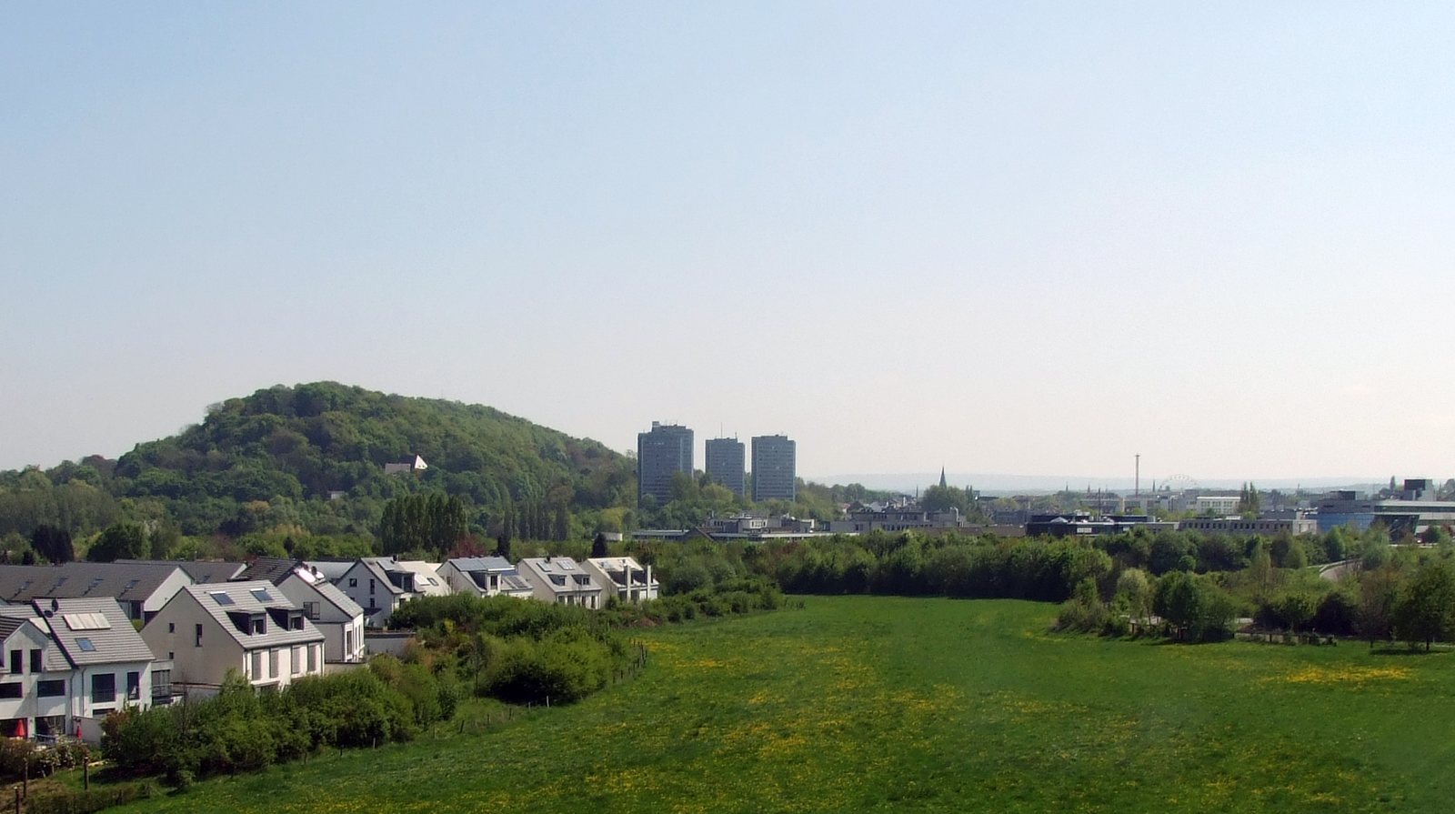
Lousberg is a 264-metre hill and landscape park at the northern edge of Aachen’s historic centre in Germany. Developed as a wooded park in the early nineteenth century according to English landscape-garden principles, it was Europe’s first landscape park initiated by citizens rather than princes.
A citizen-led landscape park
Older spellings include Louisberg, Luisberg, and Loysberg, but the name’s origin is uncertain. Suggested explanations connect it to a word meaning “to look,” to Louis the Pious, son of Charlemagne, or to the Aachen dialect word lous, meaning “clever.”
In 1804, Napoleon ordered improvements to Aachen that included work on its baths and walks beside filled-in outer fortification ditches. Johann Wilhelm Körfgen promoted the planting of Lousberg by 1806. Citizens formed a joint-stock company under his chairmanship to encourage tourism and fund a social venue, while public authorities provided the land and undertook the planting.
In 1807, Alexandre de Lameth, prefect of the Roer Department, a French administrative division in the Rhineland, commissioned the first plantings and plans. Maximilian Friedrich Weyhe designed the park, and a Committee for Embellishments chaired by Körfgen oversaw the work. After the Congress of Vienna, the 1814–15 conference that reorganized Europe following Napoleon’s defeat, Körfgen helped secure the project’s continuation under Prussian administration. By 1818, the once largely bare sheep pasture had become a wooded park.
Expansion and changing uses
The Belvédère social venue was built on the southeastern slope between 1807 and 1810. Its deteriorated condition prompted renovation and enlargement under Adam Franz Friedrich Leydel in 1827–28. A fire destroyed the building on 29 August 1836 after a ball. It was rebuilt in 1838 in the neoclassical style to Leydel’s plans, then later renovated and enlarged to designs by Friedrich Joseph Ark. Known as the Belvedere, it served as a restaurant and casino. The building and other park structures were destroyed during the Second World War.
Between 1803 and 1814, Körfgen developed his Müsch estate on Lousberg’s northern flank as a designed estate combining a working farm with ornamental landscape features. In 1866, Weyhe’s son Joseph Clemens developed its 11-hectare park, now called Müschpark. Late nineteenth-century plans by Aachen garden director Heinrich Grube extended parkland east to Salvatorberg and linked it with green spaces along the northern avenue ring and with municipal gardens designed by Peter Joseph Lenné in 1852. In 2009, the former park of St. Raphael Monastery was incorporated into Lousberg Park as Müschpark, which is listed as a protected site.
Twentieth-century changes
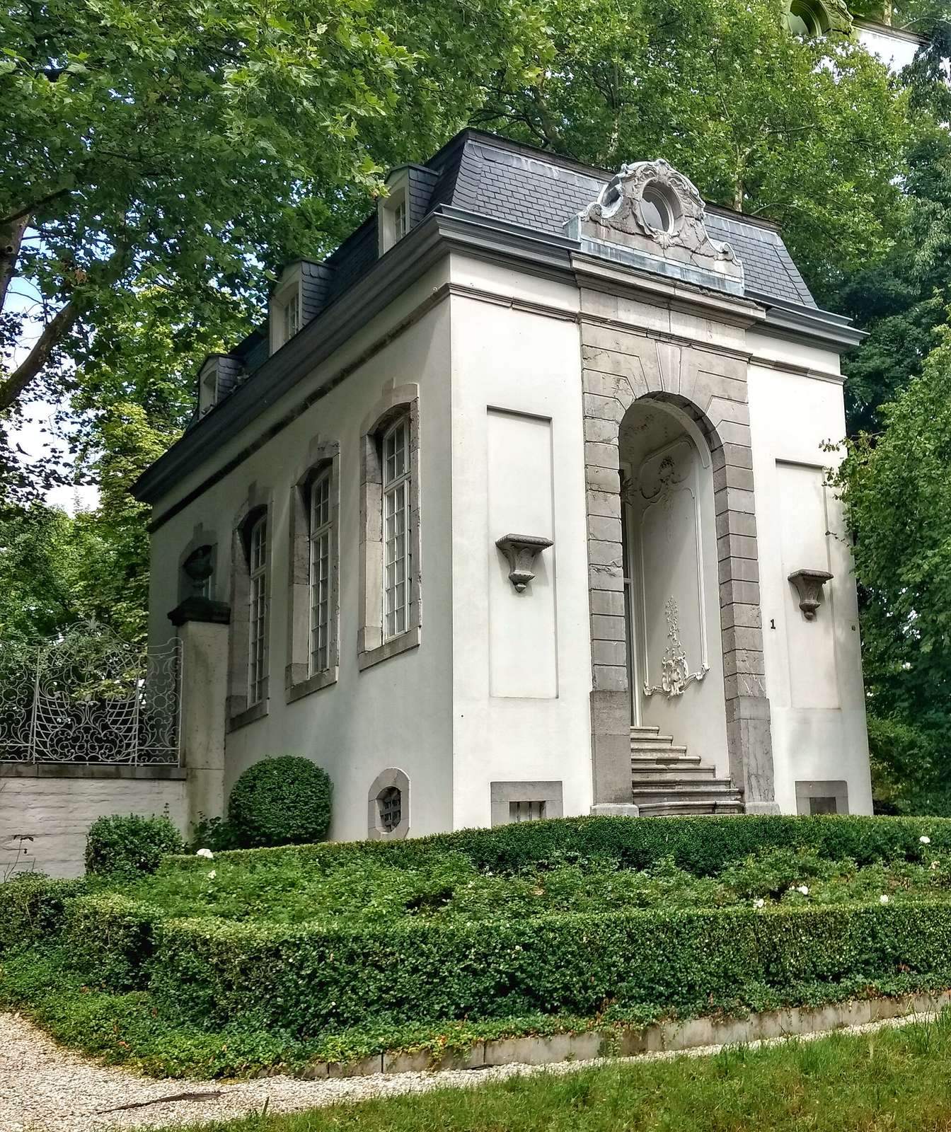
In 1906, Aachen bought and relocated the Kersten Pavilion to Lousberg to save it from demolition. An open-air stage built on the slope facing the city failed in part because of the weather. The Belvedere Water Tower was built in 1956 to supply western neighbourhoods; more efficient pumps made it unnecessary, and water-tower use ended in 1988. Lousberg is now largely wooded and serves as a local recreation area.
Remains
The park occupies a hill with a plateau covered by a continuous yew grove, wooded slopes, and paths. Its northern setting connects the hill with Müschpark and the Soers. Together, these features preserve parts of the designed landscape alongside evidence of earlier stone-working.
Geology and prehistoric quarrying
Hill and geological layers
Lousberg is one of Aachen’s three witness hills, isolated remnants of a former plateau, along with Salvatorberg and Wingertsberg. It also forms one of the southernmost extensions of the Aachen–Limburg Cretaceous plateau. Upper Cretaceous, the later part of the Cretaceous period, marine deposits began as sand and became mainly calcareous. Dark-grey, clayey to sandy Hergenrath layers underlie the hill. These formed in a swampy river delta and contain silicified wood, charcoal, and marcasite, an iron sulfide mineral. Their water-retaining clay supplies an important spring horizon at Lousberg and in Aachen Forest.
Quartz sands of the Aachen Formation, 30–50 metres thick, lie above the Hergenrath layers. Small pits on the lower slopes, including near the present playground at the end of Kupferstraße, were used to extract them. An eroded boundary separates these sands from the younger Campanian Vaals Formation. Its glauconite-rich sands, containing a green iron-bearing mineral, weather to a greenish-brown colour and were formerly called Vaals Greensands.
Tectonic movements during the Campanian, followed by subsidence of the Lower Rhine Bight, raised the Lousberg block. The Vijlen and Orsbach limestones were probably never deposited there because of its elevation. A later rise in sea level during the Maastrichtian submerged the block again, and calcareous mud formed from microorganism remains became Vetschau limestone. The limestone layer was originally about six metres thick, with brown flint layers in its upper 4.5 metres.
Neolithic flint quarry
During the Neolithic, the later part of the Stone Age associated with farming and widespread use of polished stone tools, quarrying removed almost all the limestone cap from the central plateau. Spoil heaps, up to 4.5 metres thick, now create uneven ground beneath the yew grove. Finished axes and flakes have been found on the plateau and steep slopes.
The quarried grey flint has chocolate-brown zones. People made axe blanks and other tools from it, finishing or polishing some at Lousberg and carrying others to settlements as unfinished products. The distribution of these blanks indicates that Lousberg flint travelled well beyond Aachen. Discarded limestone was piled on the slopes; because this material is loosely consolidated, small landslides still occur. Uprooted trees and cracks in footpaths mark this continuing movement.
Historic structures and designed park
Tranchot Obelisk
Jean Joseph Tranchot began a topographic survey of the Rhineland at a scale of 1:20,000 from a triangulation point on Lousberg, a surveying reference used to extend a map by measuring angles from known points. On 17 October 1807, the French Ministry of War erected a bluestone obelisk there. Designed by Captain Boucher, an engineering geographer, it honoured Tranchot and his colleagues and served as a central point for astronomical observations and regional mapping. It was destroyed on 2 April 1814, when Napoleon was deposed, then re-erected on 15 May 1815 by order of Prussian Baron Karl von Müffling, who continued the survey for Prussia. The inscription praising Napoleon was replaced, and the later inscription remains legible. Damaged edges were cut into sloping chamfers, an unusual treatment for an obelisk.
Belvédère grounds
The historic park included a Monopteros, a circular structure formed by a single ring of columns, a small Chinese pagoda, and a circular walk. The route began near the present bronze statues and followed a beech avenue on the northern slope. Views of Aachen and the surrounding countryside converged at the obelisk, while Weyhe’s route alternated level stretches with climbs of varying lengths. Columns from the destroyed Belvédère venue survive and are colloquially known as the “Aachen Acropolis.”
Kersten Pavilion
The Kersten Pavilion is a Baroque building designed by Aachen architect Johann Josef Couven, about a century older than Lousberg Park. Since 2005, the Lousberg Society, a local civic association, has managed it for exhibitions and lectures.
Belvedere Water Tower
After its water-supply use ended, the tower underwent extensive alteration and became primarily an office building. Its upper floor once held a café with a 360-degree view; a restaurant later occupied the same space.
Bronze figures and local legend
A local legend links the hills north of Aachen to the devil’s attempt to bury the city and its cathedral in sand. In one version, townspeople promise him the first living soul to enter the cathedral, then send in a wolf; the devil’s thumb is caught and broken in a cathedral door. Other versions tell of a woman who tricks him while he carries sand from the North Sea, causing him to drop it north of the city, where it forms a larger and a smaller hill. A bronze group depicting a farmer’s wife and the devil was created in 1985 by Aachen artist Krista Löneke-Kemmerling. An explanatory plaque accompanies it.
Park landscape and wildlife
Müschpark has extensive stands of wild daffodils. In the Soers north of the hill, amphibians use spawning waters. Studies by RWTH Aachen University, a technical research university in the city, recorded rich birdlife on Lousberg as well as notable populations of bats, amphibians, and reptiles.