Layer Pyramid: A Third-Dynasty Egyptian Pyramid
Site at a Glance
- Popularity
- High
- Country
- Egypt
- Primary era
- Bronze Age
- Eras represented
- Bronze Age
- Civilizations
- Egyptian
- Site type
- Burial
- Remains
- Pyramid
On this page12 sections
History
The Layer Pyramid, also called the Khaba Pyramid, is a Third-Dynasty Egyptian pyramid at Zawyet el-Aryan in Egypt. It dates to the period between the reigns of Sekhemkhet and Sneferu, founder of the Fourth Dynasty, and is generally attributed to Khaba, although its builder is uncertain.
Third-Dynasty date and attribution
The pyramid’s resemblance to the one built for Sekhemkhet supports its Third-Dynasty dating. Rainer Stadelmann identified Khaba with Huni, a ruler whom the Turin King List, an ancient record of Egyptian kings, credits with a 24-year reign. Stadelmann argued that this reign provided time for the pyramid’s construction. Other Egyptologists associate Khaba with Hudjefa II and have argued that Huni built the Meidum Pyramid instead.
Whether the Layer Pyramid was completed or used for a burial remains unsettled. Alessandro Barsanti thought it had never been used; Stadelmann considered it finished before collapsing, while Miroslav Verner proposed that construction ended after the king’s premature death. Its exposed exterior has also been cited in support of the theory that work stopped before completion.
Cemeteries and archaeological investigations
Five cemeteries around the pyramid reflect burial activity in the First, Second, and Third Dynasties, the Eighteenth Dynasty, and the Roman period. Their long span places the pyramid within a landscape used for burials across many centuries.
John Shae Perring examined the pyramid and its surroundings in 1839. In 1848, Karl Richard Lepsius identified it as a pyramid and listed it as number XIV. Gaston Maspero searched for the underground entrance in 1886; Jacques de Morgan located it in 1896 and cleared the first steps of its stairway before stopping. In 1900, Barsanti uncovered the vertical shaft and several corridors.
George Reisner and Clarence Fisher investigated the pyramid’s north and east sides and nearby cemeteries in 1910–11. Their records and Barsanti’s differ in their measurements and descriptions of the underground chambers, and the excavations remained incomplete. Vito Maragioglio and Celeste Rinaldi examined the pyramid’s truncated upper structure in the 1960s. Since 1970, the site has lain within a restricted military zone, preventing further archaeological campaigns.
Remains
Pyramid and setting
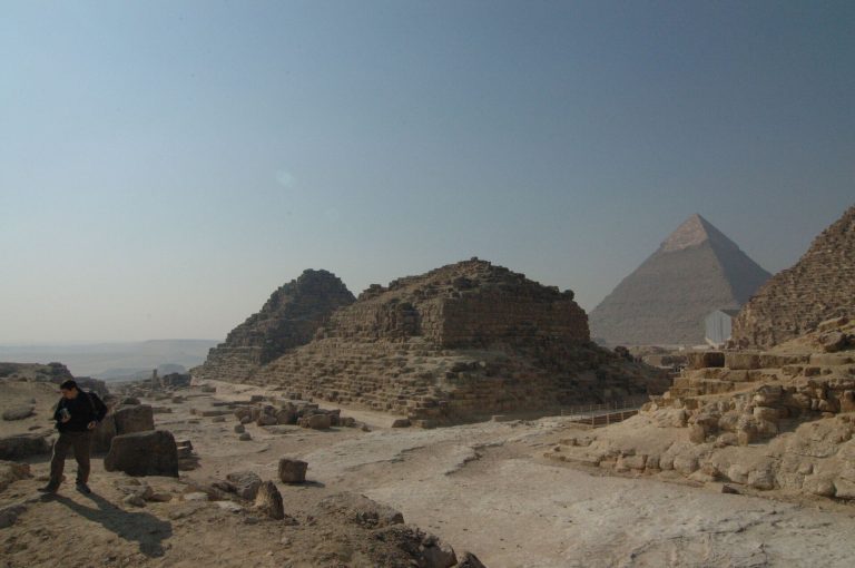
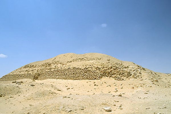
The pyramid occupies a rocky ridge above the Nile floodplain in the Zawyet el-Aryan necropolis, about eight kilometres southwest of Giza and seven kilometres north of Saqqara; sand partly covers the site. Its square base measures 84 metres on each side. Two surviving steps rise to about 17 metres. Jean-Philippe Lauer estimated that the planned pyramid had five steps and would have reached 42–45 metres, while other estimates allow for five to seven. The ruined exterior exposes a core of rough blocks quarried from local bedrock, surrounded by a 2.6-metre-thick layer of the same stone. Fourteen mortar-bonded mud-brick layers, each about 2.6 metres thick, surround this masonry. The brickwork rises at a steep inward angle of about 68 degrees. Mud-brick fragments around the pyramid have been interpreted by Stadelmann as possible remains of an outer brick covering, though most Egyptologists regard them as remnants of construction ramps.
Underground passages and chambers
Entrance and approach
The underground entrance lies near the pyramid’s northeast corner, unlike the customary north-side entrance of Old Kingdom pyramids, built during an early period of Egyptian history. A steep stairway about 36 metres long descends to a corridor running west toward a vertical shaft. Proposed explanations for the entrance’s position include reserving the north side for a mortuary temple, securing access through the bedrock, and providing convenient entry to storage rooms below the eastern entrance. Aidan Dodson challenged the temple explanation, noting that a construction ramp would also have obstructed work on the north side.
Shaft and northern galleries
An unfinished passage runs south from the upper part of the shaft toward the pyramid’s centre. At the shaft’s bottom, a junction connects the route south to the burial chamber and north to a U-shaped gallery system. Barsanti’s plan shows the northern galleries arranged like a comb, with 32 chambers that may have been intended for funerary equipment. His records also describe an unfinished passage above the burial chamber; excavation plans differ in how they represent the underground layout.
Burial chamber
The southern route follows a lower corridor that narrows at a descending stairway about halfway along. The passage is so tight that it is uncertain whether a sarcophagus could have been moved through it. Beneath the pyramid’s central axis, about 26 metres underground, the burial chamber measures 3.63 by 2.65 metres and is about three metres high.
Associated structures and cemeteries
Temple remains
Fragments of brick walls on the pyramid’s east side may belong to a mortuary temple, a building associated with a ruler’s funerary cult. Several hundred metres away are the ruins of a building that may have been the valley temple, a separate structure within a pyramid complex. If that identification is correct, its east–west orientation would be unique among Egyptian pyramid complexes. Local residents call the ruins El-gamal el-barek, meaning Lying Camel.
Cemeteries and Mastaba Z500
The surrounding cemeteries contain simple burials and numerous mastabas, flat-roofed tombs with sloping sides. Four large mud-brick mastabas belong to the Third-Dynasty cemetery. Reisner and Fisher interpreted them as tombs for members of the royal family and court officials. Mastaba Z500, about 200 metres north of the pyramid, yielded eight stone bowls inscribed with Khaba’s serekh, a palace-façade-shaped frame enclosing a king’s Horus name. These inscriptions are associated with the proposed attribution of the pyramid to Khaba.