Labitolosa: A Roman Municipium in Spain

Site at a Glance
- Rating
- 4.4
- Popularity
- Low
- Country
- Spain
- Primary era
- Classical
- Eras represented
- Classical
- Civilizations
- Roman
- Site type
- City
On this page10 sections
History
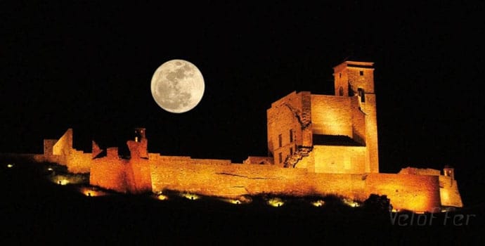
Labitolosa is a Roman municipium in Spain, located on the southern slope of Cerro del Calvario near La Puebla de Castro in Huesca. A municipium was a self-governing community whose inhabitants held Latin civic rights within the Roman administrative system. The settlement was occupied during the 1st century BC, developed during the 1st century AD and the beginning of the 2nd century, and reached its peak between the second half of the 1st century and the first half of the 2nd century. It overlooked the Ésera valley from the southern foothills of the central Pyrenees.
Origins and Roman development
Labitolosa’s territory extended across part of the southern central Pyrenees and probably bordered the territory of the Convenae to the north. The Convenae were an ancient people whose principal centre was Lugdunum Convenarum. One interpretation links the emergence of Labitolosa with the assimilation of the Tolosani by the Ilergetes. The Tolosani were a people of Gallic origin settled south of the Pyrenees, while the Ilergetes were an ancient Iberian people of northeastern Hispania. The possible identification of Labitolosa with the Tolous mentioned in the Antonine Itinerary remains uncertain.
The city is not mentioned in the known Roman literary sources, including Pliny’s Naturalis Historia. Before archaeological excavation began, its existence was known principally through a Latin inscription discovered in the 16th century. The inscription referred to the cives Labitolosani, meaning the citizens of Labitolosa, and provided the key evidence for identifying the settlement.
Municipal life and abandonment
Labitolosa developed as a Roman civic centre with a forum, a curia, two bath establishments, a private urban house, other buildings, and rural installations around the settled area. The curia was the council house of the municipality, where local councillors called decurions represented the civic elite. Two inscriptions from the curia mention the protective Genius of the city, a spiritual power associated with a person, community, or place, and Publius Clodius Flaccus, a prominent local figure who was promoted to the equestrian order by the emperor Hadrian. The equestrian order was a privileged Roman status group below the senatorial order.
Labitolosa was abandoned around AD 200, although the reason remains unknown. Excavations began in 1991 through a joint project of the University of Zaragoza and the University of Bordeaux. Work has continued regularly, revealing the principal public and domestic areas while other parts of the settlement remain under excavation and consolidation. The site was legally protected as an archaeological zone in 1998. The curia and baths have received protection, while other areas remain subject to excavation, restoration, or consolidation.
Remains
The archaeological site covers approximately 12 hectares on the southern slope of Cerro del Calvario, above the Ésera valley. Its surviving remains combine public buildings, domestic architecture, and rural installations in the surrounding area. The excavated civic centre includes a north-south forum, a curia on its northern side, and two bath establishments whose plans and heating arrangements provide substantial evidence for Roman municipal life.
Forum and civic buildings
Forum
The forum was laid out on a north-south axis during the Augustan period, the reign of Augustus from 27 BC to AD 14. Its northern section is the best-known part and was remodeled toward the end of the first quarter of the 1st century AD. The forum formed the principal civic setting for the curia and the associated inscriptions and honorary monuments.
Curia
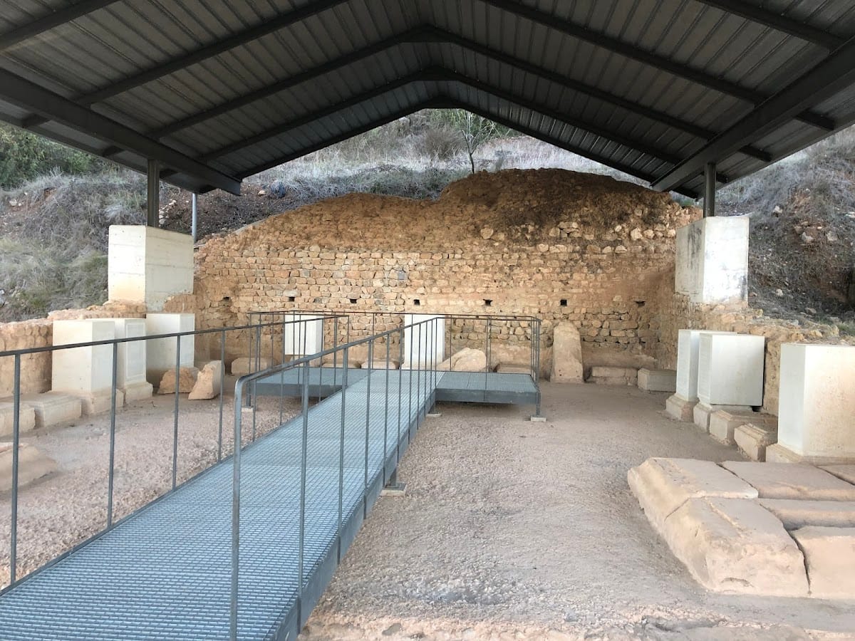
Built around AD 120–130, the curia was a rectangular building measuring approximately 18.5 by 11 metres. An entrance vestibule opened onto the forum and led into a large, roughly square meeting hall. Honorary pedestals and inscriptions associated with local notables occupied the hall, including several inscriptions found in their original positions. The building is unusually well preserved, and its surviving sculpture pedestals help convey the formal character of the municipal council house.
Roman baths
Baths I
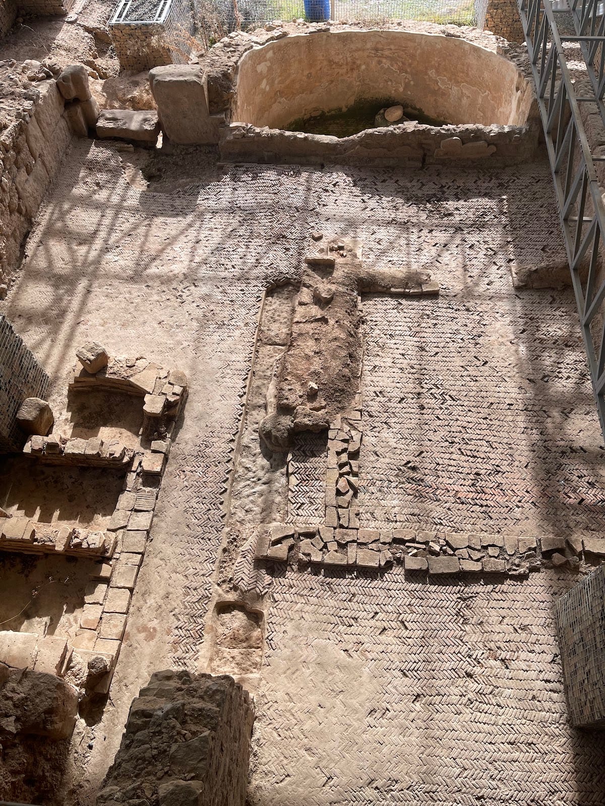
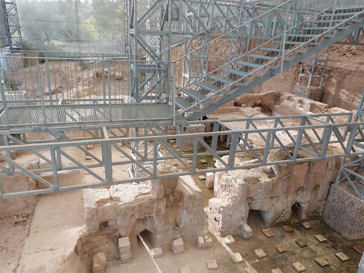
Baths I was built around AD 50–60 and measures approximately 33.5 by 15.5 metres. It is remarkably well preserved, with rooms arranged from east to west as a large apsidal frigidarium, or cold room, a tepidarium, or warm room, without an apse, and an apsidal caldarium, or hot room. A broad terrace south of the building served as a solarium, an area used for exposure to the sun.
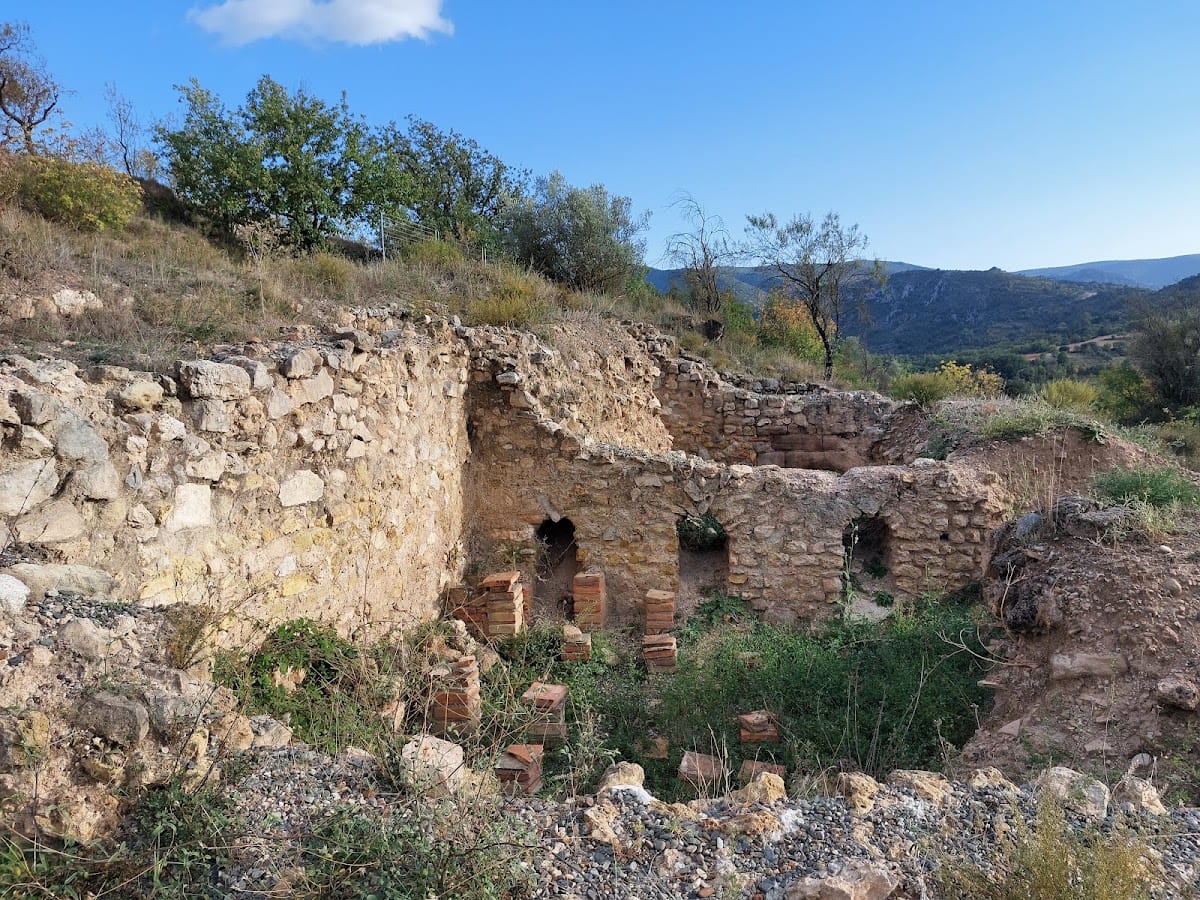
The heating system survives clearly. A praefurnium, the furnace serving the bath-heating system, stood beside the northeastern corner of the caldarium. Heated air circulated through the hypocaust, an underfloor and wall-flue system, and rose through channels built into the walls. The hot room contained a heated pool, or alveus or solium, measuring approximately 5.5 by 1.5 metres on its northern side. A labrum, a basin used for washing or cooling, occupied the southern apse.
Baths II
Baths II dates to approximately AD 70–80. It followed a plan comparable to Baths I but was somewhat smaller and is less well preserved. Its particularly large frigidarium was separated by two columns from the apodyterium, the changing room.
The changing room contained a recessed area with a bench on three sides. Its pool measured approximately 2.20 by 3.80 metres. Together with the installation in Baths I, the surviving heating arrangements are regarded as the most complex and best-preserved Roman bath system surviving in the Pyrenean region.