Königspfalz Frankfurt: A Carolingian and Ottonian Royal Palace
Site at a Glance
- Rating
- 4.6
- Popularity
- Very Low
- Country
- Germany
- Primary era
- Medieval
- External website
- Open
- Eras represented
- Medieval
- Civilizations
- Carolingian, Holy Roman Empire, Merovingian
- Site type
- Civic
- Remains
- Palace
On this page18 sections
History
Königspfalz Frankfurt was a Carolingian and Ottonian royal residence and administrative center in Frankfurt, Germany, established in the early ninth century under Louis the Pious. A Königspfalz was a royal base used by medieval rulers who travelled through their realms with their courts rather than governing from a permanent capital. The palace stood on the Domhügel and replaced a Merovingian royal court probably founded in the sixth century, after the Franks conquered the area from the Alamanni shortly after 531. The hill had already been settled regularly since the Neolithic, with continuous occupation from at least Late Antiquity. The historically inaccurate name “Kaiserpfalz Frankfurt” is also used.
From Frankish Court to Carolingian Palace
Frankfurt formed the center of a royal fiscal district measuring about 20 by 22 kilometers between Kelsterbach and Bürgel. It included parts of the Dreieich imperial forest and subsidiary courts at Griesheim, Kelsterbach, Seckbach, and Vilbel. The district supplied the royal court with agricultural produce, forest resources, fish, crafts, labor, and accommodation.
Charlemagne arrived in Frankfurt in late 793 and issued a document there on 22 February 794. It is the oldest surviving original record to use Frankfurt’s name. During an approximately eight-month stay, he celebrated Easter and convened the Synod of Frankfurt in June 794. Several thousand people attended the meeting, which addressed 56 ecclesiastical and political questions. Charlemagne’s wife Fastrada died in Frankfurt on 10 August 794 and was taken to St. Alban near Mainz for burial.
The buildings used for the synod remain uncertain. The prevailing interpretation places the main Carolingian palace under construction for Louis the Pious, Charlemagne’s son and successor as emperor, rather than attributing it directly to Charlemagne. The synod probably met in Merovingian buildings, although wooden structures, tents, or other royal courts may also have been used.
Louis the Pious probably commissioned most of the palace walls around 815, and the work had been completed by the time he returned in 822. Frankfurt then became an important political and strategic base. His son Charles the Bald was born there in 823. During the dynastic conflicts within the Carolingian Empire, Louis the German occupied Frankfurt in 833 or 834, before Louis the Pious re-entered the city in January 839. The emperor visited the palace for the last time in 840.
East Frankish Royal Center
After the Treaty of Verdun in 843 divided the Carolingian Empire, Frankfurt became part of the East Frankish kingdom under Louis the German. During his reign, the palace hosted the elevation of Lothair II as king of Lotharingia in 855, court assemblies in 859, 865, 866, 870, 871, 873, and 876, and military musters in 858, 862, and 867. Easter and Christmas celebrations also took place there. Louis the German died in the palace in 876. He had stayed in Frankfurt at least 34 times, making it, together with Regensburg, one of his principal palaces.
Around 843, Louis the German probably began the Church of the Saviour. Rabanus Maurus, Archbishop of Mainz, consecrated it in 852. Louis also established a collegiate foundation of twelve clerics and endowed it with royal property across the Rhine-Main region. A collegiate foundation was a community of clerics serving a church without necessarily belonging to a monastery. The foundation continued as the Salvator Collegiate Foundation after the church later acquired the patronage and name of Saint Bartholomew.
In its early centuries, the foundation was closely connected with visiting rulers. The rulers probably appointed its abbots, who were later called provosts, until the end of the Ottonian period. During the Salian period, the foundation moved into the sphere of influence of the archbishops of Mainz, a relationship firmly established by the middle of the twelfth century.
Ottonian Changes and Decline
By about 1000, the palace and its associated settlement had been enclosed by a wall under the Ottonian rulers, the tenth- and early-eleventh-century dynasty descended from Saxon rulers. The Ottonians made major changes to the Church of the Saviour and visited Frankfurt approximately 40 times. Royal visits declined sharply under the Salians. The synod held by Emperor Conrad II in 1027 was the last major event of the eleventh century, and only five further royal visits are documented before 1140.
The palace’s decline cannot be dated precisely. Archaeological evidence indicates a fire no earlier than the tenth century, rebuilding of at least part of the complex, and a later demolition phase probably in the twelfth century. The palace may have remained in use until the second half of the twelfth century, rather than ending in the mid-eleventh century as earlier interpretations proposed.
The Staufers resumed royal visits to Frankfurt around 1140. The relationship between their rule and the buildings on the Domhügel remains disputed. The Saalhof on the Main may have replaced the older palace, stood alongside it, or served as a different royal residence. Excavations show that the Saalhof was not connected with Charlemagne or the original Königspfalz, and its role as a Staufer residence is also contested.
Rediscovery and Archaeological Interpretation
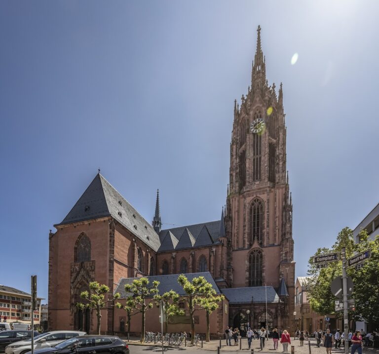
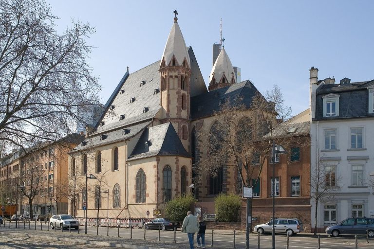
Late-medieval bourgeois buildings gradually covered the palace, and their cellars reused some of its massive walls while helping to preserve them. The Church of the Saviour was probably demolished in the fourteenth century. The Merovingian Church of St. Mary may have survived until work began on the present cathedral tower in 1415, after which the Gothic cathedral gradually replaced the earlier sacred buildings.
Humanist scholars began searching for the palace in 1562. For centuries they identified it with the Saalhof because no visible remains were known. Another theory placed a second palace near the later Leonhard Church. In 1936, Heinrich Bingemer argued that the palace lay beneath the Domhügel, partly because of evidence for a covered passage between the Church of the Saviour and the royal buildings.
Allied bombing destroyed Frankfurt’s Old Town in March 1944 and made large-scale archaeological investigation possible. Excavations begun in 1953 in the Dom-Römer area exposed the northeastern corner of the palace hall. By 1957, archaeologists had established most of the complex’s dimensions. Later excavations at the Saalhof confirmed that it was a separate Romanesque complex.
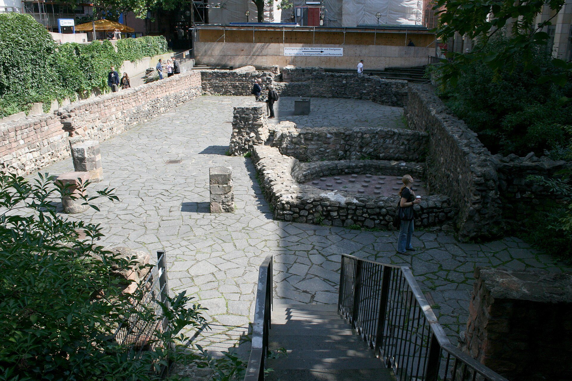
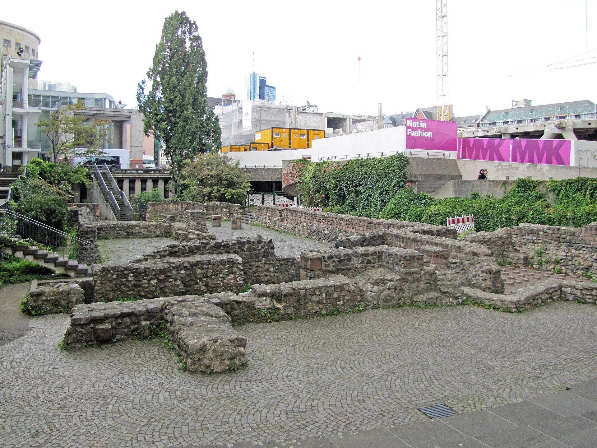
Postwar reconstruction destroyed substantial parts of the incompletely investigated oldest settlement layers. From 1973, the palace remains were presented in the Archaeological Garden. The Dom-Römer project covered the site with the Stadthaus between 2013 and 2016 while preserving the excavated remains. Since August 2018, the remains have been presented in the Kaiserpfalz Franconofurd exhibition, an outpost of the Archaeological Museum Frankfurt. A three-dimensional reconstruction first shown in 2006 and a later exhibition model represent archaeological interpretations of the palace.
Remains
The remains occupy the Domhügel, a flood-free elevation of the Lower Main Terrace approximately 325 meters long and 125 meters wide. Marshy ground associated with a former Main channel called the Braubach bounded it to the north, the Fischerfeld marshes lay to the east, the Main lay to the south, and another marshy depression began near the Römerberg to the west. A narrow strip of safe land led west toward the Karmeliterhügel. A nearby limestone ford near the later Fahrtor gave Frankfurt its name. The palace complex developed across this elevated ground, alongside earlier buildings and a settlement serving the royal court.
Earlier Frankish Buildings
Church of St. Mary
Merovingian remains in the southern area of the present cathedral tower include the Church of St. Mary, or an apsidal building, measuring approximately 11.5 meters long and 7 meters wide. An apse is a usually semicircular or polygonal end of a church or room. The building formed part of an early complex on the Domhügel and may have survived into the period when the cathedral tower was founded in 1415.
Early Residential and Service Buildings
Northeast of the church stood Building I, approximately 10 meters long and 4.5 meters wide. It contained a post-Roman hypocaust, an underfloor heating system in which hot air circulated beneath the floor. Its function remains uncertain. A high-status Frankish girl was buried inside it in the early eighth century, soon after the building apparently fell into disrepair. Her undisturbed grave, rich in grave goods, was rediscovered in 1992 beneath the later Church of the Saviour. The burial and Building I were deliberately preserved.
Other small stone remains near the former Tuchgaden and beneath the former Rotes Haus include a probable east-west rectangular building and another structure set at right angles to it, with a pronounced semicircular apse or niche. Ceramics date these buildings to the seventh or eighth century. Together with the structures near the cathedral, they formed a complex extending almost 100 meters across the Domhügel.
Carolingian Palace
Royal Hall
The principal Carolingian building was the aula regia, the main ceremonial hall of a royal palace. It measured 28.3 meters by 14.4 meters, with walls approximately 0.9 meters thick. An excavated interior pillar confirms that the building originally had two stories. The ruler’s seat was probably in the eastern part of the upper floor.
The foundations used roughly dressed blocks of limestone and basalt lava. The rising walls combined sandstone blocks with irregular rubble of basalt, limestone, and sandstone. Carefully worked sandstone corner blocks survive at the northeastern corner, while the remaining wall surfaces were probably plastered. Pale, gravel-rich lime mortar filled the foundations and hardened to a concrete-like consistency. Despite extensive medieval construction, nearly the entire circuit of the palace walls survived archaeologically.
Annexes and Covered Passage
Square annexes of similar construction were attached to the north and south sides of the hall’s western end. They probably contained stairways serving the upper royal hall. A less securely documented western structure with a vestibule may have formed the main staircase and entrance passage.
A western covered passage, or porticus, was mentioned in 979, when Emperor Otto II granted it to Hildebald, Bishop of Worms, with permission to enlarge it by up to 20 Carolingian feet on each side. This written evidence supports the reconstruction of the royal hall as a two-story building. The western annexes may have been demolished and built over before the royal hall itself. Later streets and buildings in the eastern part of the block followed the hall’s alignment more closely than that of the western annexes.
Gate Hall
A gate hall stood east of the royal hall, slightly displaced to the north so that it respected the alignment of the earlier apsidal building. Its exact contemporary function is unknown. It may have marked the beginning of a church complex with an atrium, although that plan appears not to have been completed. A covered passage was later added between the gate hall and the Church of the Saviour, allowing the ruler to reach the church under cover.
Church of the Saviour
The Church of the Saviour was a three-aisled basilica, a longitudinal church with a higher central nave flanked by lower aisles. Its semicircular eastern apse was attached directly to the transept, which projected to the same height as the nave. The interior measured 29.80 meters long and 22.20 meters wide. The eastern apse and central nave were each 7.20 meters wide, while the side aisles were probably 4.20 to 4.30 meters wide.
Rows of piers divided the nave from the side aisles, although their number and precise form are unknown. Later rebuilding destroyed much of the ninth-century evidence at the western end. The most plausible reconstruction gives the church a straight western facade, with the principal entrance opening into the northern aisle.
Ottonian Alterations
Under the Ottonians, the original eastern apse was replaced by a rectangular presbytery bay and a raised semicircular apse. A western structure with an upper gallery was added, and twin towers stood directly in front of it. These towers probably provided access to the gallery and served as bell towers. The alterations buried the Merovingian girl’s grave beneath pier foundations, while the nearby Church of St. Mary remained standing.
Settlement and Destruction Layers
The palace settlement extended toward the later Hühnermarkt and Römerberg. It probably included simple half-timbered houses and pit houses for unfree royal dependents who worked as farmers and craftsmen and maintained the palace and collegiate foundation. A market and a harbor on the Main probably served the royal court and its large retinue.
Evidence for destruction includes a gray and black charcoal layer 8 to 25 centimeters thick in the passage to the church, the gate-hall area, and the royal hall. Standing walls show heat damage. A stone bedding layer above the fire deposit indicates that at least part of the palace was rebuilt. The western annexes have a different archaeological history, without comparable fire evidence.
A later demolition layer, 25 to 100 centimeters thick, contained rubble, pale gravel-rich mortar, and Carolingian ashlar. Extraction pits show that much of the stone was removed for reuse in later buildings. Ceramics place the fire no earlier than the tenth century and the major demolition phase probably in the twelfth century. The intervals between the fire, rebuilding, and final abandonment cannot be established. The excavated remains now lie below the present ground level. Some visible masonry was rebuilt in modern times for educational presentation rather than retained in its original position.
The Saalhof
The Saalhof lies southwest of the Domhügel on the Main. It consists of a residential tower, a residential building, and a chapel added to them. Excavations showed that the tower and residential building were constructed together, while the chapel was added later and subsequently raised to its present height. Timber from the chapel’s foundation dates to spring 1200. Its upper storey is dated approximately to 1210 to 1220 by its late-Romanesque double-arcade capitals, although stylistic dating places those capitals between about 1165 and 1200, and they may have been reused from an earlier context.
Present Presentation
The Stadthaus protects the excavated palace remains from weather damage and provides exhibition and event space. The Kaiserpfalz Franconofurd exhibition includes a bronze model approximately two meters long, made at a scale of 1:90, showing the Carolingian palace in its reconstructed state around 860. A large three-dimensional digital reconstruction presents another interpretation of the palace’s form.